More Stories
Do you remember this? Snow...and lots of it.
People in the Rocky Mountains, the Midwest and the Great Plains have seen plenty of powder so far this winter. You can tell just by looking at videos, pictures and social media how much that snow has impacted them since the cold season began.
And then……there's us.
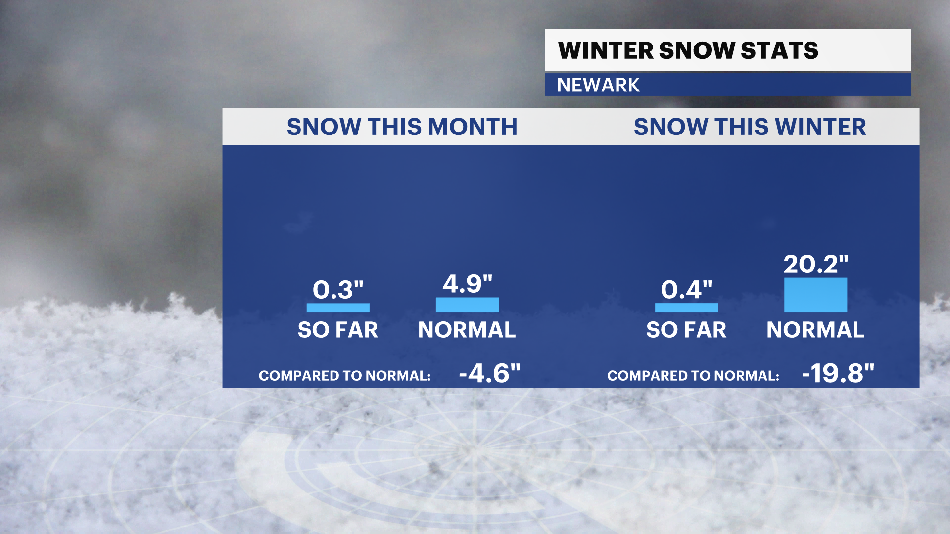
New Jersey and the entire tri-state area are well below average for snow this winter. For February so far, there has been a mere 0.3 inches of an inch of snow; this is more than 1 ½ feet below what we’d typically see up to now.
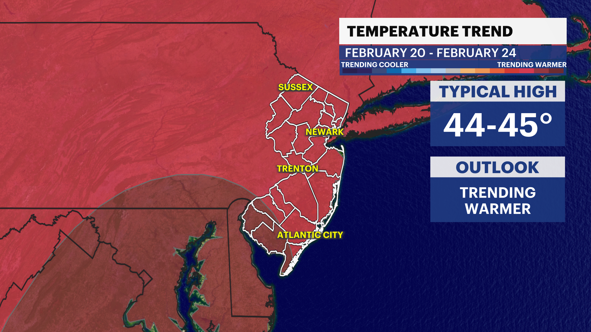
Unfortunately for snow lovers, there looks to be no real shot of snow in sight to wrap up the month of February. Temps are expected to still be above average across the eastern half of the United States, and that includes New Jersey and the tri-state region.
The reason? La Niña.
La Niña is a global wind pattern that promotes warmer winters in the southern U.S. and along the East Coast. It is defined as colder than average waters along the equator in the Pacific Ocean, located off of the South American coast.
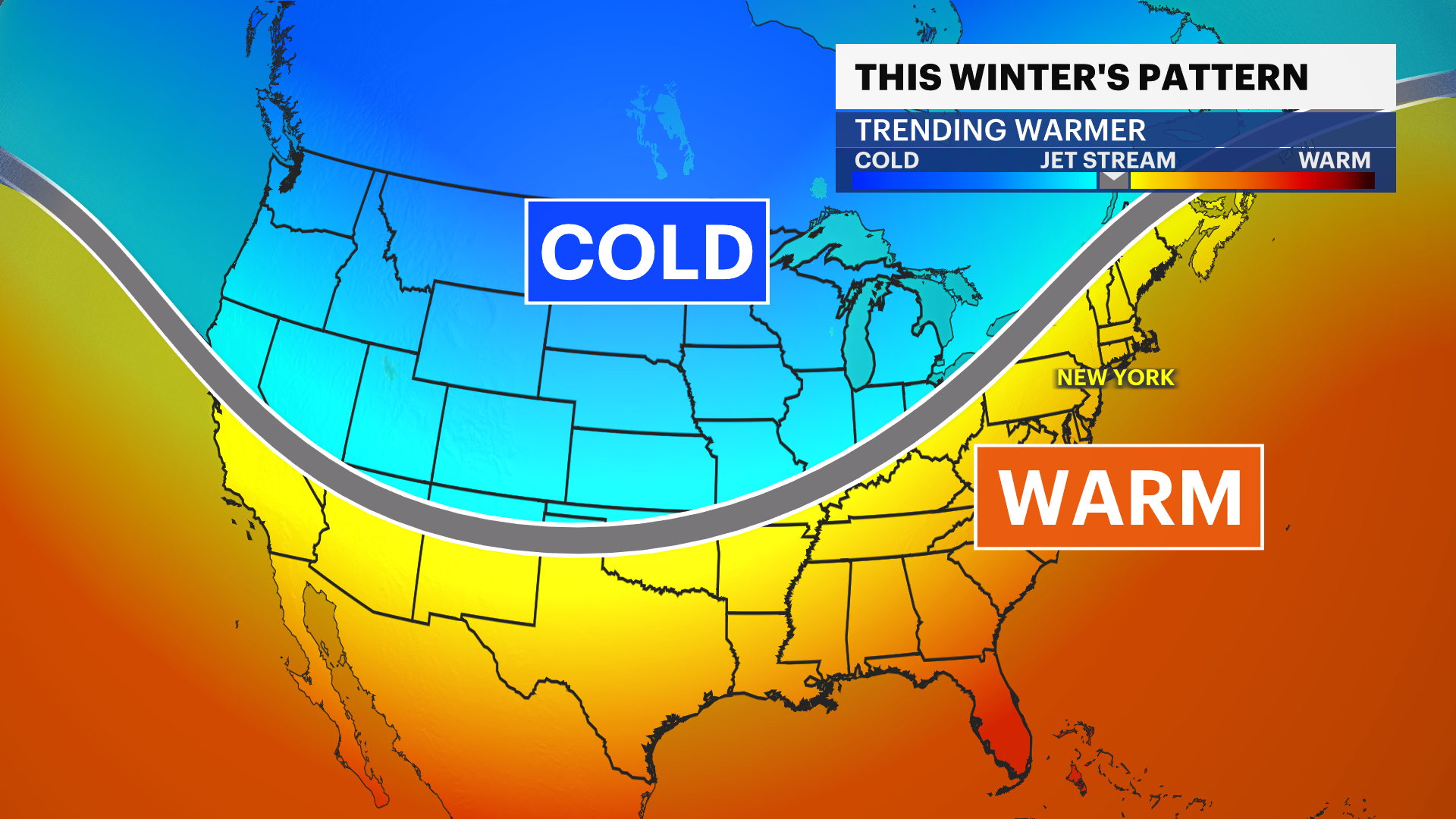
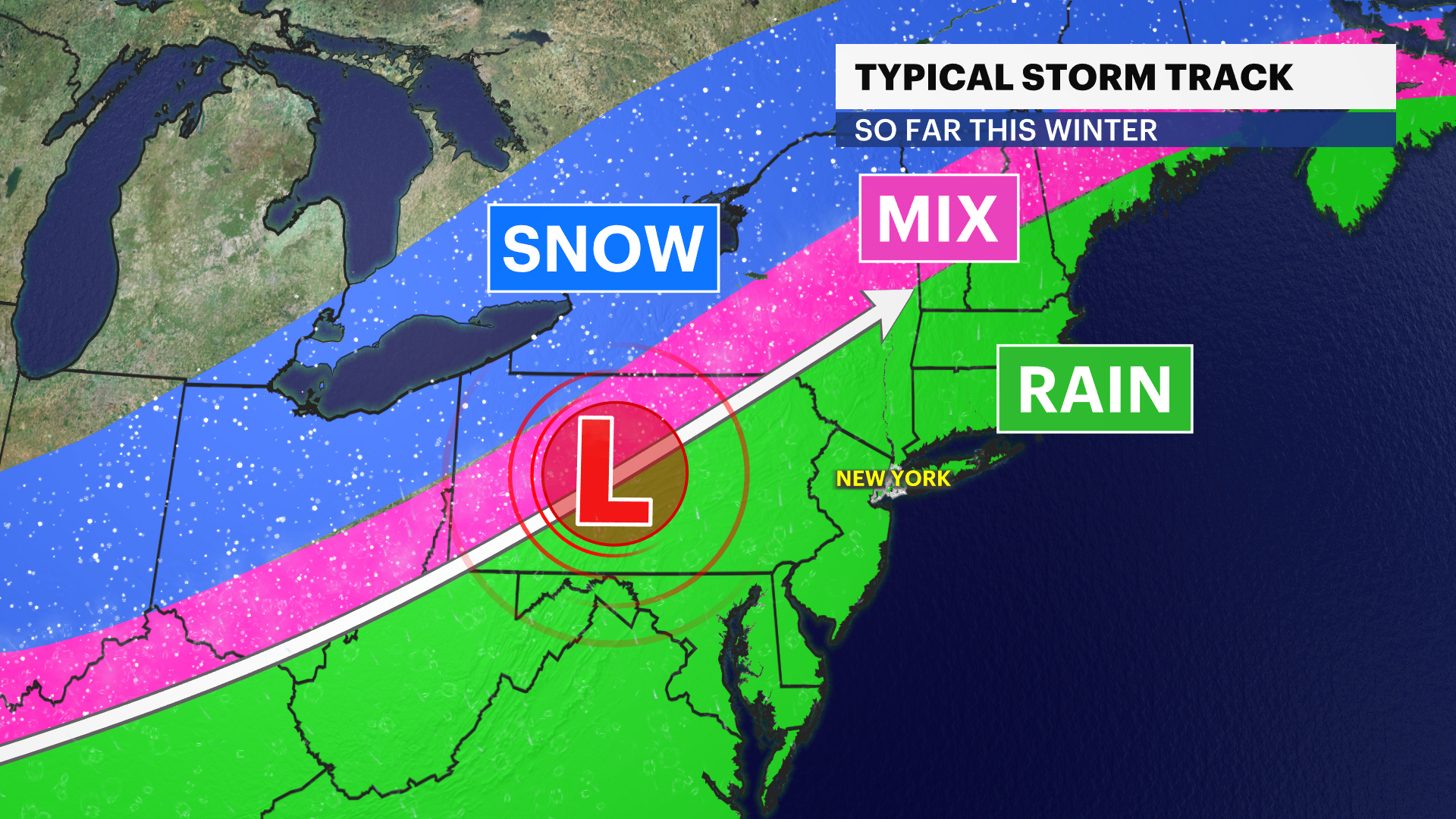
La Niña allows for a huge dip in the jet over the West Coast, which funnels colder air west. Over New Jersey - the jet stream clears the way for storm systems to move in, but with areas of low pressure being too far to our west, we're not seeing enough cold air with this year's round of coastal storms. Storms have come in warmer instead.
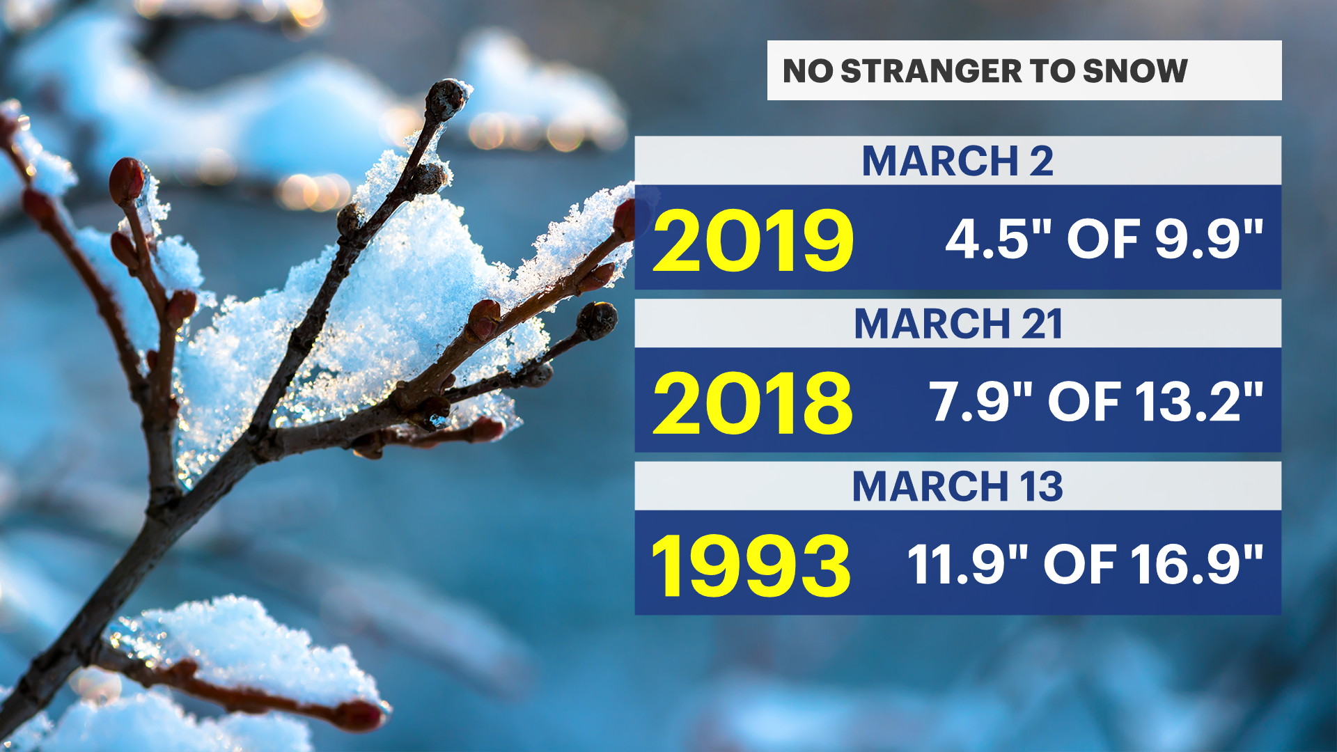
But don't lose all hope snow lovers, we have seen several large snowstorms in March - including in 2019, 2018, and 1993.
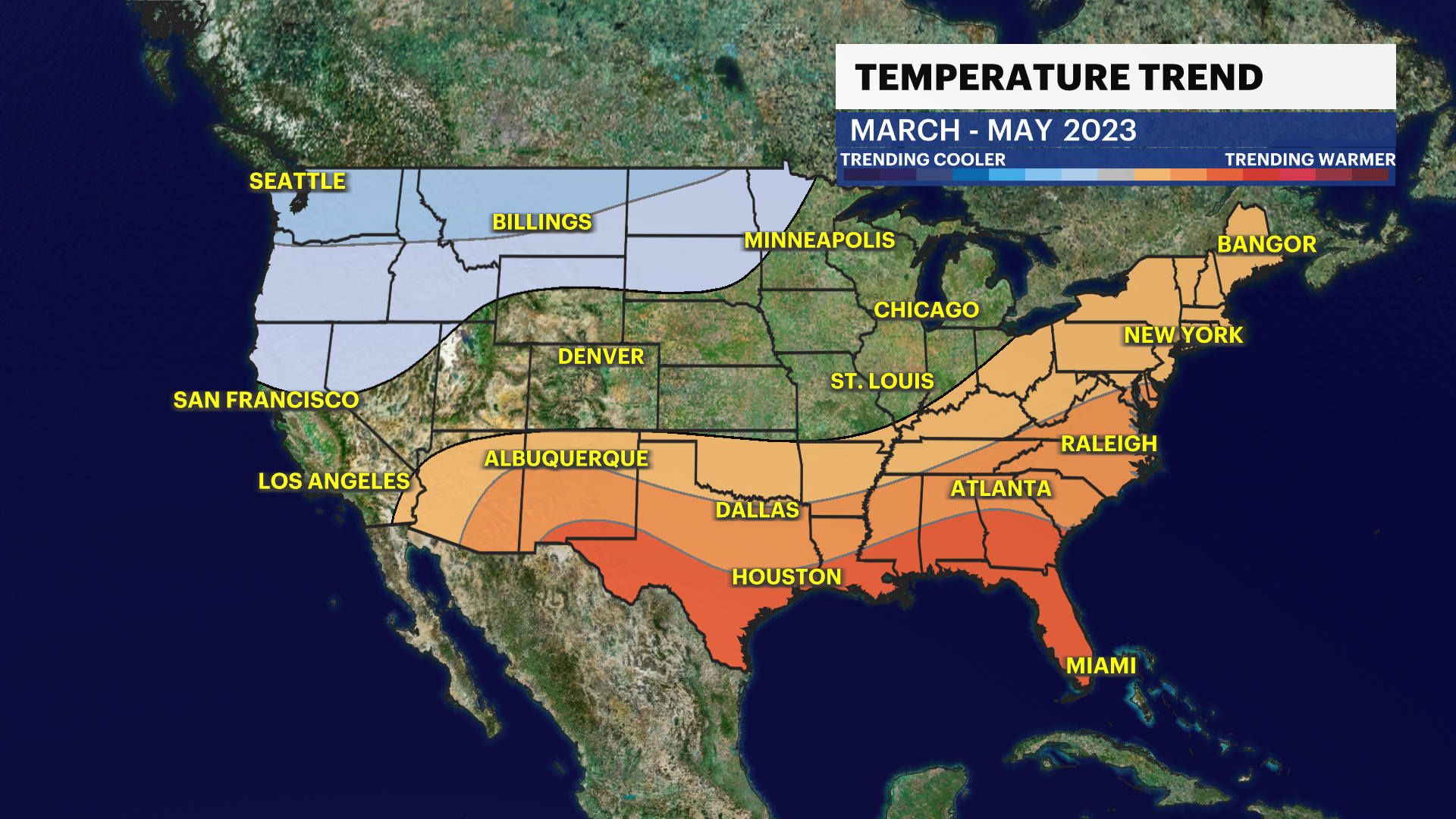
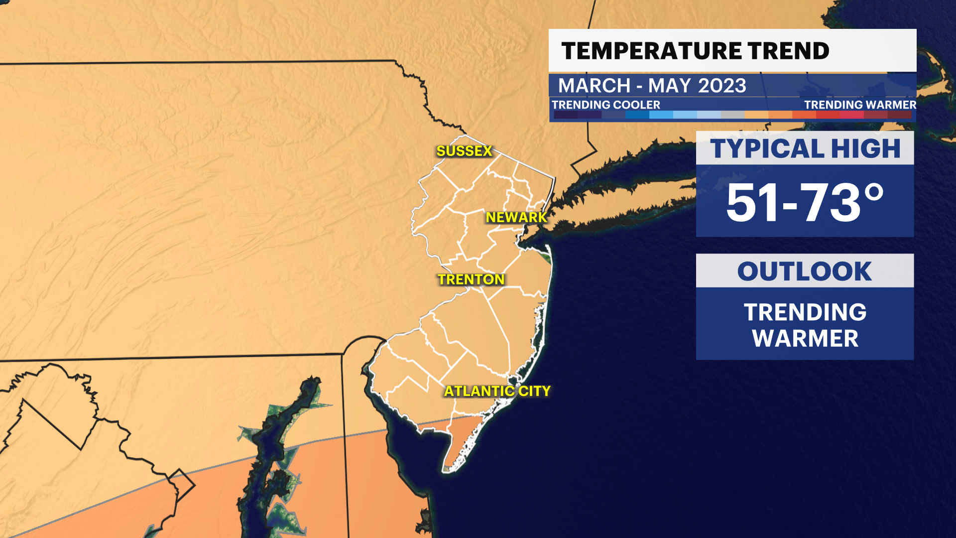
But with the trends for 2023 coming in...it's not looking good for snow.
More from News 12
1:47

Celestial sights you don’t want to miss this April
1:50

Who do you call to fix a pothole? On Long Island, it's complicated
0:39

Blood shortage in wake of February blizzard sparks urgent call for donors
2:05

‘Disgraceful and criminal:' Mob snowball attack against NYPD in Washington Square Park sparks outrage
2:39

Brookhaven Town residents say roads are still covered in snow
0:21
