Rough surf, coastal flooding expected for parts of Long Island this weekend from Lee
News 12 Storm Watch Team Meteorologist Sam Augeri says parts of Long Island could see coastal flooding and rough surf heading into the weekend.
More Stories


News 12 Storm Watch Team Meteorologist Sam Augeri says parts of Long Island could see coastal flooding and rough surf heading into the weekend.
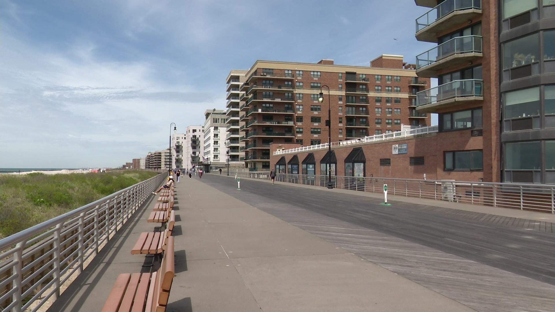
Coastal flood advisory through Sunday morning. Water 1 to 2 ft above ground in vulnerable shoreline areas across Long Island, especially at high tide.
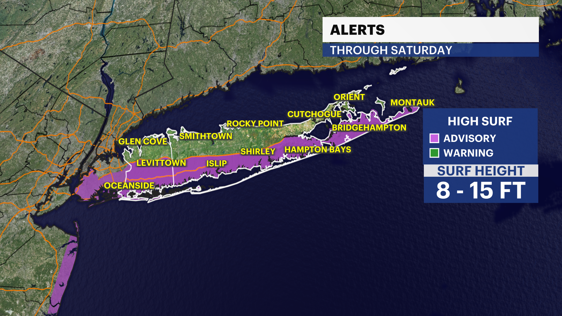
High surf advisory through Saturday. Waves increasing 10 to 15 ft along the South Shore.
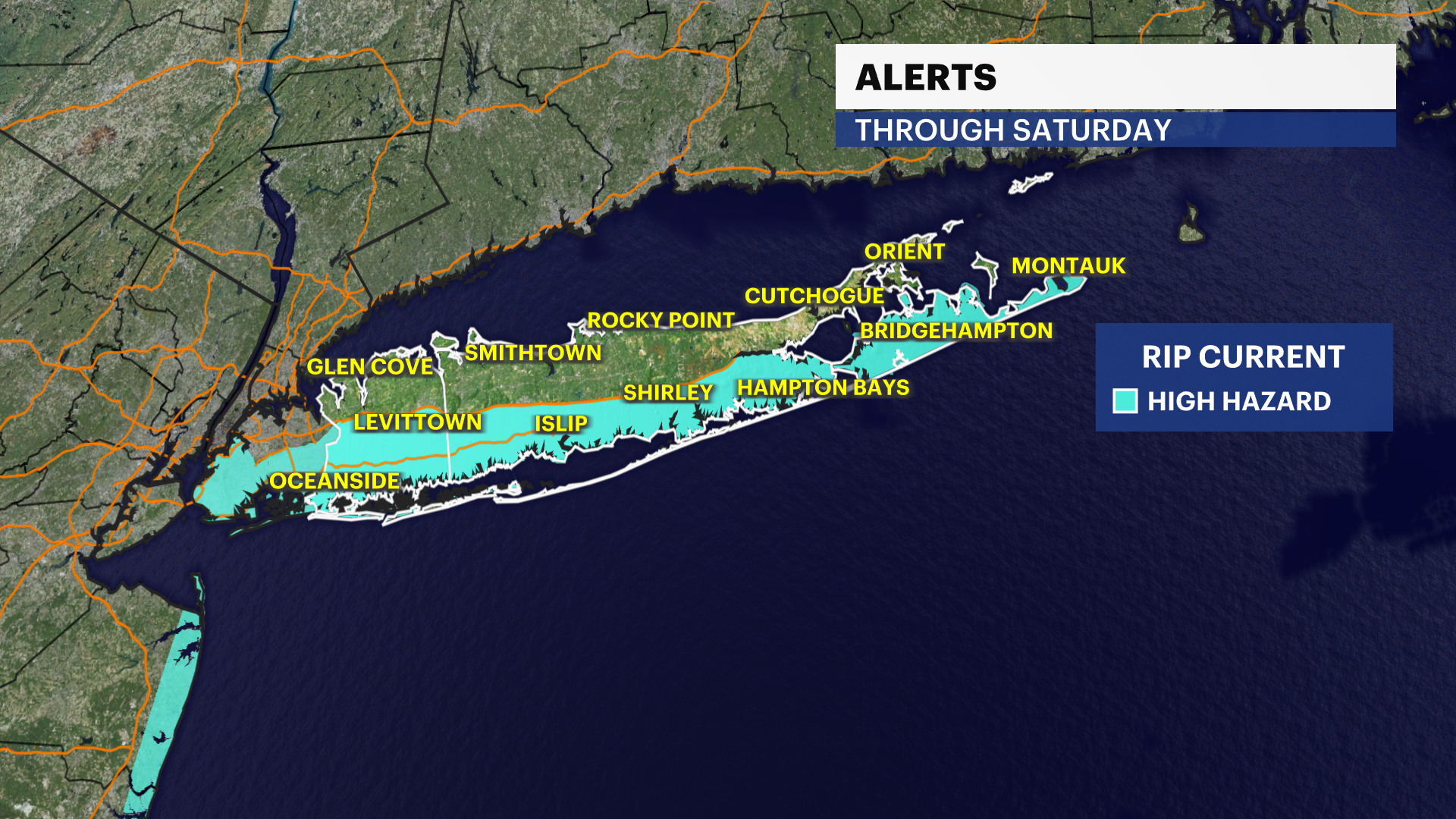
High risk of rip currents through Saturday.
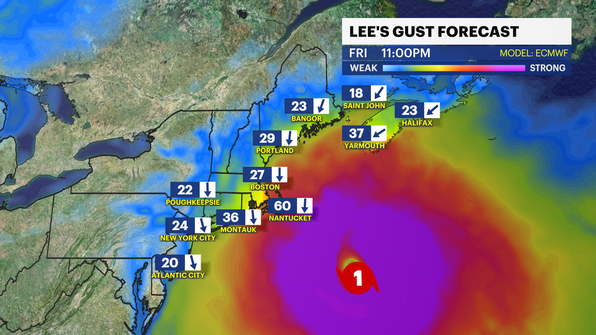
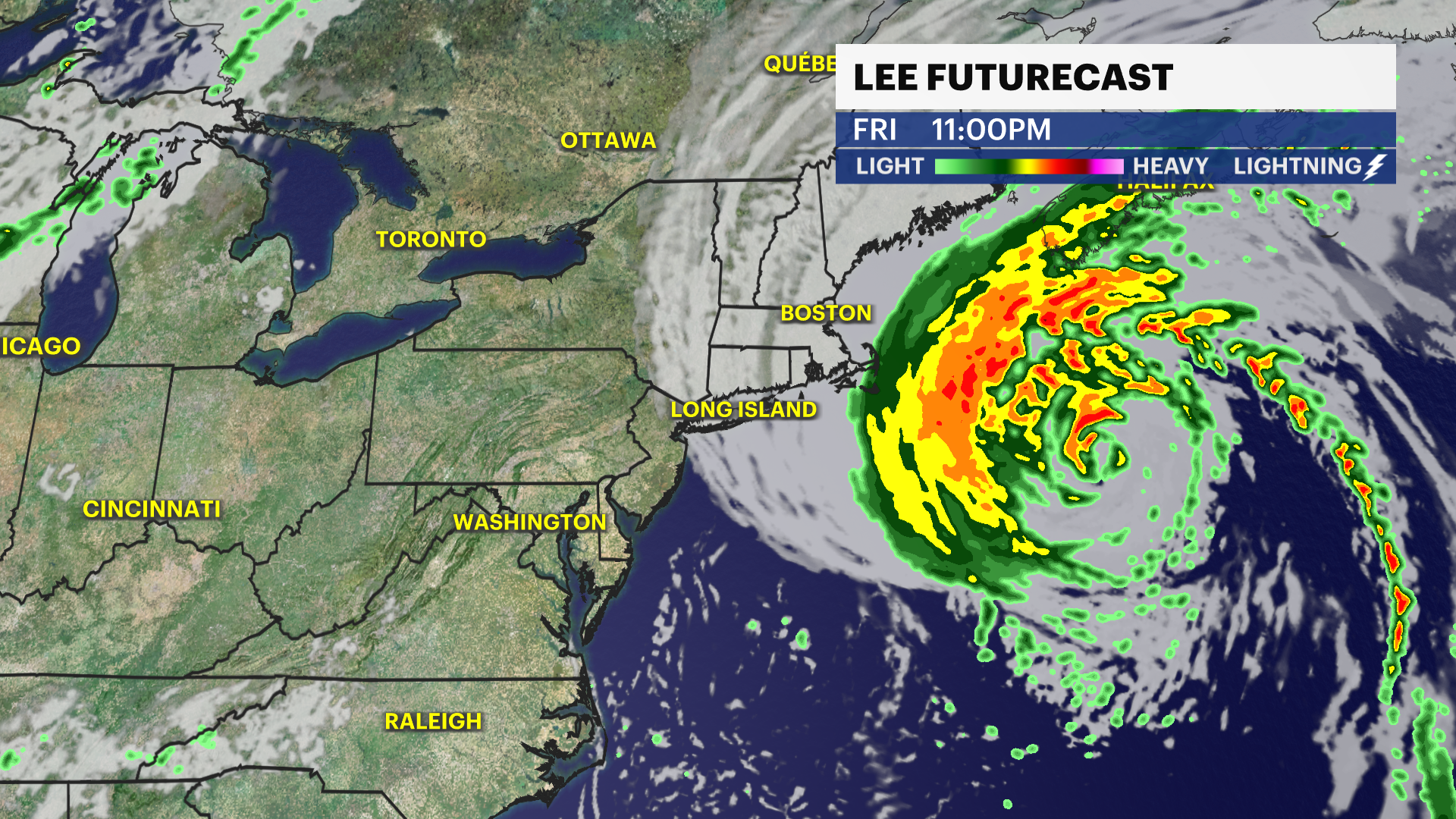
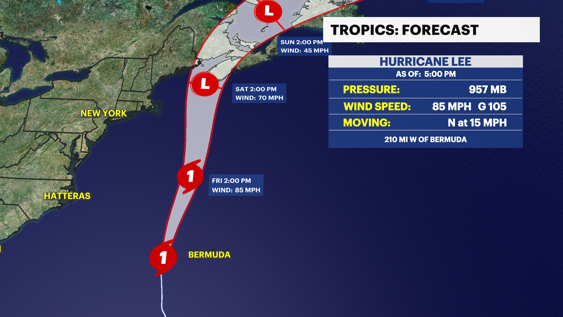
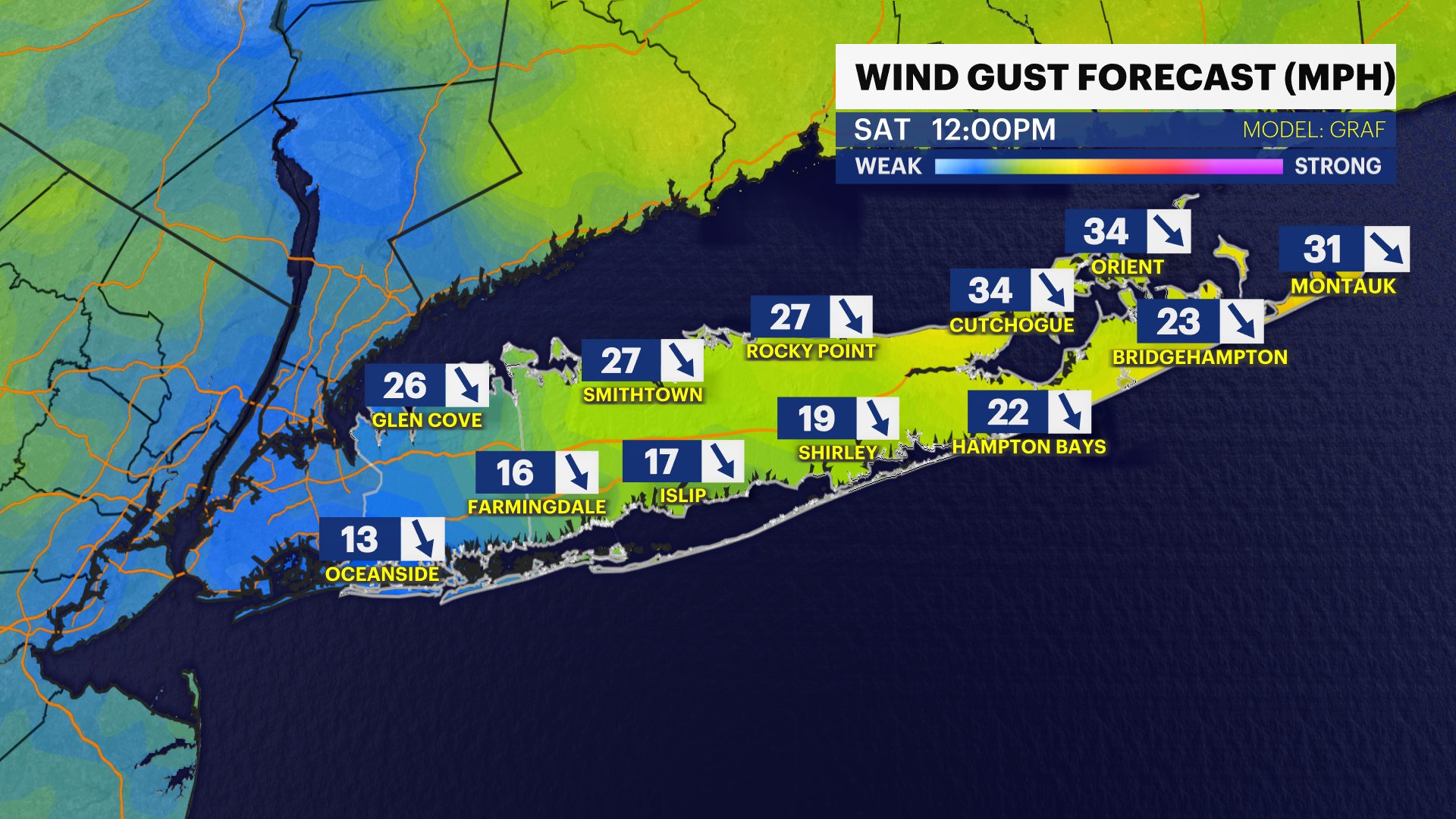
Hurricane Lee: The storm will pass 250 miles to our east Friday night into Saturday morning as a Category 1 hurricane. It will turn windy on the East End by Friday night with northerly gusts 30 to 40 mph, the rest of Long Island 10 to 25 mph. The storm looks to be tracking a bit farther east so we are expecting dry weather, but it will turn mostly cloudy on Saturday.
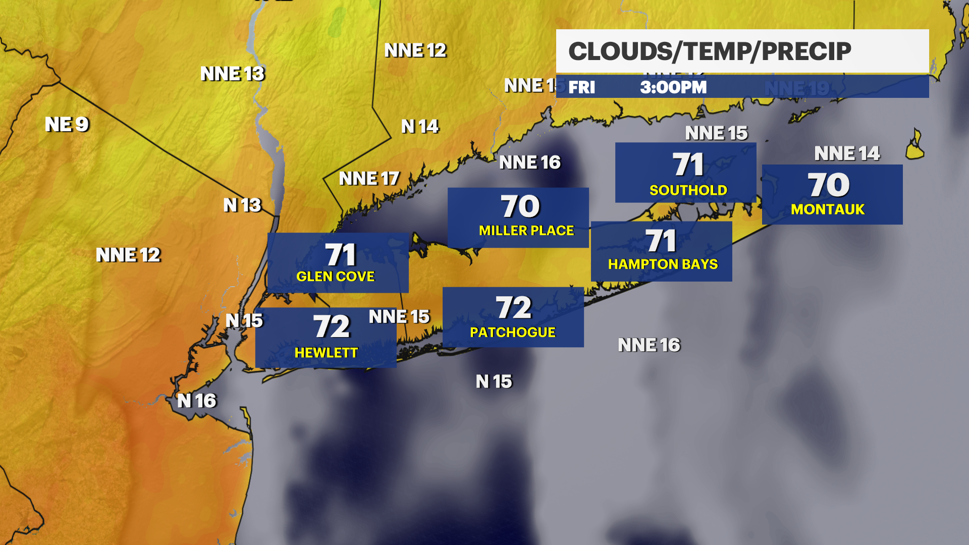
FRIDAY: Partly sunny and breezy with highs near 75. North wind 10 to 20 mph. Sunset: 7:02.
FRIDAY NIGHT: Partly cloudy, breezy, and cool. Lows near 59 with northwesterly winds 15 to 20 mph gusting to 30.
12 tips to avoid getting caught in a rip current
SATURDAY: Partly sunny to mostly cloudy and windy. Highs near 77. Lows near 60.
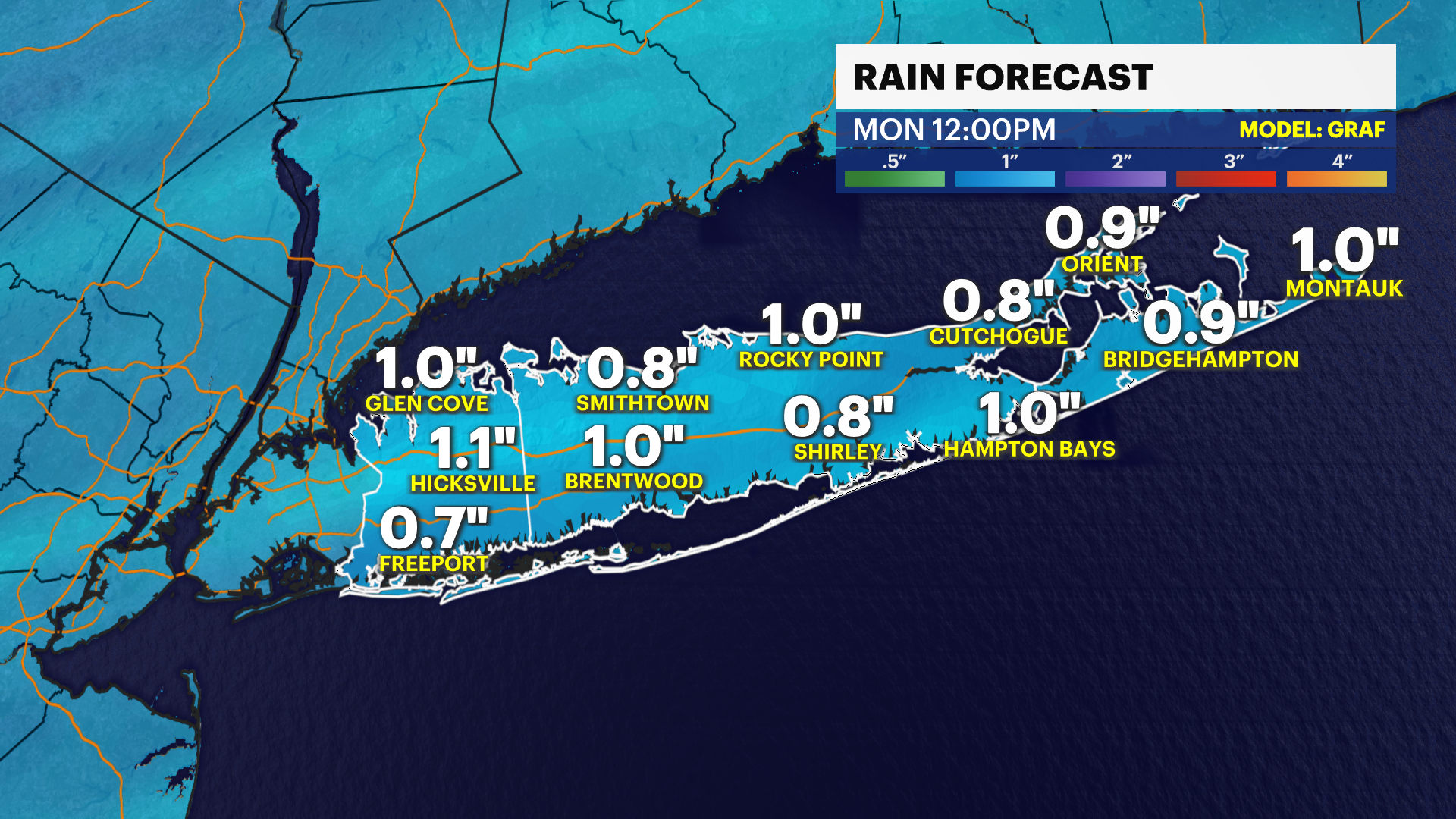
SUNDAY: Mostly sunny and nice with less wind. Highs near 79. Mostly cloudy at night with the chance for a few light showers. Lows near 62.
MONDAY: Mostly cloudy with the chance for a few showers in the morning. Improving during the afternoon. Highs near 77. Lows near 62.