More Stories
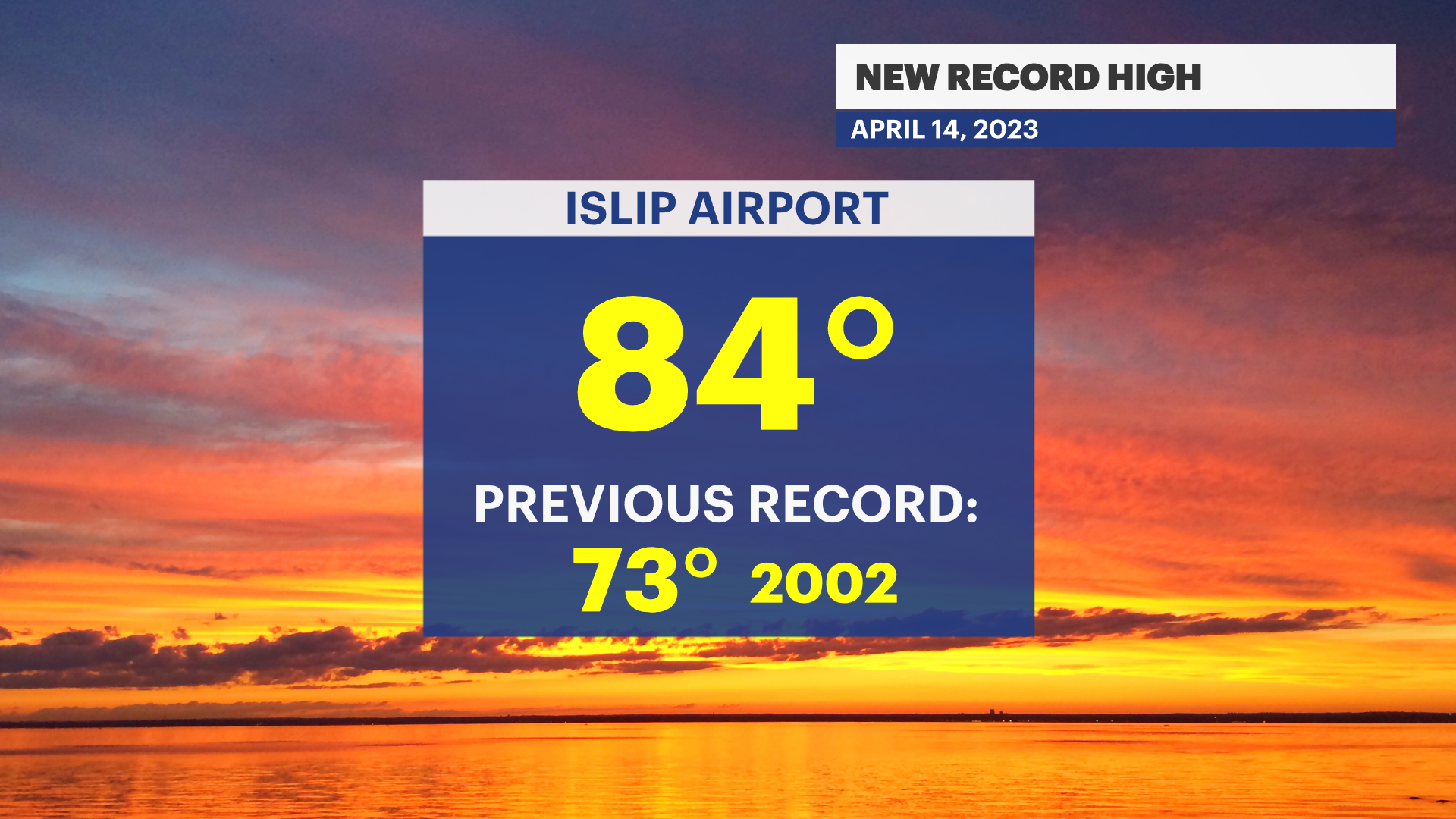
NEW RECORD HIGH FRIDAY OF 84 DEGREES AT ISLIP AIRPORT. PREVIOUS RECORD WAS 73 SET IN 2002.
WHAT'S NEW: The summer stretch ends with cooler temperatures and some showers for the weekend.
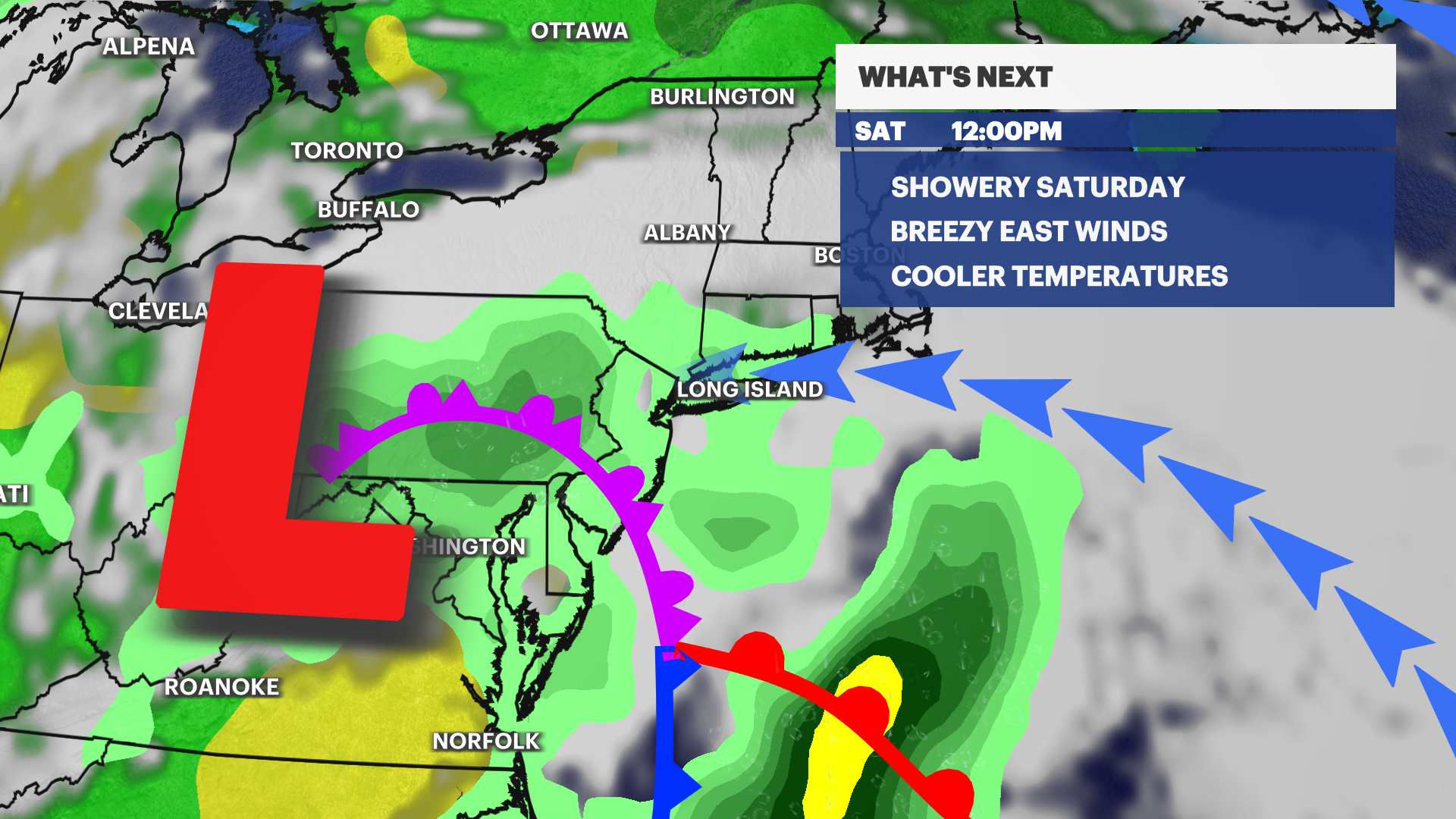
WHAT'S NEXT: Nice spring weather is ahead for much of next week. After showers on Monday we'll be seasonable with some nice mid week sunshine.
News 12 Storm Watch Sam Augeri says cooler temperatures and some showers are expected this weekend

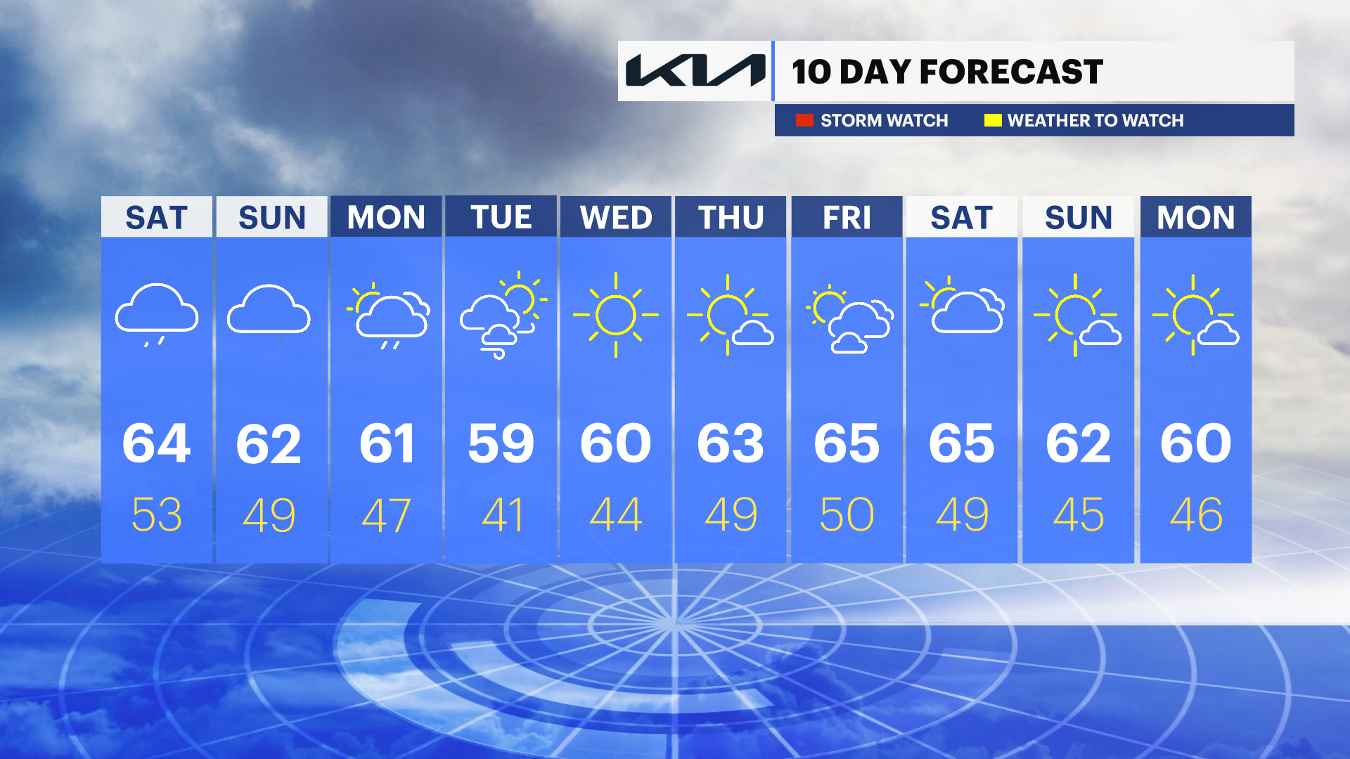
OVERNIGHT: Becoming cloudy and cooler with lows near 54. Patchy fog. South wind 5 to 15 mph. Sunrise: 6:13.
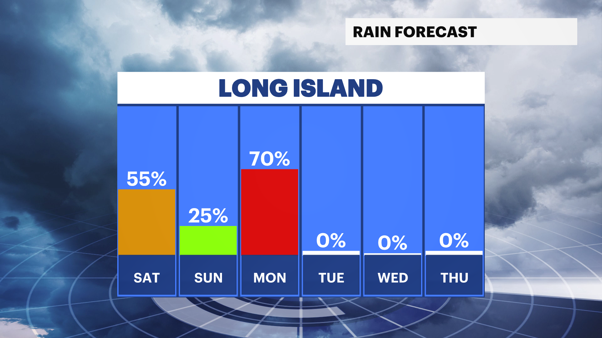
SATURDAY: Mostly cloudy with scattered showers and a chance of thunderstorms late in the day. The best chance for rain is through the late afternoon into the evening. Highs near 64. Cloudy with scattered showers early at night. Patchy fog. Lows near 53. East winds 5 to 10 mph. Sunset: 7:33.
SUNDAY: Cloudy with the slight chance of a passing sprinkle or shower. Most of the day is dry. Highs near 62. Lows near 49.
MONDAY: Mostly cloudy and breezy with a good chance of scattered rain showers. Highs near 61. Lows near 47.
TUESDAY: Mostly sunny and breezy. Seasonable with highs near 59. Lows near 41.
WEDNESDAY: Sunny and beautiful. Highs near 60. Lows near 44.
More from News 12
1:29

Jury in the trial of Guy Rivera expected to begin deliberations Wednesday
0:41

Queens man facing upgraded charges in connection with death of crossing guard in Merrick
1:42

Rain shower chances return tonight; more warmth, some sun and spotty rain Wednesday
1:41

Westbury street undergoing major repairs following News 12 coverage
1:27

Ninth grader and mother save neighbor from house fire before school
0:25
