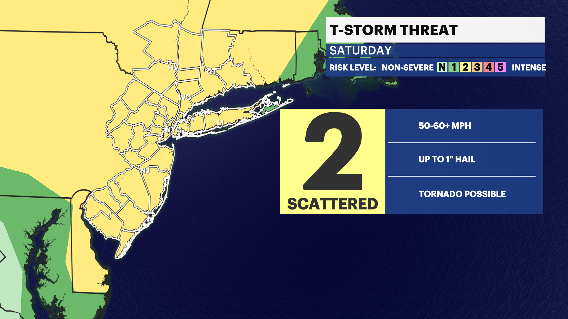
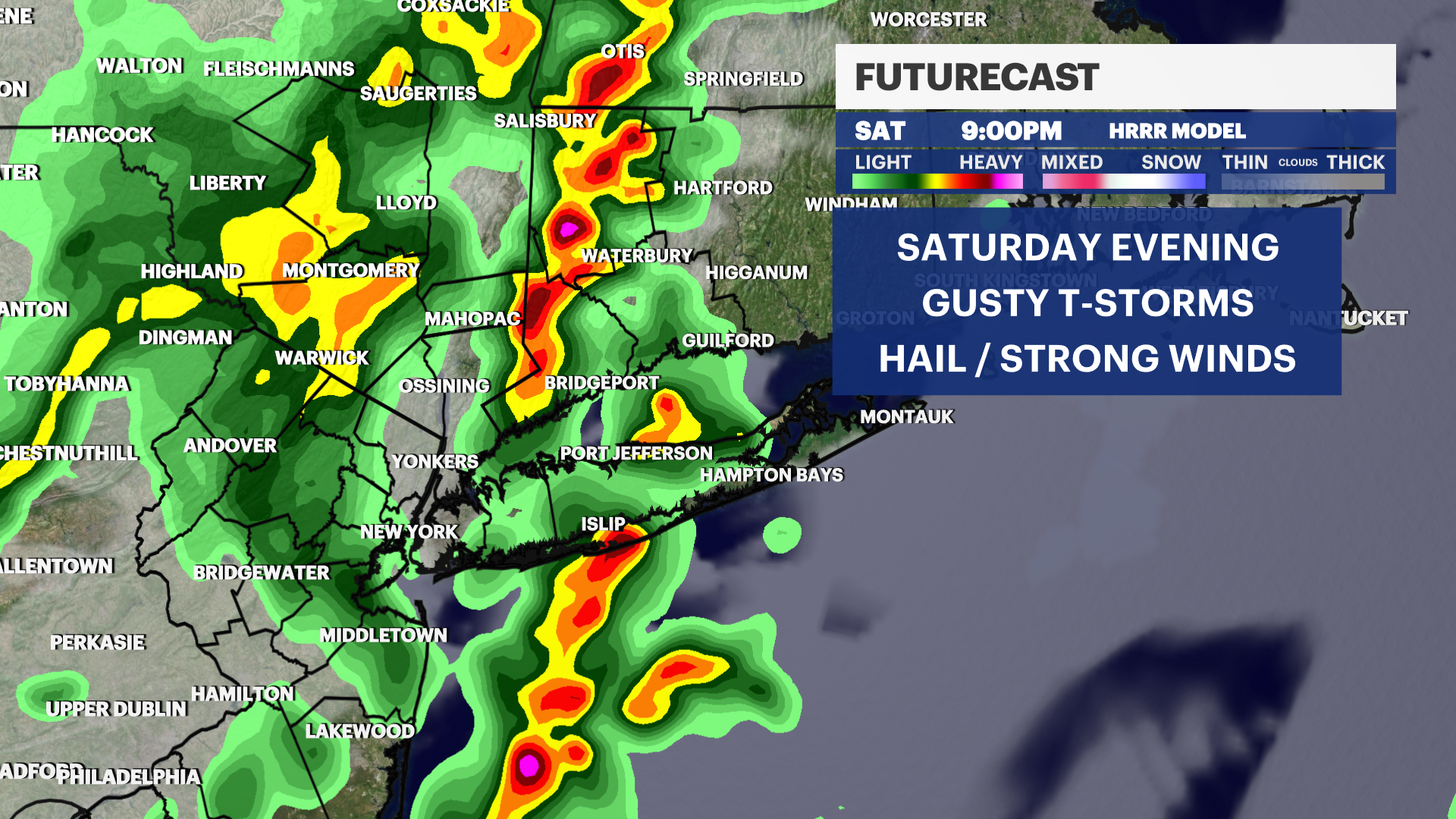
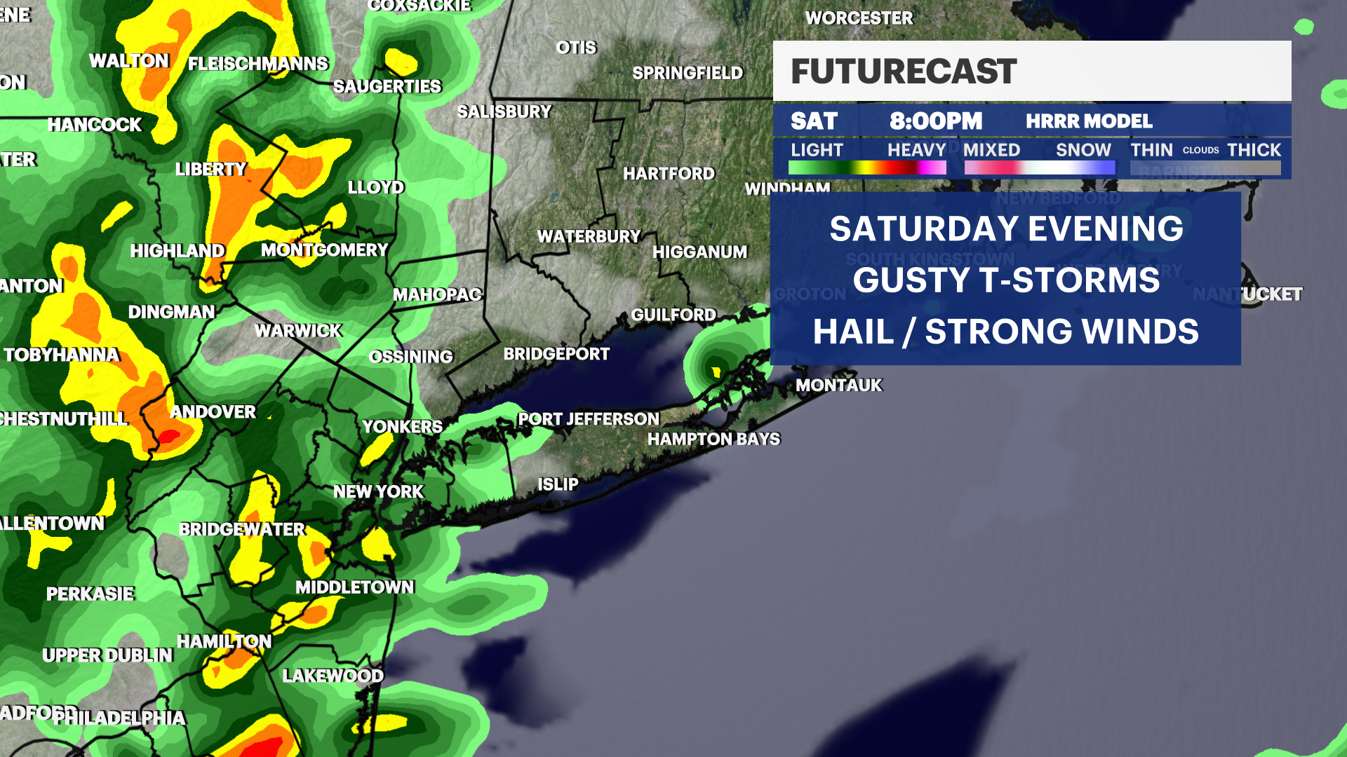
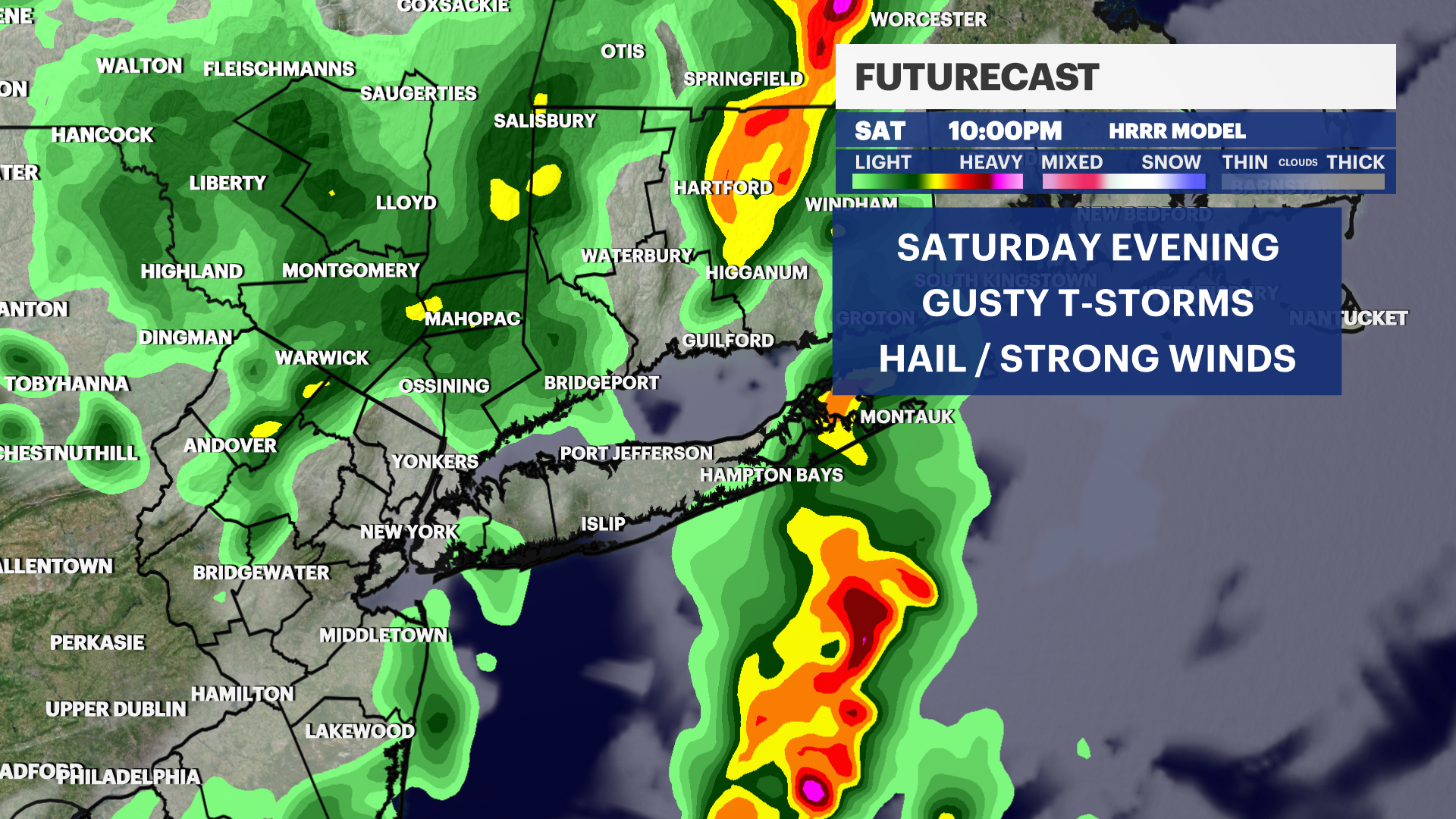
Weather to Watch: Potentially strong thunderstorms with gusty winds for Saturday evening
News 12 Storm Watch Team Meteorologist Sam Augeri says there is a chance for fast-hitting, short-lasting gusty thunderstorms Saturday starting at around 7 p.m.
Share:
More Stories

News 12 weather blog
4ds ago
Expert explains why your appetite seems to drop in the summer
12ds ago1:12

Summer begins with record-breaking heat wave across tri-state
34ds ago1:42

Long Islanders working outside seek to stay safe amid extreme heat
34ds ago
HEAT SAFETY: How hot does the inside of a car get in the summer?
34ds ago1:29

Long Islanders working outside take extra precautions amid heat wave
35ds agoNews 12 weather blog
4ds agoExpert explains why your appetite seems to drop in the summer
12ds ago1:12
Summer begins with record-breaking heat wave across tri-state
34ds ago1:42
Long Islanders working outside seek to stay safe amid extreme heat
34ds agoHEAT SAFETY: How hot does the inside of a car get in the summer?
34ds ago1:29
Long Islanders working outside take extra precautions amid heat wave
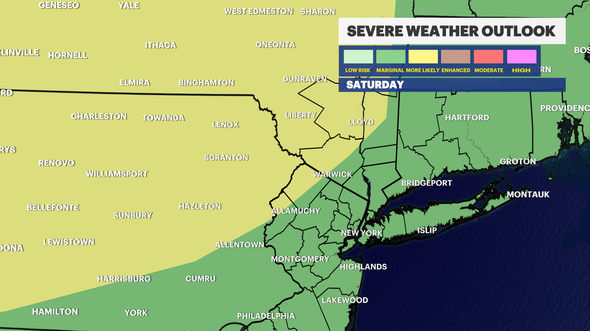
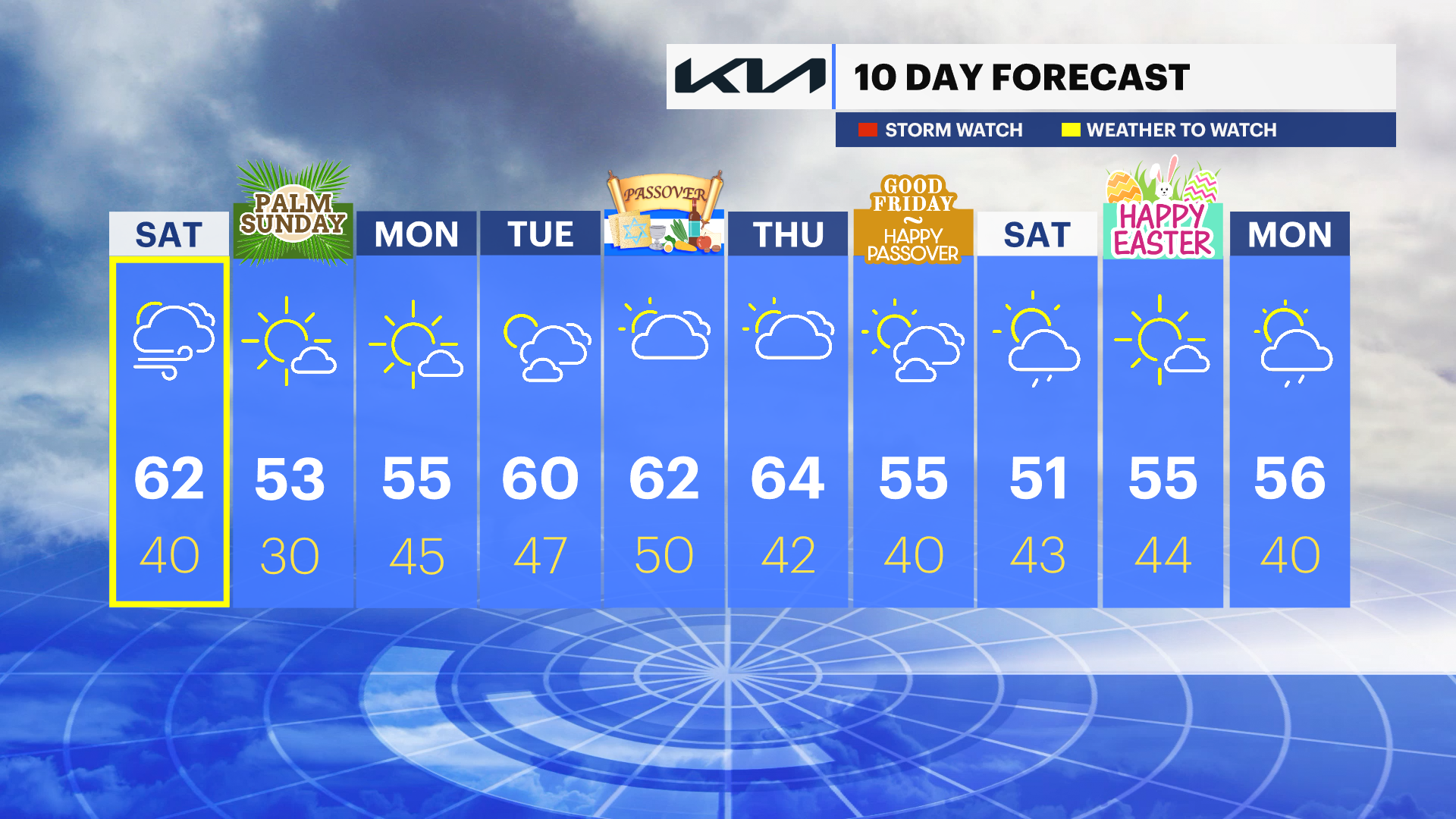
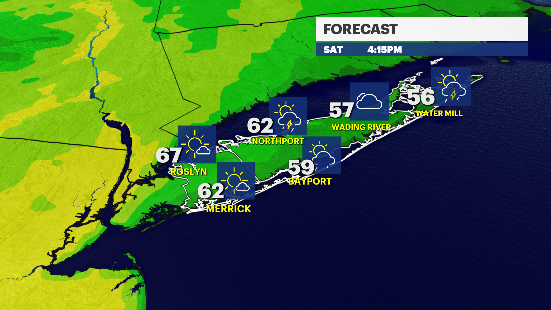
35ds agoWHAT'S NEW: A few showers arrive this evening, but most of the steady rain won't get here until after 2am. Expect periods of rain with gusty winds Saturday morning through lunch time. A midday break with some sun will allow for temperatures to rise to near 70 degrees in parts of Nassau County with upper 50's to mid 60s elsewhere. A cold front approaches in the evening with the chance for thunderstorms between 5 and 10pm. The best chance will be in Nassau County where it's warmer but quite often this time of year any storms will weaken as they track across LI with winds off the water and a marine layer. NYC and NJ have a better chance for seeing some strong to severe storms.
WHAT'S NEXT: Sunday clears with sunshine and a cooler breeze. Much of next week is warmer with highs near 60 degrees and a few mid week showers.
News 12 Storm Watch Team Meteorologist Sam Augeri says there is a chance for fast-hitting, short-lasting gusty thunderstorms Saturday starting at around 7 p.m.
OVERNIGHT: Cloudy and breezy with showers developing. Lows near 47 with southwest winds 10 to 20 mph. Sunrise: 6:35
SATURDAY: Cloudy and breezy with rain in the morning. Partly sunny and warm in the afternoon with the chance of late day thunderstorms. Highs near 62. Southwest winds 10 to 25 mph. Sunset: 7:18.
SATURDAY NIGHT: Showers end. Partly cloudy and windy with lows near 40. Southwest to northwest winds 20 to 40 mph.
SUNDAY: Sunny, breezy, and cooler with highs near 53. Lows near 30.
MONDAY: Mostly sunny and breezy. Highs near 55. Lows near 45.
TUESDAY: Sun and clouds. Highs near 60. Lows near 47
More from News 12
1:54

250 patients file lawsuit against Northwell Health over alleged illegal surveillance at Great Neck facilities
2:22

HEAT ALERT: Extreme heat continues; cooler at South Shore beaches
0:19

Southwest offering flights from MacArthur to St. Thomas through BWI in 2026
1:57

2 Long Islanders participate in world's biggest kids golf tournament
1:40

Garden Guide: How to get rid of a yellow jacket nest
0:18
