STORM WATCH: Sun and soaking showers this morning on Long Island
Today is not a washout, but there will be isolated downpours in between sunshine today.
More Stories


RIGHT NOW
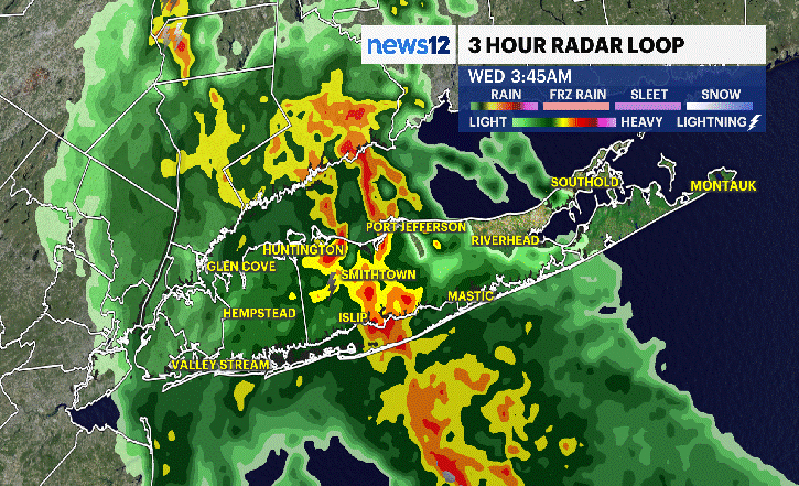
Mostly cloudy skies and humid conditions are here to stay today. Stray showers are popping up around the island. The radar image above displays the past three hours. The most notable feature this morning is how isolated the rain is. Some of us stay dry while other neighborhoods will be soaked. Severe weather is not expected.
LESS RAIN THIS AFTERNOON
The risk for rain decreases throughout the day although there will be a threat for a few pop up storms until the evening. Any storms could produce quick ponding on the roads. Use caution traveling if you get caught in any heavy rain. Rain chances will diminish into Thursday evening ahead of a couple of drier days!
FABULOUS FOR FRIDAY
Sunny skies return tomorrow with a pleasant morning in the low 60s. Areas of fog are expected early, but sunshine will quickly diminish the fog by 8 a.m. The rest of the day is muggy with highs in the mid 80s. A stray rain cloud is possible.
THE WEEKEND
Saturday is the pick out of the weekend. There will be a mix of sun and clouds with temperatures in the mid 80s. Rain is not expected.
Sunday is mainly cloudy with scattered showers in the afternoon or evening. It does not look like a washout, but it will not be perfect. High temperatures are in the low 80s.
MARINE CONDITIONS
There are no weather related alerts for boaters today. Ocean swells are generally 2-3 feet today with winds from the north at 10 to 15 mph. There is a moderate risk for rip currents today and tomorrow.


