More Stories
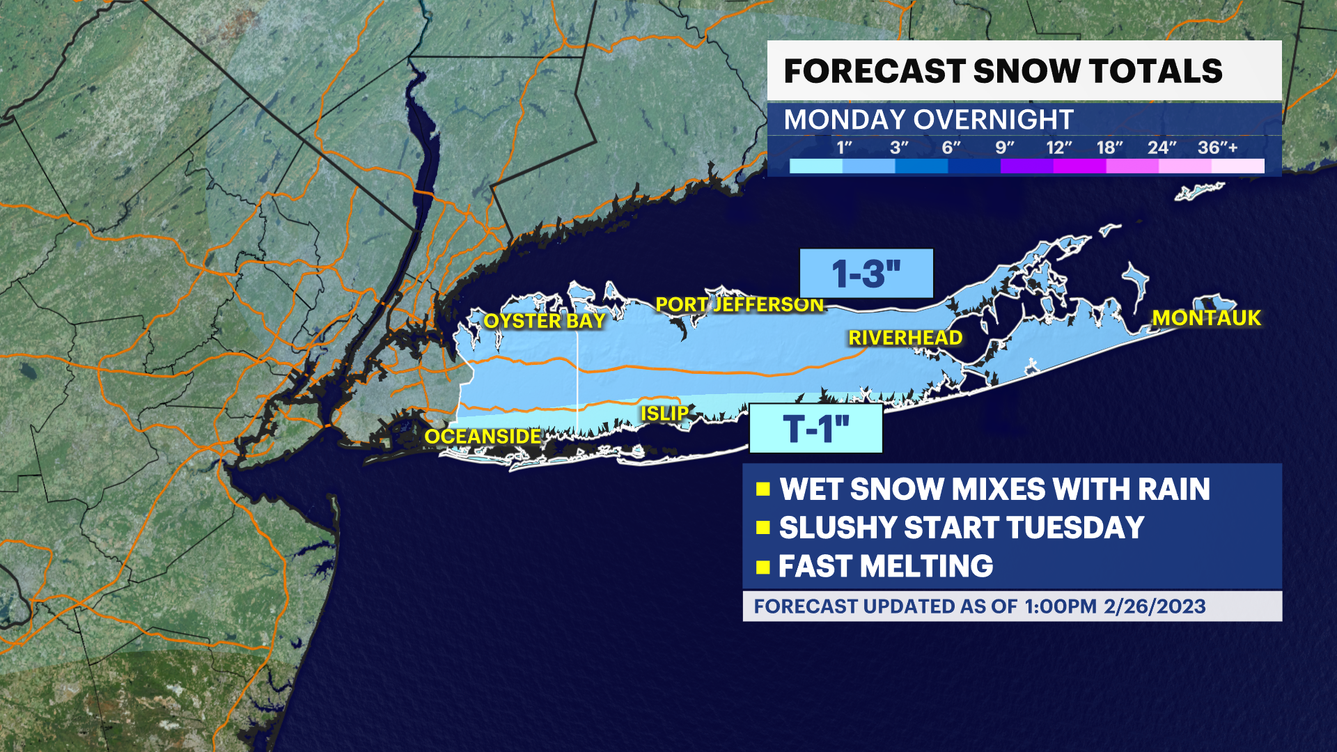
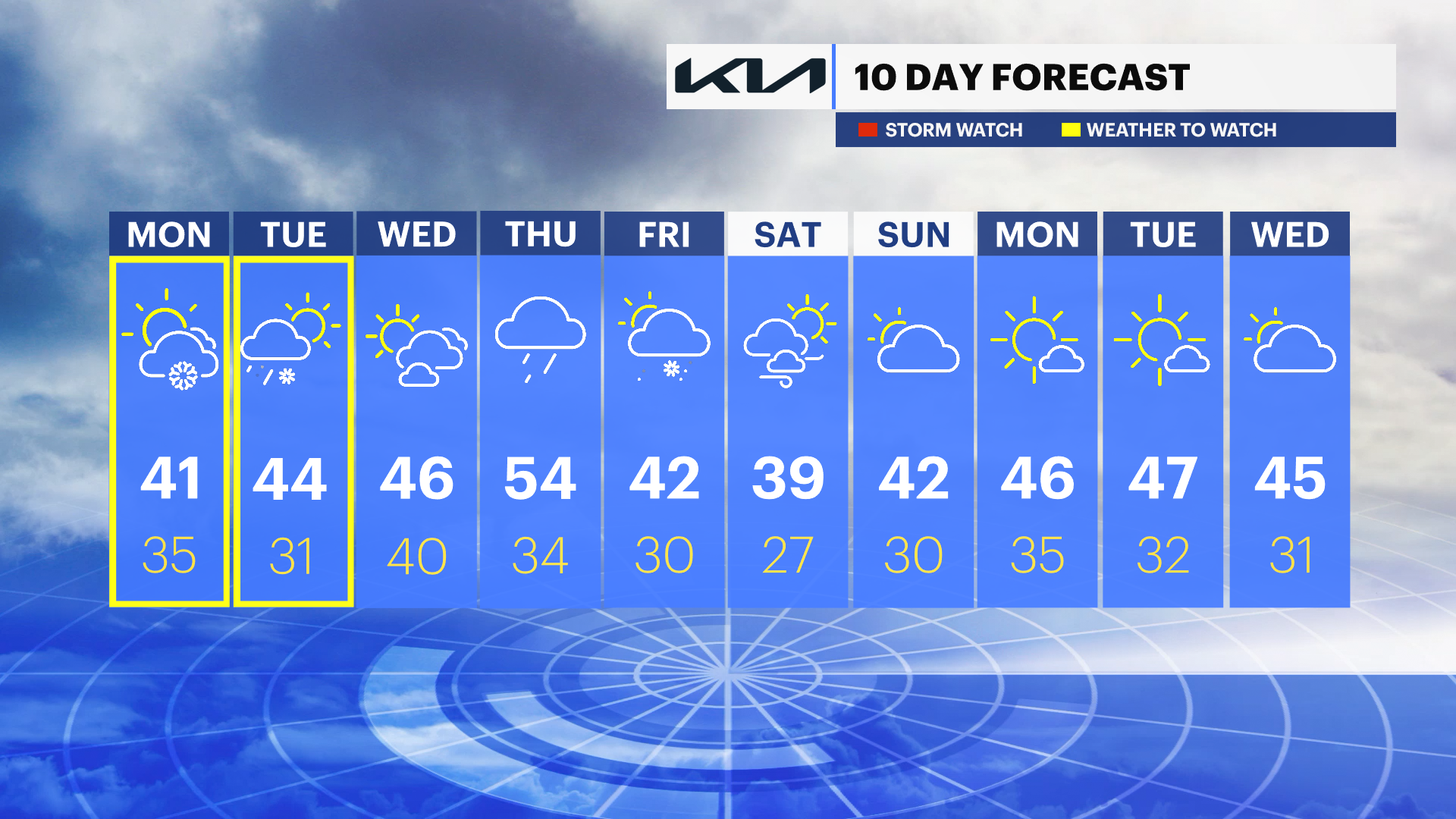
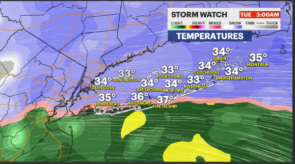
News 12 Storm Watch Team Meteorologist Craig Allen says to expect wet, heavy snow with minor accumulations Monday night into Tuesday morning.
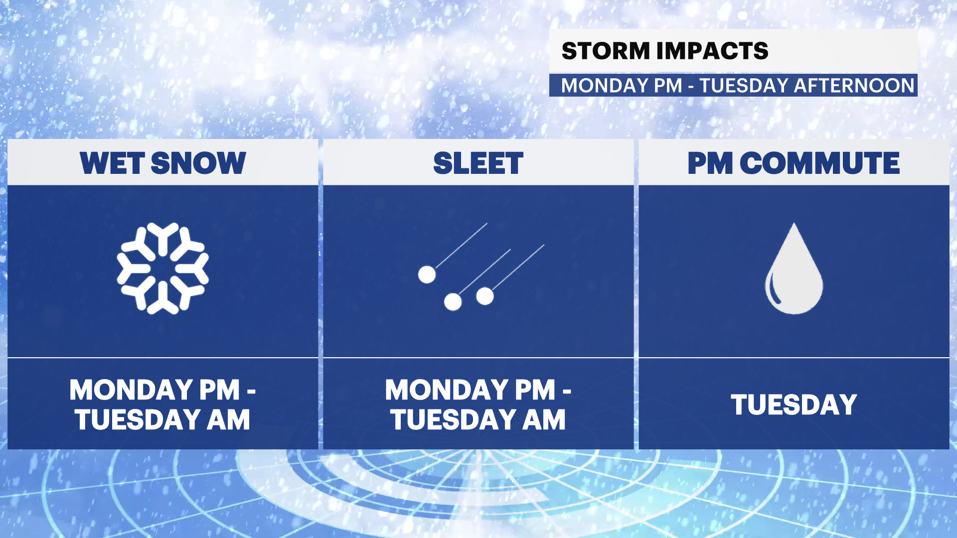
NEXT: Snow is expected after 6 p.m. Monday into Tuesday morning. There's a better chance of a switch to a mix/rain Tuesday morning into early afternoon. Slushy accumulations expected. Some totals under 1 inch, but a few neighborhoods could see up to 3 inches.
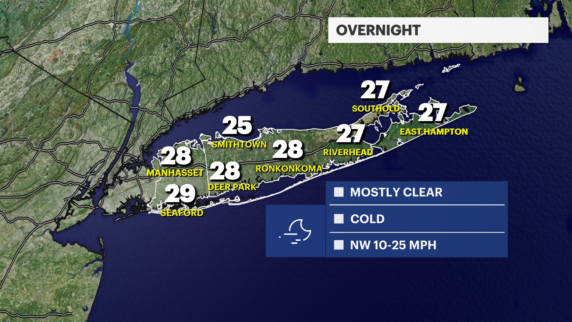
OVERNIGHT: Mostly clear skies and cold. Lows in the upper-20s.
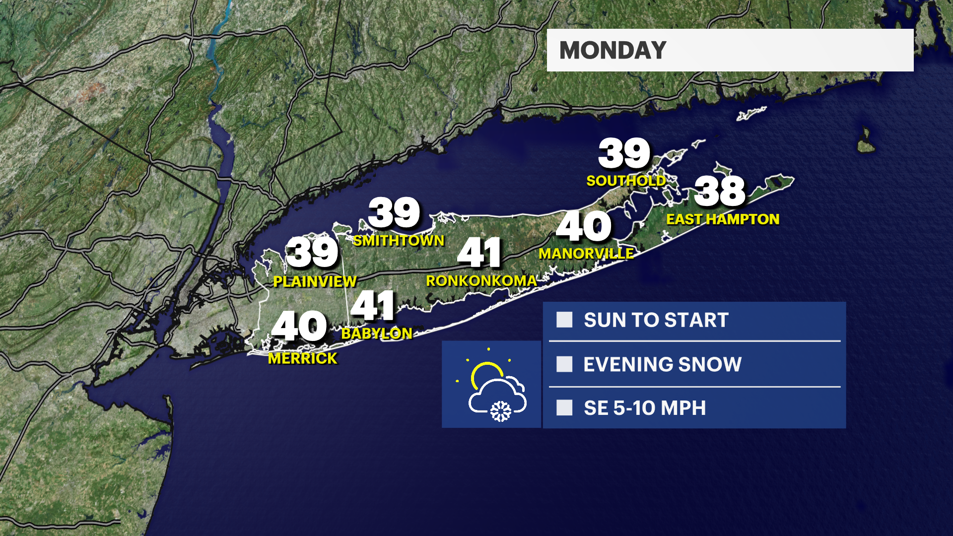
MONDAY: Sunny to start with increasing clouds into the afternoon. Snow likely after 6 p.m. with wet snow transitioning for some to a mix/cold rain into Tuesday morning. Highs in the upper-30s to low-40s. Lows in the mid-30s.
TUESDAY: Slippery early, dry in the afternoon. Highs in the 40s. Lows in the 30s.
WEDNESDAY: Scattered clouds with some sun. Highs in the mid- to upper-40s. Lows near 40.
More from News 12
1:44

Adult, child killed in Hempstead apartment building fire
1:52

A winter feel with gusty winds; stormy weather on Monday

Two men in separate cars shot while driving on Sagtikos Parkway
1:41

Man accused in DWI crash that killed Nassau officer pleads not guilty to upgraded charges
0:33

John Gotti’s grandson granted sentencing delay to donate kidney to his mother
0:25
