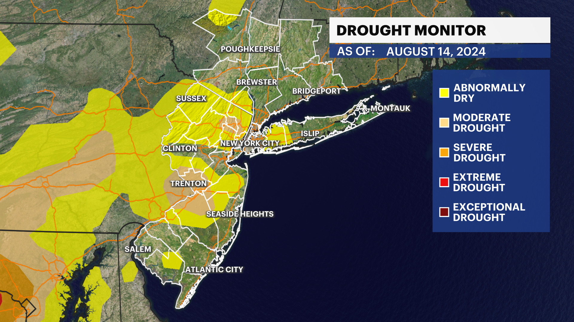
Skies slow to clear, but humidity eases across New Jersey
The weather improves for most of the week. Temperatures are pleasant and the sun is shining. Until it's not. Friday looks stormy once again
More Stories


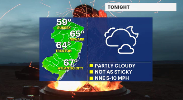
The rain has been rebellious today. It hasn't been a full soaker, but the mist has been more of an annoyance. Overall, the clouds should stick around for most of tonight. The rain will slowly be dragged east. For a brief moment, the humidity will go on hiatus as the breeze cleanses our atmospheric palate.
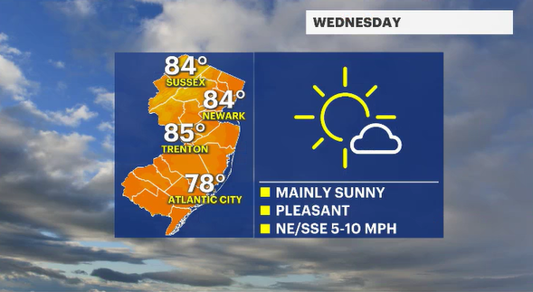
Wednesday looks to be the best day of the week. It will be sunny. The air will feel pleasant. And the humidity won't be so demoralizing when spending time outside. Temperatures, in fact, will be near, or just slightly below, where they should be for this time of year.
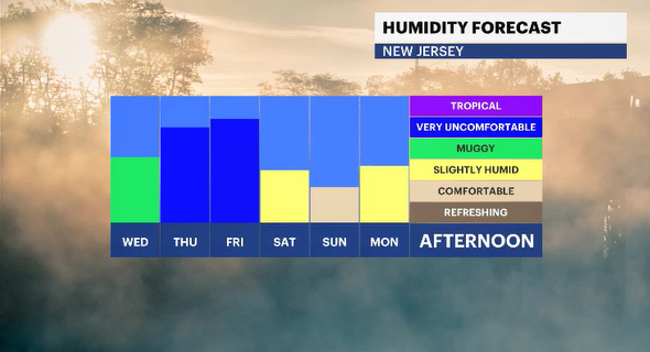
By Wednesday night, the winds change direction again. The humidity will be on the rise, slowly. The skies should be starlit save for a few fair-weather nighttime clouds.
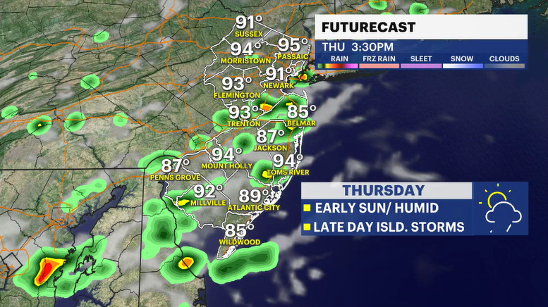
Thursday starts sunny. The humidity will continue to climb. Clouds will slowly collect toward mid to late afternoon. There is a chance for an isolated, widely scattered storm to develop. Something we will need to watch given the deluge we just dealt with. Friday is wet and stormy to end the week.