More Stories
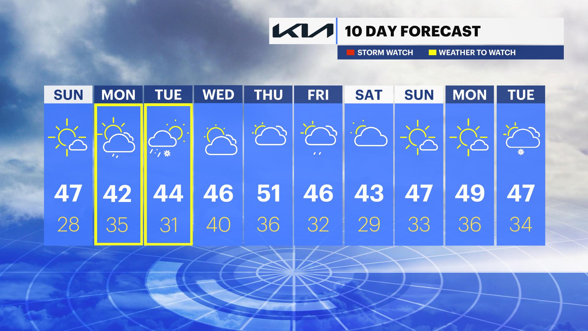
News 12 Storm Watch Team Meteorologist Meredith Garofalo says all eyes will be on the storm system Monday evening into Tuesday. There will be measurable snow, but how much?
NEW: All eyes on the storm system Monday night into Tuesday. Will see some measurable snow, the question will be how much and be determined by if/when the snow switches over to a mix/rain Tuesday morning.
NOW: Quiet and cold overnight.
NEXT: More sun and warmer on Sunday.
FORECAST:
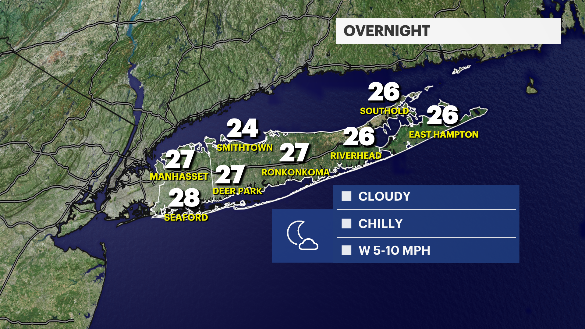
OVERNIGHT: Clearing out. Still cold. Lows: mid to upper 20s.
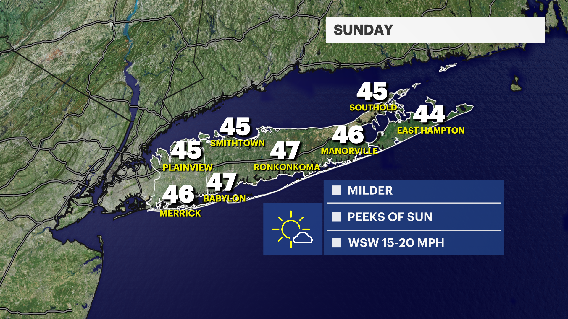
SUNDAY: More sunshine. Milder in the afternoon. Highs in the mid- to upper-40s. Lows in the upper-20s.
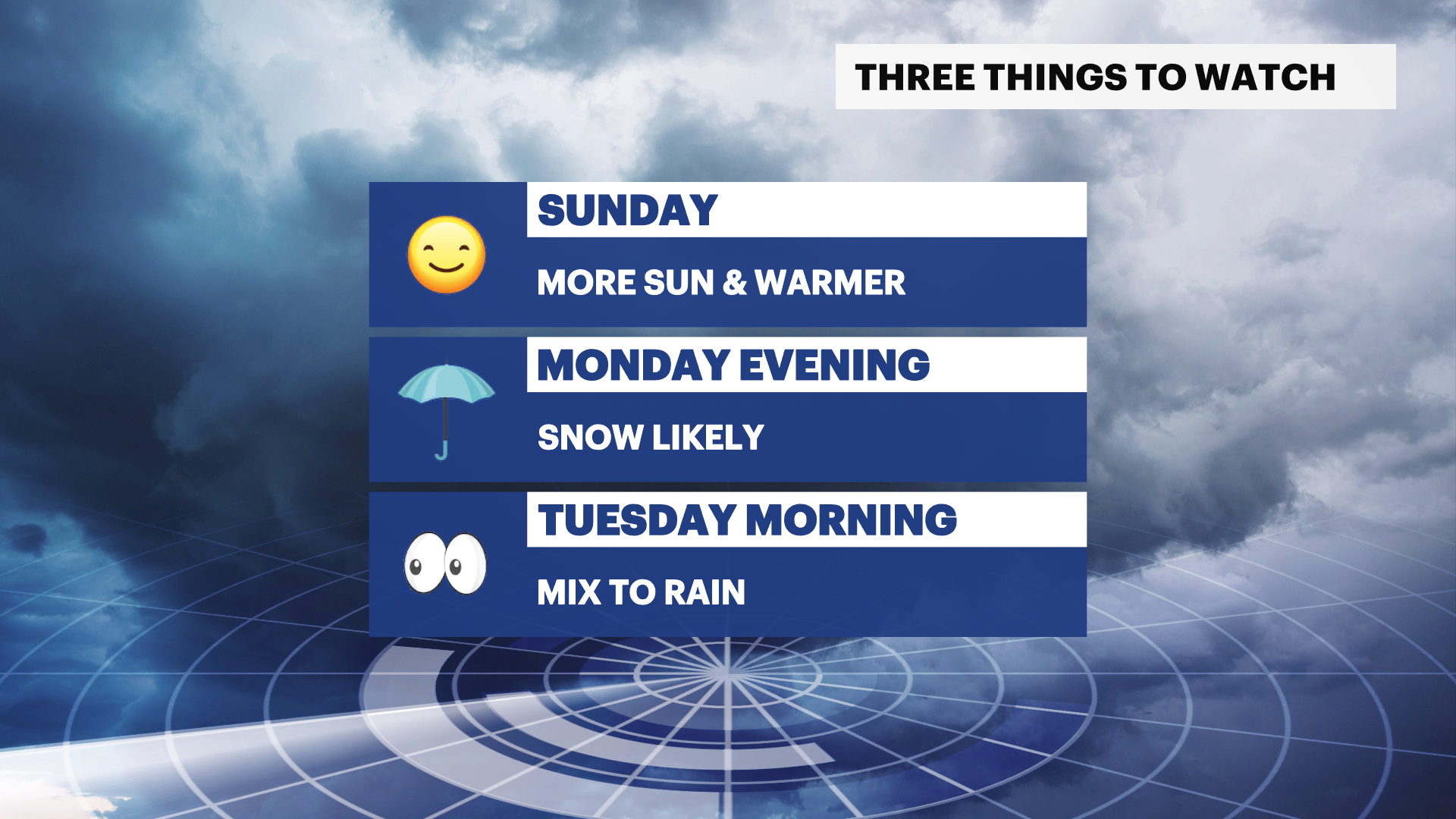
MONDAY: WEATHER TO WATCH (PM) - Mostly cloudy to overcast. Snow likely after 6 p.m. with the chance to start to become a mix in the overnight. Highs in the low-40s. Lows in the mid-30s.
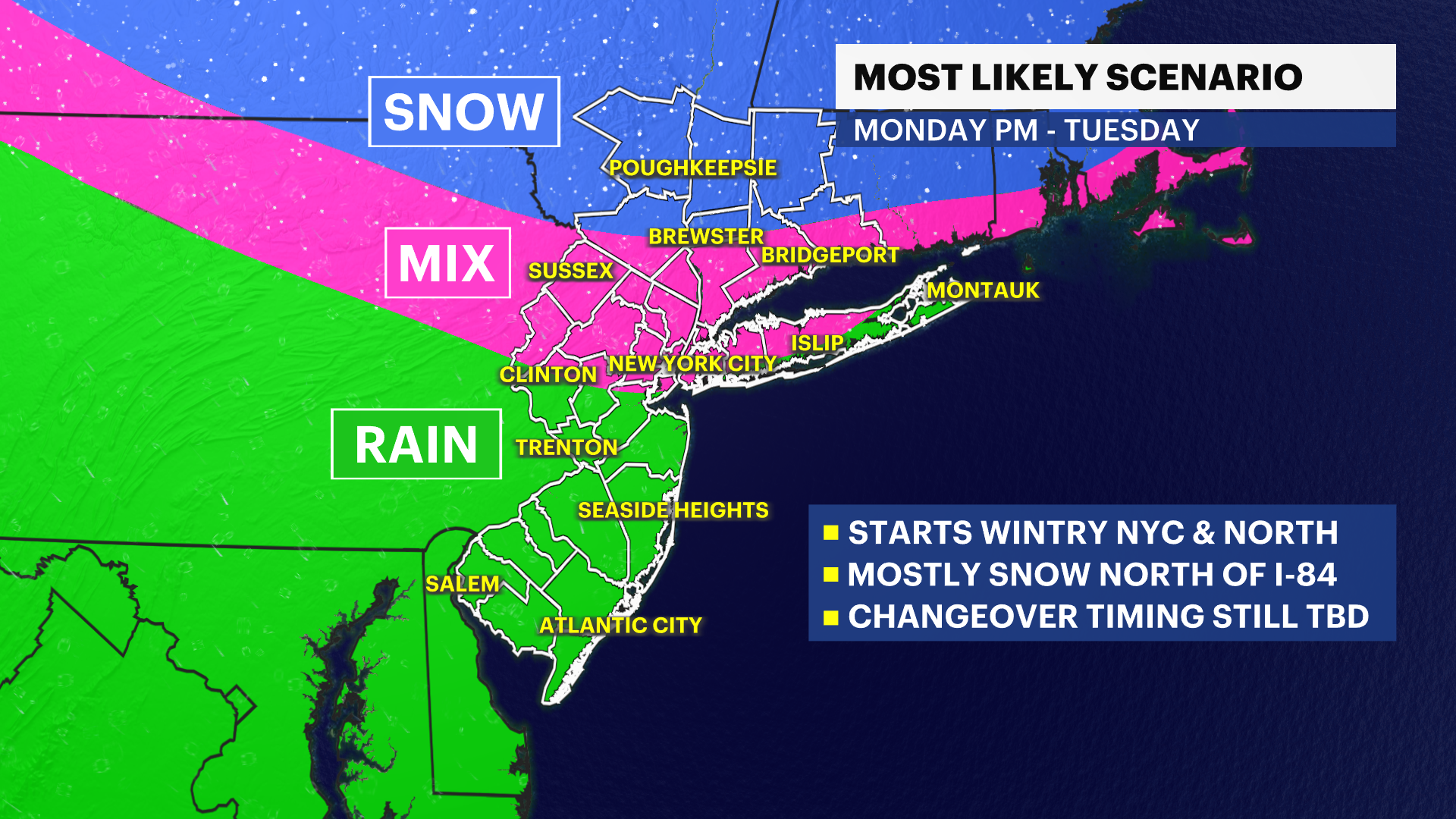
TUESDAY: WEATHER TO WATCH (AM) - Depending on the temperatures, still could have some lingering snow otherwise moving into a wintry mix or rain expected early, then cloudy and dry in the afternoon. Highs in the 40s. Lows near 30.
WEDNESDAY: (MARCH 1) – Scattered clouds. Highs in the mid- to upper-40s. Lows near 40.
THURSDAY: Mostly cloudy with scattered rain showers. Milder. Highs near 51. Lows in the 30s.
FRIDAY AND SATURDAY: Tracking a future winter storm. Will be the next one to watch after the one to kick off the week.
More from News 12
1:32

Nesconset man faces DWI and weapon charges following early morning crash in Elwood
2:22

Wet and breezy Easter Sunday is on tap for Long Island
1:49

Hundreds get baptized during Easter vigil masses in Rockville Centre Diocese
0:47

Man accused of sex trafficking and promoting prostitution at Patchogue motel
1:32

AAA shares tips to gear up vehicles before spring and summer travel
0:58
