More Stories
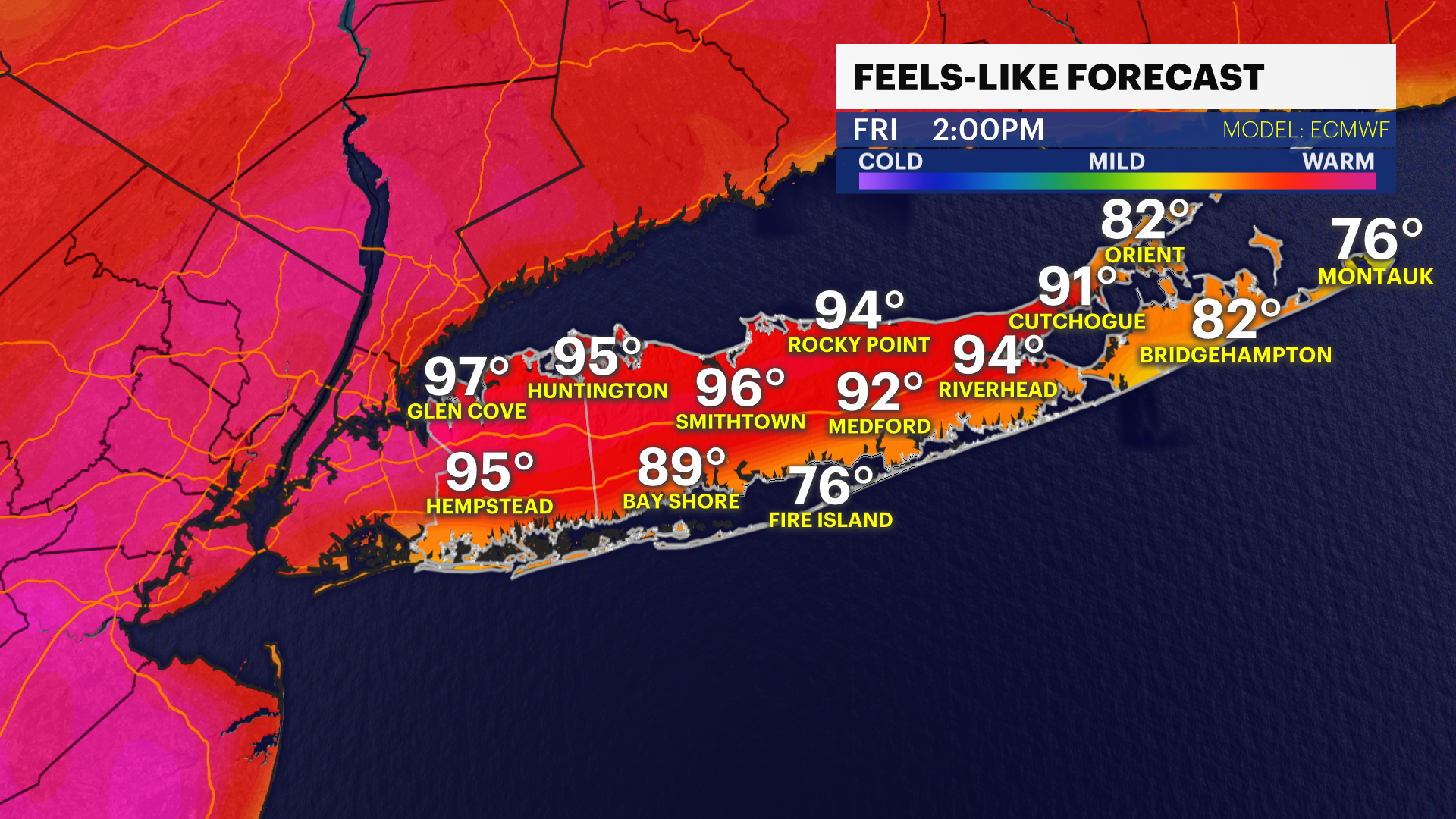
A heat advisory is in effect for Log Island through Friday at 8 p.m.
WHAT'S NEW -- HEAT ADVISORY again until 8pm Friday. Feels like temperatures 95 to 100. Islip didn't set a new record as high only reached 90. Record high is still 91 set in 2006.
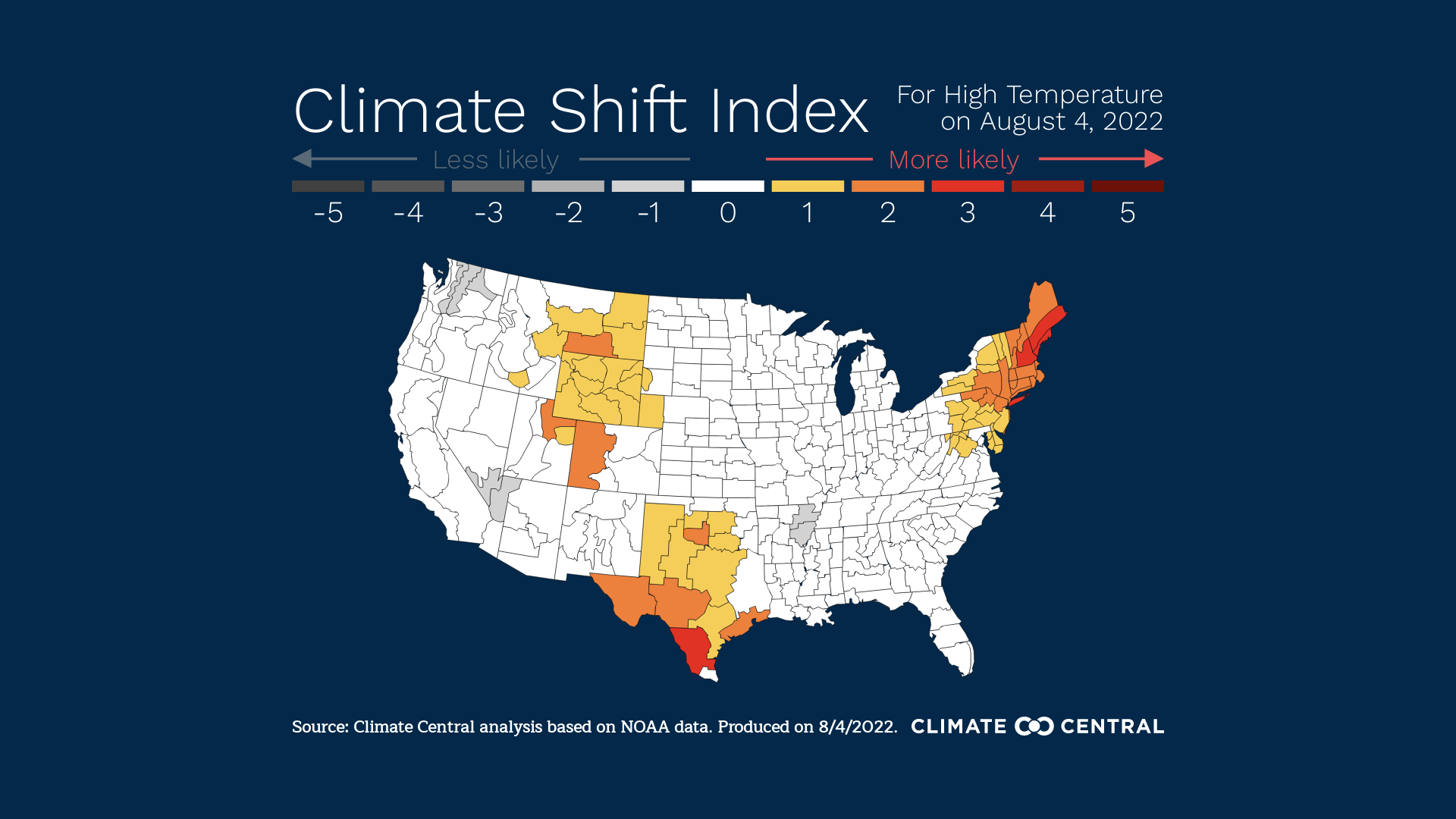
A real time climate shift index fingerprint shows that climate change made today's heat is 3x more likely to occur.
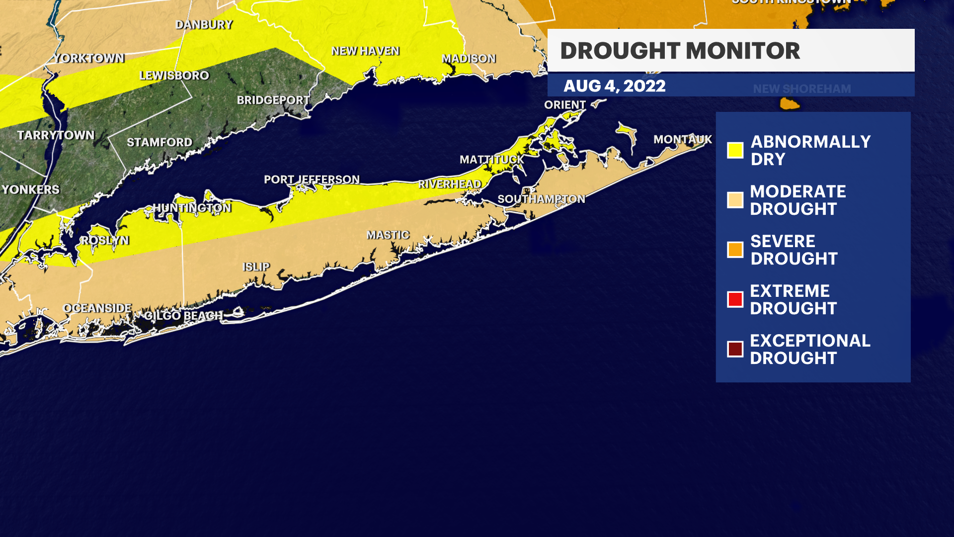
WHAT'S NEXT -- Record temperature for overnight warmth may be tied tonight: 76 degrees set in 1989. Storms likely tomorrow evening and early Saturday. Any storms can have heavy flooding rains, gusty winds and small hail. No storm will be a drought buster.
News 12 Storm Watch Team meteorologist Mike Favetta says the heat advisory continues into Friday before a threat of storms to start the weekend.
TONIGHT: HEAT ALERT - HEAT ADVISORY - Partly Cloudy. Patchy fog. Warm and Muggy. Lows 70 to 75.
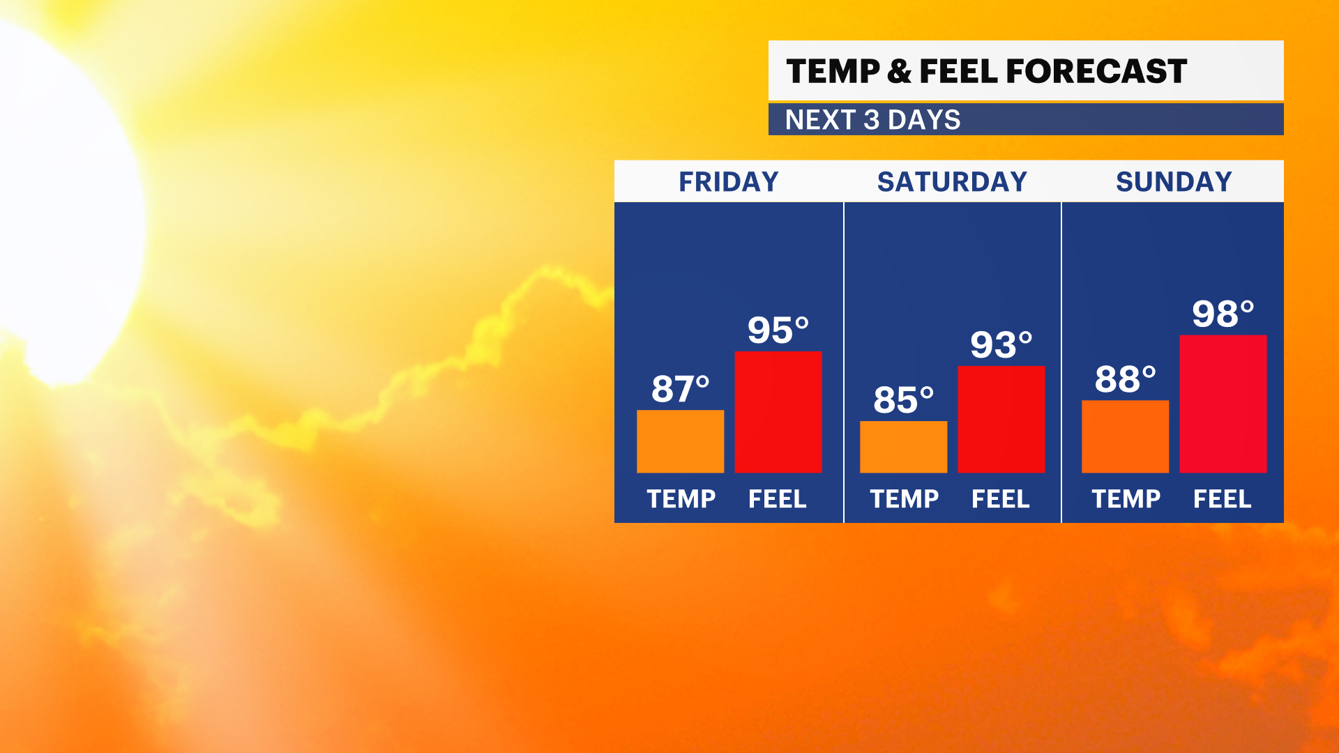
FRIDAY: HEAT ALERT - HEAT ADVISORY -Partly Sunny. A few afternoon showers and thunderstorms. Any storms can have heavy rain, gusty winds and small hail. Highs 85 to 90. Feels Like or Heat Index 95 to 100 degrees.
FRIDAY NIGHT: Partly Cloudy. Warm and Muggy, patchy fog. Chance of a shower or thunderstorm. Lows near 73.
SATURDAY: Partly Sunny. A few afternoon showers and thunderstorms. More dry conditions than wet. Highs 85 to 90. Feels Like or Heat Index 90 to 95 degrees.
SATURDAY NIGHT: Partly Cloudy. Chance of a shower or thunderstorm. Lows near 74.
SUNDAY: Sun and Clouds. Warm/Hot. Highs 83 to 88.
SUNDAY NIGHT: Partly Cloudy. Chance of a shower or thunderstorm. Lows 70 to 75.
More from News 12
1:54

Fallen tree causes power outage in Old Bethpage
2:11

Calm and cloudy on Sunday ahead of possible strong storms Monday
0:11

2-car collision sends SUV through glass storefront in Hicksville
1:22

‘I feel proud to be Irish’: Bay Shore St. Patrick’s Day parade celebrates Irish pride and community spirit
0:20

Freeport crash leaves 60-year-old woman critically injured
0:26
