Poor air quality for Connecticut as Canadian wildfire smoke lingers
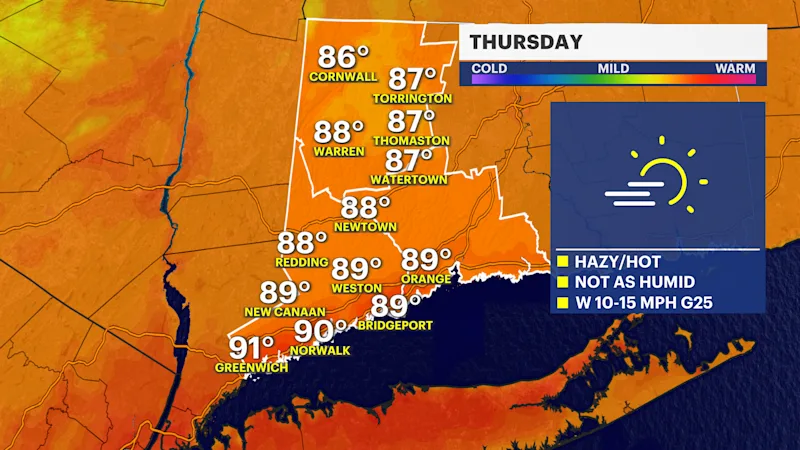
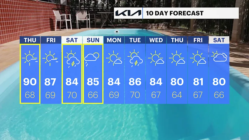
it will still be hot but less humid for Thursday and Friday in Connecticut.
More Stories


ALERTS:
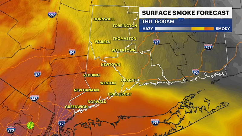
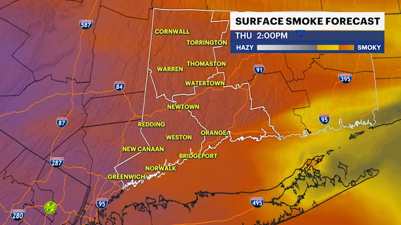
AIR QUALITY ALERT through 12 p.m. Thursday.
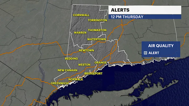
The air quality will once again become unhealthy for everyone Thursday. Expect to see some moderation in the morning, but the smoke will pick up in the afternoon and evening. The latest forecasts are now calling for the smoke to stay around into early Friday. The best bet is to stay indoors with the air conditioning during this time.
The sky will continue to have a smoky haze to it, making sunrises and sunsets much more colorful.
A cold front has now brought less humid air to the area, so it will be a hot day but not very humid. The winds will pick up out of the northwest and then west with gusts up to 25 mph. Temperatures in the afternoon will peak in the upper 80s to near 90 in spots.
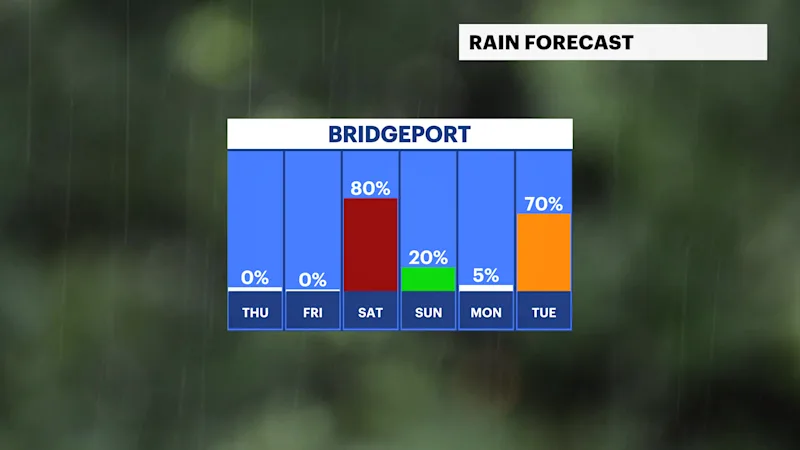
Showers and thunderstorms will come our way for the weekend.
Saturday looks to be the wettest weekend day with showers and thunderstorms likely with some heavy downpours. Stay with News 12 Connecticut for the latest.