Air Quality Alert: Smoky sky today with severe weather possible Saturday
Smoke continues into Saturday. Showers and thunderstorms Saturday afternoon could bring strong winds and heavy rain.
More Stories


Poor air quality remains the big weather story today as smoke from the Canadian wildfires continues to drift across the Northeast. Sensitive groups (Children, elderly, people asthma and heart disease) should limit prolonged time outdoors if possible. Otherwise, expect a mix of sunshine and hazy skies throughout the day. Temperatures will climb into the 80s this afternoon, making for another warm day despite the smoky conditions.
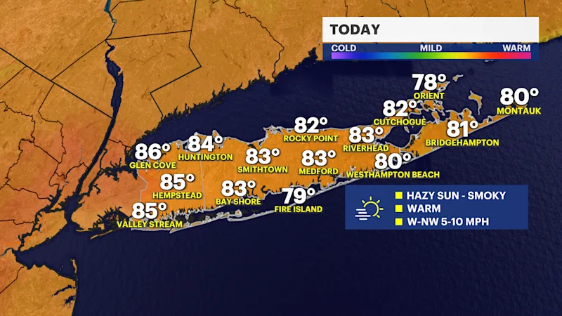
Tonight will be quiet with partly cloudy skies and a little lingering haze. It will stay comfortable overnight with lows falling into the 60s. If you're heading out this evening, you'll still notice the smoky appearance to the sky at times, but no widespread rain is expected.
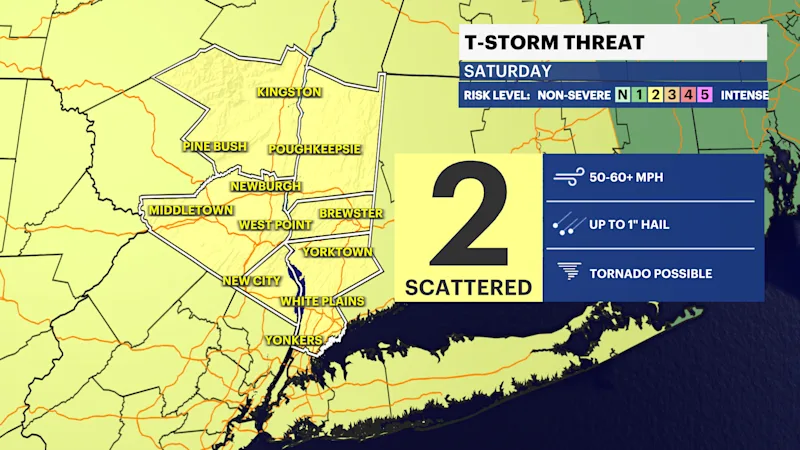
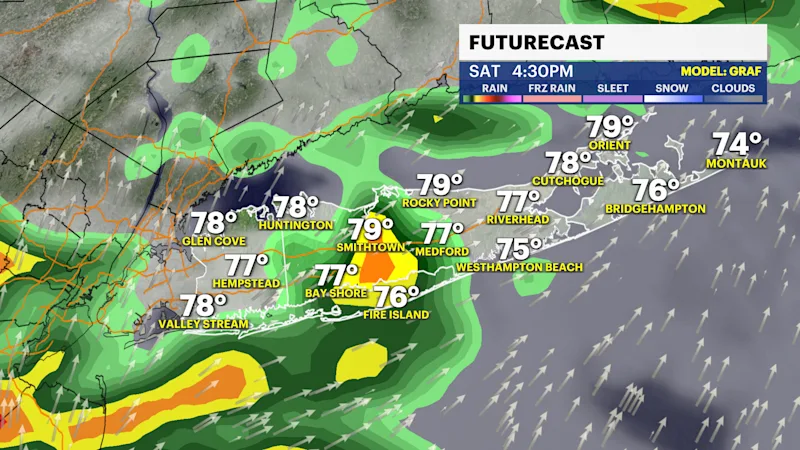
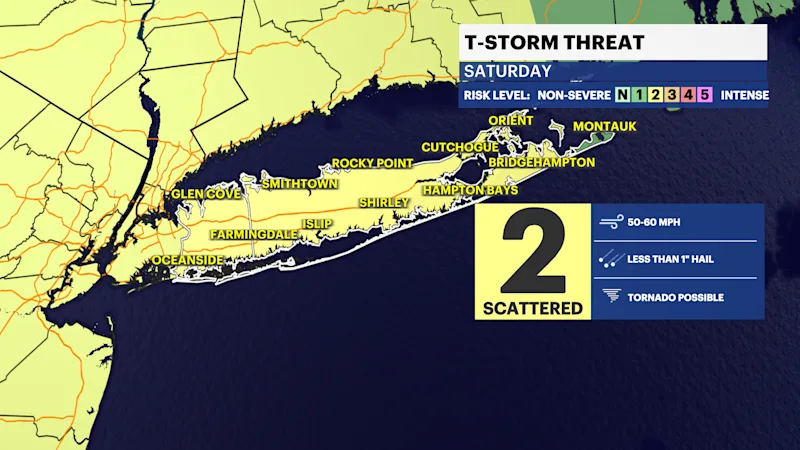
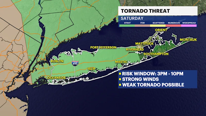
Changes arrive on Saturday as clouds increase and showers develop during the day. By the afternoon, scattered thunderstorms are possible, and a few could produce pockets of heavier rainfall. High temperatures will top out in the lower 80s.
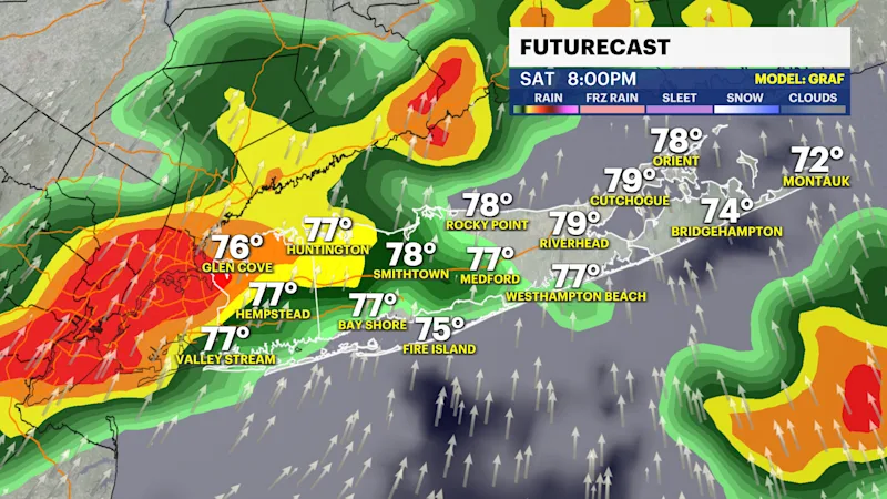
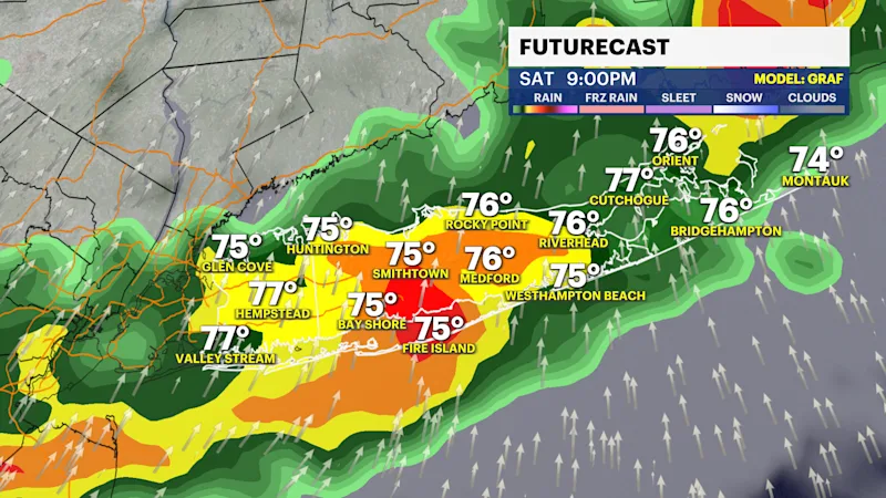
Strong to Severe Thunderstorms possible 3 p.m. to 10 p.m.
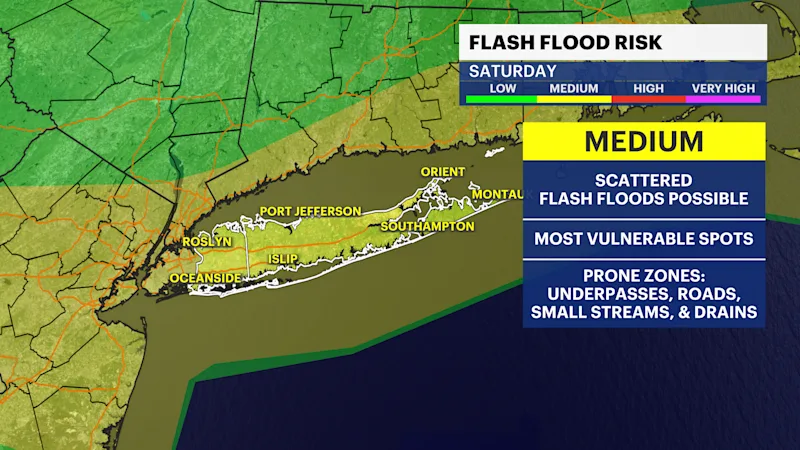
Saturday night remains unsettled with mostly cloudy skies, periods of showers and the chance for additional thunderstorms. Overnight lows will settle into the upper 60s to lower 70s.
Sunday starts with plenty of clouds and the chance of a lingering morning shower, but conditions improve through the afternoon as sunshine returns. Overall, it looks like a pleasant finish to the weekend with highs back in the 80s. Looking ahead to Monday, expect dry weather, plenty of sunshine and seasonably warm temperatures in the 80s.