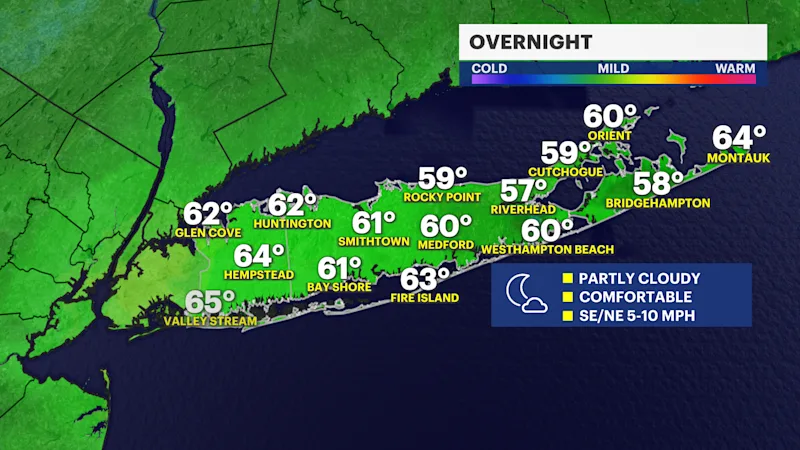
Partly cloudy and comfortable overnight ahead of amazing weekend weather
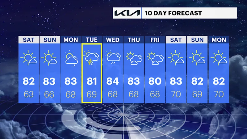
The great weather from Thursday and Friday will still continue for the entire weekend, but rain chances will return early next week.
More Stories


OVERNIGHT
It will be partly cloudy with low temperatures in the upper 50s to middle 60s into Saturday morning.
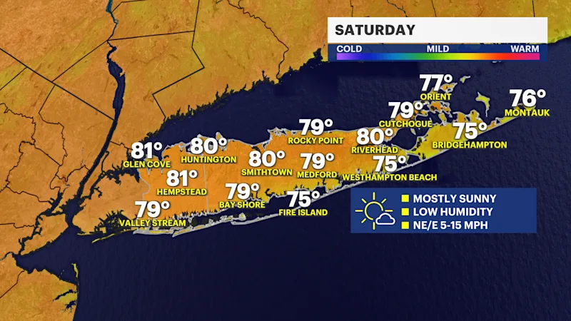
WEEKEND WEATHER
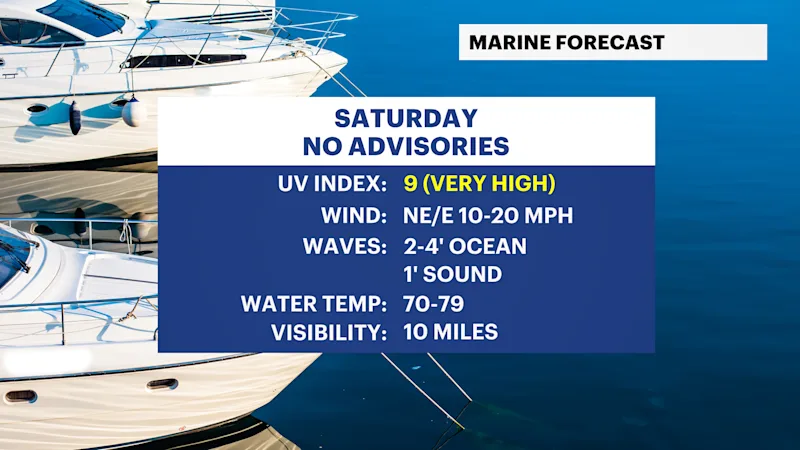
This sunny stretch with low humidity will continue through the entire weekend - enjoy! High temperatures will be in the upper 70s to mid-80s and the UV index will remain very high both Saturday and Sunday.
EXTENDED FORECAST
OVERNIGHT: Partly cloudy and comfortable with lows in the upper 50s to middle 60s. Wind: Southeast to northeast 5 mph to 10 mph.
SATURDAY: Mostly sunny and staying comfortable with highs around 82 degrees. Lows near 63 degrees.
SUNDAY: Mostly sunny and nice with highs around 83 degrees. Lows near 66 degrees.
MONDAY: Sun and clouds. A few scattered showers possible, mostly late in the day. Highs around 83 degrees. Lows near 68 degrees.
TUESDAY: Partly sunny to mostly cloudy with scattered showers and a thunderstorm possible. Highs around 81 degrees. Lows near 69 degrees.
WEDNESDAY: Sun and clouds. Scattered lingering showers possible. Highs around 84 degrees. Lows near 68 degrees.
THURSDAY: Sun and clouds. Highs around 83 degrees. Lows near 68 degrees.
FRIDAY: Sun and clouds. Highs around 83 degrees. Lows near 68 degrees.