Shower chance with patchy fog overnight; expect some midday showers Saturday
Variably cloudy with patchy fog and a shower chance overnight, but there will be the chance for scattered showers mostly around 10 a.m. to 4 p.m. Saturday.
More Stories


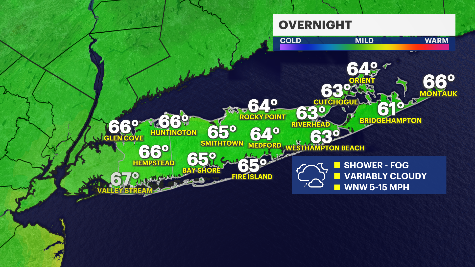
OVERNIGHT
Warm and muggy overnight with a shower chance and patchy fog. Lows into Saturday morning will be mostly in the mid- to upper 60s.
WEEKEND WEATHER
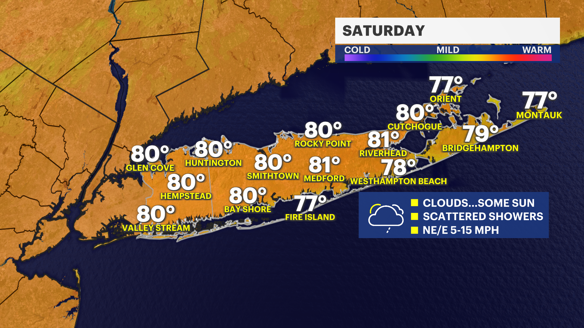
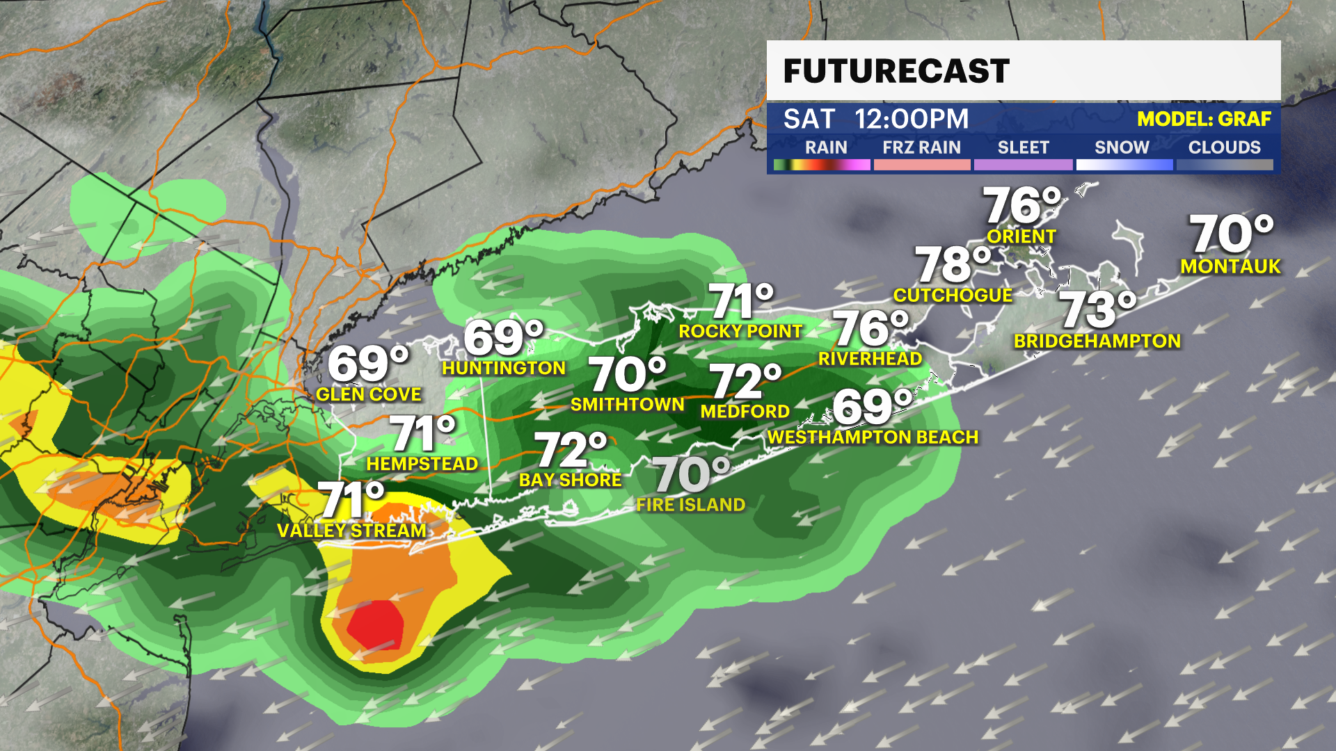
This weekend is a bit of a 50-50 split between the chance for some unsettled and rainy at times weather Saturday and a near-perfect summer Sunday. There will be the chance for a round of scattered rain from around 10 a.m. to 4 p.m. Saturday. It is not a washout, but those midday hours can be rainy, with more clouds than sun. Highs will be around the upper 70s to lower 80s Saturday with noticeable humidity. The late-afternoon and evening hours will be dry with a clearer sky developing.
Sunday will be nearly completely sunny with lower humidity and highs in the low to mid-80s. This is easily the best weekend day this weekend - enjoy!
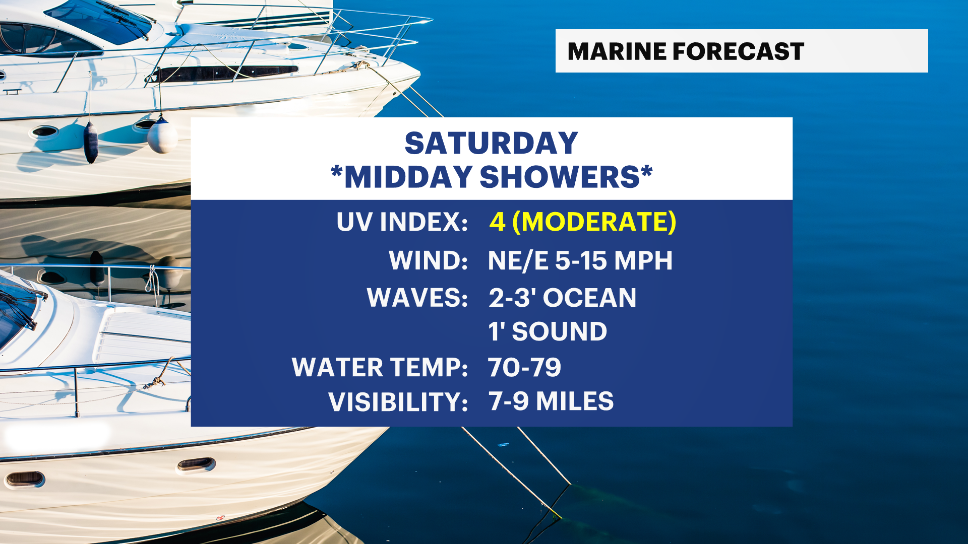
MARINE FORECAST
There is a low to moderate risk for rip currents on Saturday. Waves are generally around 2 feet for Saturday. There are no weather-related alerts for boaters this weekend at this time other than watching out for some midday scattered rain showers on Saturday.
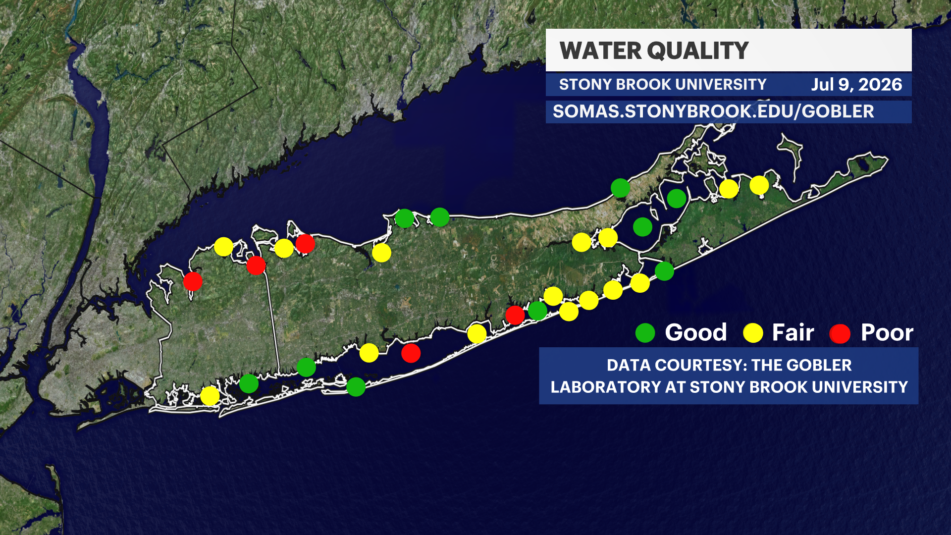
Every Thursday, water quality index updates are released by The Gobler Laboratory at Stony Brook University. This week's update shows generally fair water quality around Long Island. Last week's generally good water quality was reduced, in part, by recent heavy rains.
EXTENDED FORECAST
OVERNIGHT: A few showers possible with patchy fog. Otherwise, variably cloudy and muggy with lows in the middle to upper 60s into Saturday morning.
SATURDAY: MIDDAY SHOWERS -- Partly sunny to mostly cloudy with scattered rain showers from around 10 a.m. to 4 p.m. An isolated downpour is possible. Drier mid to late afternoon with a clearing sky. Still noticeably humid. Highs around 82 degrees. Lows near 68 degrees.
SUNDAY: Mostly sunny to partly cloudy. Highs around 85 degrees, but less humid. Lows near 68 degrees.
MONDAY: Mostly sunny to partly cloudy. Highs around 86 degrees. Lows near 70 degrees.
TUESDAY: Mostly sunny and hot with highs around 88 degrees. Lows near 74 degrees.
WEDNESDAY: Sun and clouds. Chance for a shower or thunderstorm. Hot. Highs around 92 degrees. Lows near 73 degrees.
THURSDAY: Mostly sunny and hot with highs around 90 degrees. Lows near 74 degrees.