Long Island Forecast: Dry & breezy Sunday brings elevated risk for fire spread
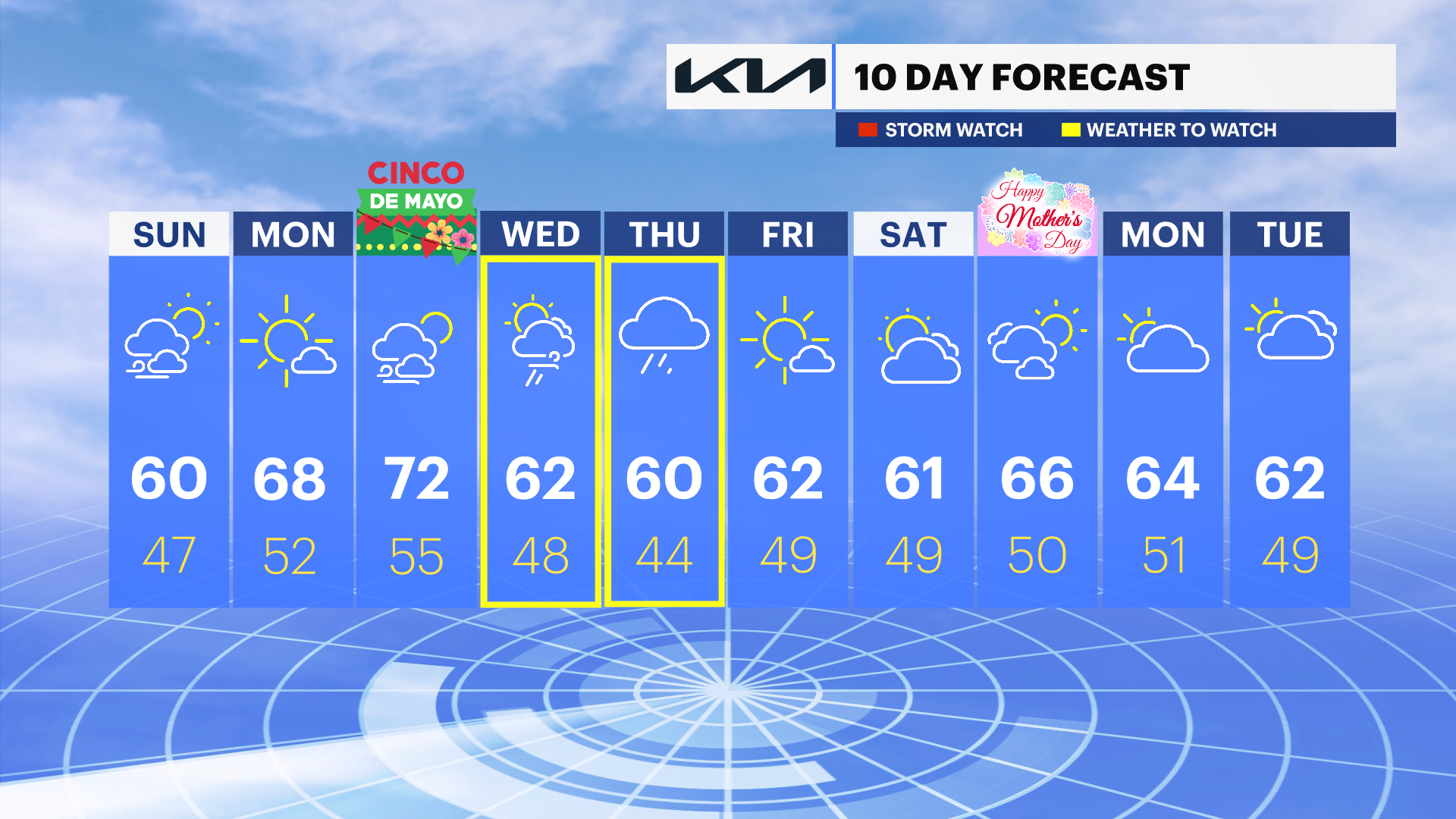
Temperatures are going to warm up significantly for the start of the week, then heavy rain arrives for mid-week.
More Stories


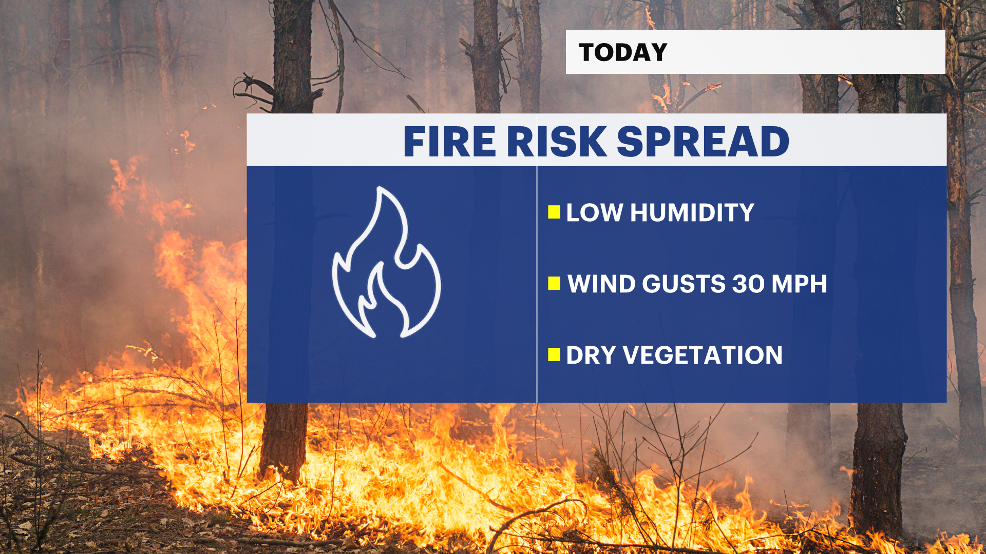
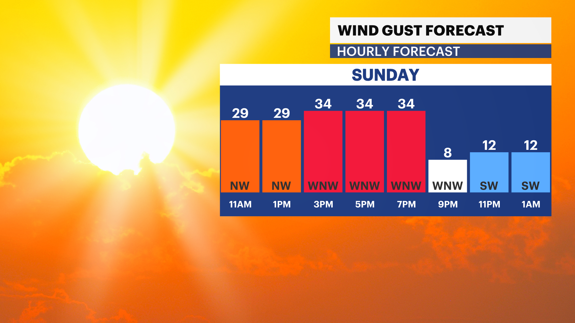
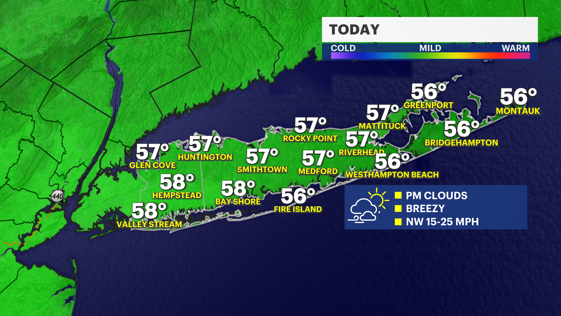
It's a fantastic start to your Sunday with plenty of sunshine and a cool breeze. However, a dry breeze this afternoon will create conditions that will support the potential for rapid fire spread in the afternoon. Warm weather arrives for Monday and Tuesday before rain moves in for the middle of the week.
Today: Cool Breeze with Sunshine
Temperatures will jump to near 60-degrees this afternoon with sunshine to start and then afternoon clouds. Winds will increase to 20 mph which will create a risk for elevated fire spread.
Tonight: Clear and crisp
It's a seasonably chilly night with lows in the mid 40s.
Monday: Warm and sunny
Temperatures are cool to start but will jump into the 70s in the afternoon in many neighborhoods. It will be cooler for the beaches and out east.
Tuesday: Warmest day of the week
High temperatures soar to the 70s across the area for much of the afternoon with the warmest neighborhoods hitting the low 80s. It is sunny in the morning with increasing clouds in the afternoon.
Wednesday & Thursday: Rain moves in
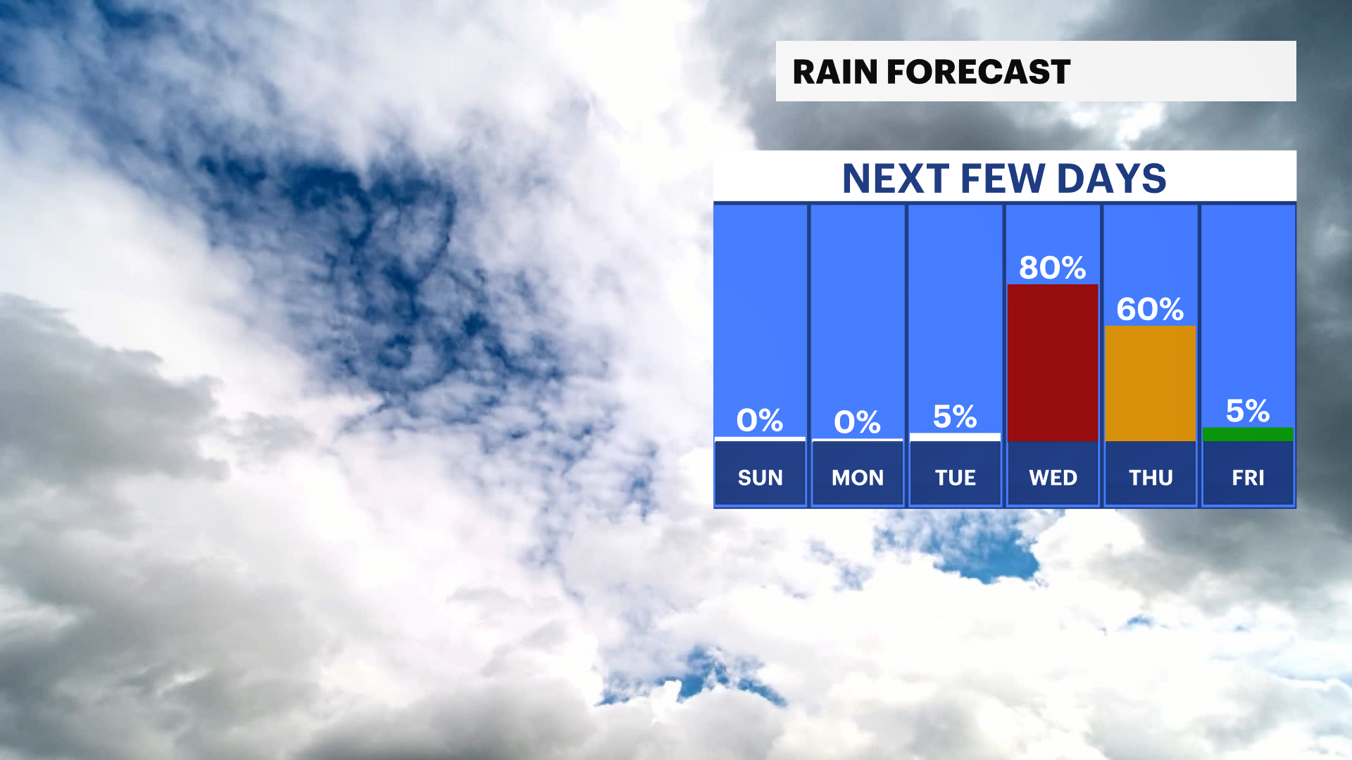
Showers are expected Wednesday morning with a risk for heavy rain Wednesday afternoon through Thursday afternoon. About 1 inch of rain is expected.
Mother's Day Weekend
Temperatures will be seasonable, but there is a chance for rain next Saturday into the early morning on Mother's Day.