What you need to know about the snowstorm heading toward the tri-state Sunday into Monday
A major storm will track just offshore and will bring winter weather to the tri-state. Here's an early Friday update on where the heaviest snow could fall.
More Stories


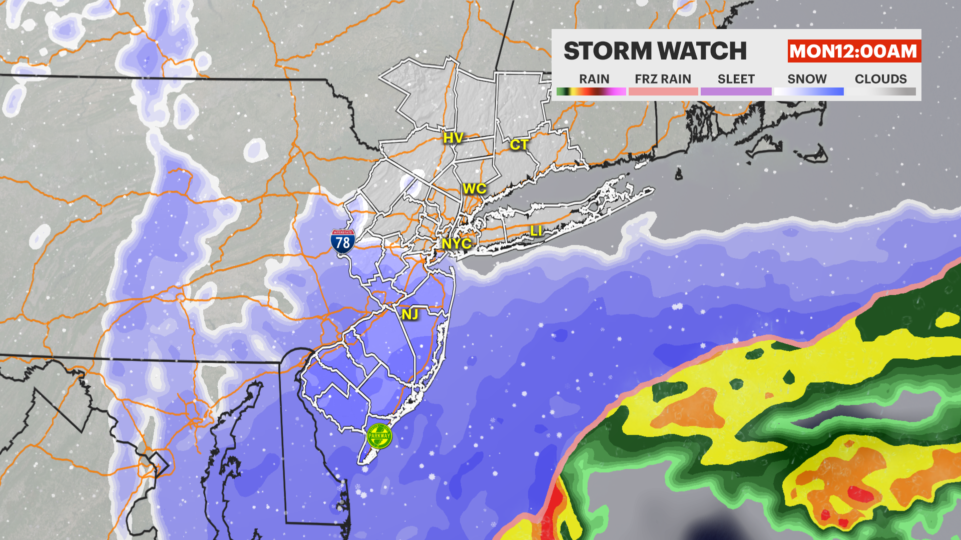
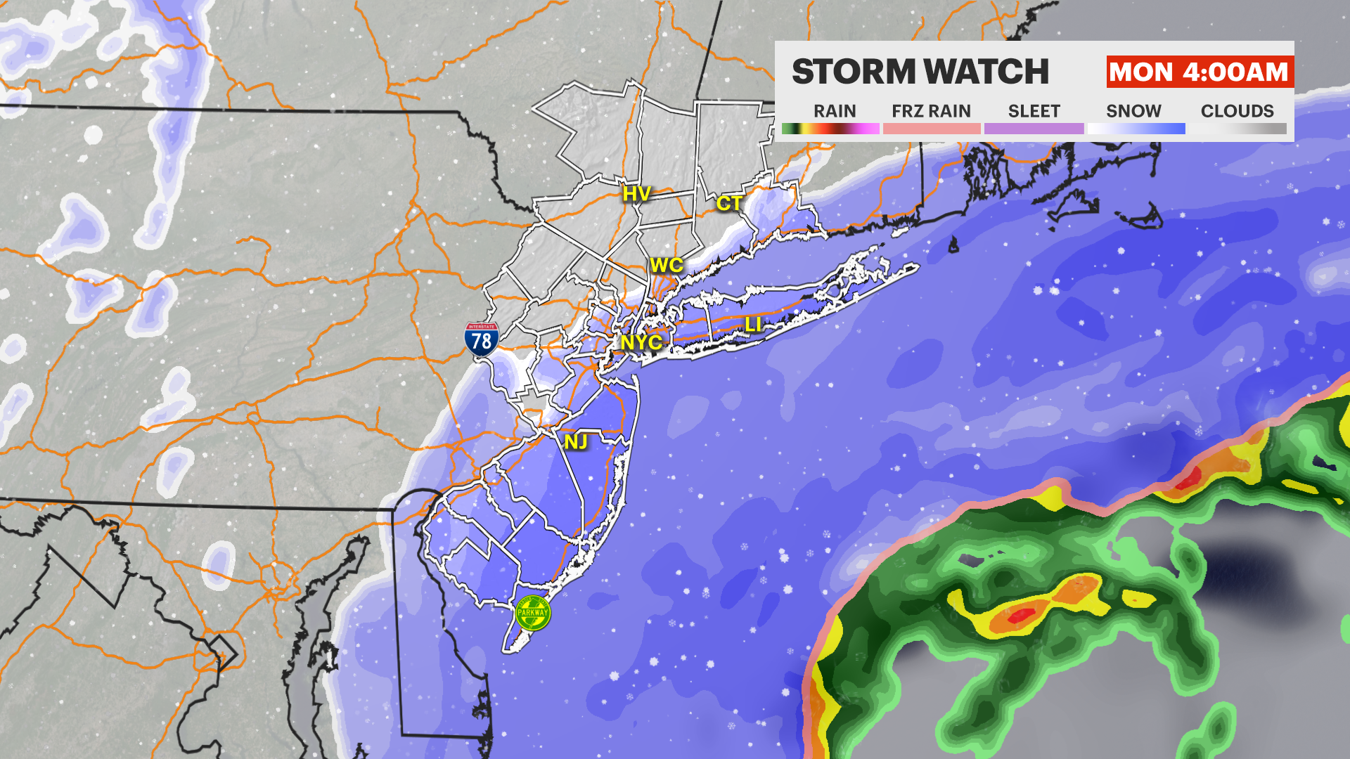
A major Nor'easter is expected to sit just off the coast on Sunday and Monday. Major travel impacts are expected from the combination of snow and wind, particularly along the coast beginning Sunday evening and becoming more widespread Sunday night and Monday morning.
How Much Snow?
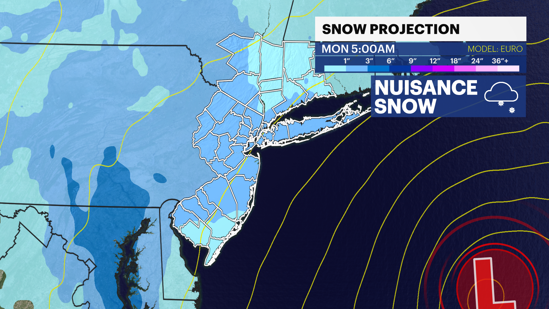
As of our early Friday morning forecast, we expect a moderate snow event with 3-6" of snow across the tri-state and the potential for significantly higher totals for Central and South Jersey and for Long Island. Coastal areas will also experience coastal flooding during high tide and wind gusts over 40 mph, bringing near-blizzard conditions combined with snow.

Storm Timing
Scattered snow is expected ahead of the storm Saturday night into Sunday morning across the tri-state. Minor snow accumulations are possible by the end of the morning on Sunday.
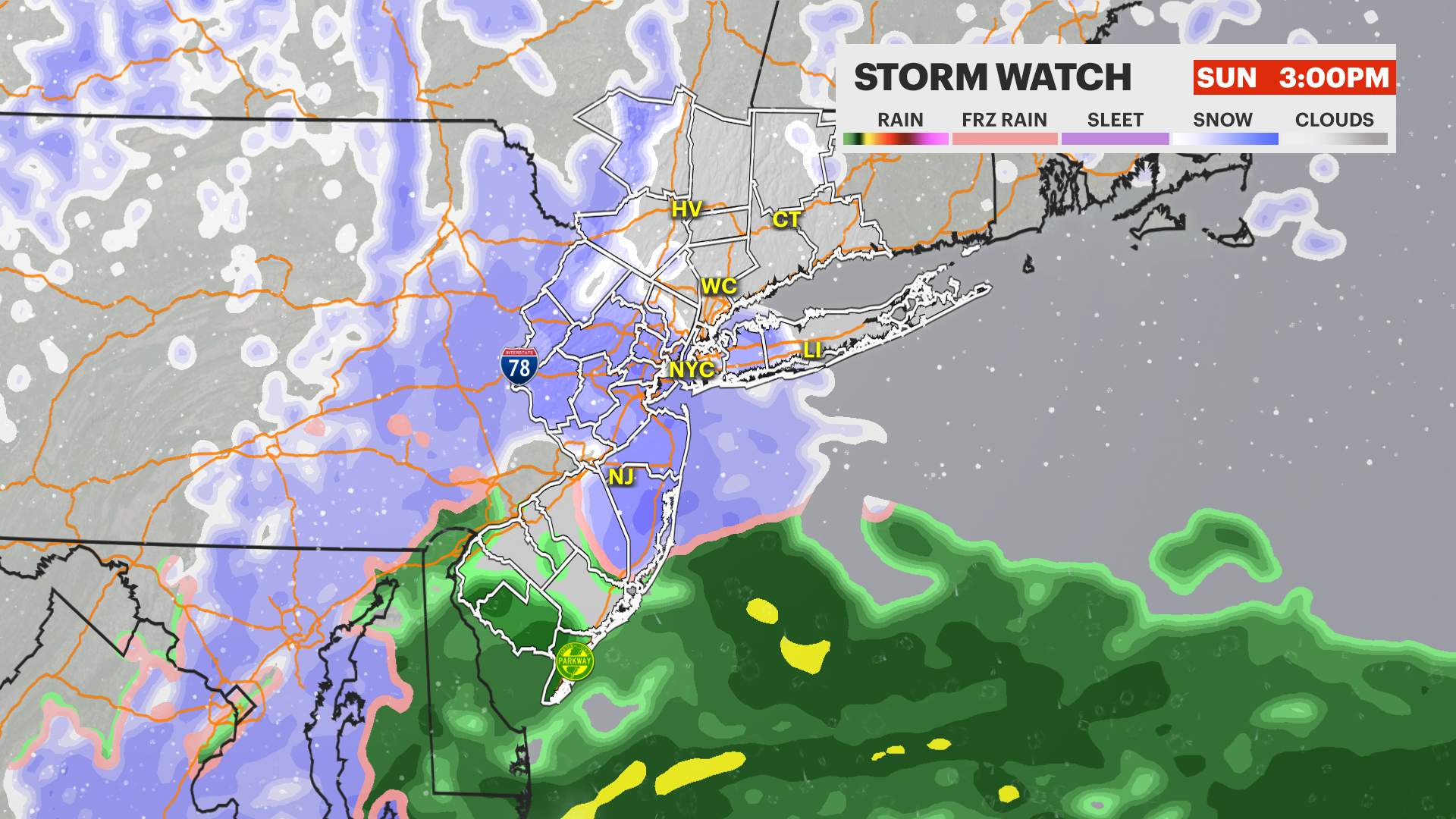
Steadier snowfall will move in from the south Sunday afternoon in New Jersey and Sunday night through Monday morning for the rest of the tri-state. The greatest risk for snow will likely be Sunday evening through Monday morning. Snow showers will dissipate throughout Monday morning.
The duration of the snow will be significantly reduced if the storm takes a path that is farther out to sea.
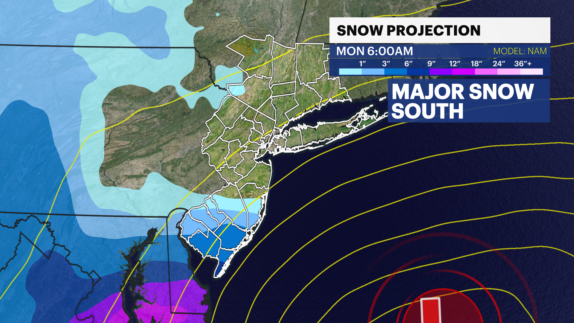
*** NOT A FORECAST *** What do the Weather Models Look Like?
The forecast confidence is lower than usual with this storm because the computer models do not have any consistency among them. These computer models update every 6 hours (4 times a day.) Below is an example of the model discrepancy.
The NAM Model, which has been reliable for us this winter, is the only model that projects little to no snow for most of the tri-state. Notice the heavy snow lies south with this model and there is a very sharp cutoff.
The EURO Model, which is a historically reliable model for us, projects a more realistic moderate snow event for many of us and brings the threat of higher totals along the coast.