Offshore nor'easter continues to bring an increase in wind, rough surf to Long Island
It will be breezy, chilly and dry overnight, with windy but mostly dry weather continuing Wednesday, along with waves 6 to 10 feet just off the South Shore.
More Stories




Islip Information
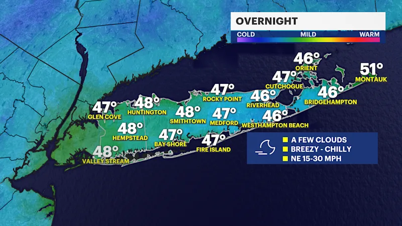
OVERNIGHT
It will be a good idea to have a heavier winter coat overnight. It will be a dry night, but breezy and quite chilly by Wednesday morning. The sky will continue to be mostly clear to partly cloudy. Overnight low temperatures will fall into the mid-to-upper 40s. A persistent northeast wind with gusts between around 20 to 30 mph will make it feel like the upper 30s to lower 40s into early Wednesday morning.
OFFSHORE NOR'EASTER
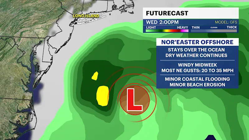
Other than a slight chance for a passing shower over eastern Suffolk County Wednesday evening, it will continue to stay dry this week, but an offshore Nor'easter (coastal storm) is bringing some windier weather and rough surf to Long Island still from now into the start of Thursday.
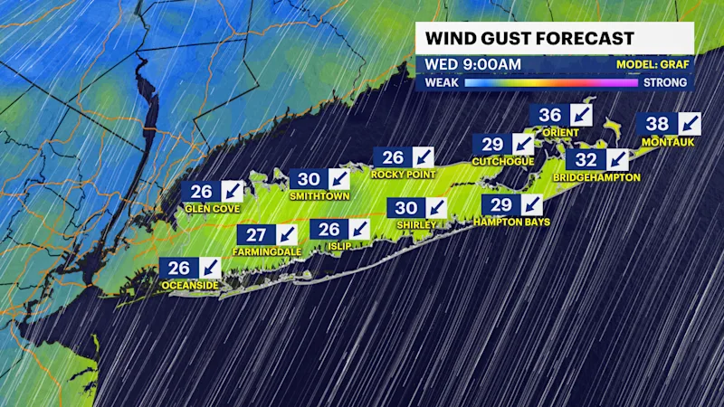
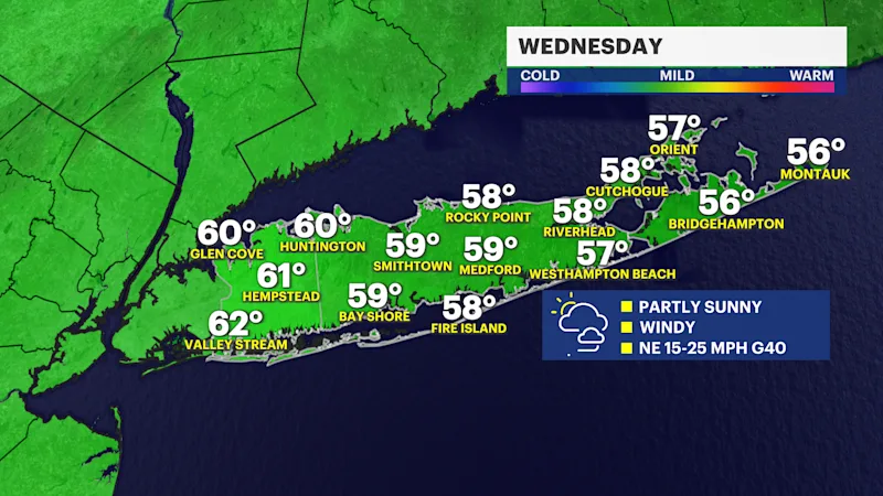
Even though the center of the storm is staying well offshore, its wind field is still bringing northeast gusts of around 20 to 40 mph to Long Island through Wednesday. The highest gusts in the 30 to 40-mph range will mostly be along the shoreline and East End of Long Island. That's not necessarily damaging wind, but it will be annoying at times. Just expect decent, but windy and cool weather midweek with some more clouds around on Wednesday, too.
Here is a look at the projected hour-by-hour weather for Long Island:
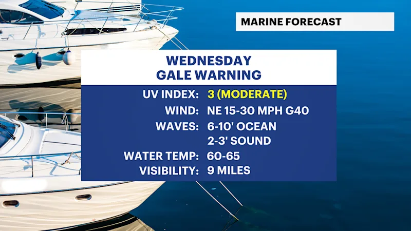
This offshore storm is also bringing rough surf along the South Shore. Waves will build to around 6 to 10 feet, creating high surf and the potential for some minor beach erosion. Coastal communities, especially along the South Shore and East End, should keep an eye on conditions as we head through the middle of the week.
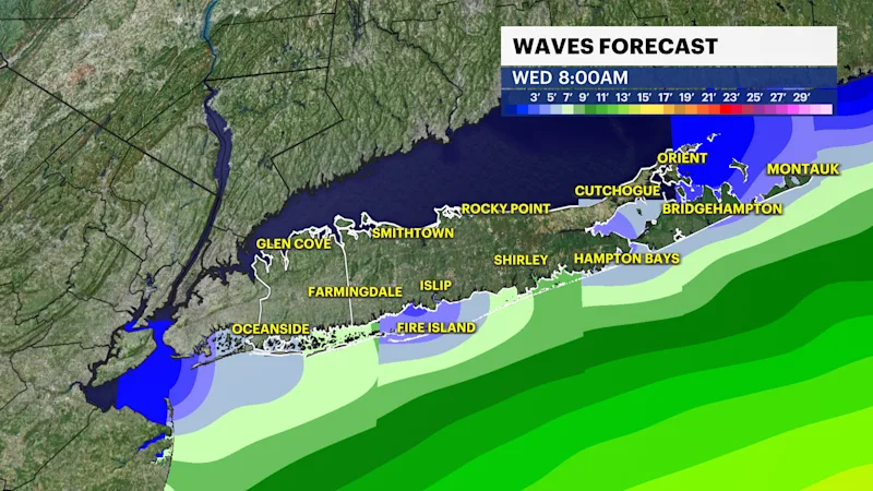
Beach erosion and minor coastal flooding are possible Wednesday into Thursday. Right now, the tide that would be impacted with the best chance for some minor coastal flooding would be Wednesday evening, but we are not expecting much impact at this time.
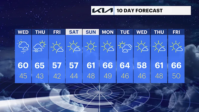
EXTENDED FORECAST
OVERNIGHT: Mostly clear to partly cloudy, breezy and chilly. Wind: northeast 10 to 20 mph with some gusts around 30 mph. Low temperatures will be in the mid-to-upper 40s into early Wednesday morning.
WEDNESDAY: Partly sunny to, at times, mainly cloudy. Windy with northeast gusts around 20 to 40 mph. Sustained wind will be closer to 15 to 25 mph. Some brief and minor coastal flooding is possible during the evening high tide cycle as well as rough surf along the South Shore. A rain shower or two cannot be ruled out over eastern Suffolk County in the evening. Highs near 60 degrees. Lows near 45 degrees.
THURSDAY: A mix of sun and clouds. Becoming less windy, but still breezy. Highs around 65 degrees. Lows near 43 degrees.
FRIDAY: Mostly sunny, cool and breezy. Highs around 57 degrees. Lows near 42 degrees.
SATURDAY: Mostly sunny with highs again around 57 degrees. Lows near 44 degrees.
SUNDAY: Sunny with highs around 61 degrees. Lows near 48 degrees.
MONDAY: Mostly sunny. Highs around 66 degrees. Lows near 49 degrees.
TUESDAY: Sun and clouds. Highs around 64 degrees. Lows near 46 degrees.