Thursday is the 'Pick of the Week' with sun and mild temps ahead for the Hudson Valley
Temperatures will stay cool today but warm up nicely tomorrow!
Top Stories


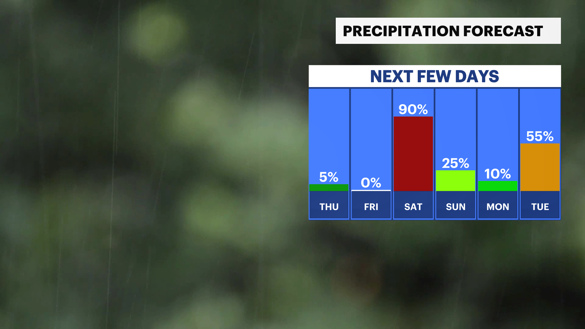
Umbrellas were the must-have accessory this morning as rounds of Earth Day showers moved through the region.
The good news? Things cleared out for the second half of the day. It remained on the cooler side, however, with daytime highs topping out in the low 50s.
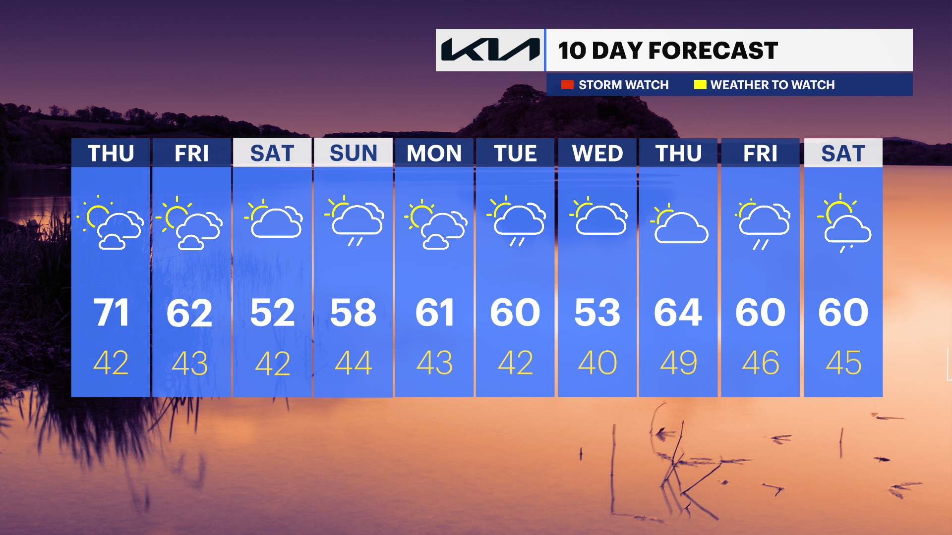
We won't have to wait long for a rebound. Thursday is easily the "Pick of the Week." We’ll see a 20-degree jump with highs hitting the 70s in many spots! It’ll be a beautiful, breezy taste of May, though it is unfortunately short-lived.
Clouds return Friday, with rain arriving for the weekend. This will knock temperatures back into the low 50s to start the weekend. Sunday currently looks like the drier half of the pair, with highs reaching for the 60s.
ALMANAC:
Average High: 62 | Average Low: 42
Record High: 84 (2001) | Record Low: 27 (1975)
Sunrise: 6:05 a.m. | Sunset: 7:42 p.m.
THE FORECAST:
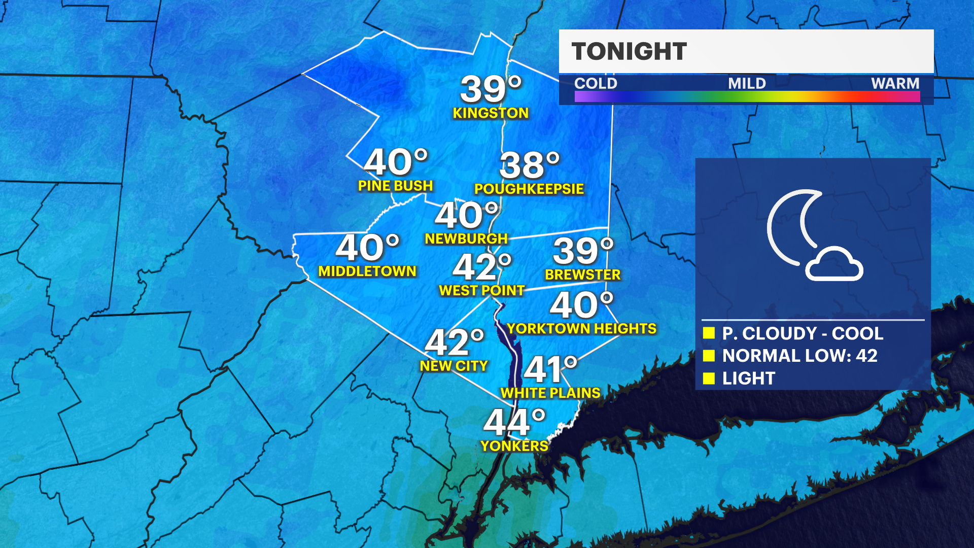
TONIGHT: Partly cloudy and cool with a light to calm breeze. Lows: upper 30s to low 40s.
THURSDAY: PICK OF THE WEEK - Mix of sun and clouds with above-average temperatures, feeling more like mid-May. Highs: Upper 60s. Lows: Low 40s.
FRIDAY: Sun and clouds with a cooler temperature trend. Showers arrive very late in the day. Highs: Upper 50s to low 60s. Lows: Low 40s.
SATURDAY: Mostly cloudy and cool with scattered showers through the day. Highs: Low 50s. Lows: Low 40s.