Signs show an El Niño pattern taking shape. How active will hurricane season be?
After three consecutive years of a La Nina pattern in which temperatures were above normal and precipitation was near normal, there are signs that an El Niño pattern is taking shape in the next few months.
More Stories

Hurricane season is right around the corner, and a change in climate pattern will determine how active this season will be in the Northeast.
After three consecutive years of a La Nina pattern in which temperatures were above normal and precipitation was near normal, there are signs that an El Niño pattern is taking shape in the next few months.
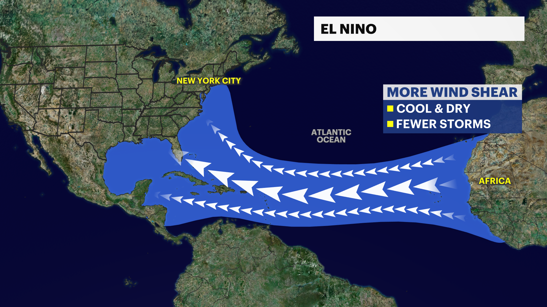
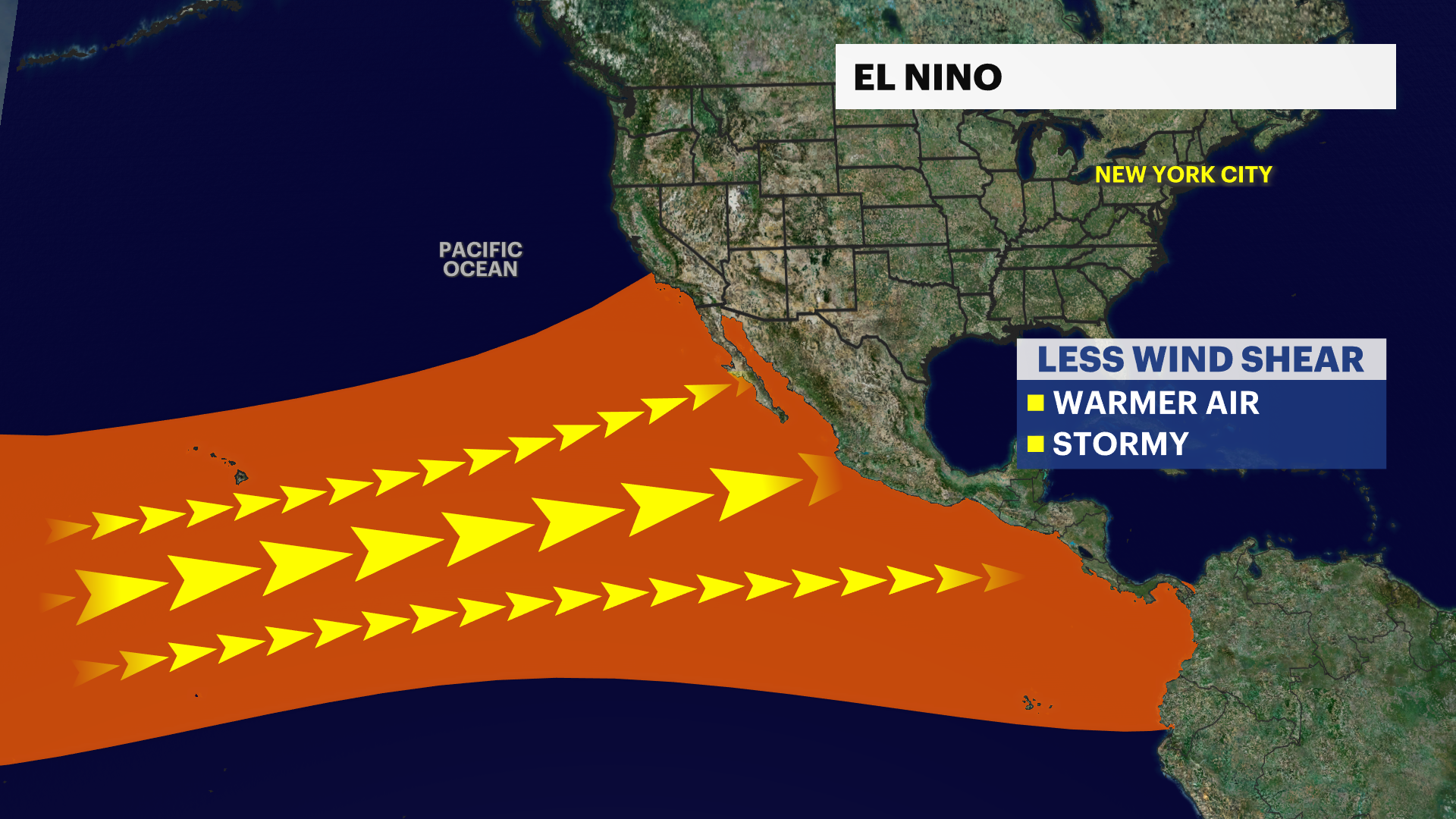
El Niño, also known as “little boy” in Spanish, refers to the warming of the tropical Pacific Ocean. NOAA’s Climate Prediction Center has issued an El Niño watch, meaning conditions are favorable for an El Niño pattern to occur in the next six months. An El Niño pattern can weaken tropical development in the Atlantic basin. Faster trade winds can lower the chances of seeing an above average tropical season in the Atlantic. Meanwhile in the Pacific basin, more tropical systems will be possible due to the very warm sea surface temperatures, weak trade winds and a moisture-rich environment.
However, tropical storms and hurricanes are still expected for the Atlantic hurricane season. NOAA predicts a near normal hurricane season with 12-17 named storms, of which could be five to nine hurricanes including one to four major hurricanes.
With ocean temperatures being above average and an emerging El Niño pattern taking hold, hurricane season is forecast to be less active than in recent years. Despite the strong wind shear in the Atlantic, the real question will be if the warm sea surface temperatures hold these tropical systems together long enough to impact land or the U.S.
According to NOAA, there’s a greater than 90% chance that an El Niño pattern will persist into the winter season. There's still some uncertainty as to how strong this El Niño might be, but the likelihood of it developing is a growing concern globally and even here locally.
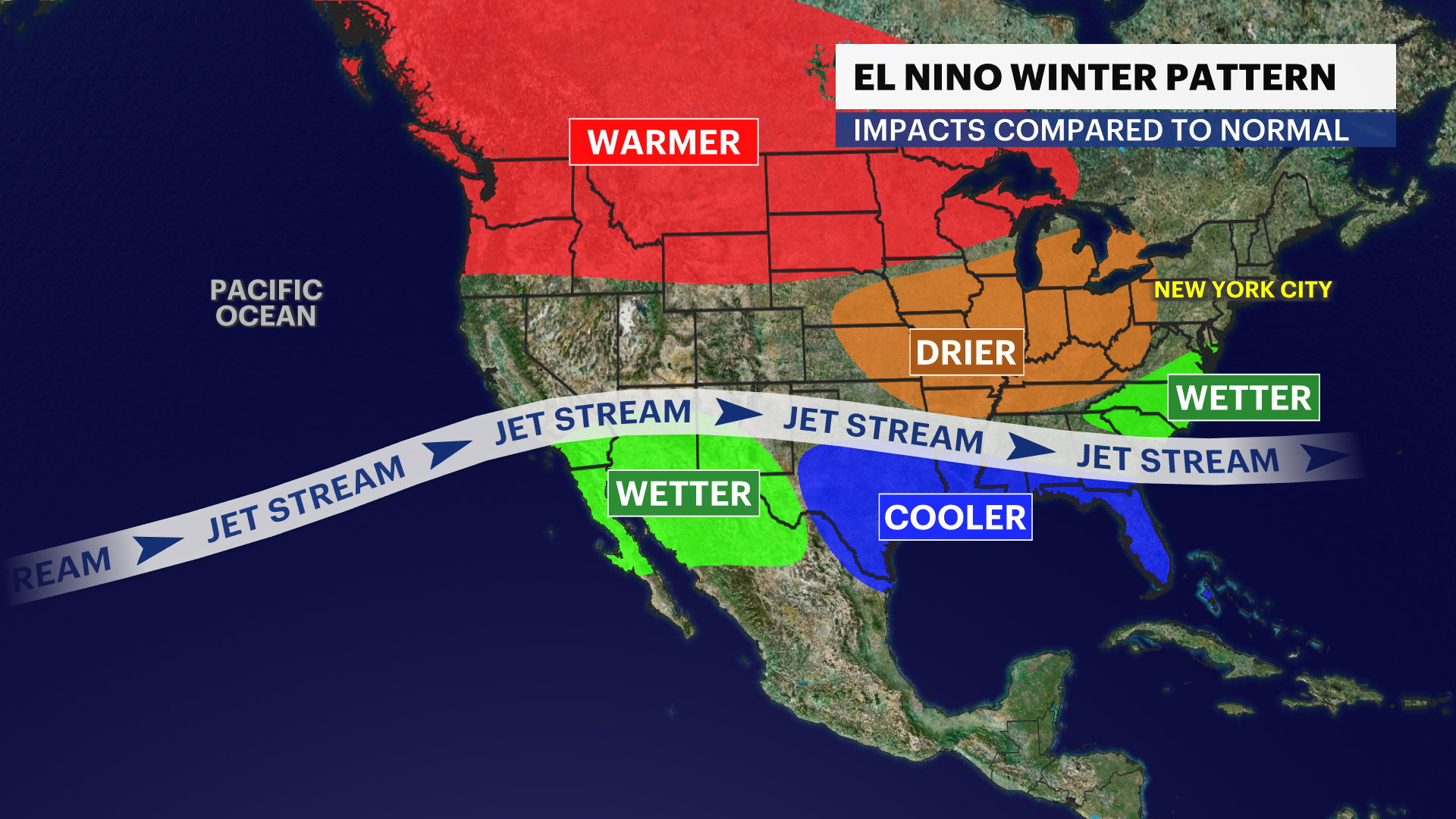
In the U.S, El-Niño-related temperatures and precipitation impacts normally occur during October through March. When this happens, portions of the north experience drier weather and warmer than normal temperatures.
Meanwhile, in the Southeast and Gulf Coast, these areas appear cooler and wetter than normal with an enhanced risk of flooding. In the tri-state, warmer than average temperatures and near normal to above normal precipitation are possible. Each El Niño can impact winter conditions differently. It can either bring another snow drought or bring intense nor’easters and blizzards to the tri-state. These impacts vary widely from impacting our economy for recreational activities during the winter season or significant storm damage.
Whether it’s extreme heat, tropical systems or a snowstorm, your News 12 Storm Watch team of meteorologists has you covered.