Low humidity and sunshine for Long Island
Some clouds and a few showers for the East End this morning gives way to sunny skies this afternoon.
More Stories


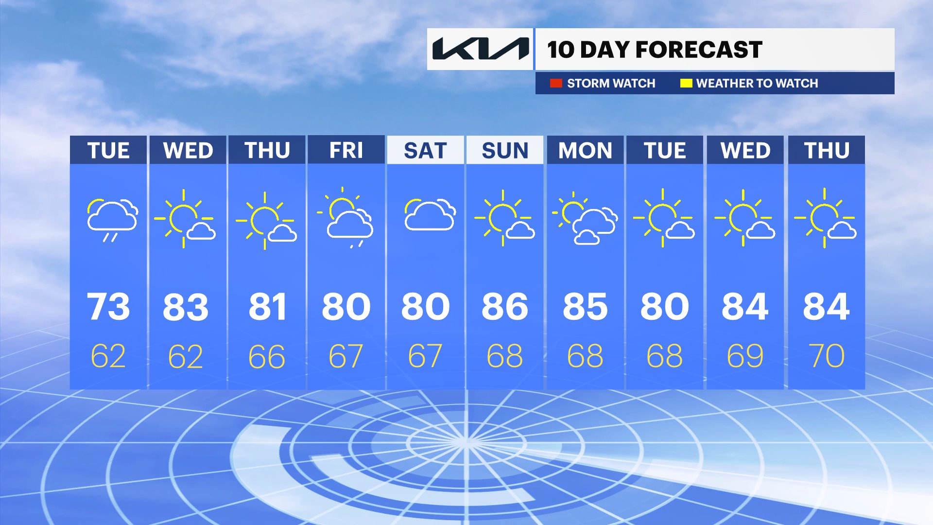
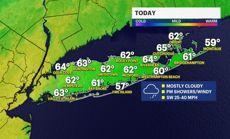
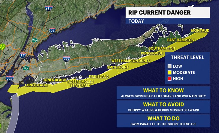
A beautiful stretch of summer weather is settling across Long Island today. After a few early morning clouds, skies will become mostly sunny with noticeably lower humidity, making for a comfortable afternoon. High temperatures will reach the lower 80s inland, while south-facing beaches stay cooler in the 70s thanks to the ocean breeze. The UV index will be high, so be sure to use sunscreen and other sun protection if you'll be spending time outdoors. If you're heading to the South Shore beaches, keep in mind there is a high risk for rip currents, so swim only at beaches with lifeguards on duty and always follow their guidance.
Tonight will be quiet and comfortable under mostly clear skies. The drier air will allow temperatures to cool into the 60s across most of Long Island, with some of the typically cooler spots in the Pine Barrens of eastern Suffolk County dipping into the lower and middle 50s by daybreak.
Friday brings another picture-perfect summer day. Expect plenty of sunshine with just a few fair-weather clouds developing during the afternoon. High temperatures will once again climb into the 80s inland, with readings holding in the 70s along the beaches. Humidity remains in check, making for another pleasant day to enjoy outdoor activities.
Looking ahead to the weekend, the forecast continues to look outstanding. Both Saturday and Sunday feature mostly sunny skies, dry weather, and comfortable humidity. Afternoon highs will be in the lower 80s inland, with cooler 70s along the shoreline. Whether you're heading to the beach, firing up the grill, or spending time outdoors, the weekend is shaping up to be one of the nicest stretches of weather we've seen in quite some time. Just remember that the rip current risk can remain elevated at the ocean beaches, so always use caution in the surf.