Stormy finish gives way to a stunning weekend!
Keep the umbrella close for Friday’s afternoon storms before a beautiful, low-humidity washout-clearing weekend takes over.
More Stories
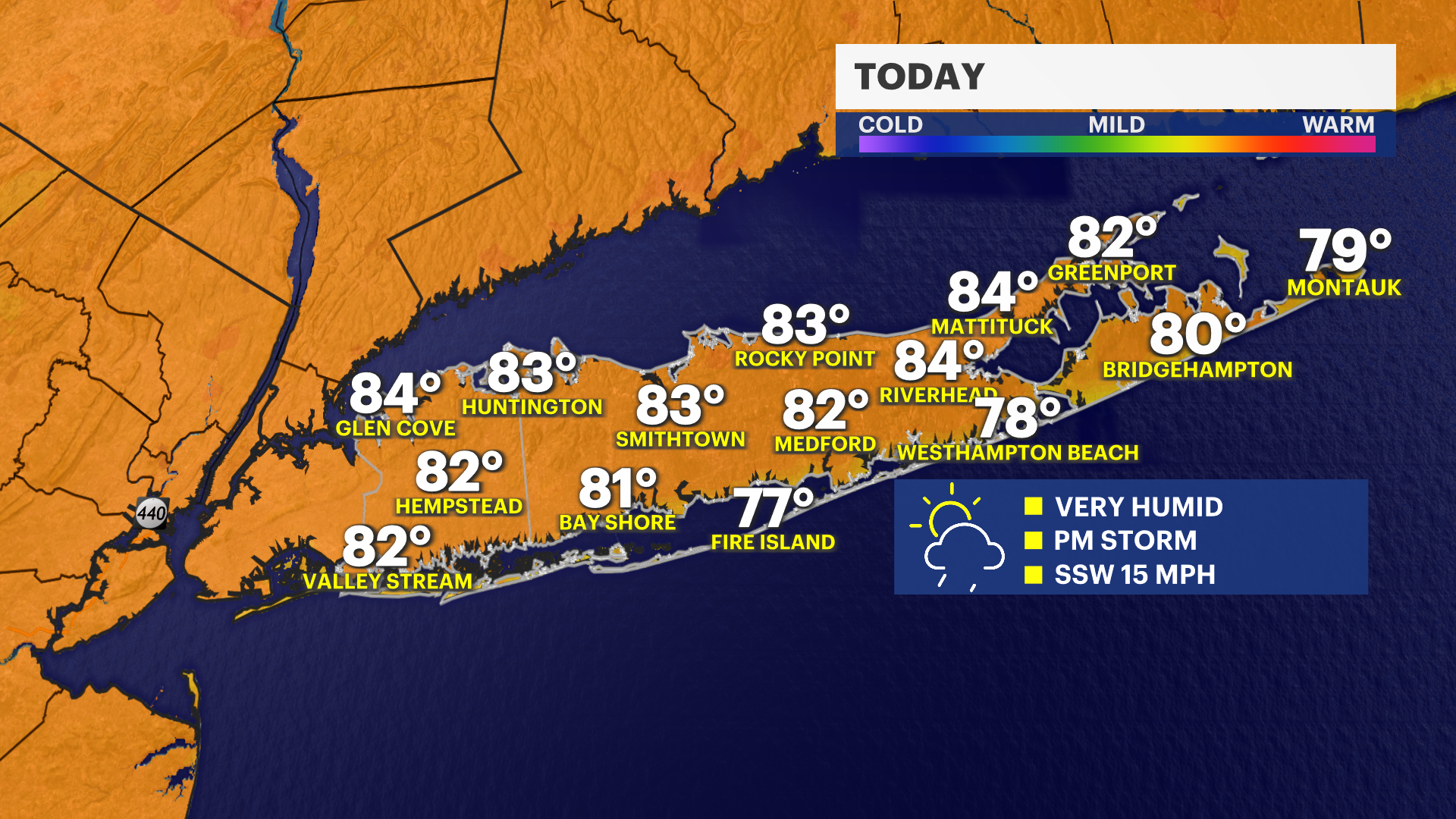


Forecast:
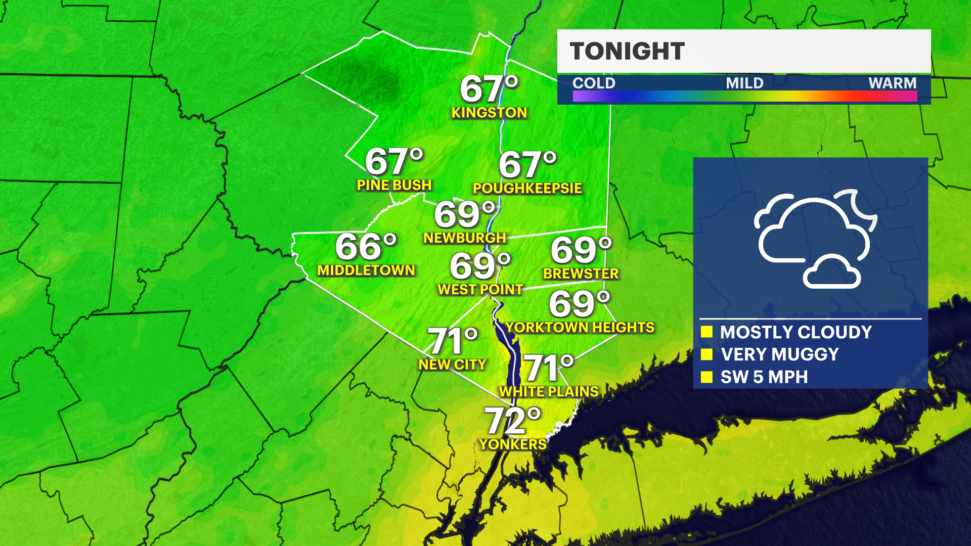
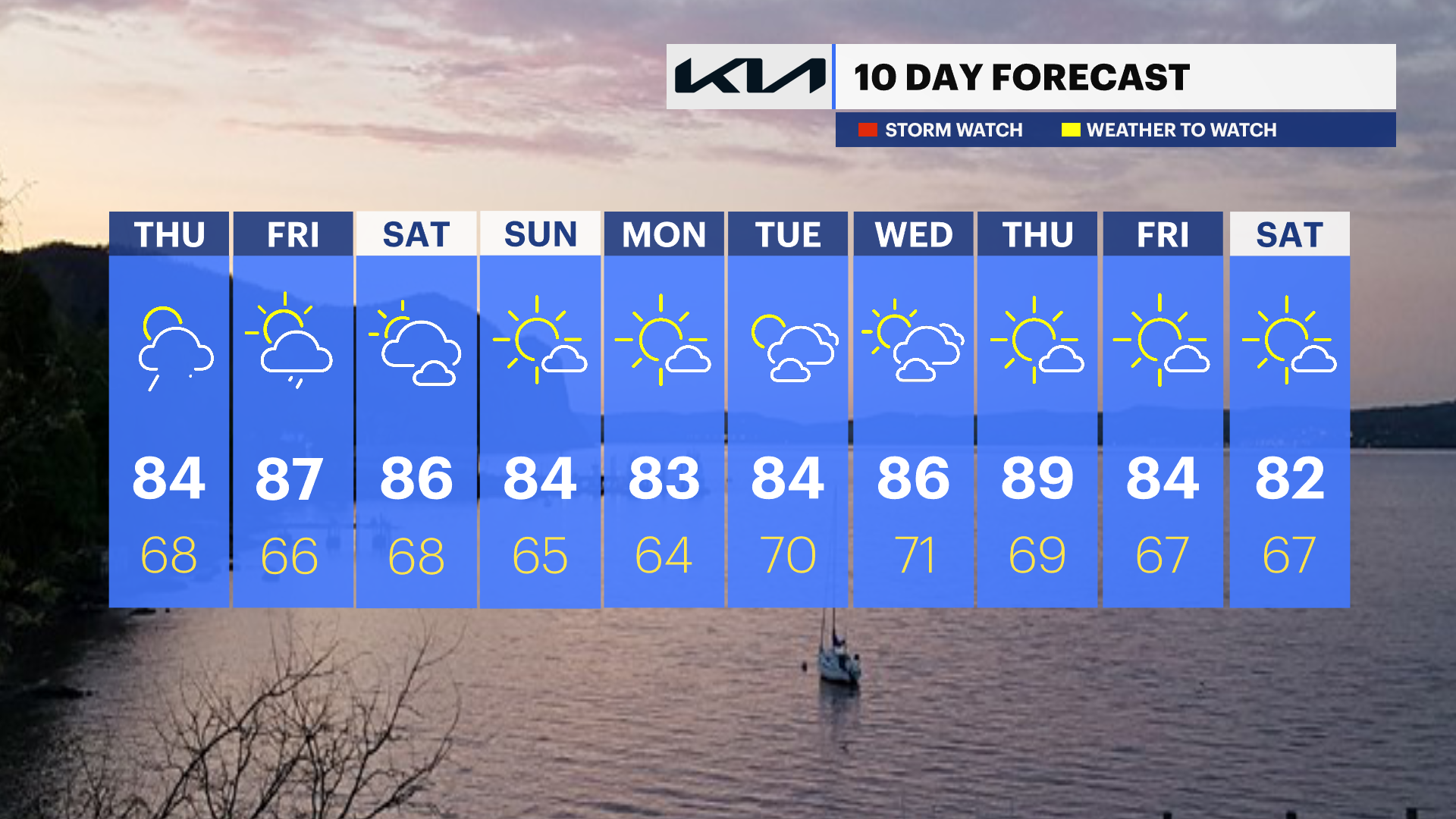
TONIGHT: Afternoon rain showers and thunderstorms will taper off, leaving most of the area dry early this evening. Expect lingering clouds and high humidity to persist through the night with mild temperatures.
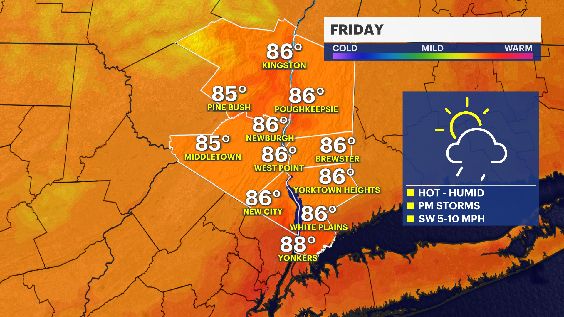
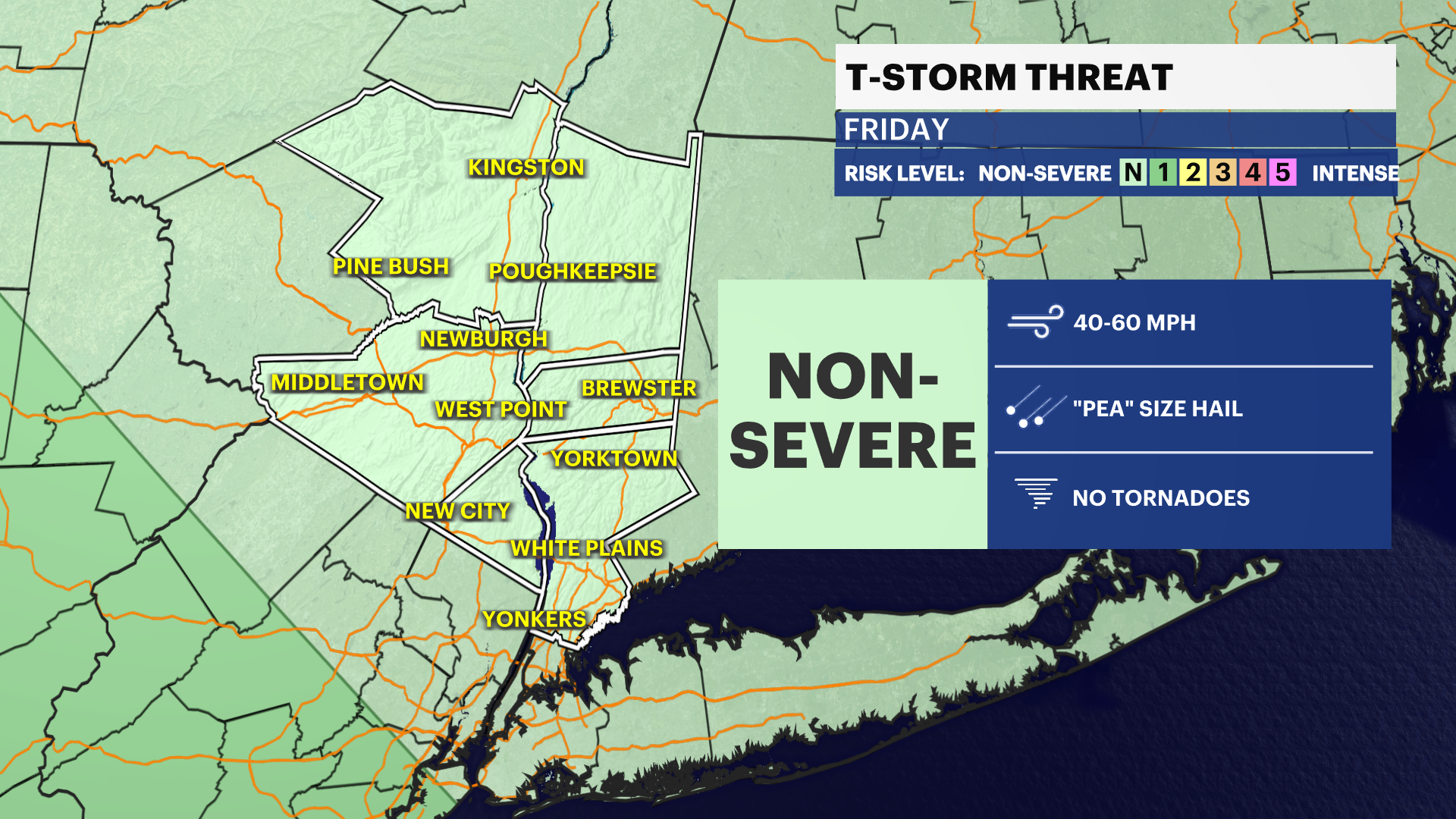
FRIDAY: A carbon copy of Thursday. The heat and humidity will build back in, pushing afternoon temperatures close to the 90-degree mark under scattered skies. The combination of heat and thick humidity will trigger another chance for a pop-up afternoon or early evening thunderstorm.
SATURDAY: High pressure begins to clear things out. A few clouds may linger early in the morning, but it will quickly turn mostly sunny. It will feel a little humid to start, but the air will become much more comfortable as the day progresses, offering a cooler and very pleasant afternoon compared to Friday.
SUNDAY: The pick of the weekend! Expect gorgeous weather from start to finish with abundant sunshine, low humidity, and near-seasonable, comfortable temperatures.