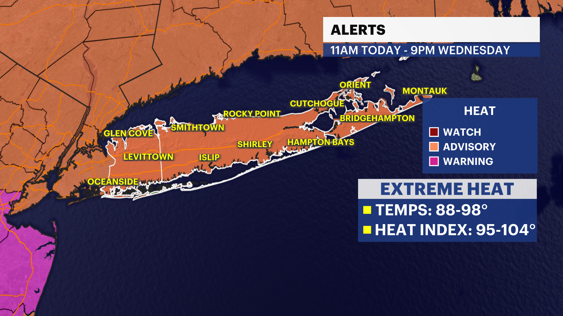
HEAT ALERT: Dangerous heat Wednesday; wildfire smoke from Canada overhead this week
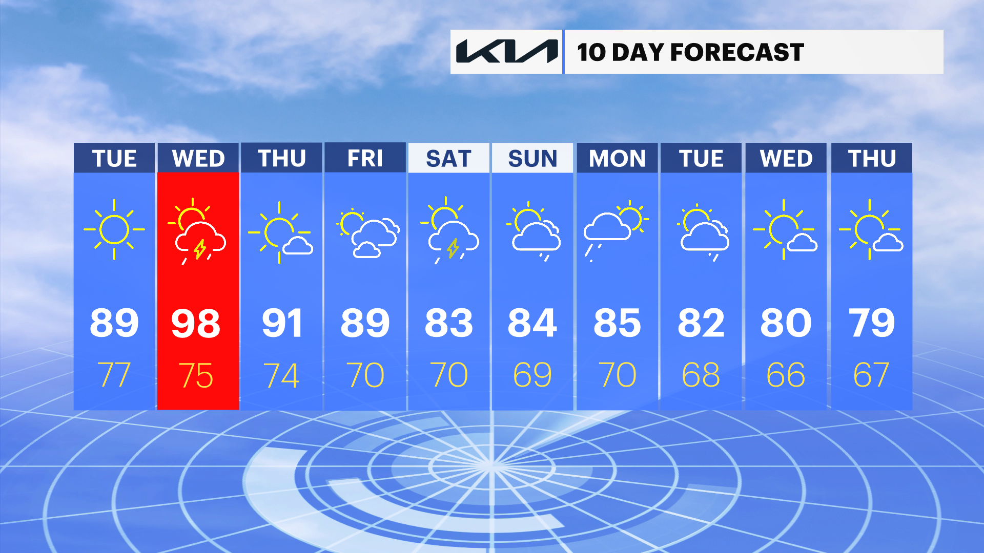
Potential for a four day heat wave for parts of Long Island. High temperatures in the 90s with heat index into the 100s.
More Stories


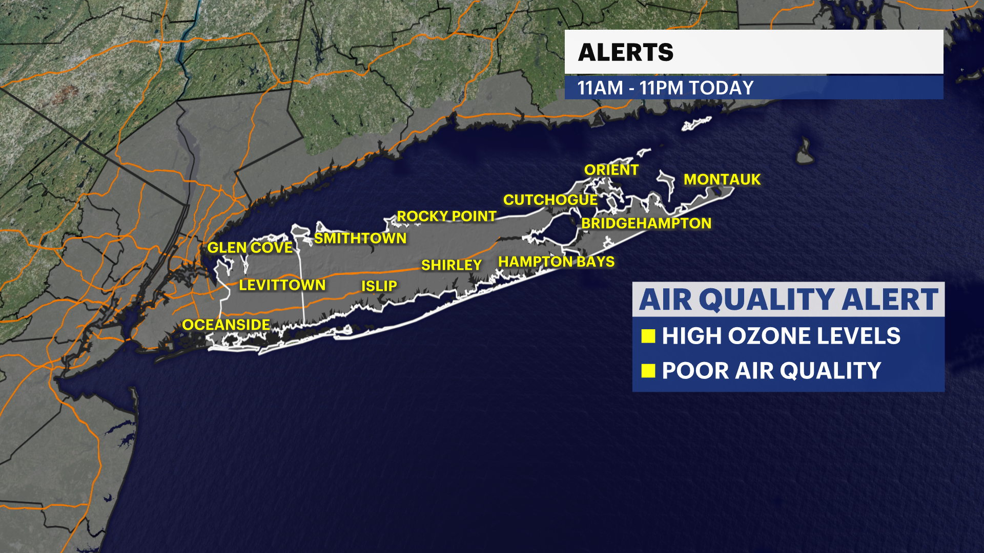
ALERTS:
- Heat Advisory - Today: Nassau County and Western Suffolk, Wednesday: All of Long Island
- Air Quality Alert - Today: Nassau and Suffolk Counties.
Hot weather is making a comeback across Long Island, and we're under a Heat Advisory through Wednesday. It's also an Air Quality Alert day, so if you have respiratory issues, you'll want to limit prolonged time outdoors when possible. And if you're heading to the South Shore beaches, keep in mind there's a high risk for dangerous rip currents. Swim only where lifeguards are on duty. For today, expect plenty of sunshine and hot conditions with afternoon temperatures climbing into the upper 80s and lower 90s. It'll feel even hotter, with heat index values reaching the mid to upper 90s. The UV index is also very high, so don't forget the sunscreen and stay well hydrated.
Tonight will remain warm and muggy under partly cloudy skies. Overnight lows will only fall into the 70s, offering little relief from the daytime heat. If you're spending time outdoors this evening, continue to drink plenty of water and take frequent breaks if you're active.
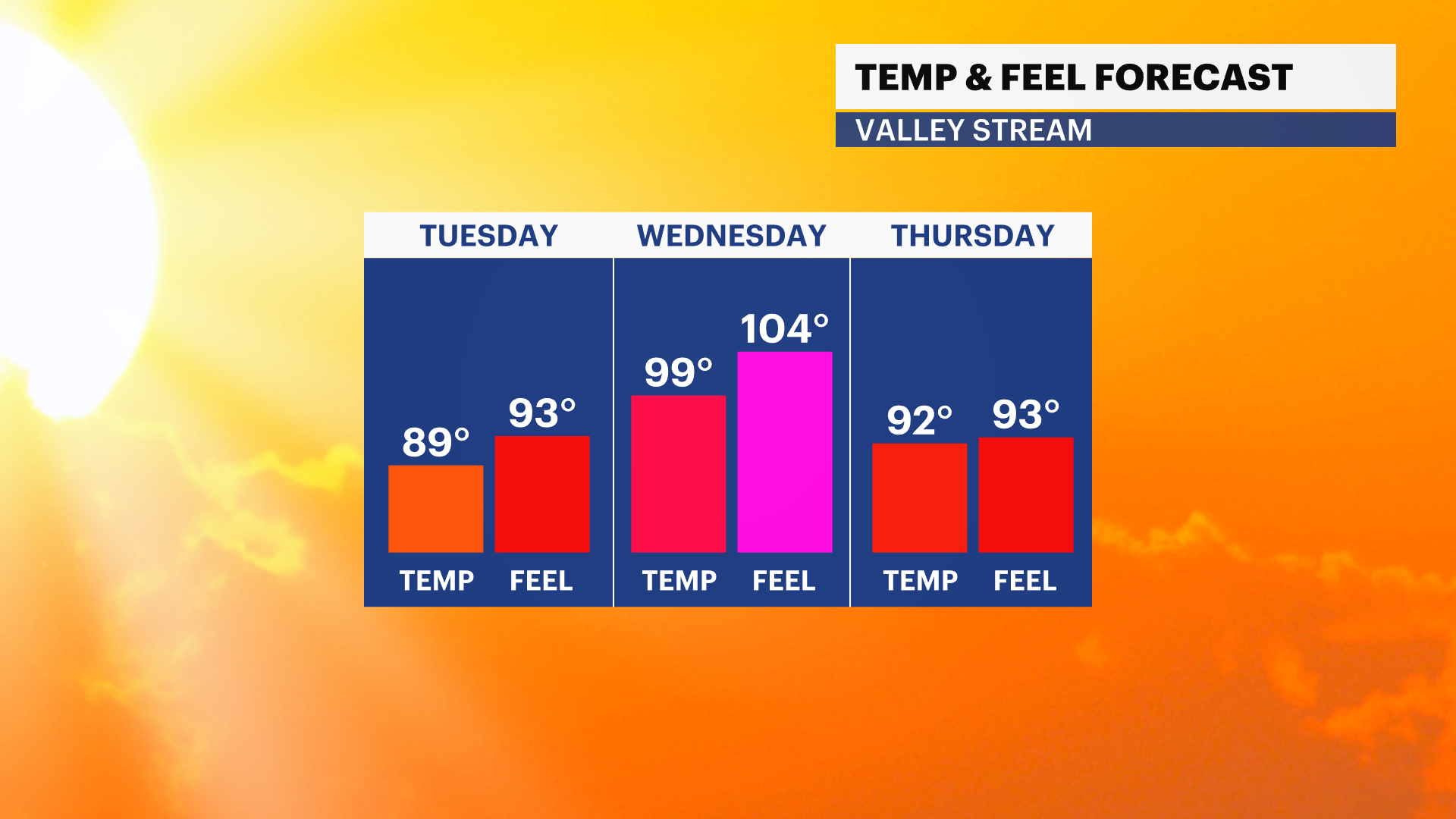
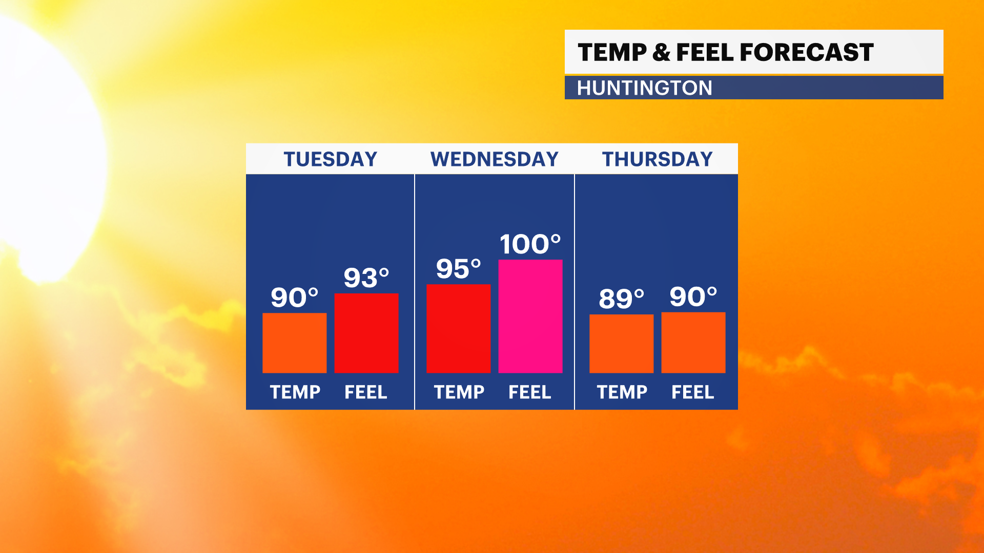
Wednesday will be the hottest day of the stretch. Expect abundant sunshine with temperatures soaring into the 90s, and a few spots could reach the mid to upper 90s. Heat index values will climb into the lower 100s, creating dangerous conditions if you're outside for extended periods. The UV index remains very high, so take extra precautions. By Wednesday night, a few scattered showers and thunderstorms could develop as temperatures settle back into the 70s.
Looking ahead, Thursday stays mostly sunny and hot with highs in the upper 80s to lower 90s. Friday brings more sunshine along with another chance for a late-day shower or thunderstorm as temperatures once again reach the upper 80s to lower 90s. The hot and humid pattern continues through the end of the week, so continue to take the heat seriously, stay hydrated, check on vulnerable family members and neighbors, and remember that dangerous rip currents and poor air quality will remain concerns at times.