Long Island Forecast: Perfect Wednesday, thunderstorms return Thursday & Friday
It's a gorgeous summer day on the island today, but keep the umbrella handy for Thursday and Friday
More Stories


What to know
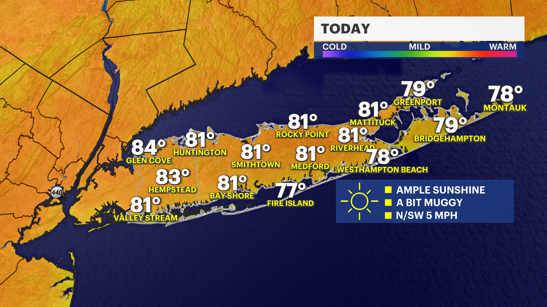
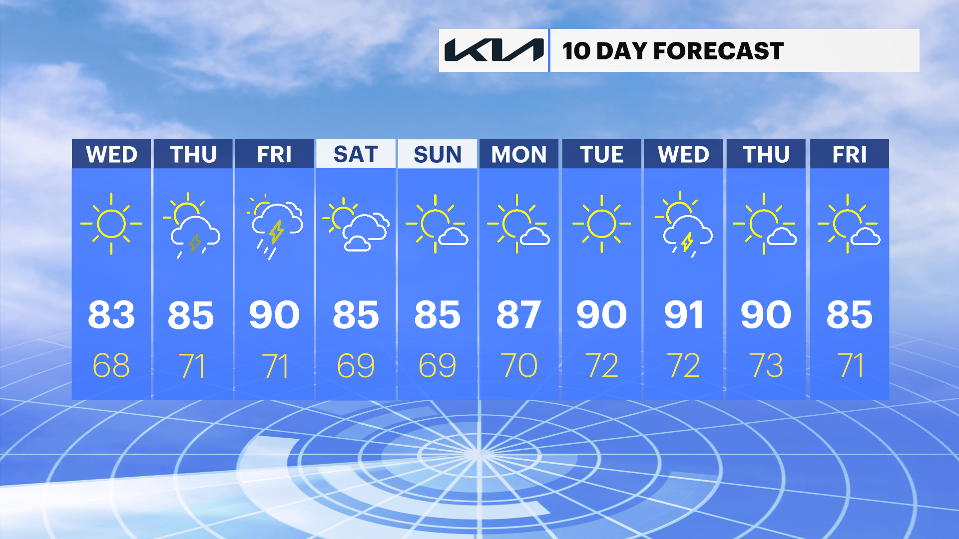
Today is the pick of the week. Plenty of sunshine, but a touch humid.
Pop up storms are expected Thursday and Friday evening.
The weekend looks good. Sunday will be sunnier than Saturday
Potential for a heat wave next week
Today: Pick of the week
All outdoor activities are a go! It is going to be noticeably humid, but mostly sunny with high temperatures in the low to mid 80s. The UV Index is very high, so reapplying sunscreen every two hours will help you avoid a sunburn in around 10 minutes on unprotected skin.
BOATERS: A small craft advisory will continue along the Atlantic Ocean in Suffolk County, but waves will drop to around two to four feet even there into the afternoon. The wind is light from the north this morning shifting to the south west this afternoon at 5 mph. There is a moderate risk for rip currents.
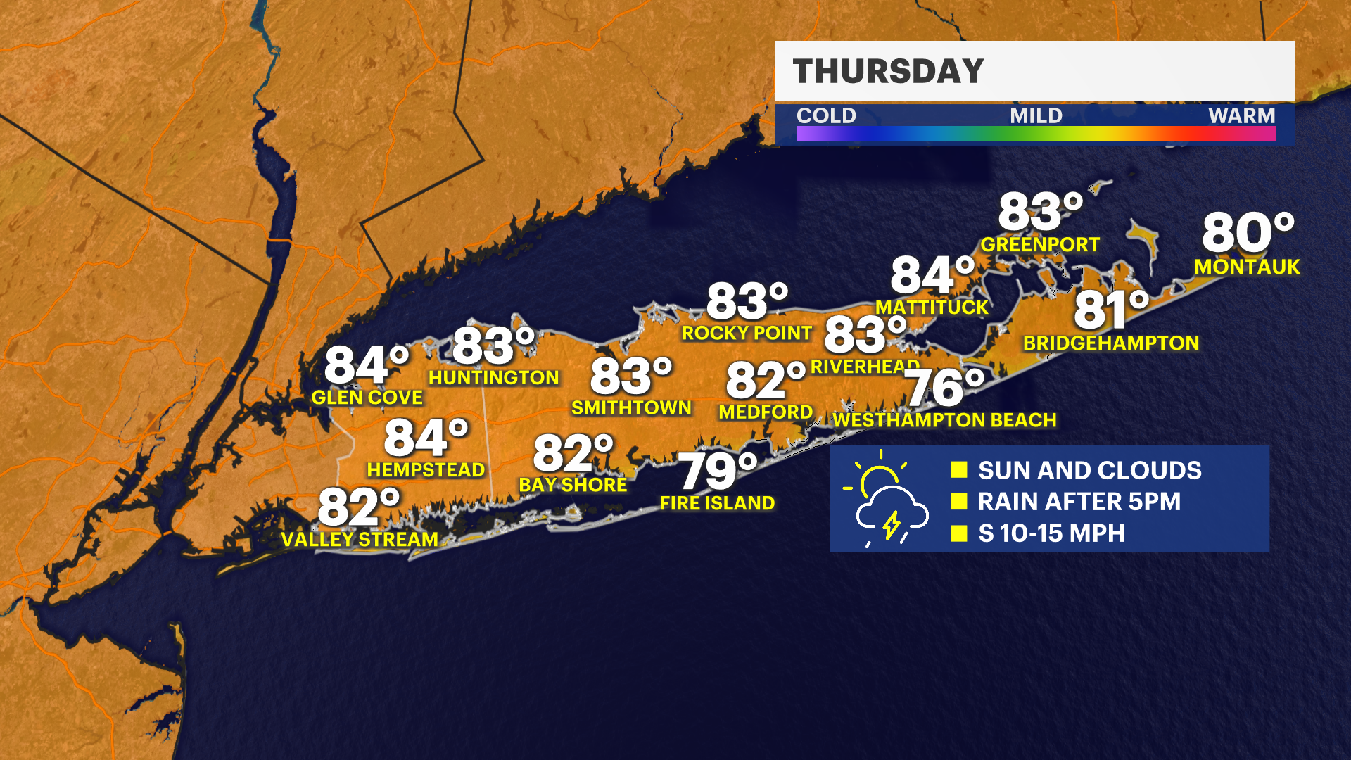
Thursday & Friday: Muggy with PM Storms
It will be warm and humid on Thursday with temperatures in the mid 80s, but heat index values around 90. There can be a pop-up shower or thunderstorm in the afternoon or evening with the best chance between 5 and 10 pm for Nassau county and Western Suffolk. The east end looks dry. A stiff south wind moves in during the afternoon cooling down the beaches to near 80-degrees. There is a moderate risk for rip currents.
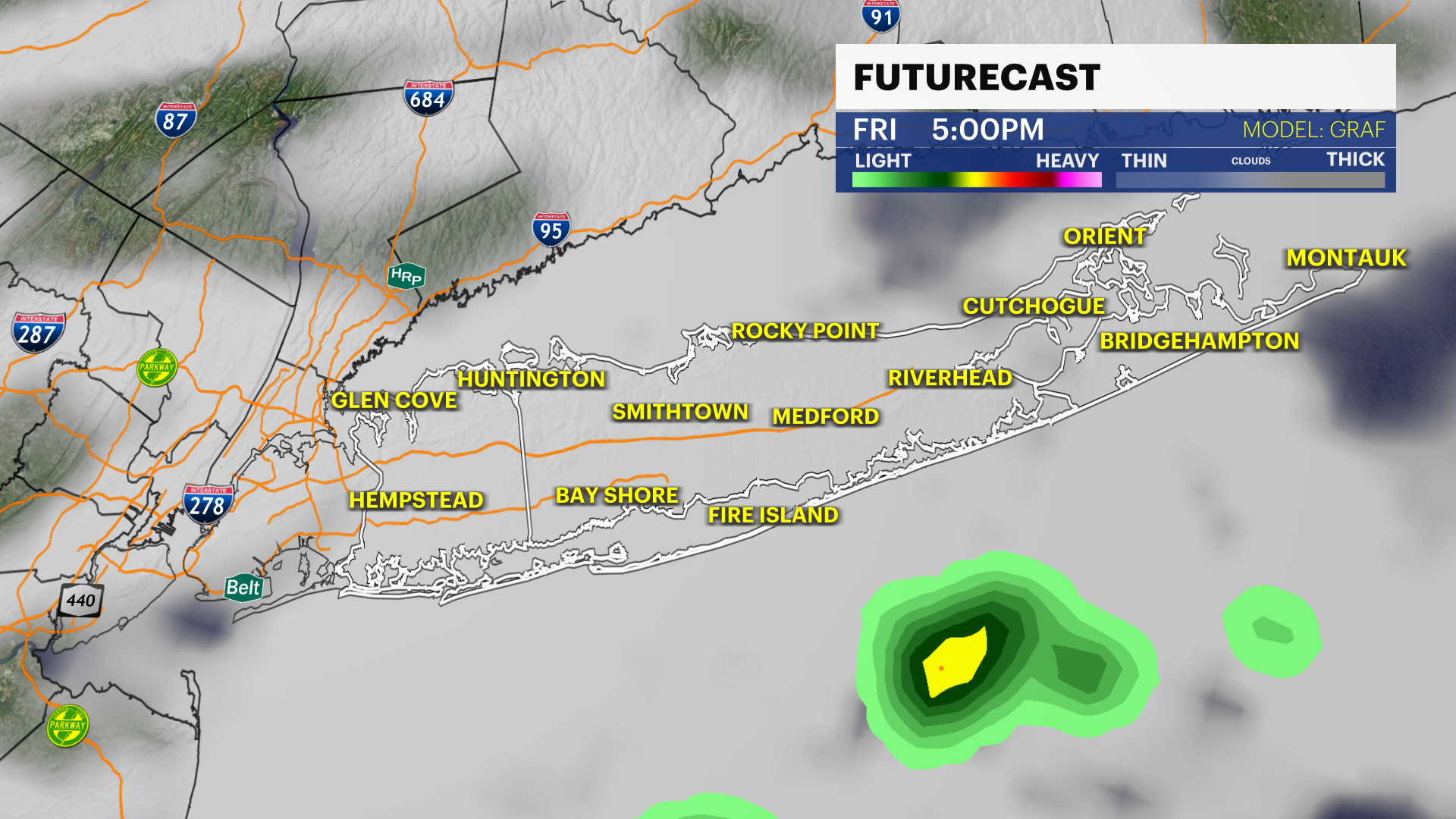
Friday will be the hottest day this week with high temperatures near 90 degrees, paired with tropical-like humidity. This is only expected to last one day at this time, but plan on it feeling like the middle 90s on Friday. As a front approaches Long Island late in the day, this will bring a few showers and thunderstorms into the evening. At this time, no severe weather is expected locally, but the News 12 Storm Watch Team will monitor this for you throughout the week.
The weekend: Warm & Likely Dry
Saturday morning will start off with a few clouds, but sunshine will be in and out through the afternoon and the rain risk is low. Sunday is the pick of the weekend with ample sunshine. Both days will have high temperatures in the mid to potentially upper 80s