Pleasant start, midweek rain ahead for the Hudson Valley
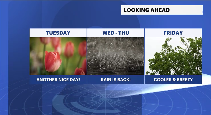
Sunshine continues Tuesday before showers arrive Wednesday night, and a cooler, breezy pattern follows
More Stories
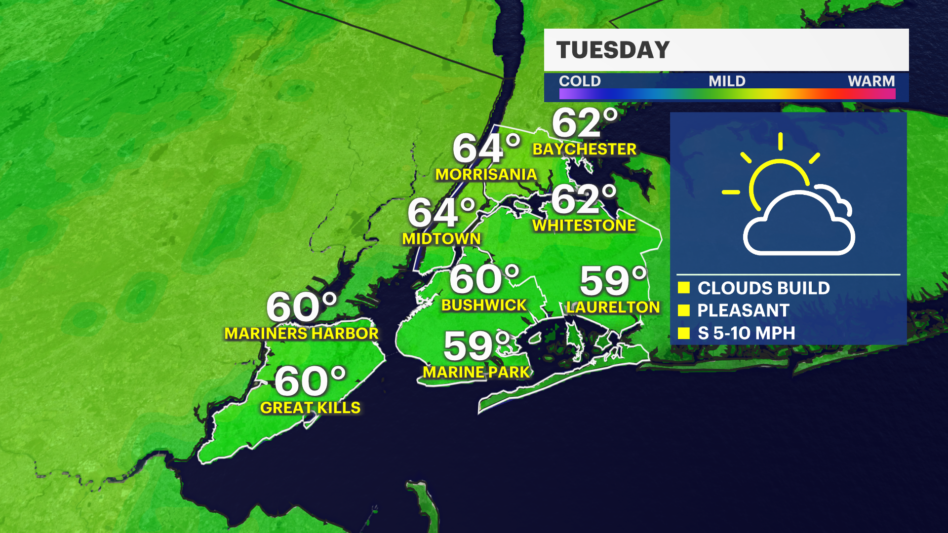
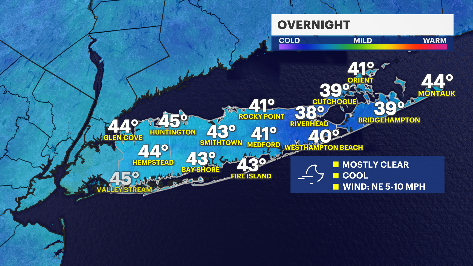

Overnight stays quiet, with mostly clear skies and cool temperatures settling in. Tuesday will bring a similar feel overall, though with a slight change. Expect a mix of sun and increasing clouds through the afternoon, along with slightly cooler temperatures. Despite the added clouds, conditions remain dry through the day.
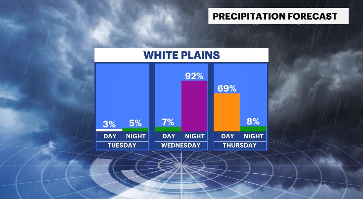
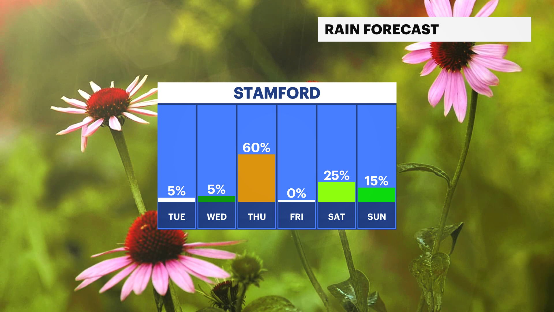
Changes arrive midweek. A storm system approaches on Wednesday, with dry conditions holding through much of the day before rain develops after 6 p.m. Showers will become more widespread on Wednesday night and continue into early Thursday morning, making for a damp start to the day.
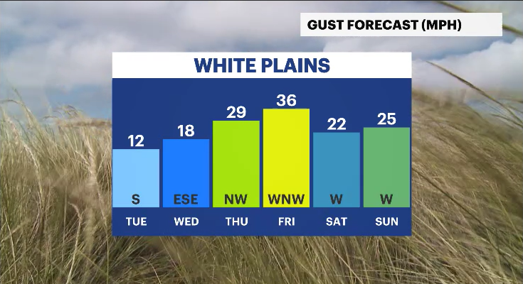
Behind the system, a cooler pattern settles in. Thursday afternoon trends drier, and that dry stretch continues into Friday. However, breezy conditions will develop, adding a noticeable chill to the air as the workweek closes out.
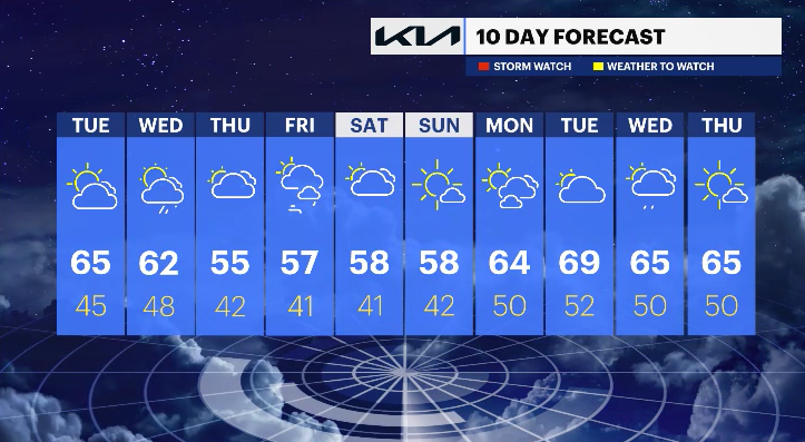
Looking ahead to the first weekend of May, there are signs of additional chances of showers, particularly on Saturday, though some uncertainty remains regarding timing and coverage. Temperatures are expected to run below average, with highs likely in the 50s.
THE FORECAST:
OVERNIGHT: Mostly clear and cool. Lows: Low to mid-40s.
TUESDAY: Mostly sunny, then increasing clouds. Highs: Mid-60s. Lows: Mid-40s.
WEDNESDAY: Partly sunny, then cloudy with rain developing after 6 p.m. Highs: Low 60s. Lows: Upper 40s.
THURSDAY: Mostly cloudy with early showers, then gradual clearing. Highs: Mid-50s. Lows: Low 40s.