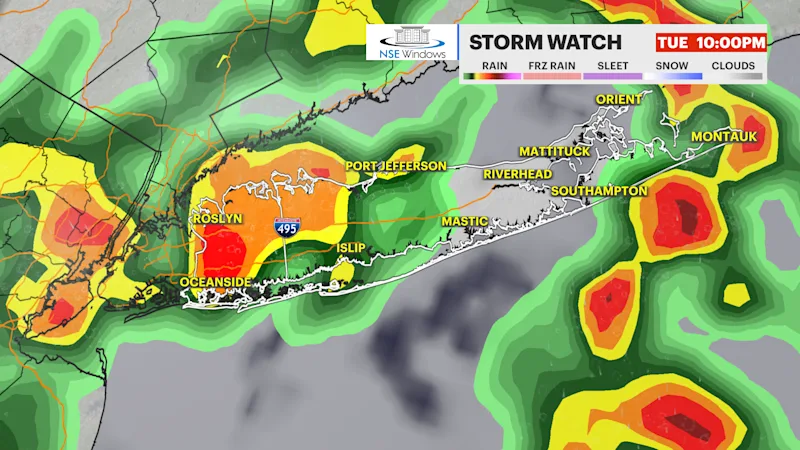
STORM WATCH: Scattered strong thunderstorms this afternoon into this evening on Long Island
Scattered thunderstorms can be strong with damaging winds and heavy flooding rain.
More Stories


STRONG TO SEVERE THUNDERSTORMS POSSIBLE THIS AFTERNOON INTO THIS EVENING
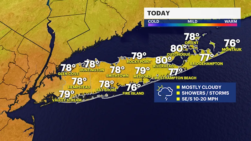
Today starts with a few hints of sunshine, but clouds will quickly take over, leading to a mostly cloudy day across Long Island. Scattered showers will develop after 10am, and a few thunderstorms are expected through the afternoon as temperatures climb into the upper-70s to around 80 degrees. While much of the day won't be a washout, keep the umbrella handy because showers will become more numerous later on. Be alert some thunderstorm can have damaging winds up to 60 mph and heavy flooding rains.
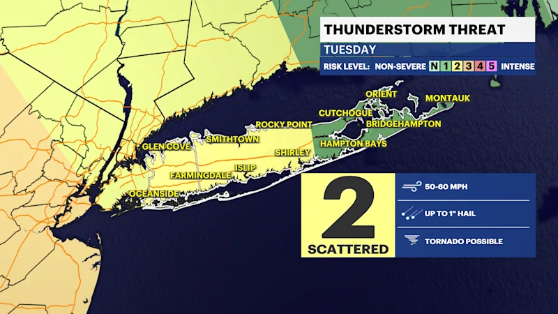
The greatest concern arrives toward this evening, especially around sunset, when the atmosphere becomes more favorable for stronger thunderstorms. Some of these storms could produce brief torrential downpours, localized flooding and strong, damaging wind gusts. If you have outdoor plans this afternoon or this evening, stay weather-aware and be prepared to head indoors quickly if warnings are issued.
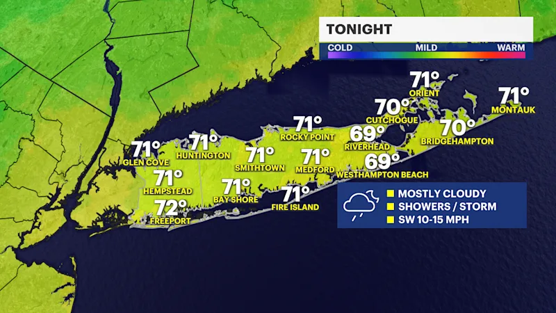
Tonight remains unsettled with mostly cloudy skies, scattered showers, and a few thunderstorms continuing through the overnight hours. Temperatures will stay mild, with lows settling into the upper-60s to lower-70s. Any heavier downpours could linger for a time before conditions gradually begin to improve overnight.
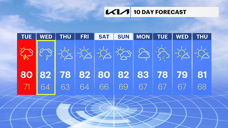
Wednesday brings mostly cloudy skies with a few breaks of sunshine. There will still be the chance for a couple of spotty afternoon showers and thunderstorms, but coverage should be more limited than today. Highs will reach the upper-70s to lower-80s. Looking ahead, the weather turns much quieter as sunshine returns for Thursday, Friday, and Saturday, with comfortable summertime conditions, dry weather, and afternoon temperatures in the 80s.