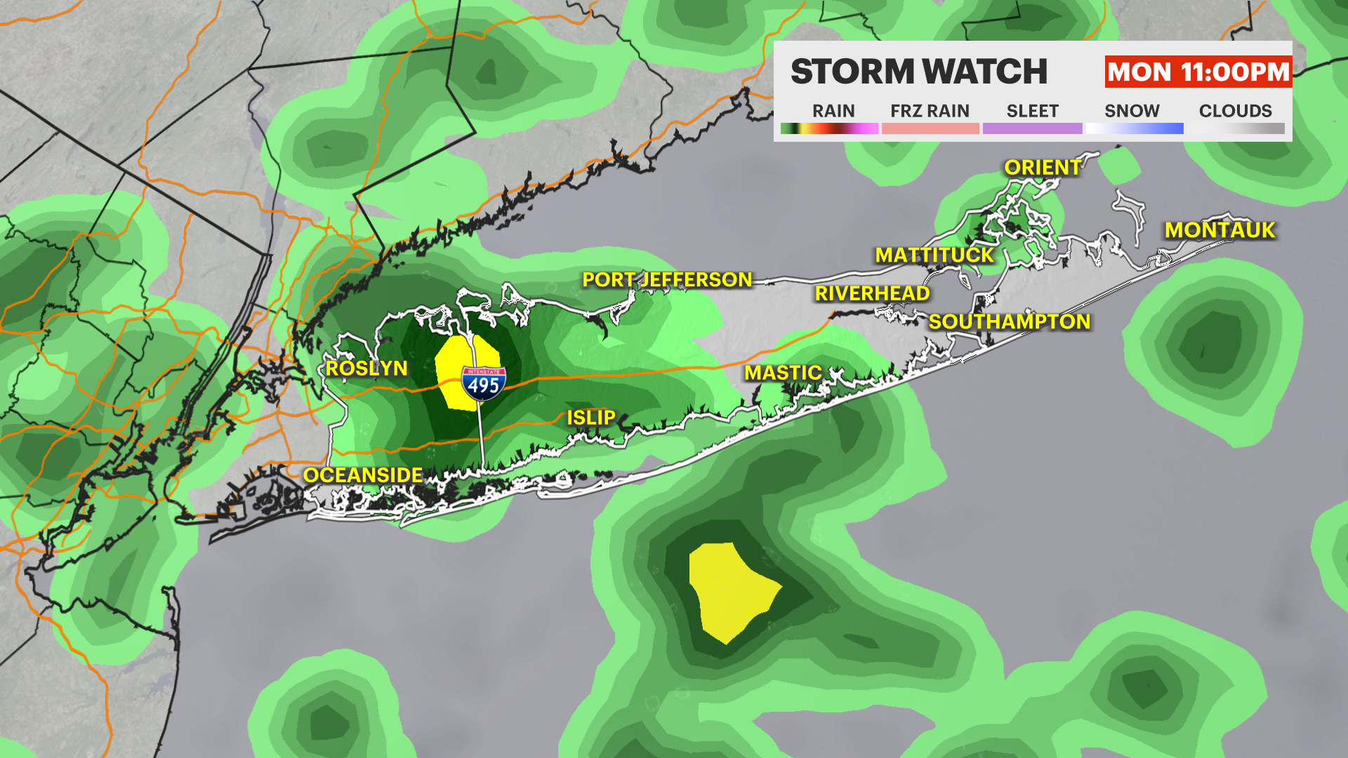
STORM WATCH: Scattered flooding lingers with some additional rain through tonight
While gradual improvements are happening this evening, scattered downpours can still be possible through early Tuesday morning - use caution traveling.
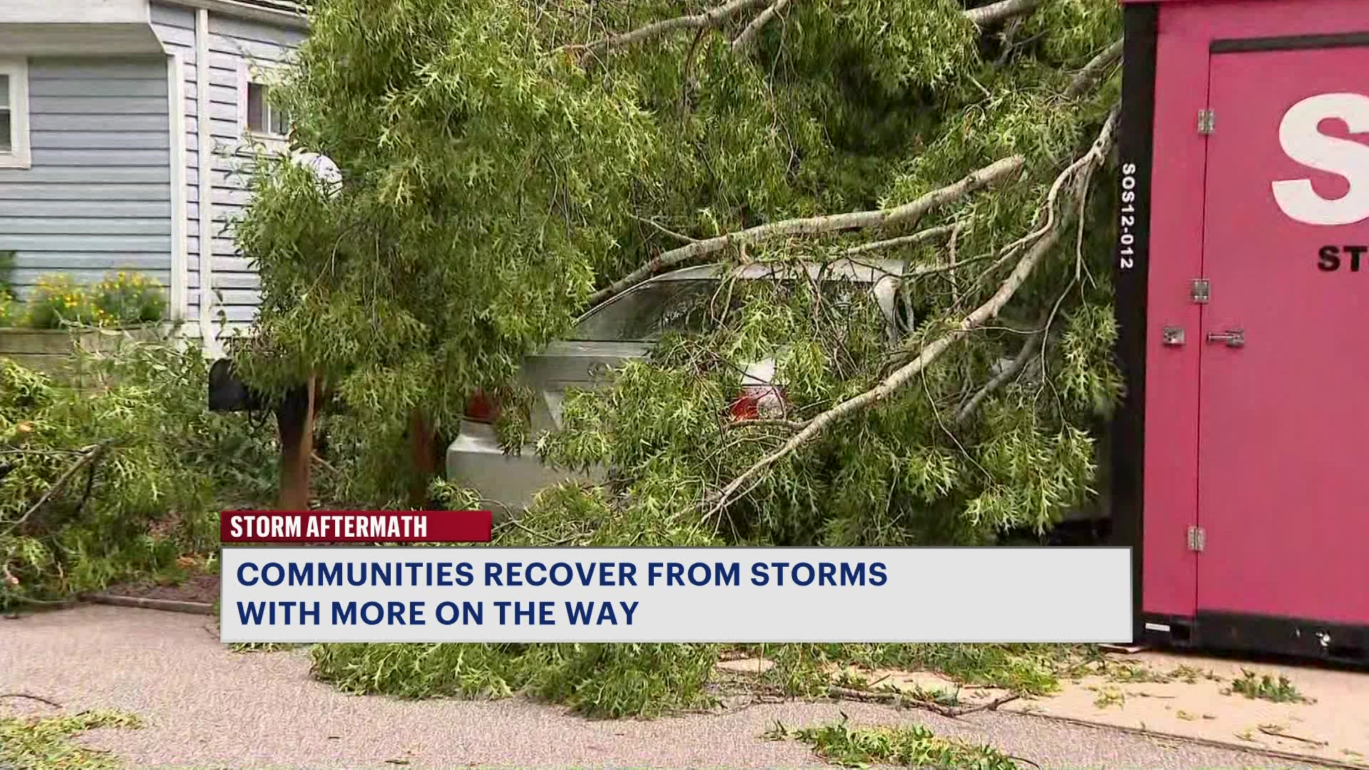
More Stories


PERIODS OF LINGERING RAIN
USE CAUTION -- While the worst of today's weather is behind us, scattered rain continues this evening. Most rain will be light to moderate, but a few additional downpours will be possible. Any downpours will be more widely scattered than the more widespread torrential downpours that fell across much of Long Island earlier today. Use caution when traveling, as areas of standing water are still around and will be more difficult to see at night.

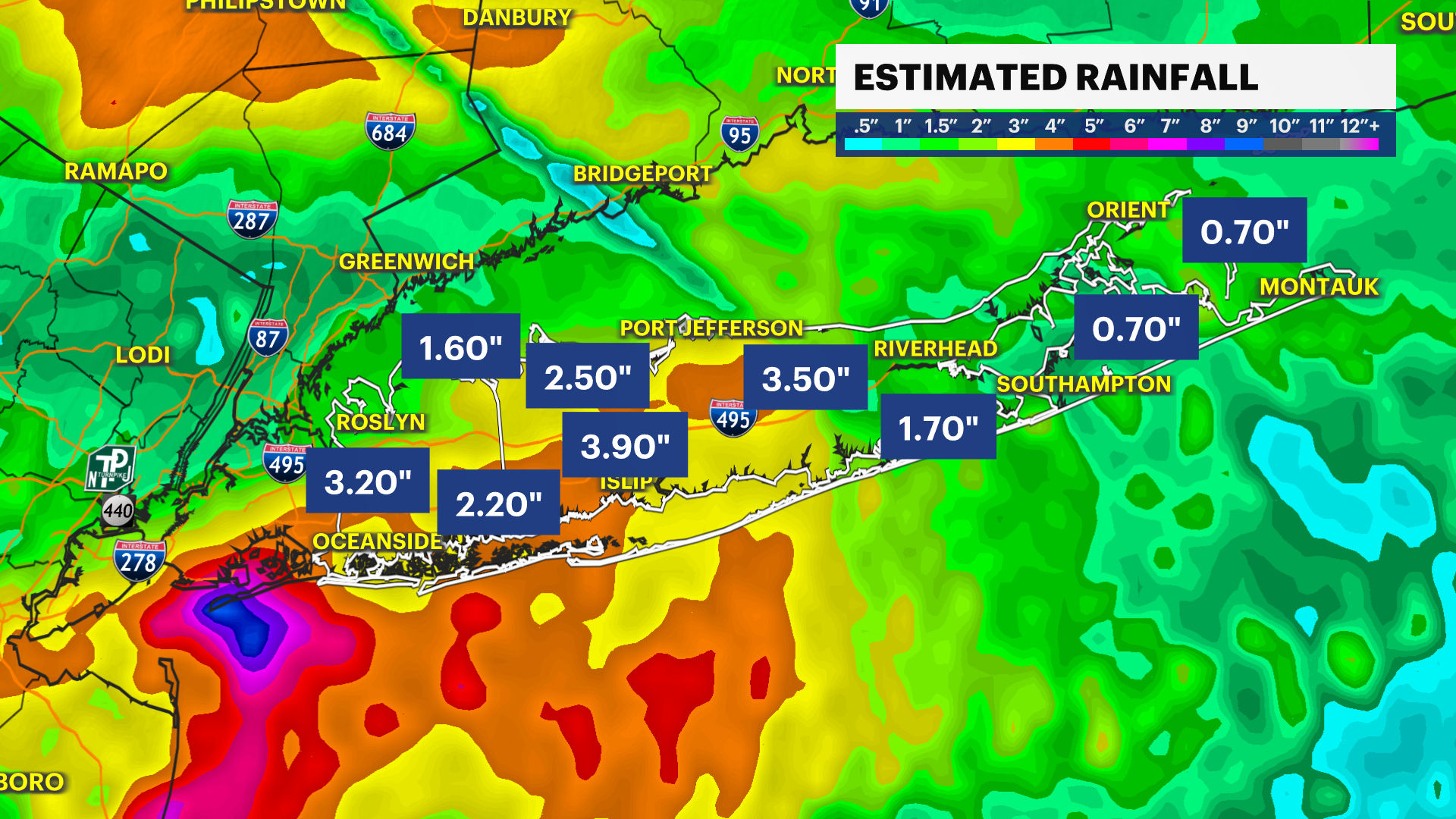
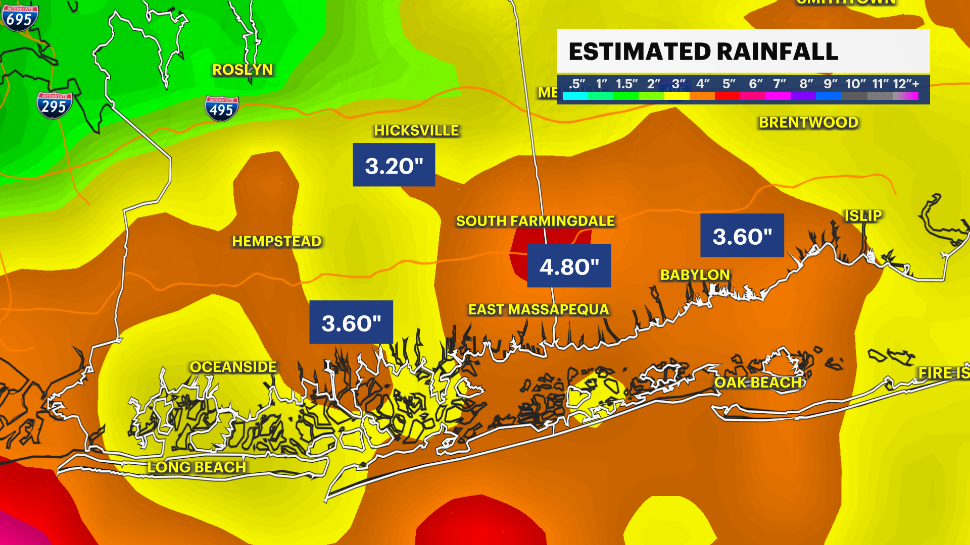
The southern half of Nassau and Suffolk counties generally received the most rain today, 2 to 4 inches with locally higher amounts closer to 5 inches. That is around or even a little more than one month's worth of rain! Long Island certainly needed the rain, but too much too quickly can cause scattered flooding issues like it did today.
EXTENDED FORECAST
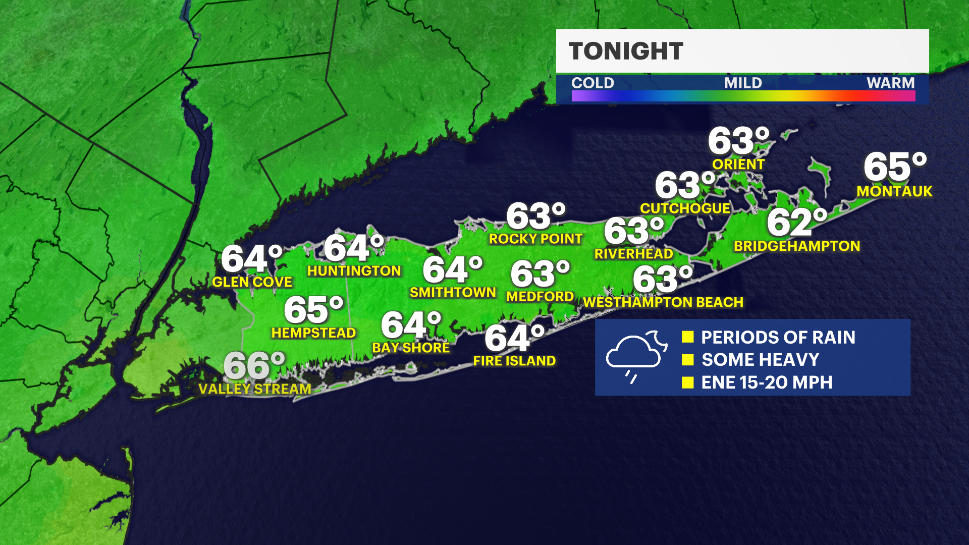
TONIGHT: STORM WATCH -- Cloudy with scattered periods of rain. A few downpours will still be possible through around 5 a.m. Tuesday. Use caution traveling as lingering areas of flooding can be around. Breezy with an east-northeast wind around 15 to 20 mph. Lows in the 60s.
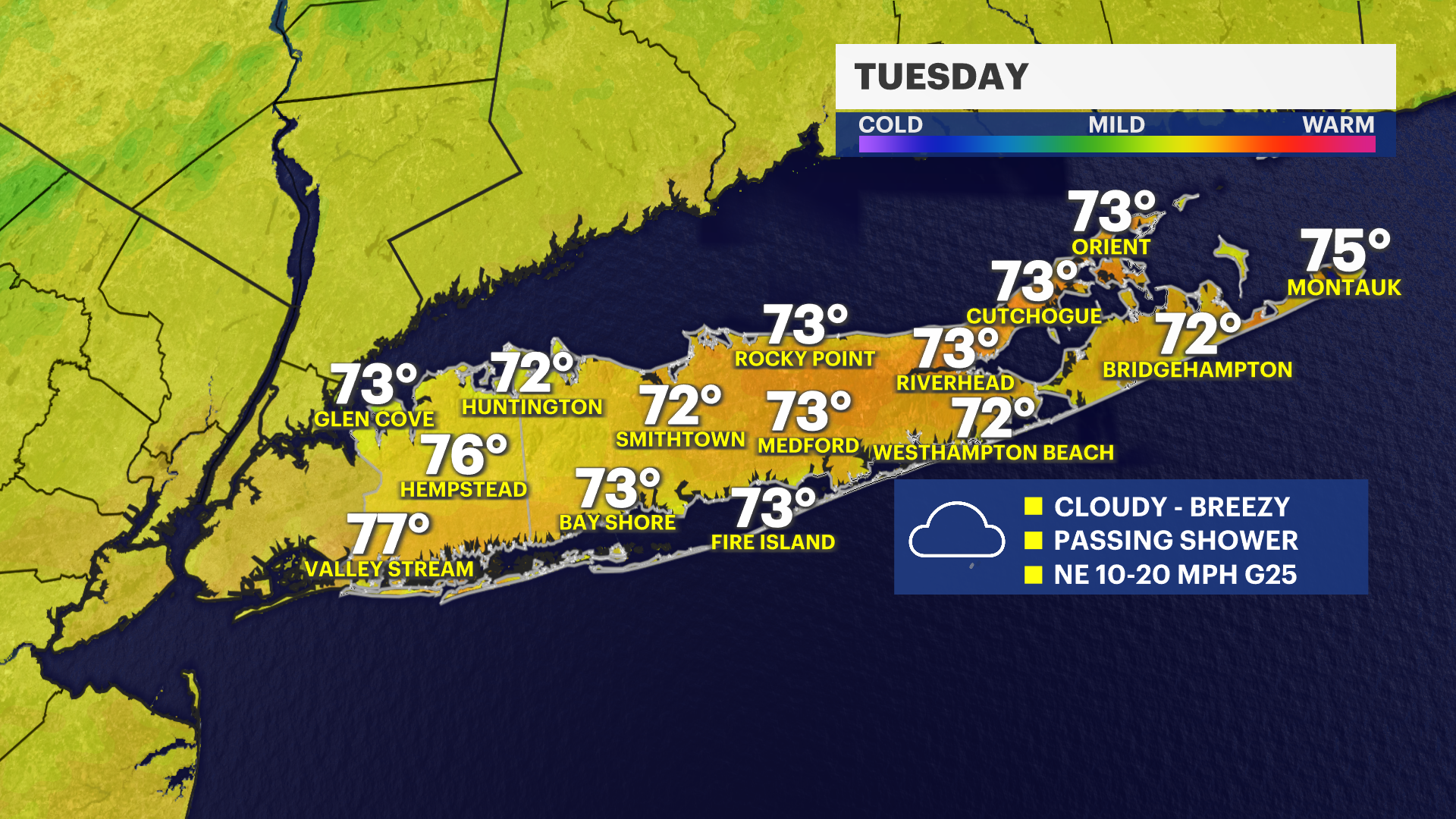
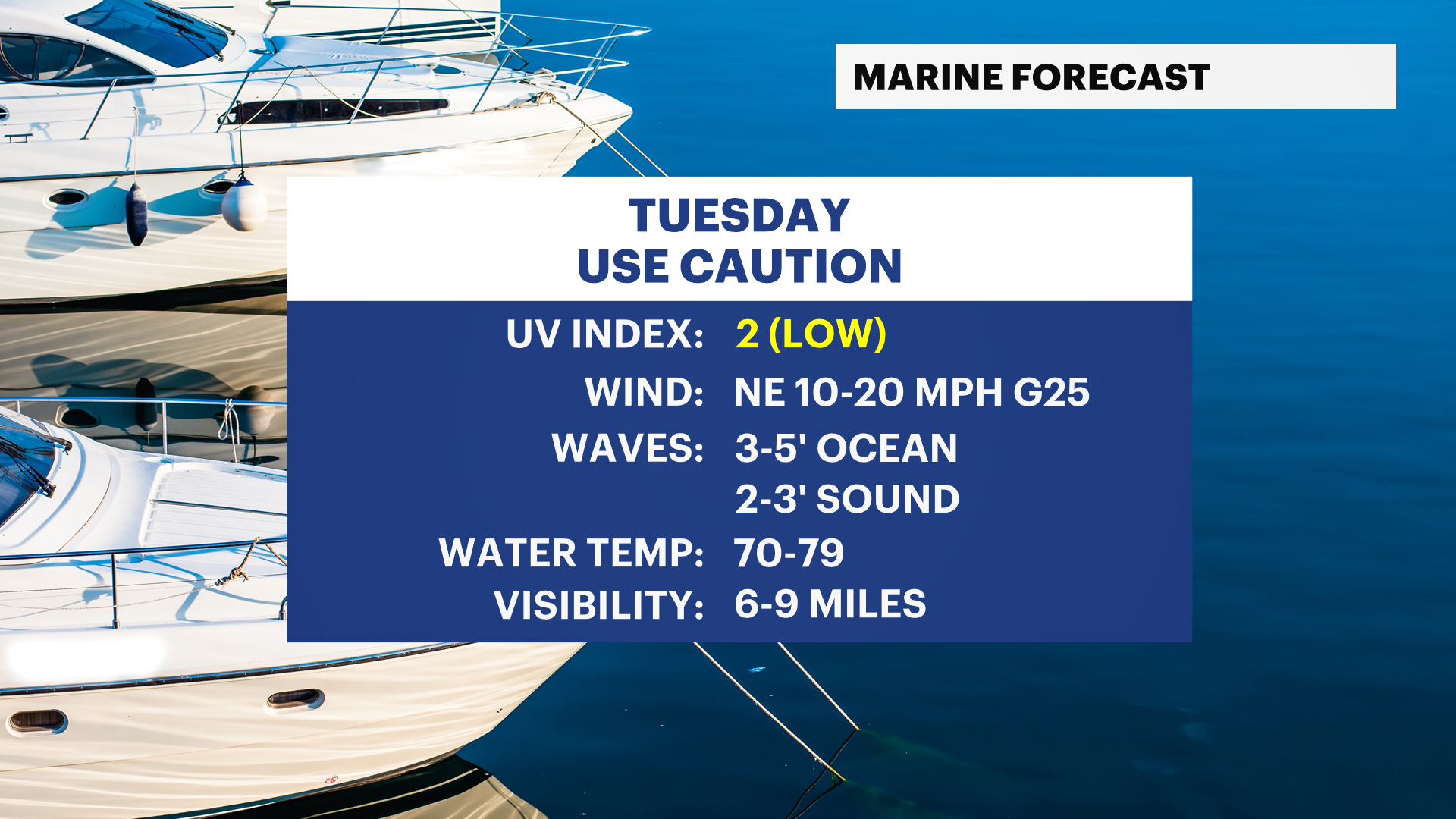
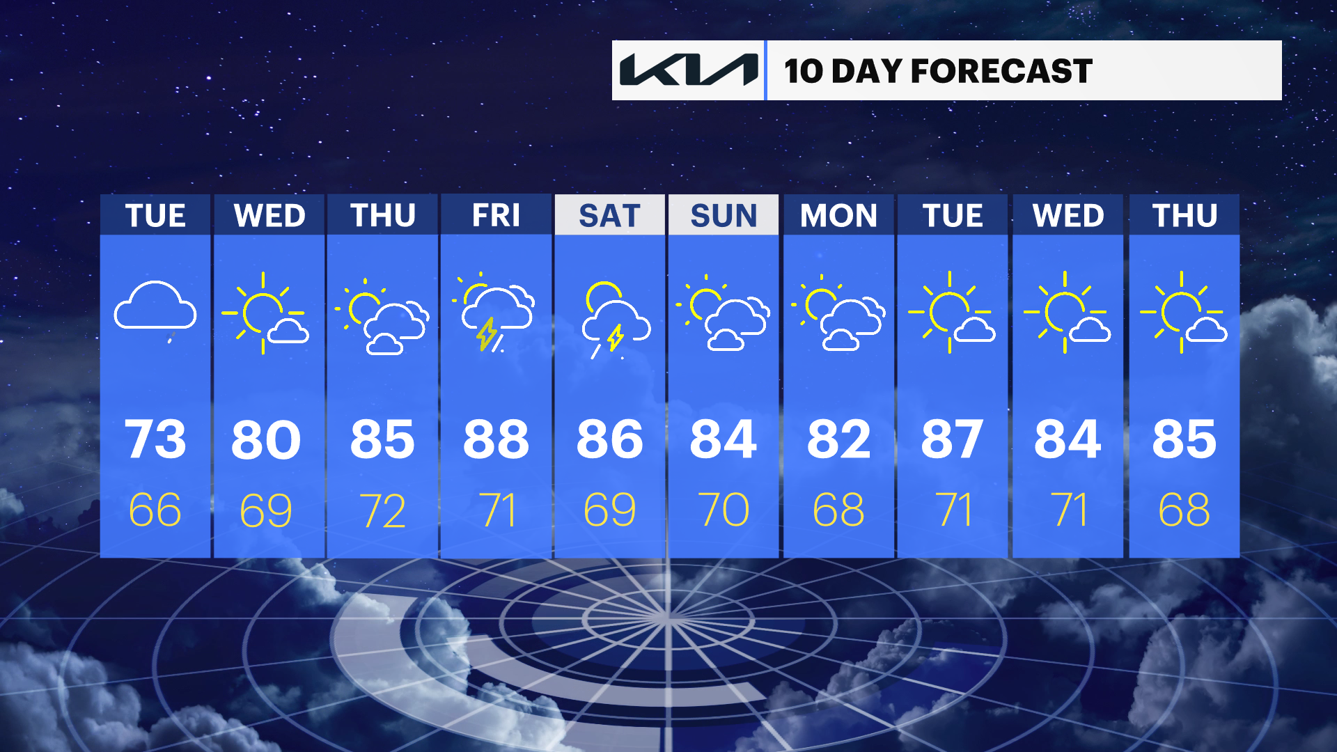
TUESDAY: Cloudy and much cooler than average with highs around the lower 70s. A few passing light rain showers will be possible, but it will be a much drier day than Monday. Lows near 66 degrees.
WEDNESDAY: Mostly sunny to partly cloudy. Highs around 80 degrees. Lows near 69 degrees.
THURSDAY: Sun and clouds. Highs around 85 degrees. Lows near 72 degrees.
FRIDAY: Partly sunny with a few showers and thunderstorms possible. Highs around 88 degrees. Lows near 71 degrees.
SATURDAY: Sun and clouds. A pop-up shower or thunderstorm possible. Highs around 86 degrees. Lows near 69 degrees.
SUNDAY: Sun and clouds. Highs around 84 degrees. Lows near 70 degrees.
MONDAY: Sun and clouds. Highs around 82 degrees. Lows near 68 degrees.