STORM WATCH: Thunderstorms return Monday across Long Island
It's not a bad Sunday across the island, but we are tracking on and off downpours that could produce flooding on Monday.
More Stories


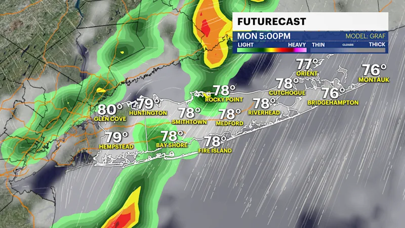
Drenching thunderstorms are in the forecast on Monday and flooding is expected tomorrow in the heaviest rain bands during the morning on Monday through the early evening. A general 1" of rain is expected, but isolated 2-3" of rain in some neighborhoods in a short period of time would be enough to create problems.
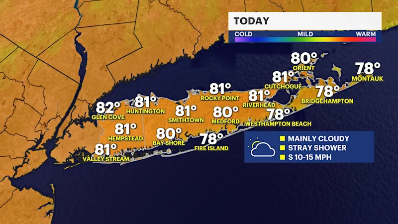
Today: Cloudy with stray showers
It's not a perfect Sunday, but any showers today will be generally light. Thunderstorm are not expected. Skies will be mostly cloudy and temperatures are in the low 80s, but it will feel hotter with the humidity.
Boat and Beach forecast: Watch for rip currents
The risk for rip currents is "moderate" for all Atlantic facing beaches. This is an improvement from yesterday, but beach goers should know their limits when swimming. Rip currents are a hidden danger and can be very strong even when the ocean looks calm. Ocean swells will be around 3 feet for the beaches today.
A high risk for rip currents is expected on Monday and a Small Craft Advisory is in effect for the Atlantic Ocean starting 8 a.m. on Monday. Boaters and beach goers will also need to be alert for thunderstorms. Lightning often strikes before rain arrives.
Monday: Storm Watch for heavy rain
Mostly cloudy skies are expected with on and off rain starting Sunday night and lingering through Monday evening. Thunderstorms will be capable of producing flooding so watch for ponding on the roads. 1" of rain is expected with locally higher amounts in Storms.
Tuesday: Trending dry
Expect a mix of sun and clouds and a break from the rain. However, it will still be muggy. Highs are in the mid 80s.
Rest of the week
It's humid and hot with sun and clouds and scattered thunderstorms every afternoon. Highs are in the mid 80s but will feel like near 90-degrees.