

🌊 Tri-State Forecast High Tides
Long Island • Connecticut • NYC • New Jersey • Hudson Valley
NWS New York (OKX) & Mount Holly / Philadelphia (PHI)Loading NWS forecasts…
Retrieving forecast stations…
Below flood stageActionMinorModerateMajor
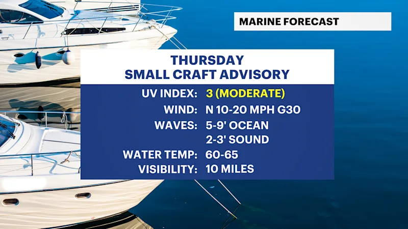
A Coastal Flood Advisory is in effect for southern Nassau County and southwestern Suffolk County until around 9 p.m. Minor coastal flooding is possible around the time of high tide, especially in low-lying and flood-prone shoreline communities. Some roads near the waterfront could experience minor flooding. Waves 5 to 10 feet along the South Shore will lead to beach erosion.
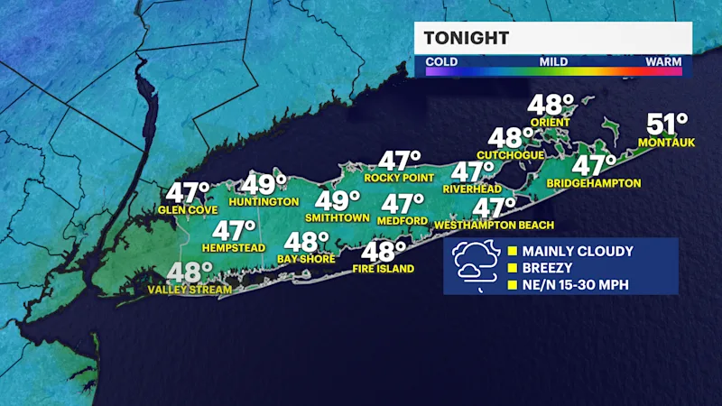
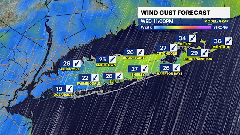
Other than a slight chance for a passing light shower over eastern Suffolk County, it will be dry and mostly cloudy with wind gusts between around 20 to 35 mph this evening and overnight. Have a heavier coat with you. Evening temperatures will be gradually dropping through the 50s and towards the upper 40s this evening and it will feel chilly with the wind. Overnight lows into Thursday morning will stay in the upper 40s, but it can feel like the upper 30s.
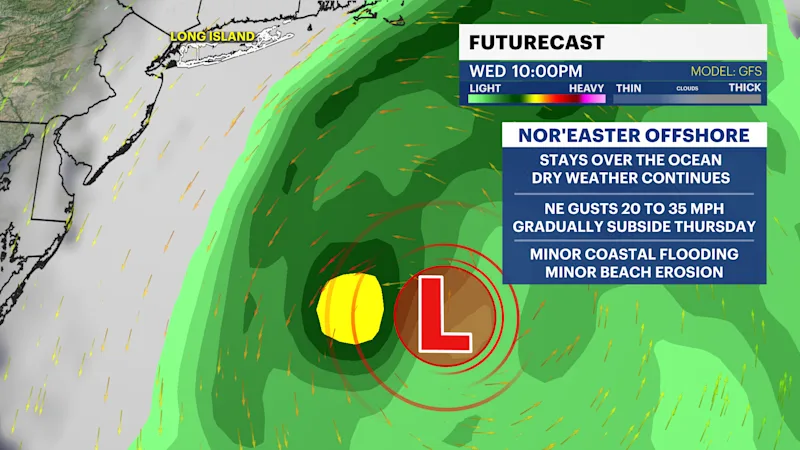
The nor'easter we have been tracking offshore of Long Island for several days is now officially classified as a subtropical storm with the name Josephine. This was designated by the National Hurricane Center at 5 p.m. this evening. This does not change the forecast for Long Island and this storm will continue to pull away gradually through Thursday. A subtropical storm is essentially a hybrid storm between a tropical storm and a normal area of low-pressure meaning Josephine only has some tropical characteristics.
Minor coastal flooding and minor beach erosion remain possible tonight, with improvements to surf and wind gusts all across Long Island arriving on Thursday.
Here is a look at the projected hour-by-hour weather for Long Island:
TONIGHT: Mainly cloudy, breezy and chilly. Lows in the upper 40s can feel like the upper 30s at times into early Thursday morning. Wind: northeast-north 15 to 30 mph.
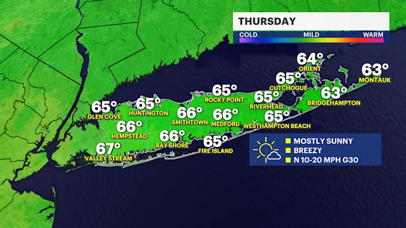
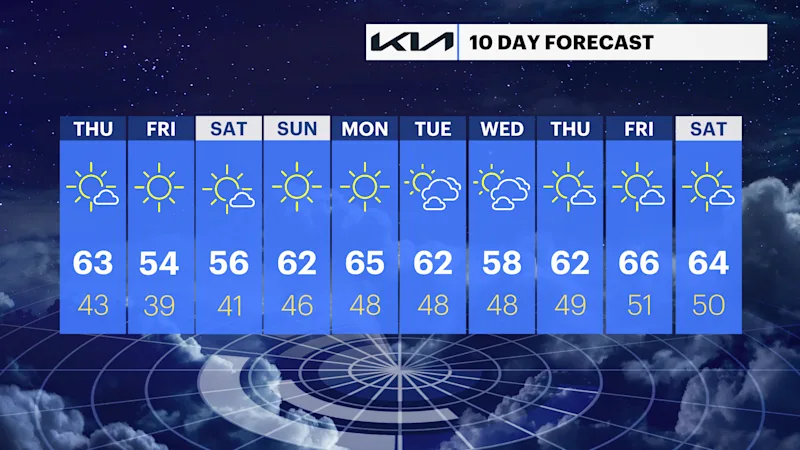
THURSDAY: Becoming mostly sunny. Gradually lowering wind gusts, but still breezy. Highs around the middle 60s. Lows near 43 degrees.
FRIDAY: Mostly sunny and cool. Highs around 54 degrees. Lows near 39 degrees.
SATURDAY: Mostly sunny with highs again around 56 degrees. Good news for everyone taking part in Saturday's Jones Beach Ironman 70.3! The weather is looking dry for the race, although it will be a chilly start, with morning temperatures in the 40s. The biggest improvement will be the winds, which will be much lighter than what we've been dealing with during the week. Northerly winds in the morning will gradually shift to the southwest during the afternoon, generally around 5 to 15 mph. Overall, it looks like a nice fall day for the race, with dry weather and much more manageable winds. Lows near 41 degrees.
SUNDAY: Sunny with highs around 62 degrees. Lows near 46 degrees.
MONDAY: Mostly sunny. Highs around 65 degrees. Lows near 48 degrees.
TUESDAY: Sun and clouds. Highs around 62 degrees. Lows near 48 degrees.
WEDNESDAY: Sun and clouds. Highs around 58 degrees. Lows near 48 degrees.