Increasing sunshine with a mild breeze today in the Hudson Valley
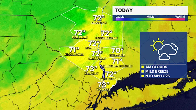
Today will be a brighter day with mild temperatures in the 70s and gusty winds up to 25 MPH.




White Plains Information
After a stormy Sunday, weather conditions improve this week. This afternoon humidity drops with increasing sunshine and seasonable temperatures in the mid 70s. Tonight, a Fall chill settles in with temperatures dropping to the 40s and 50s.
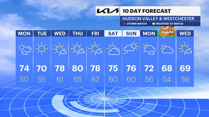
A quiet stretch of weather is heading our way for most of this week with highs in the 70s to low 80s. Humidity gradually increases this weekend with a chance of rain Saturday into Sunday. As of now, the frontal system moves in from the west Saturday evening into Sunday bringing widespread rain to the region. It's still too soon to know the exact timing and potential impacts. Stay tuned for updates.
FORECAST
Today: Morning clouds to afternoon sun, mild and breezy. Highs in the low to mid-70s.
Tonight: Mostly clear and cool. Lows in the upper 40s to low 50s.
Tuesday: Sunny and cooler. Highs in the upper 60s to low 70s.
Wednesday: Mostly sunny and warmer. Highs in the upper 70s to low 80s.
Thursday: Mostly sunny and warm. Noticeably humid. Highs in the upper 70s to low 80s.
Friday: Sun, clouds and warm. Highs in the upper 70s to low 80s.
Saturday: Partly sunny, with a chance of late showers. Highs in the mid to upper 70s.
Sunday: Mostly cloudy, warm with a chance of AM showers. Highs in the upper 70s to low 80s.