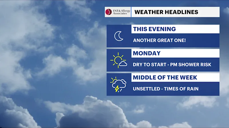
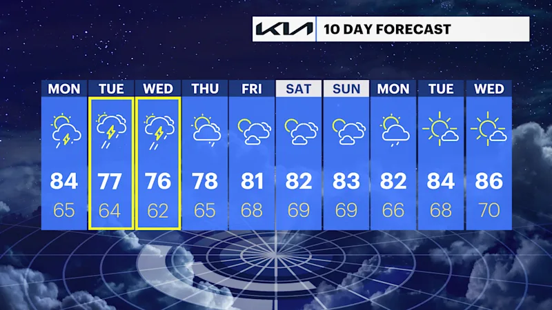
Mostly dry start on Monday across the Hudson Valley before late-day scattered showers
Several rounds of showers and thunderstorms will bring periods of heavy rain, localized flooding concerns and unsettled conditions through Thursday.
More Stories


What to expect:
Mostly dry overnight, with only an isolated storm possible Monday afternoon and evening.
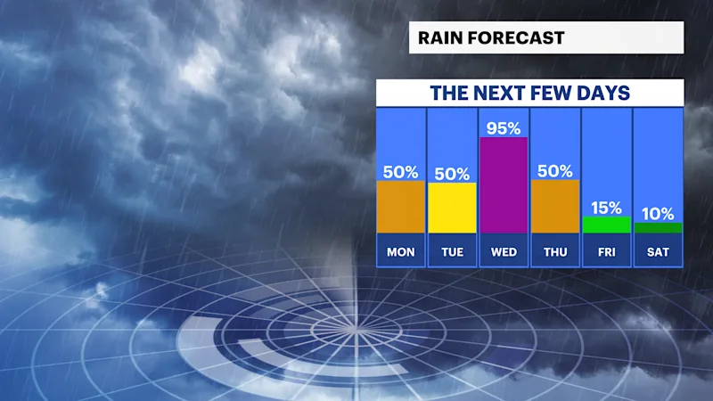
Widespread showers and thunderstorms develop Tuesday and continue at times through Thursday.
Locally heavy rainfall may lead to isolated flooding, especially in poor drainage and low-lying areas.
A few stronger thunderstorms are possible, mainly on Tuesday.
Drier, more comfortable weather returns Friday into next weekend.
FORECAST
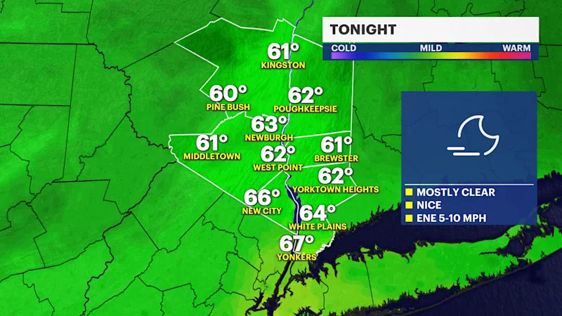
Overnight (Temperatures: Low 60s)
Mostly clear and comfortable, with light winds. A quiet night before the weather becomes more active to start the workweek.
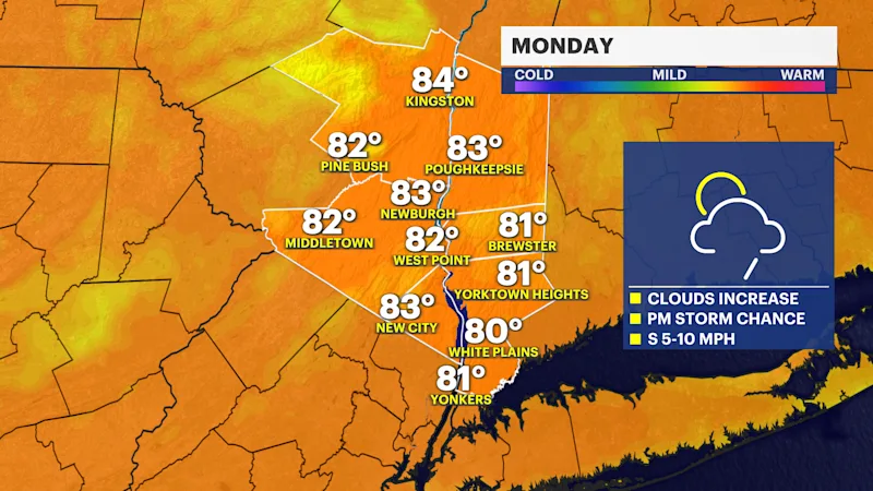
Monday (Temperatures: Low to mid-80s)
Partly to mostly sunny, with increasing humidity. Most of the day stays dry, but scattered showers and thunderstorms may develop during the afternoon and evening. While severe weather is not expected to be widespread, any storm could produce brief heavy downpours and lightning.
Monday Night (Temperatures: Mid-60s)
Scattered showers and thunderstorms continue at times, with increasing cloud cover. Rainfall will generally be light to moderate, but locally heavier downpours are possible.
Tuesday (Temperatures: Mid- to upper 70s)
A wet and unsettled day, with widespread showers and thunderstorms. Periods of heavy rain are likely and localized flooding may develop where storms repeatedly move over the same areas. A few storms could become strong, with gusty winds and frequent lightning.
Tuesday Night (Temperatures: Low to mid-60s)
Showers and a few thunderstorms continue through much of the night. Additional heavy rainfall may occur, especially during the evening, with localized flooding remaining possible.
Wednesday (Temperatures: Mid- to upper 70s)
Cloudy and unsettled, with more showers and scattered thunderstorms. While rainfall may not be continuous, several rounds of rain are expected throughout the day, with locally heavy downpours still possible.
Thursday (Temperatures: Mid- to upper 70s)
A mix of clouds and some sunshine, with scattered showers and afternoon thunderstorms still possible. Coverage should become more limited as the storm system slowly moves away.
Friday (Temperatures: Around 80 to Low 80s)
Mostly sunny, with lower humidity and pleasant summer weather returning.
Weather alerts, watches, and hazards
Heavy Rain Potential (Tuesday through Thursday):
Several rounds of showers and thunderstorms are expected as a slow-moving storm system crosses the region. Rainfall will be spread over multiple days, with locally heavy downpours capable of producing isolated flooding.
Localized Flooding:
Repeated rounds of rain may cause ponding on roads and minor flooding in poor drainage, low-lying and flood-prone areas. While widespread flash flooding is not anticipated as of Sunday evening's forecast, localized flooding remains a concern wherever heavier bands of rain persist.
Thunderstorm Risk (Monday Afternoon through Wednesday):
Scattered thunderstorms are possible beginning Monday afternoon, with the greatest coverage expected Tuesday. A few storms could become strong Tuesday, with gusty winds, frequent lightning and torrential rainfall. The severe weather threat appears lower by Wednesday, although thunderstorms remain possible.
Extended Unsettled Pattern:
Unlike a quick-moving cold front, this system will move slowly through the Northeast, bringing several opportunities for rain from Monday afternoon through Thursday before finally exiting the region.
Improving Late Week:
High pressure returns Friday, bringing sunshine, lower humidity and seasonable temperatures into next weekend.