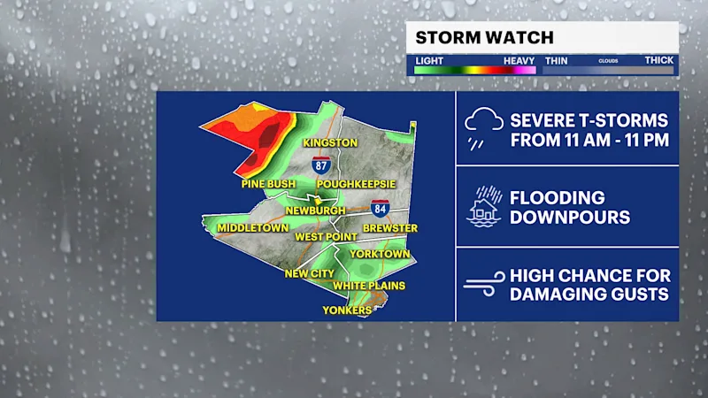
STORM WATCH: Severe storms will produce flooding downpours and damaging winds to the region today
Stay weather aware as rounds of thunderstorms are expected midday and after sunset today, bringing threats of flooding downpours and damaging winds, along with hail and a possible tornado.
More Stories


ALERTS:
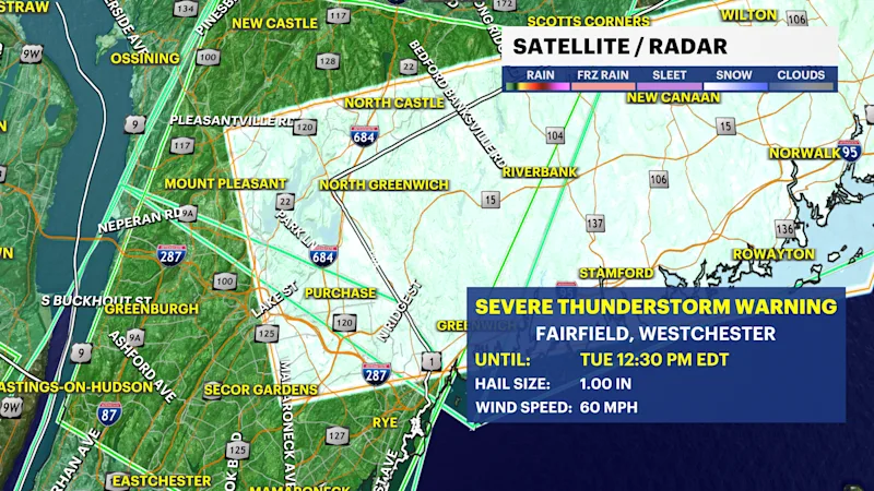
A Severe Thunderstorm Warning has been issued for Westchester County. Damaging wind gusts, heavy rain, and frequent lightning are expected until 12:30 p.m. Move indoors and stay away from windows.
Seek shelter NOW if you are within the highlighted areas until the warning is over.
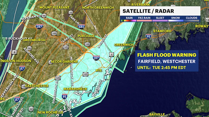
Flash Flood Warning is in effect for Westchester County until 2:45 p.m. Avoid flooded roads and never drive through water. Turn around, don’t drown
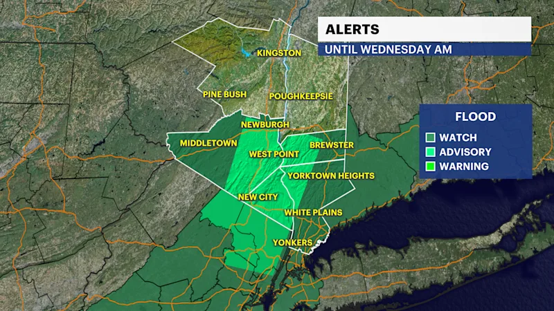
Flood Watch has been issued for Orange, Putnam, Rockland, and Westchester Counties until 2 a.m. Wednesday morning.
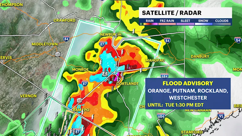
Flood Advisory is in effect for Orange, Putnam, and Rockland counties until 1:30 p.m.
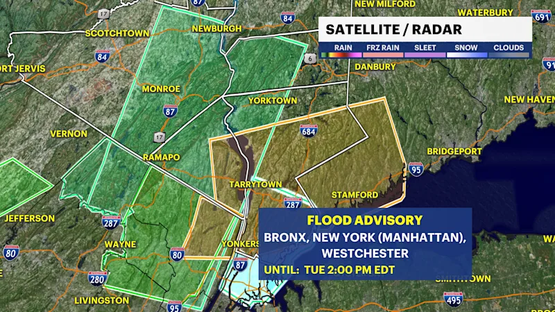
Flood Advisory is in effect for Westchester County until 2:00 p.m.
FORECAST:
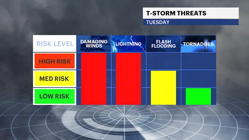
Ongoing heavy rainfall from thunderstorms impacting the region into the early afternoon hours. The main threat for strong and severe storms will be by lunchtime and again after sunset today. All modes of severe weather are on the table from any of these thunderstorms.
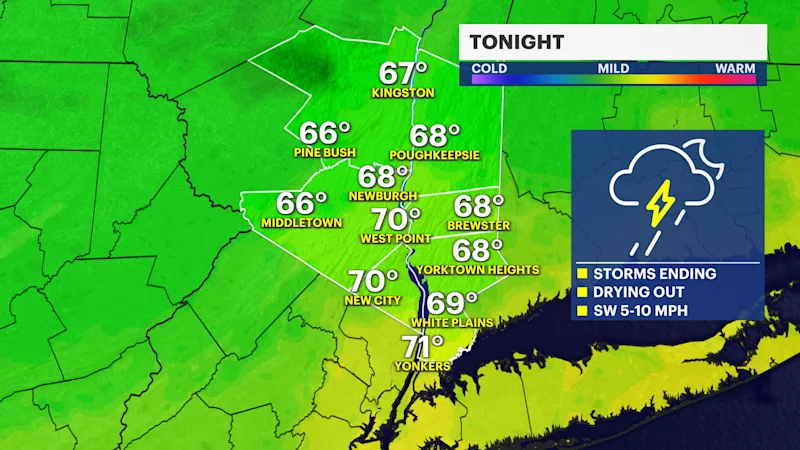
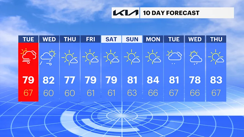
The greatest concern will be flooding downpours and damaging wind gusts across the region. Storms are expected to clear the area tonight by midnight. Wednesday will have more tame weather. A chance for a few scattered rain showers, breezy, but drying out by the afternoon and evening. The rest of the week, from Thursday into the weekend, the forecast looks amazing. Mostly sunny, and temperatures ranging from the upper 70s to the low 80s.
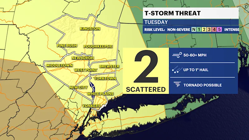
TODAY'S STORM THREAT:
First round of thunderstorms will be from late this morning to about 4 p.m. Heavy downpours and high winds are likely with this first round.
Second round will be from 7 p.m. to 11 p.m. The activity should wind down around midnight. This looks to be the main event and of highest concern. Damaging wind gusts, widespread downpours that could lead to flash flooding, hail, and a possible tornado from rotating thunderstorms are possible with this line of storms.
Stay weather aware today; check our News 12 forecast for any changes and consistent updates throughout the day
Take the time to tie down any loose items, clear any drains to limit any flooding, and have your alerts on.