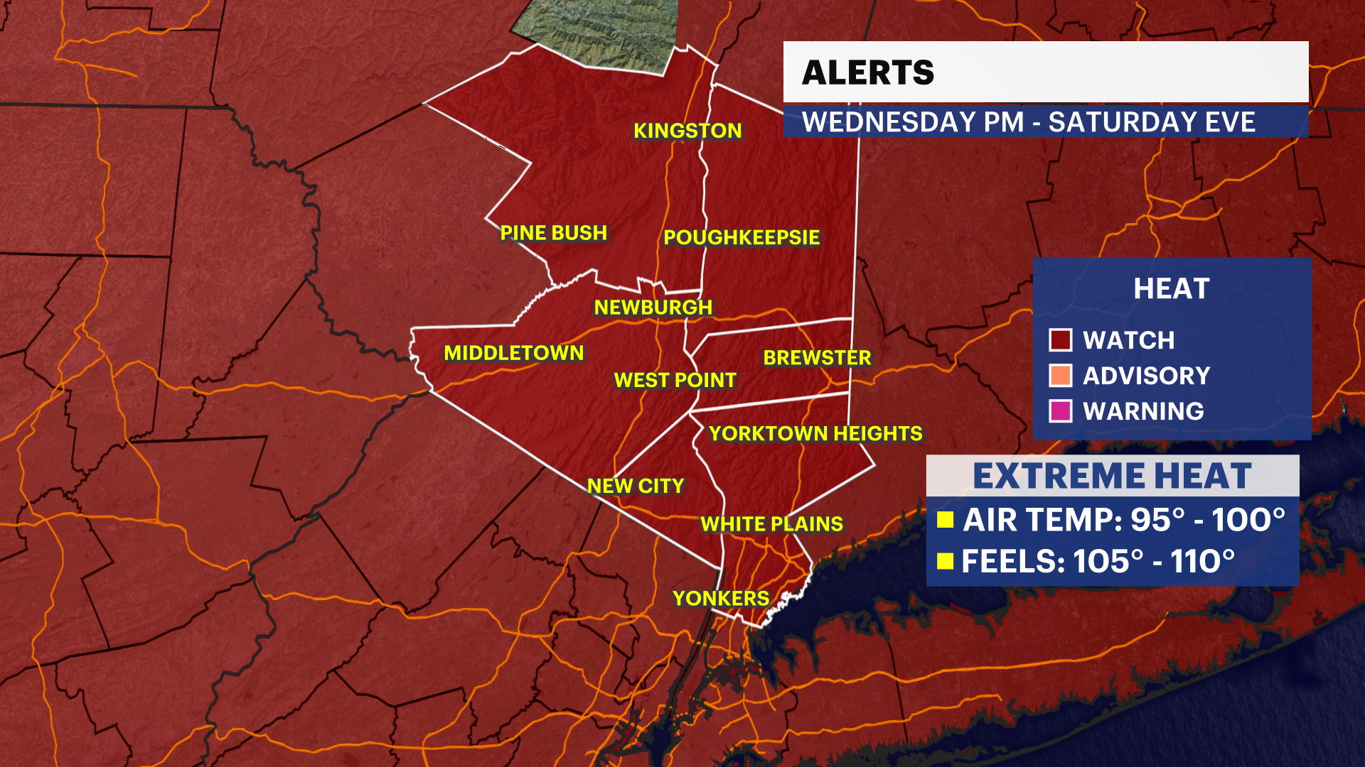
Heat Alert: Dangerous, extreme heat builds, with oppressive conditions lasting into the holiday weekend
Temperatures surge into the mid- to upper 90s Wednesday through Friday. Heat index values could reach 105 to 110 degrees, while isolated afternoon and evening thunderstorms remain possible through the period.
Jun 29, 2026, 9:33 PM
•
Updated
More Stories
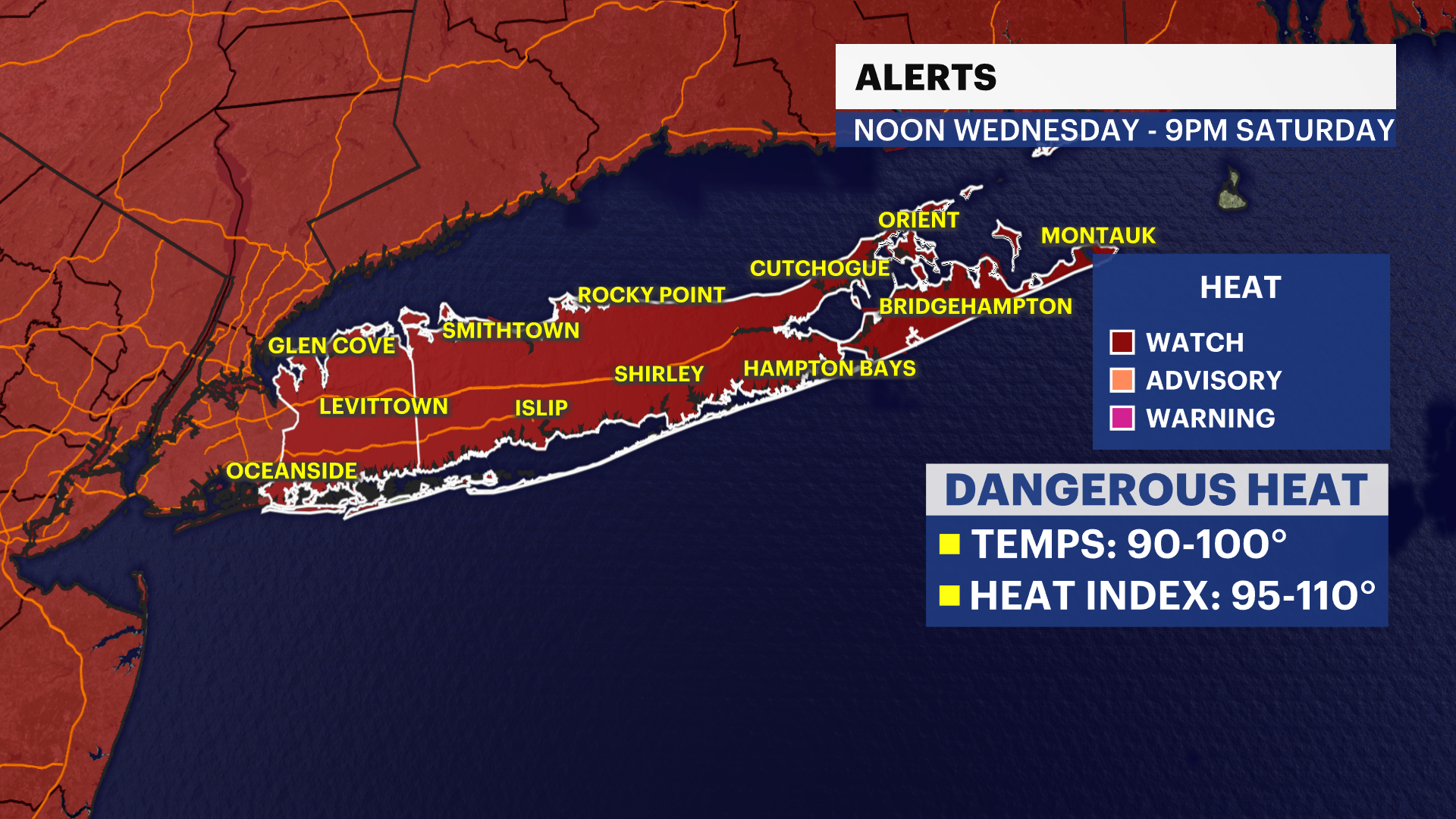


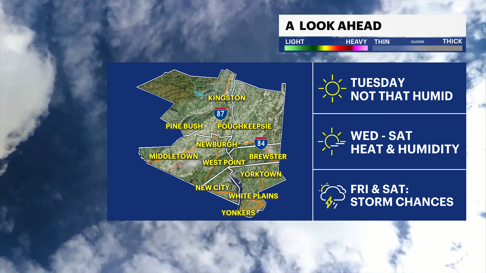
Alert: Extreme heat watch in effect for the entire Hudson Valley from Wednesday at noon to Friday at 9 p.m.
What to Expect
Hot weather intensifies Tuesday before becoming dangerous Wednesday through Friday.
Afternoon temperatures will climb into the upper 90s, with heat index values between 105 and 110 degrees
possible in the Hudson Valley.
Warm, muggy nights in the 70s will offer little relief, increasing the risk of heat-related illness.
Isolated afternoon and evening thunderstorms are possible Tuesday and Wednesday, with additional scattered storms arriving Friday night and continuing through the holiday weekend.
While storms will be spotty through midweek, any thunderstorm could produce brief heavy downpours and gusty winds.
Forecast
Overnight: Mostly clear and warm. Lows in the mid-60s.
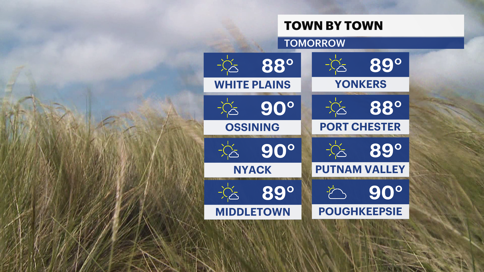
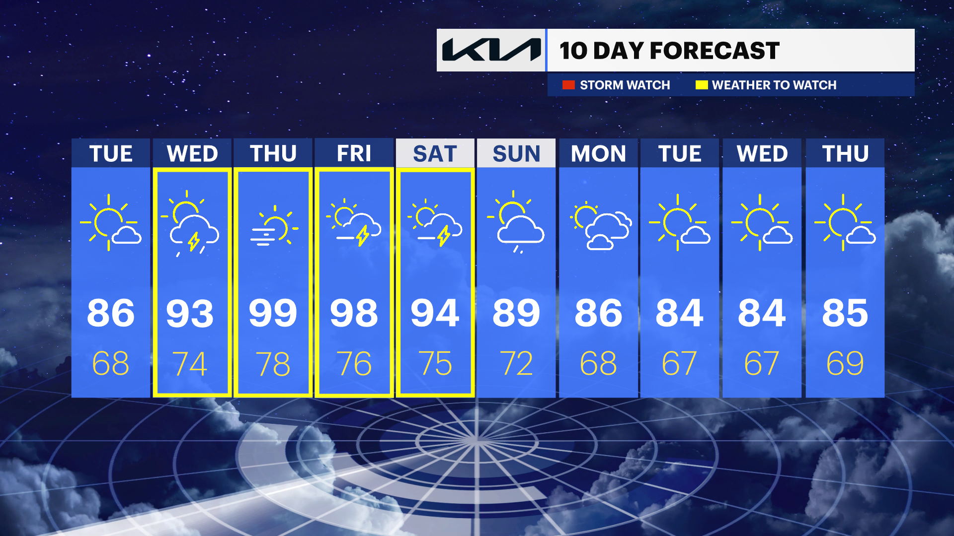
Tuesday: Mostly sunny, hot and increasingly humid. A slight chance of an afternoon or evening thunderstorm. Highs in the mid- to upper 80s.
Tuesday Night: Partly cloudy, warm and muggy with a slight chance of a thunderstorm. Lows in the upper 60s.
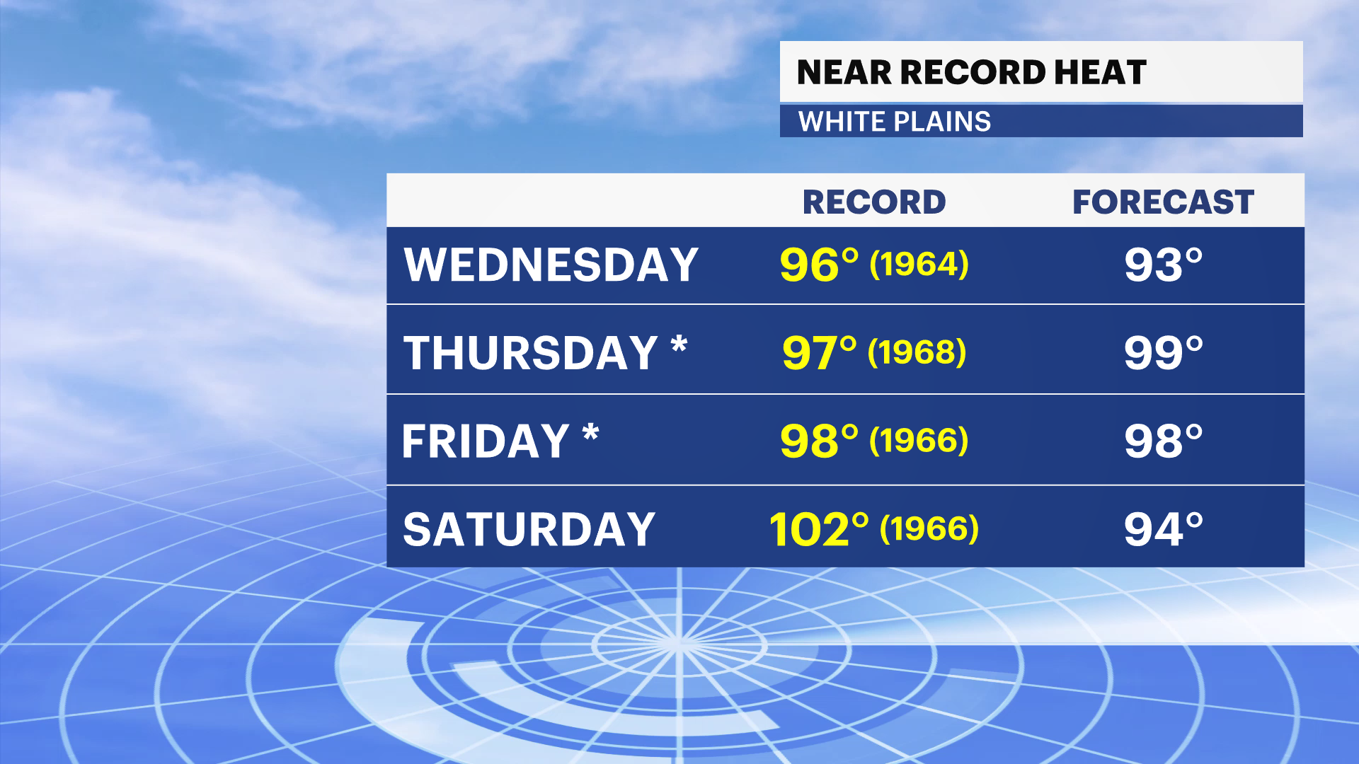
Wednesday: Mostly sunny and dangerously hot. A slight chance of an afternoon thunderstorm. Highs in the lower to mid-90s.
Thursday: Sunny and dangerously hot. Highs in the upper 90s with heat index values between 105 and 110 degrees.
Friday: Sunny and oppressively hot. Highs in the upper 90s. A chance of thunderstorms develops Friday night.
Saturday (Independence Day): Mostly sunny, very hot and humid with scattered afternoon and evening showers and thunderstorms. Highs in the lower 90s.
Sunday: Mostly sunny, hot and humid with scattered afternoon thunderstorms possible. Highs in the upper 80s to around 90 degrees.