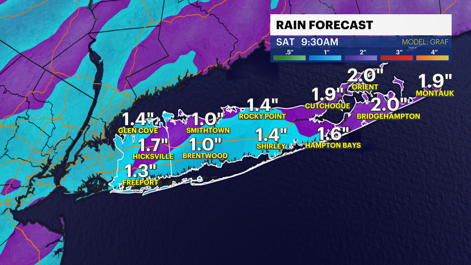
STORM WATCH: Heavy rain, damaging winds and coastal flooding a concern to start the weekend
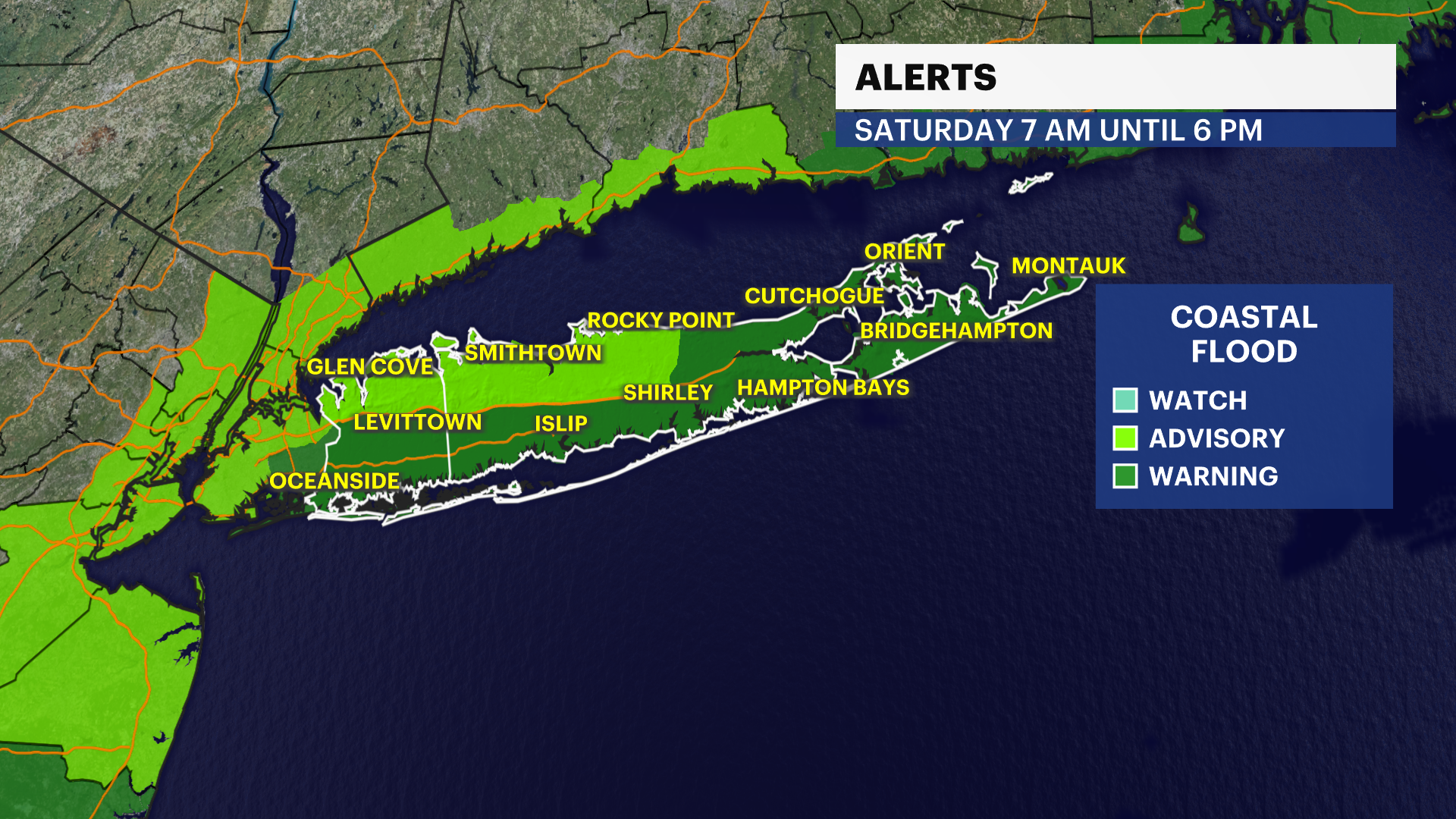
The News 12 Storm Watch Team says to expect strong winds, heavy rain and coastal flooding for the first half of Saturday.
More Stories


The News 12 Storm Watch Team says to expect strong winds, heavy rain and coastal flooding for the first half of Saturday.
FORECAST: The storms that keep on giving continue across Long Island overnight. Rain will be with us tonight through the morning commute as the showers fade away. The big threats for this round are once again, coastal flooding and damaging wind gusts.
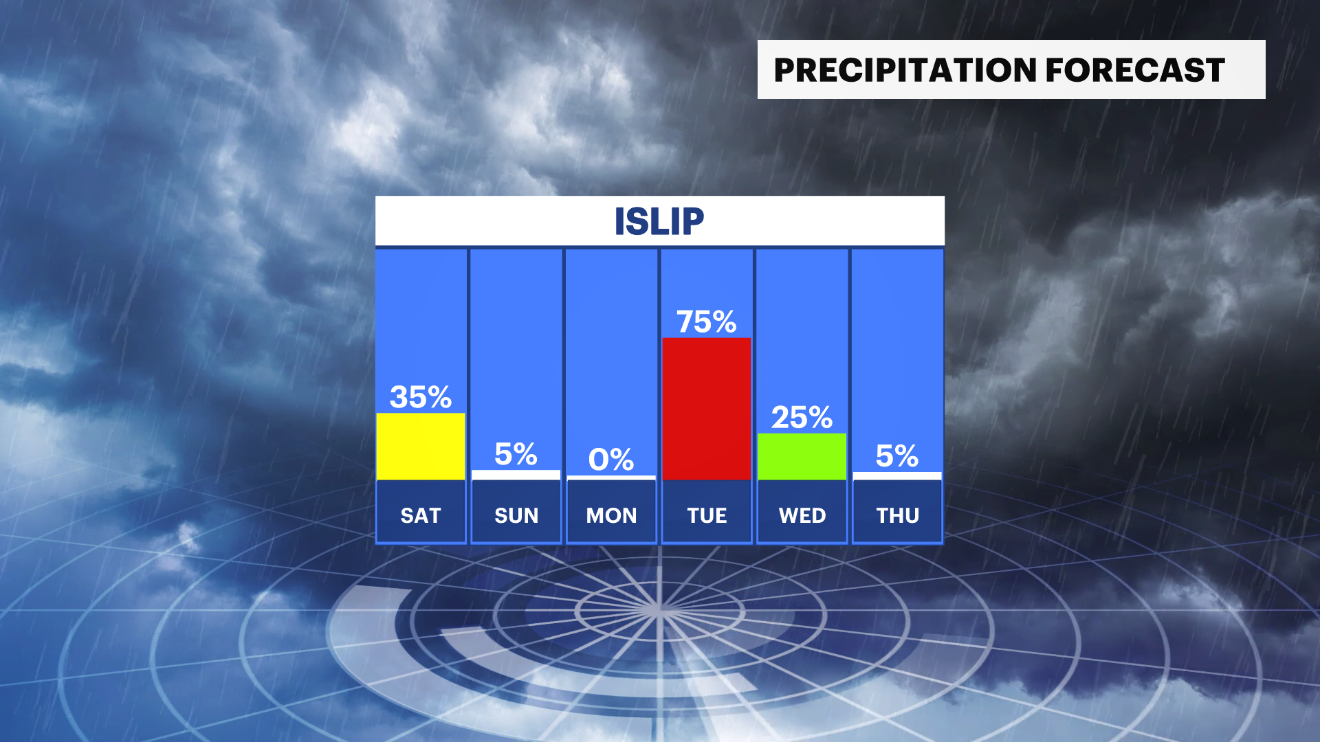
Make sure to prepare in communities right on the water for the flood threats and secure loose articles that are outdoors. The wind threat is greatest overnight with the flood potential rising throughout the day on Saturday, especially at high tide. We won't be able to see much of a break for the rest of the weekend as there is a chance for some rain or snow showers for the East End and South Shore Sunday afternoon.
This will drive temperatures down and give us the potential for some snow Tuesday into early Wednesday as confidence increases for freezing temperatures and more snow in the cards as we head toward the long-term.
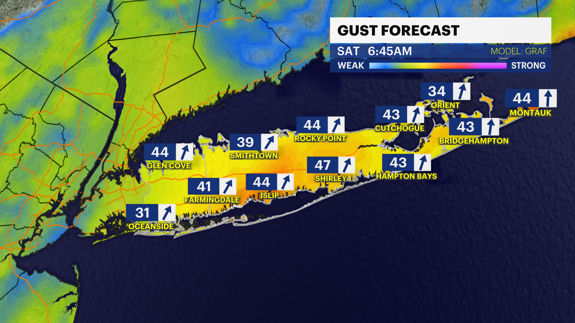
FRIDAY NIGHT: Downpours, damaging wind gusts, and flood potential heading into the morning. Breezy wind up to 45 MPH. Lows in the 40s.
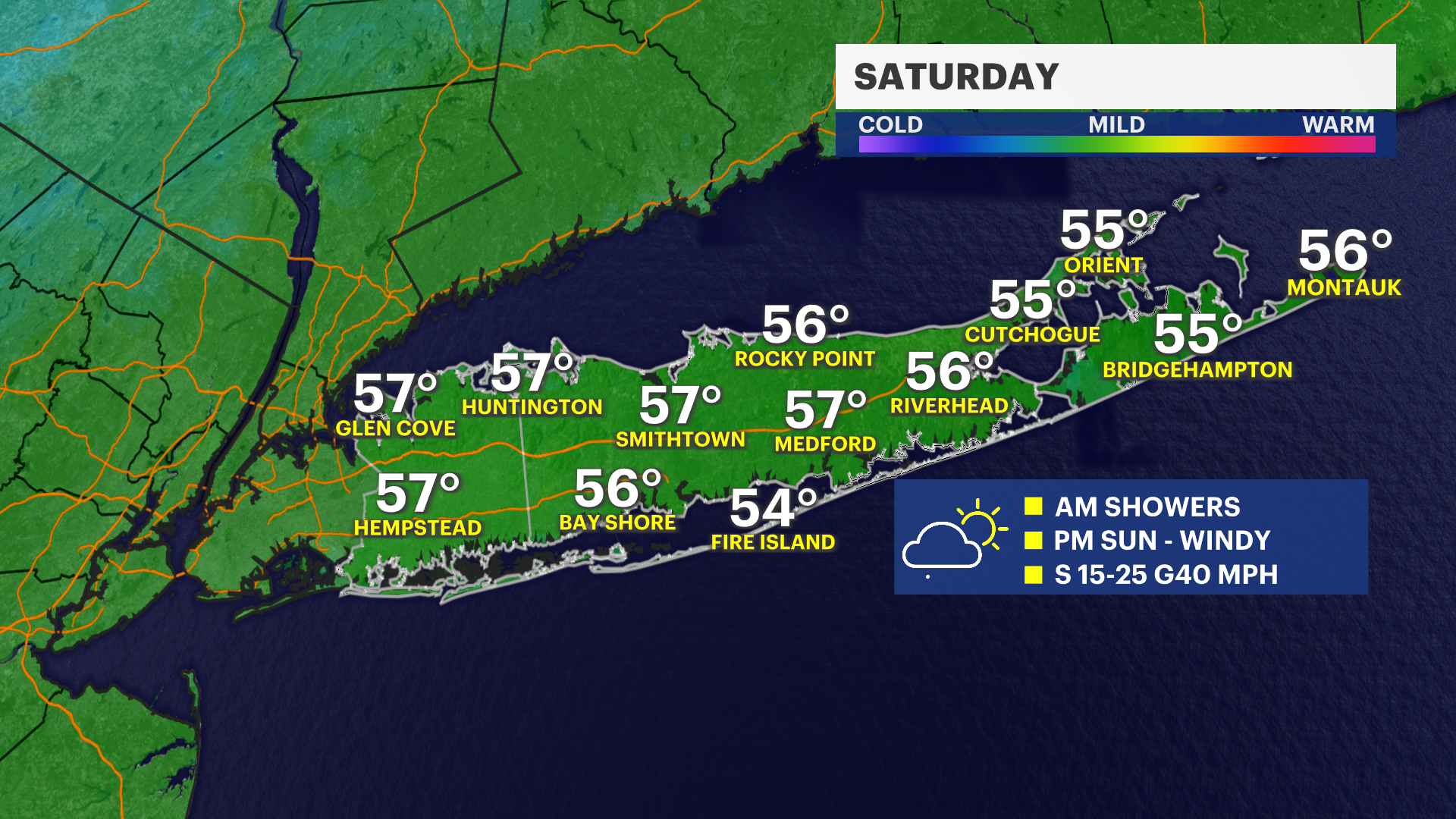
SATURDAY: Rain ends, turning mostly cloudy and breezy. Greatest threat for coastal flooding. Highs in the 50s. Gusts up to 35 MPH.
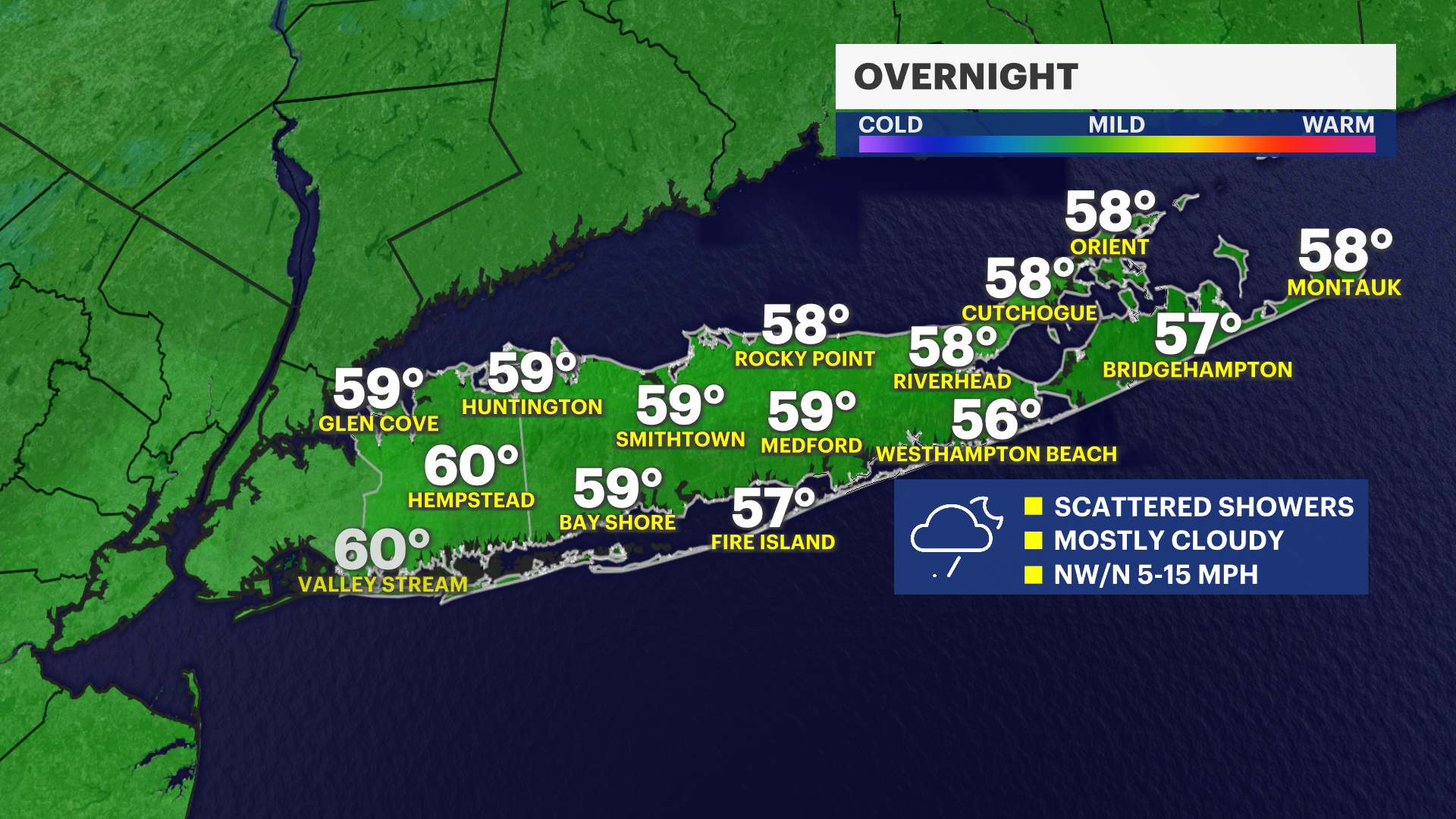
SATURDAY NIGHT: Mostly clear and cold. Blustery with gusts up to 30 MPH. Wind chills in the 20s. Lows near 30.
SUNDAY: Sun to start, with a few rain or snow showers in the afternoon. mainly for the South Shore and East End. Gusts up to 35 MPH. Highs near 40 and lows near 20.
MONDAY: Cold, clear, and blustery. Highs around freezing. Lows in the 20s. Snow possible overnight into Tuesday morning.
TUESDAY: Possible snow and wind. Highs in the 30s. Lingering snow showers possible through Wednesday morning.