Storm Watch: Heavy rain, damaging winds, flooding possible during Sunday storm on Long Island
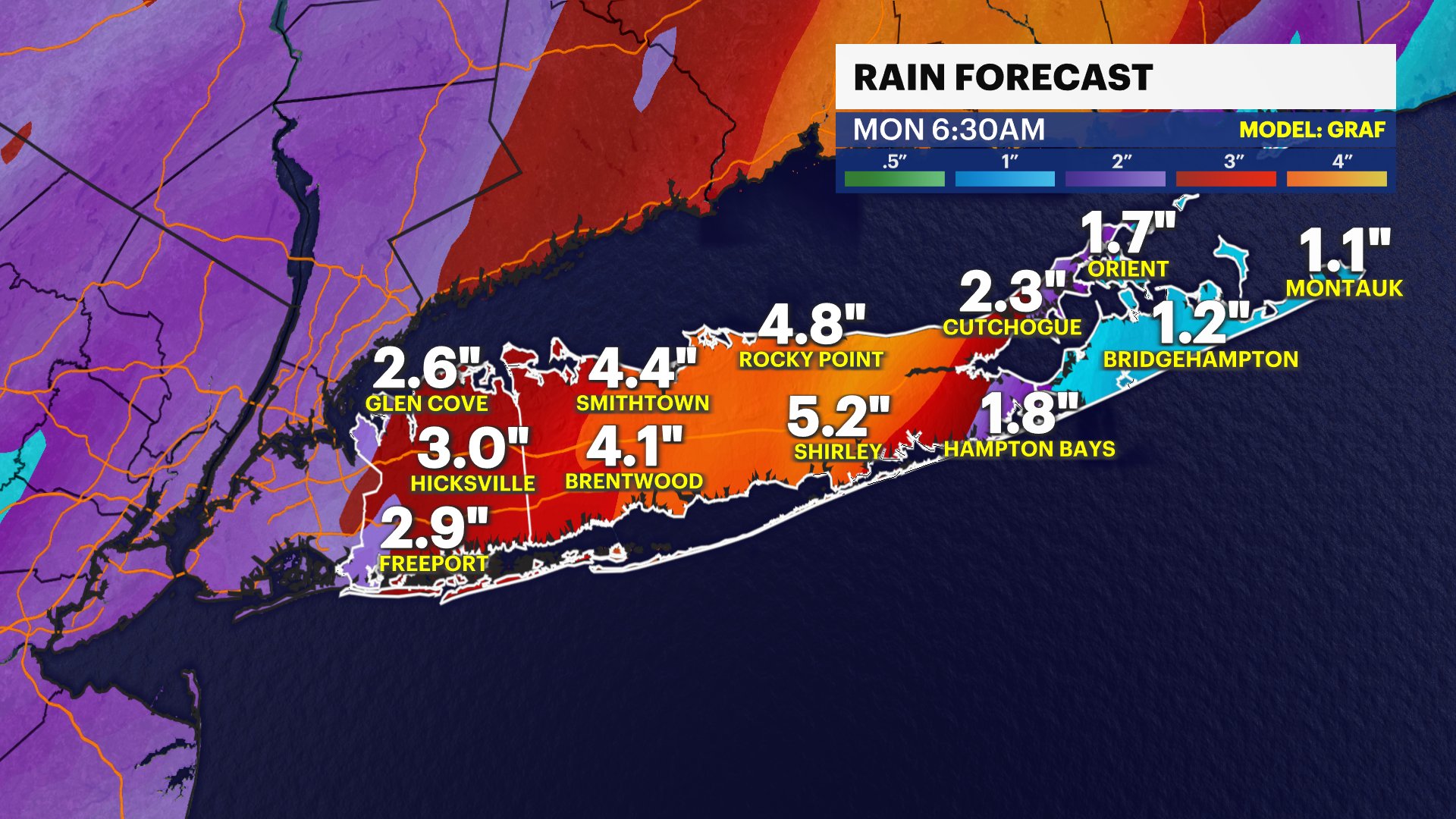
Storm Watch Team Meteorologist Krystal Ellis says some areas of Long Island could see more than 3 inches of rain on Sunday. Wind gusts could be up to 60 mph.
More Stories


Programming note: News 12 Long Island will begin special Storm Watch coverage early tomorrow morning at 4:30 a.m. We'll show you current conditions to keep you safe and help you get where you need to go during the storm.
Storm Watch Team Meteorologist Krystal Ellis says some areas of Long Island could see more than 3 inches of rain on Sunday. Wind gusts could be up to 60 mph.
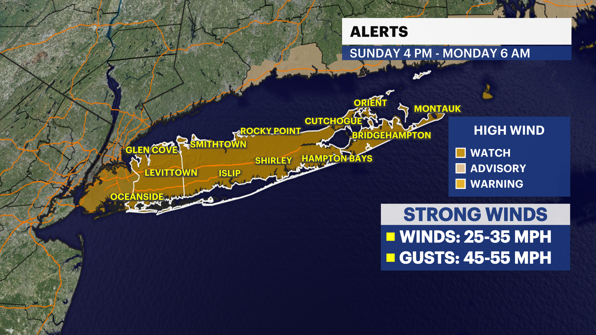
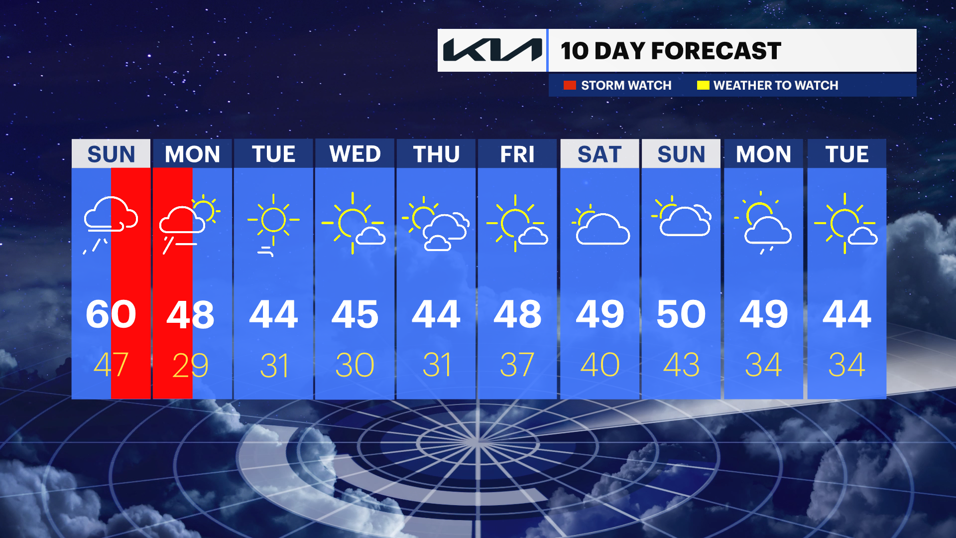
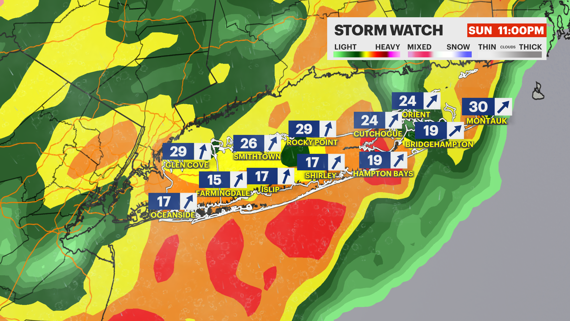
WHAT'S NEXT: Sunday night will be stormy with gusty winds and heavy rain impacting the area. Damaging wind gusts and flooding rain is possible. The timing for the worst weather to impact us will be late Sunday night through predawn Monday morning.
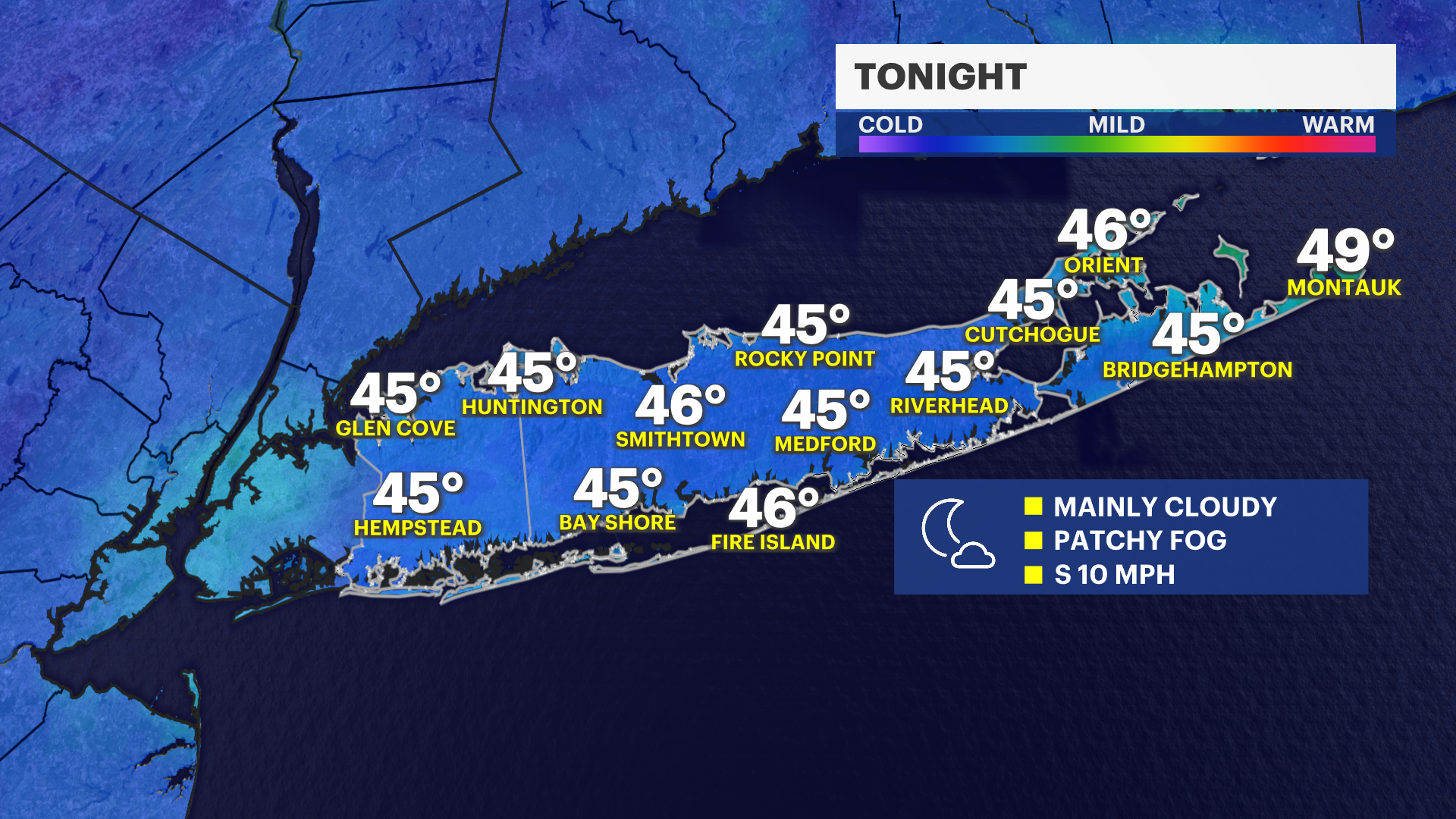
TONIGHT: Mostly cloudy with lows near 42. Light southeast winds.
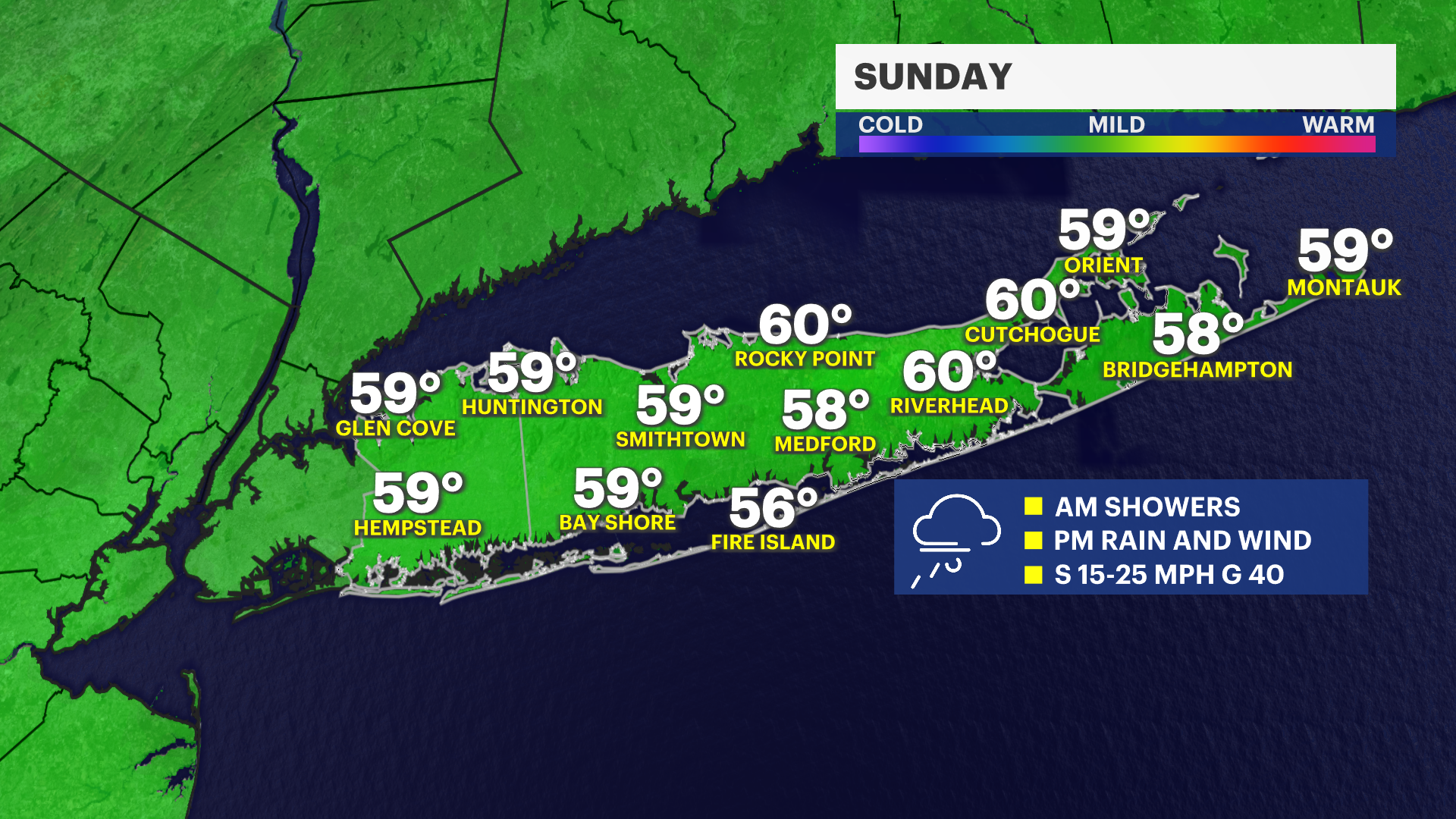
SUNDAY: Mild and cloudy to start with showers developing by the afternoon. Southerly winds gradually increasing throughout the day and gusting up to 40 mph by late afternoon. Highs near 60.
SUNDAY NIGHT: Steady to moderate rain with areas of heavy rain that could lead to flooding especially late Sunday night, overnight and into early Monday. Damaging south winds between 20-40 mph with damaging gusts possible between 40-60 mph. Lows near 47.
MONDAY: Mild to start with breezy showers tapering off by afternoon. Skies will improve as blustery and cold northwest winds filter in much colder air by sunset. Highs near 48. Lows near 29.
TUESDAY: Sunny with highs near 44. Lows near 31.
WEDNESDAY: Mostly sunny with highs near 45. Lows near 30.
THURSDAY: Mostly sunny with highs near 44. Lows near 31.