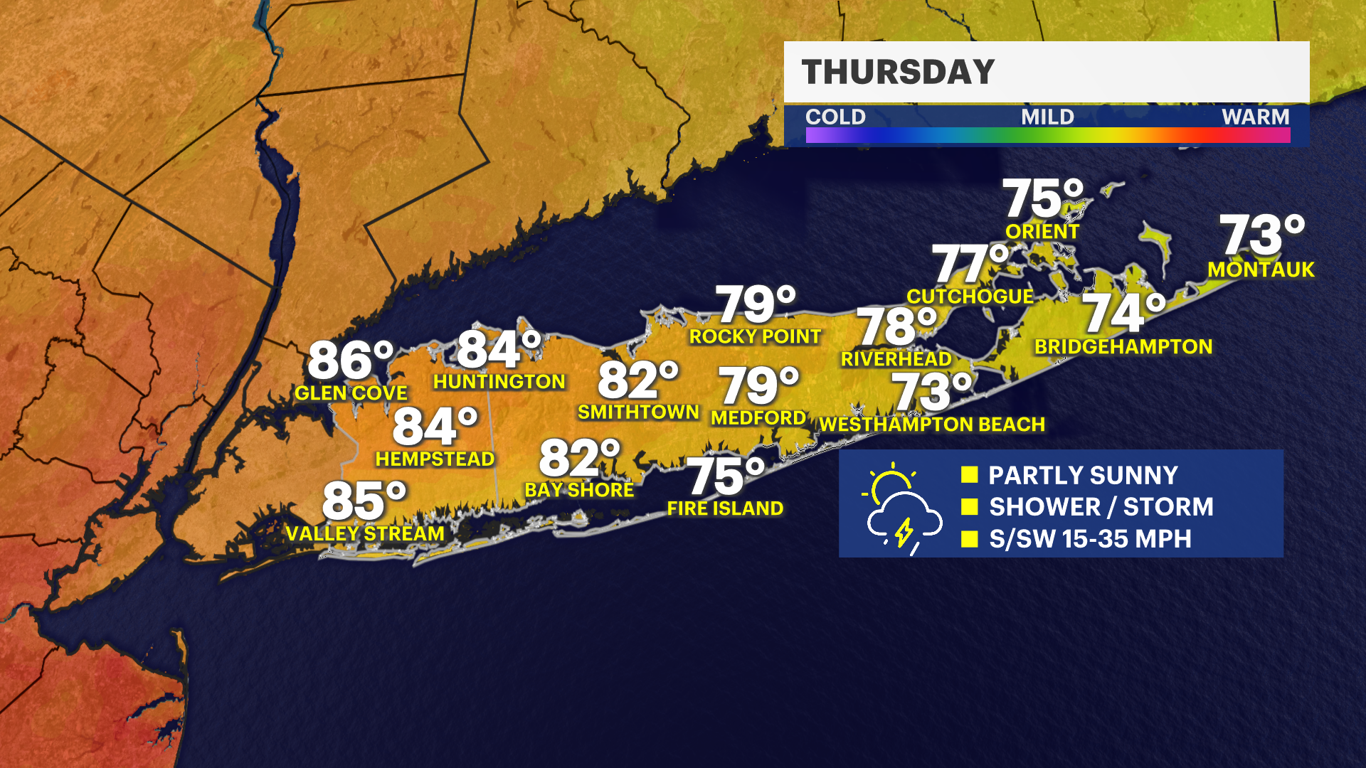
Warmer temperatures and humidity return with a thunderstorm chance for Thursday
Stronger storms capable of damaging winds and hail Thursday afternoon.
More Stories


What to Expect:
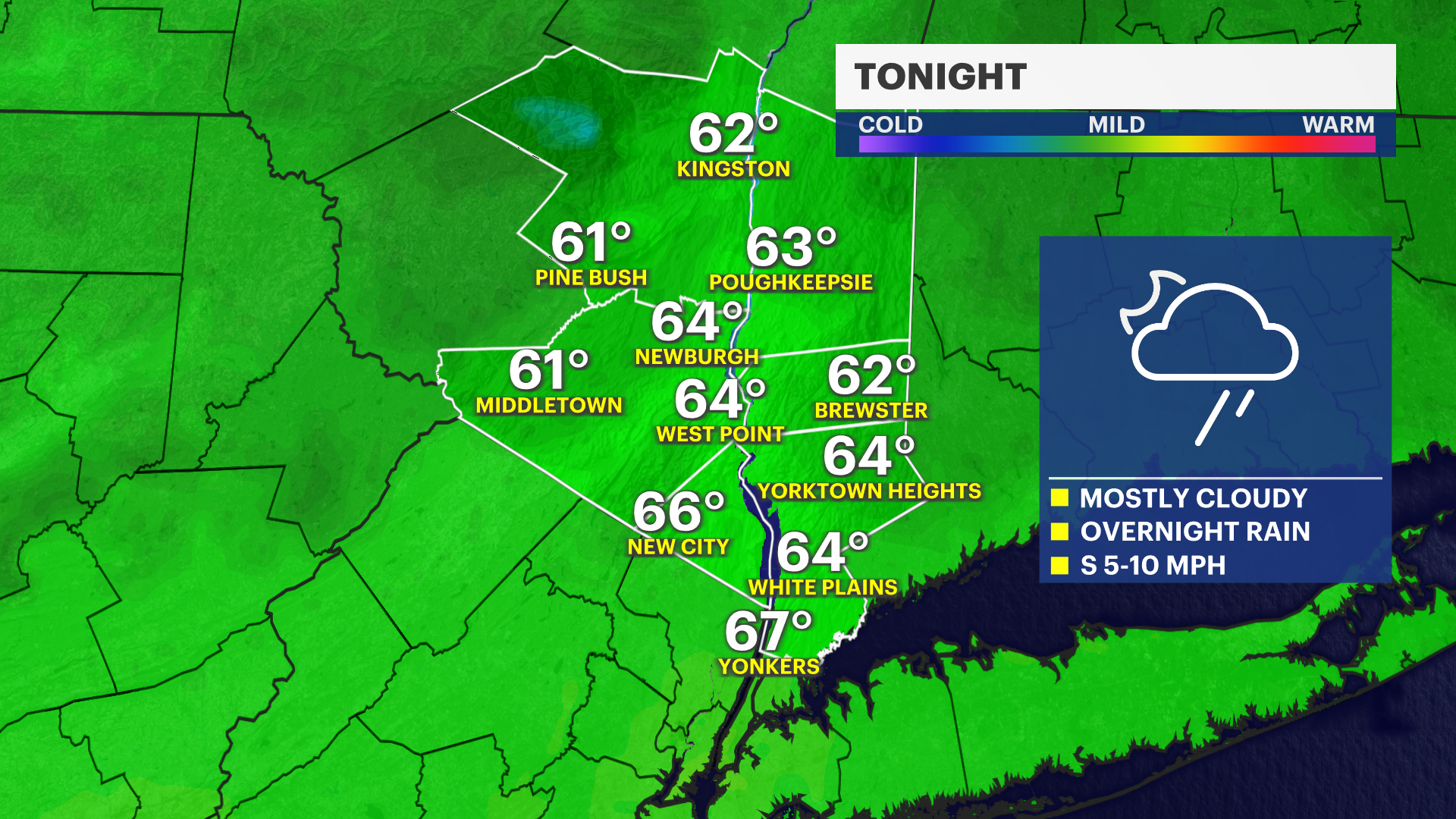
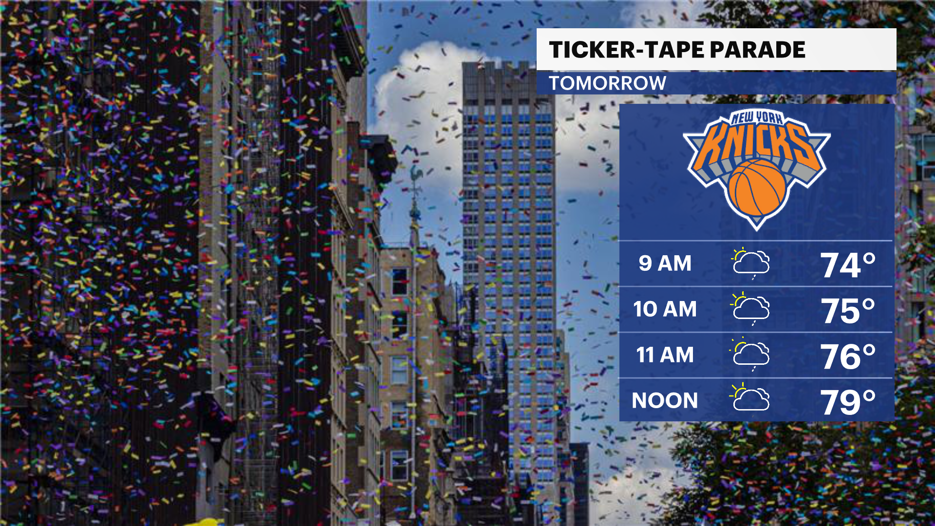
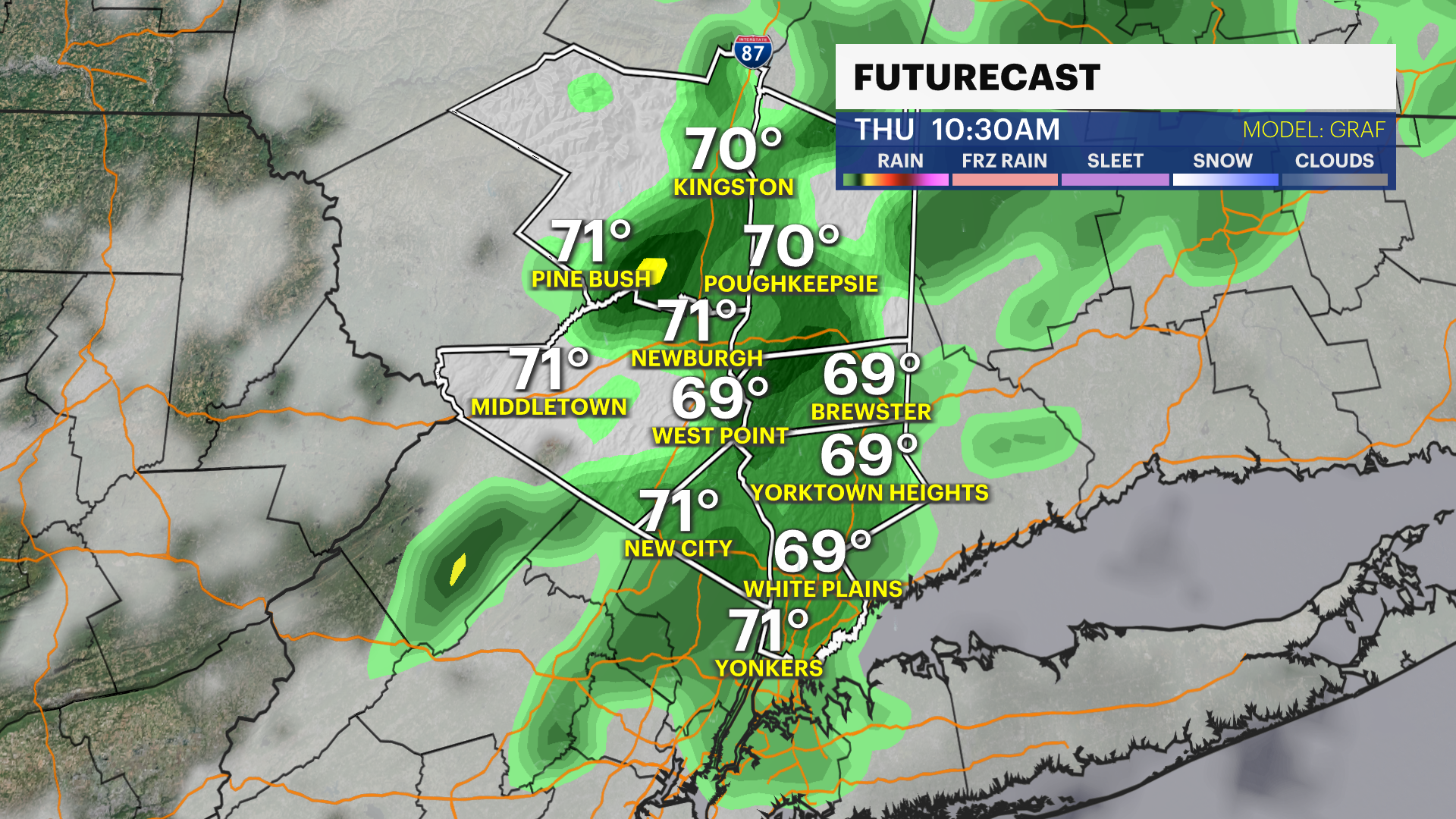
Clouds roll in tonight, and the humidity climbs as we head into Thursday. It will start out cloudy, warm and a little more humid, so if you're heading to the Knicks ticker-tape parade down in the city, note that scattered showers and storms are possible by late morning into the afternoon.
In fact, the Storm Prediction Center has bumped the entire Lower Hudson Valley up to a Slight Risk (Level 2 of 5) for severe weather. Any strong storms that pop up could pack torrential downpours, hail and damaging wind gusts between 50 mph and 60 mph. Even as that severe threat tapers off later in the afternoon, it’ll stay warm and windy with gusts hitting 35 mph outside of the storm zones.
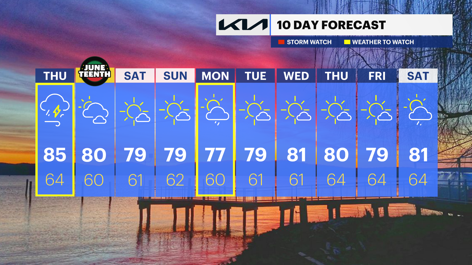
The good news is that cooler, drier air moves in Thursday night and sticks around through Friday, dropping temperatures back to normal just in time for Juneteenth. That sets us up for a great Father’s Day weekend with comfortable humidity and mainly dry skies before our next real chance of widespread rain arrives on Monday.