Connecticut Forecast: Dry today, but rain on the way for part of Mother's Day weekend
A stray shower is possible today, but rain is likely for Saturday afternoon. Here's the latest timing on the rain and a few changes for next week's forecast.
More Stories


Right now: It's chillier than yesterday morning and there's an isolated light shower through 7 a.m. Grab a jacket this morning.
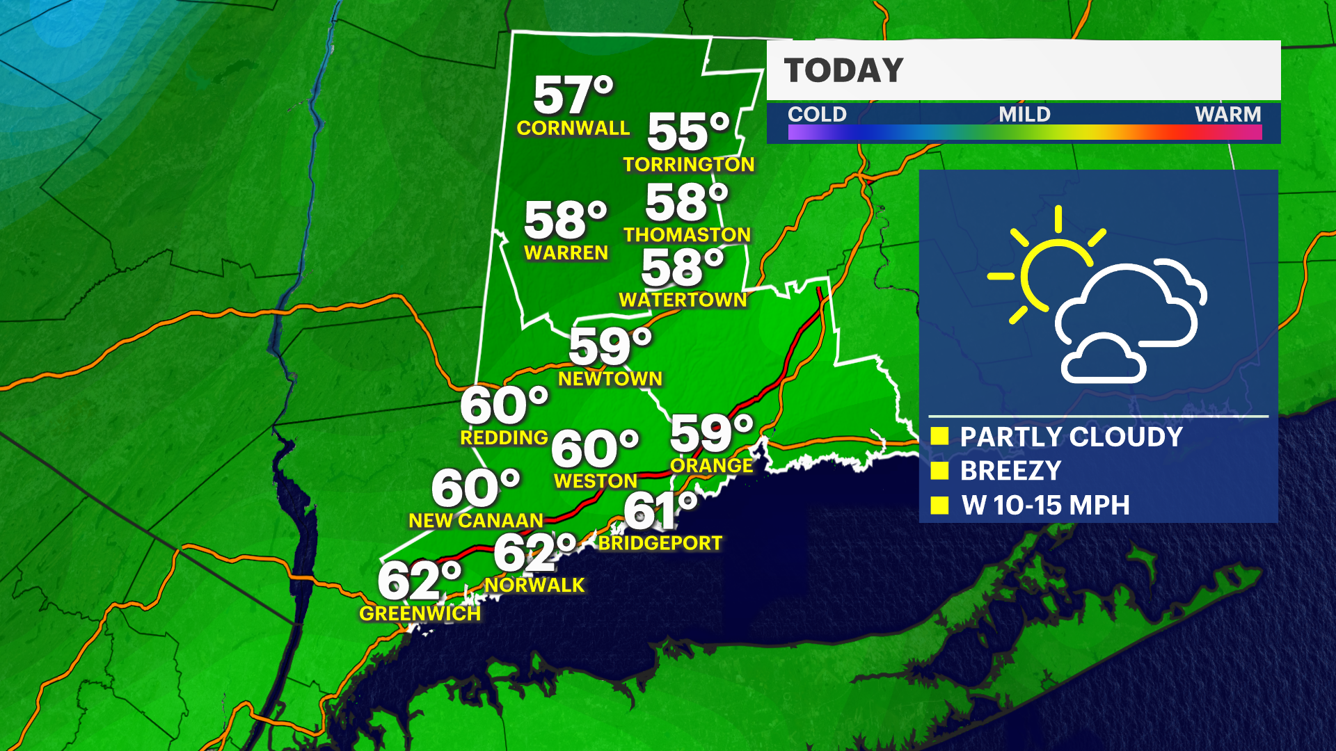
Today
A mix of sun and clouds is expected with highs in the low 60s. A stray shower is possible.
Tonight
Mostly cloudy and cooler than average. Lows are in the mid 40s.
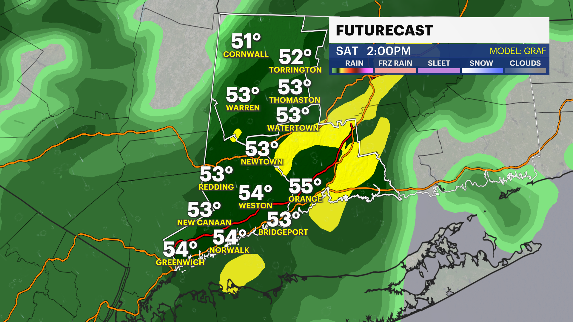
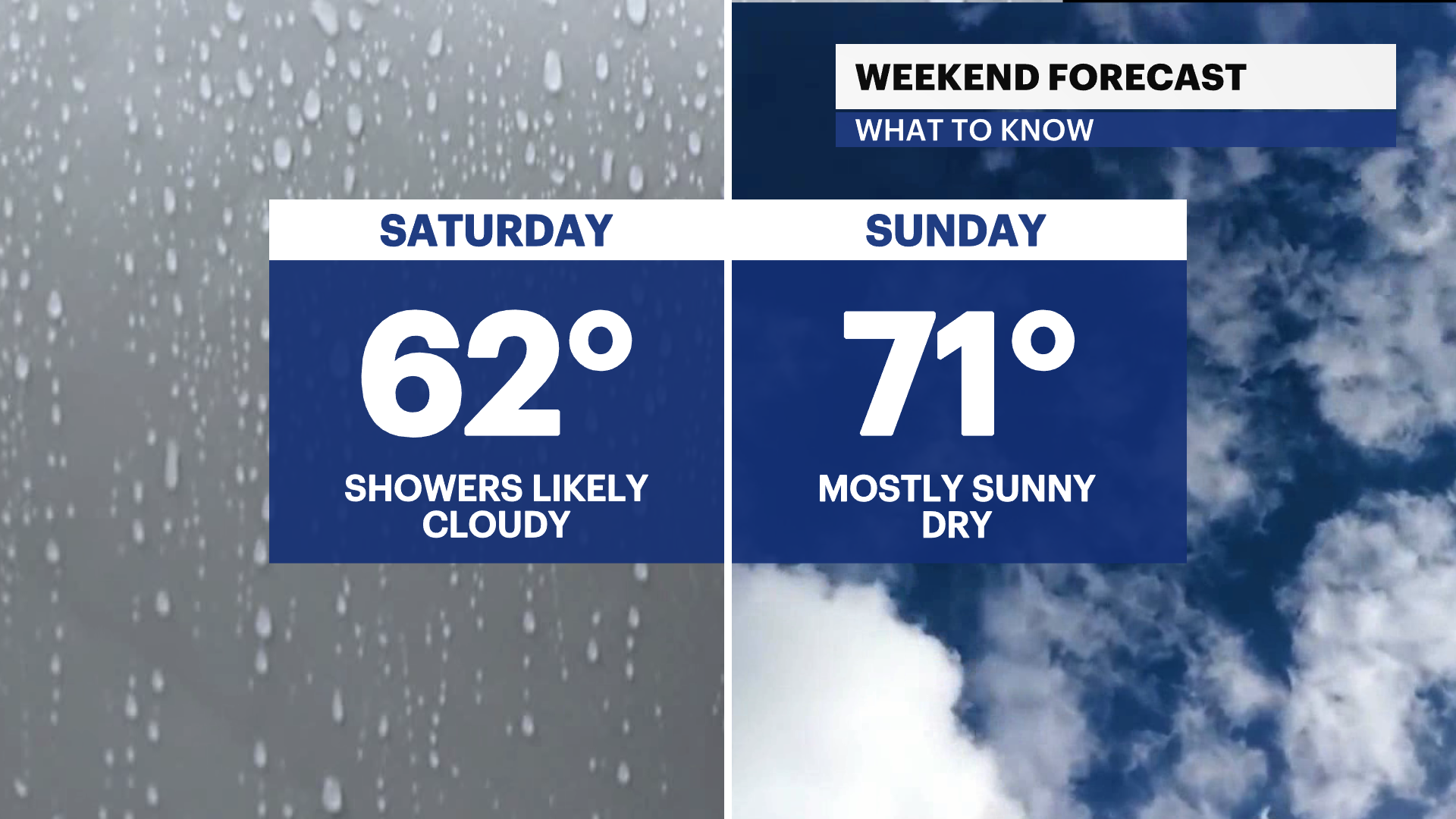
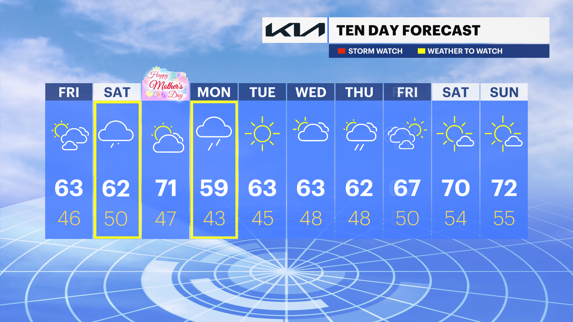
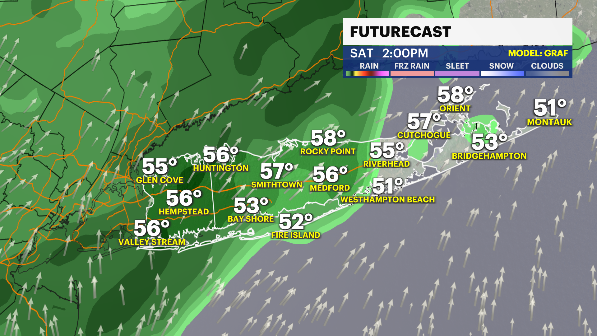
Saturday
Cloudy skies are expected with a stray shower in the morning and steady rain after 10 a.m. A thunderstorm is possible after 3 p.m. Highs near 60-degrees.
Mother's Day
A nice mix of sun and clouds and mild weather is expected. Highs are in the low 70s.
Next week
Temperatures are trending cooler than average, with highs generally in the 60s and lows in the 40s. Rain is expected on Monday and showers are possible Wednesday and Thursday. Tuesday is the pick of the week with highs in the mid 60s and plenty of sunshine.