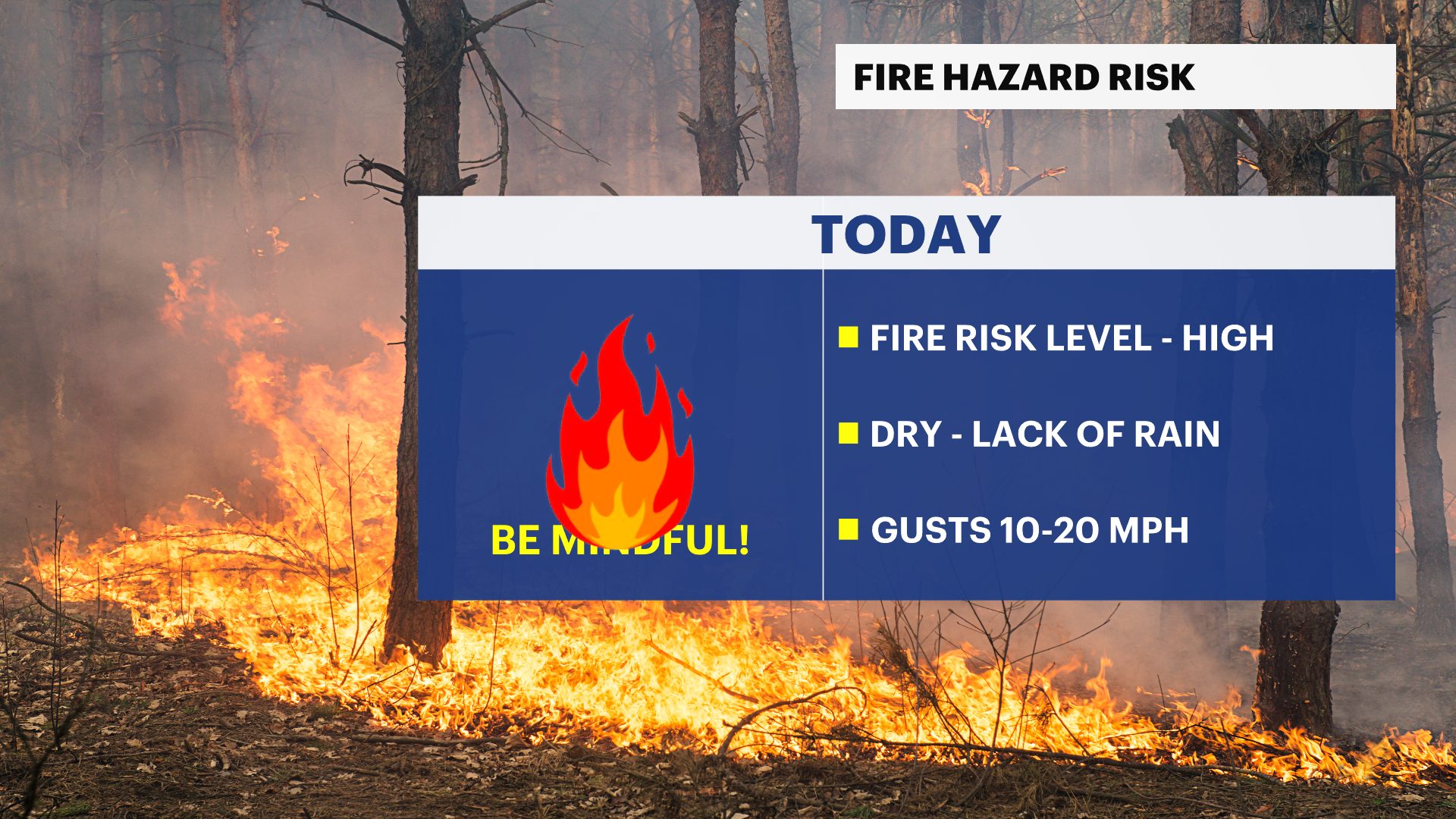
Breezy this afternoon with elevated fire danger, big warmup ahead
Dry and mild conditions today give way to a much warmer stretch next week.
More Stories


ELEVATED RISK OF FIRE SPREAD SATURDAY... The combination of gusty northwest winds, up to 25 to 30 mph, and low relative humidity, as low as 30 percent today will produce an elevated risk of fire spread.
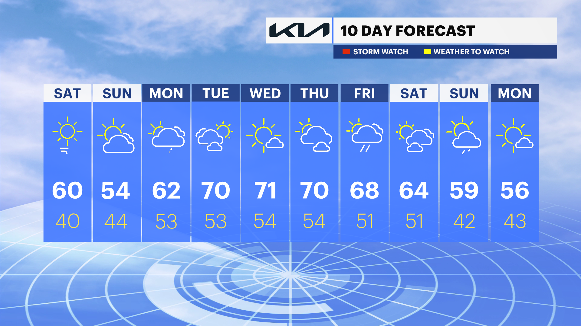
This afternoon: A cold front slips through early with no meaningful rain, and the rest of the day turns dry and breezy. Northwest winds will pick up, and highs will be around 60°—a bit cooler inland, slightly milder near the coast. With dry air, gusty winds, and dry ground, there’s an elevated risk for fires to start and spread, so be extra careful with anything that could spark a flame.
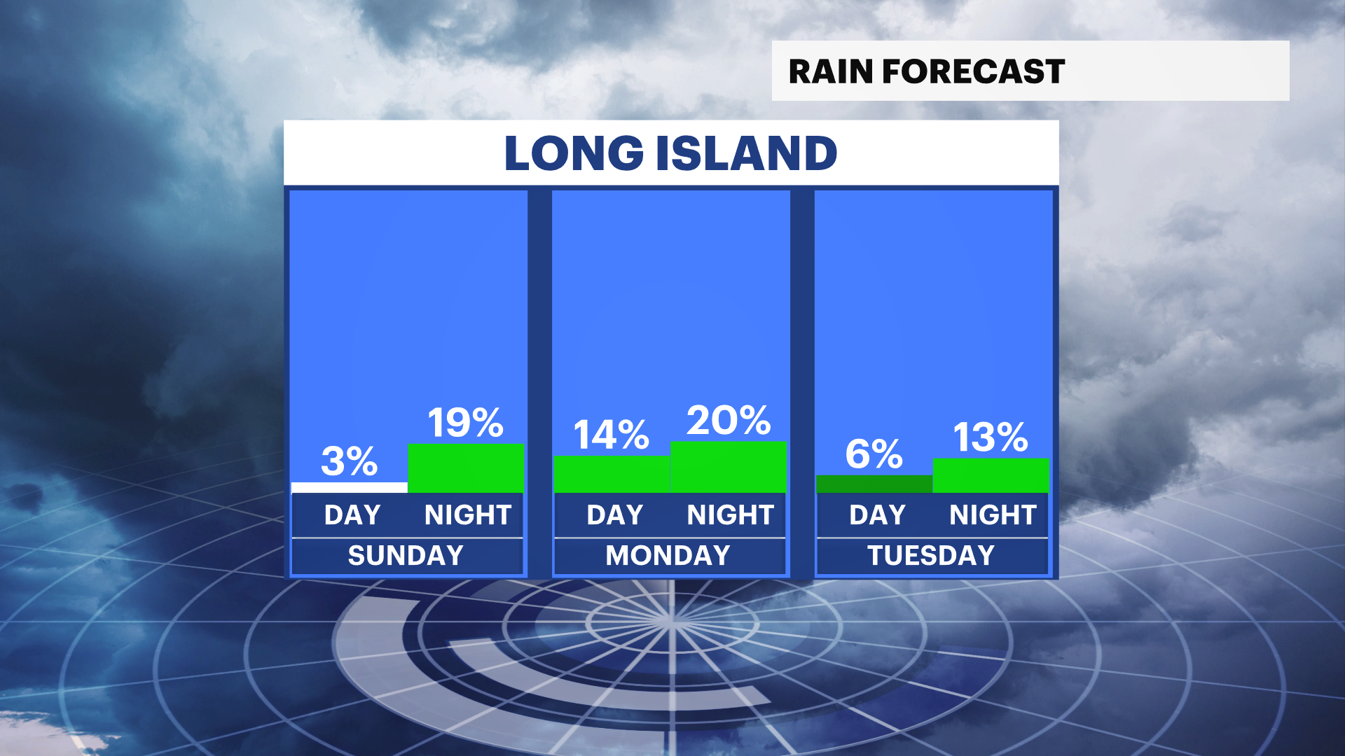
Tonight into Sunday: Winds ease up this evening as high pressure builds in, leading to a calm night. Sunday stays dry, but an ocean breeze keeps temperatures on the cooler side, mainly in the 50s. Overall, a quiet and comfortable end to the weekend.
Early next week: A warmup gets underway starting Monday and especially into Tuesday, with temperatures climbing well above normal. It’ll feel more like late spring, with a mix of sunshine and some afternoon clouds. There could be a spotty shower or thunderstorm later in the day.
Mid to late next week: The warmest weather peaks around Wednesday, with inland areas possibly reaching the 70s. Coastal spots will be a bit cooler but still much warmer than usual. A cold front may bring showers and storms late Wednesday into early Thursday, followed by slightly cooler air—but temperatures will stay above normal heading into Friday.