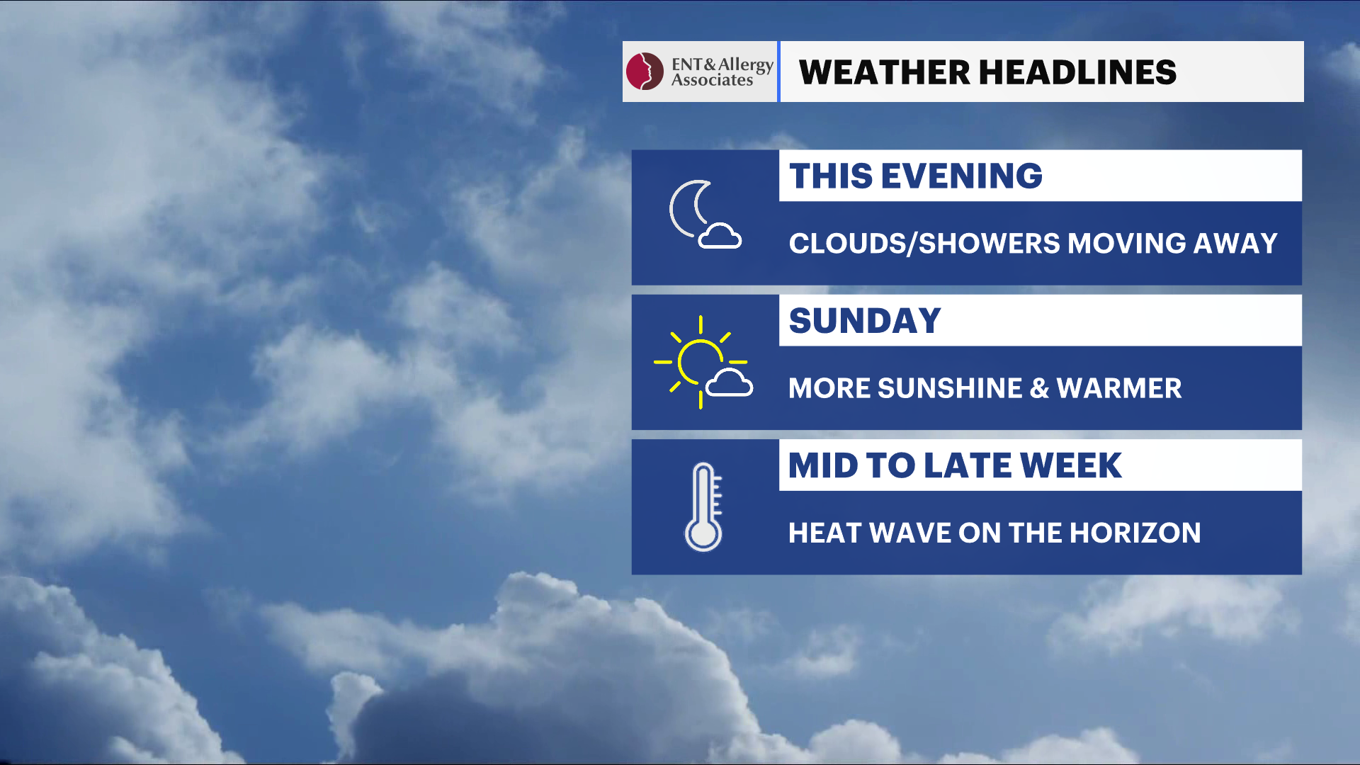
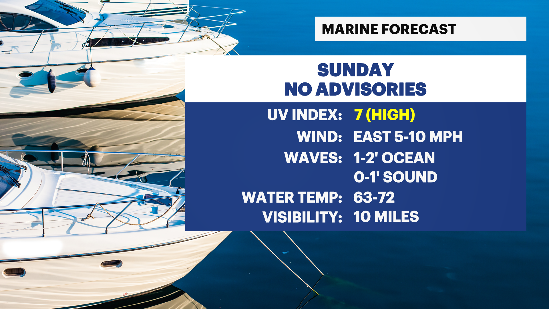
Sun and clouds, with warm temperatures for Sunday across Long Island; increase in heat and humidity mid to late week
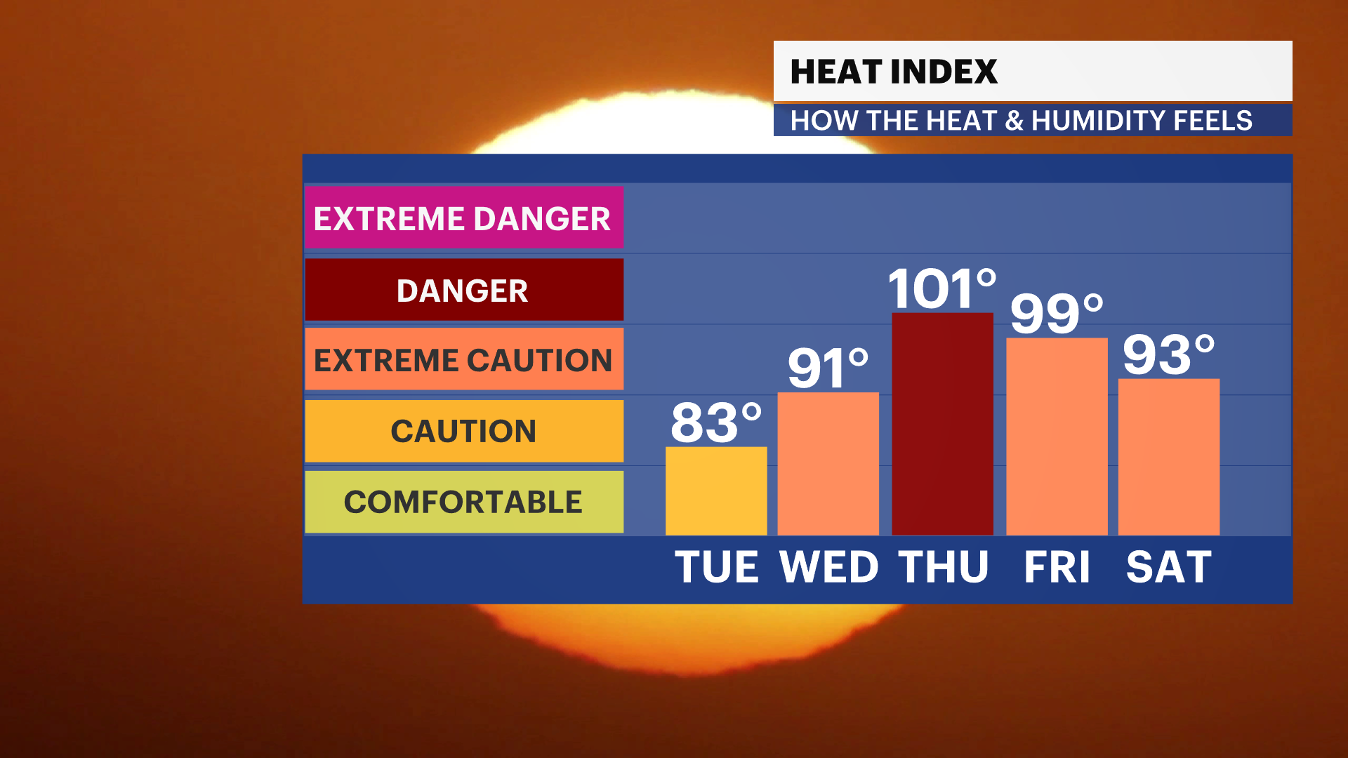
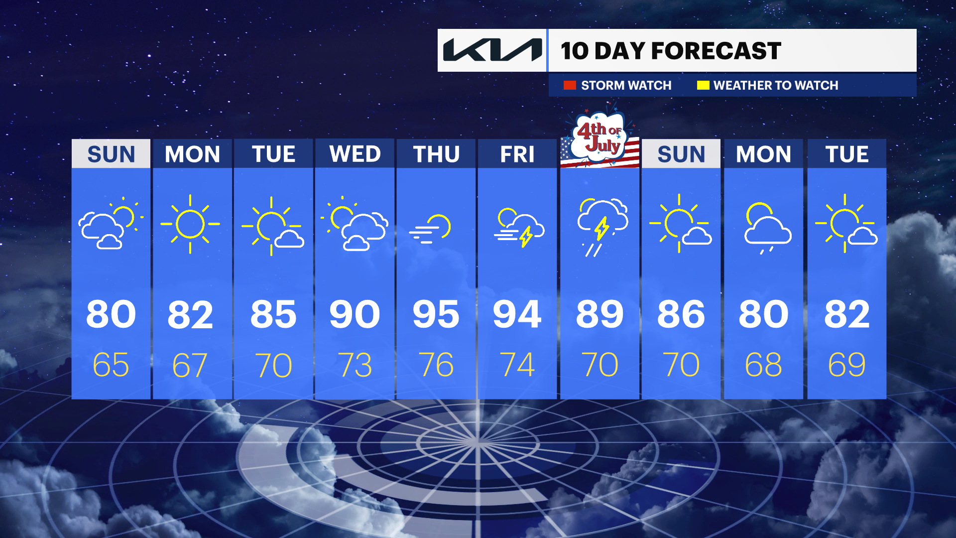
Quiet weather continues through midweek, with plenty of sunshine and gradually rising temperatures. The hottest weather arrives Thursday and Friday, when temperatures push into the 90s with increasing humidity and the potential for heat advisories.
More Stories


What to Expect
Dry and tranquil weather continues through at least Tuesday, with comfortable summer conditions.
Temperatures steadily climb each day, with increasing humidity beginning Tuesday and continuing through the end of the week.
The hottest weather is expected Thursday and Friday, when much of Long Island could see afternoon temperatures well into the 90s away from the immediate shoreline.
Heat indices may climb into the mid-90s or higher, and heat advisories may eventually be needed.
While most of the week remains dry, a few disturbances could trigger an isolated shower or thunderstorm, especially Tuesday night into Wednesday and again by Friday.
Forecast
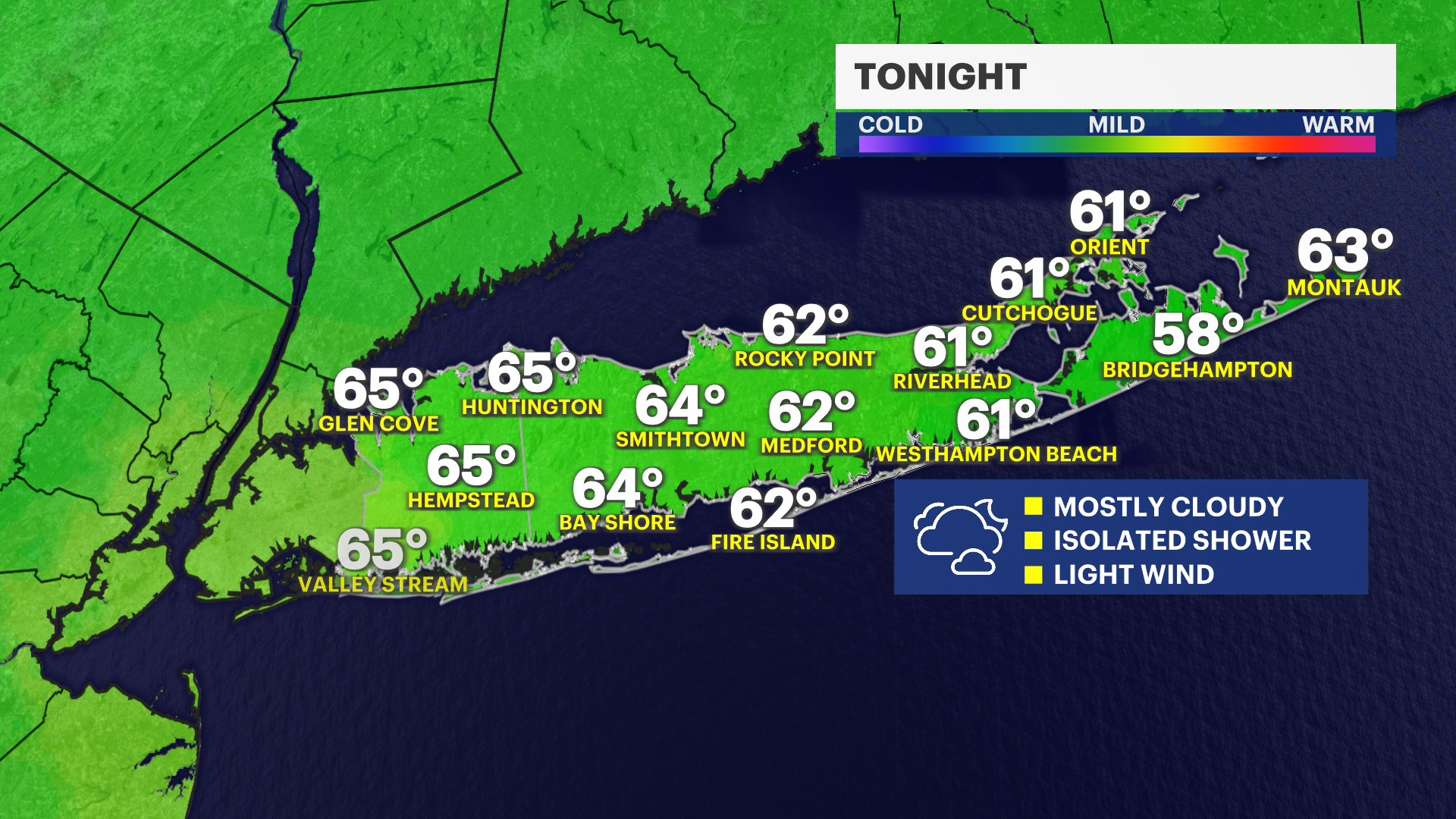
Overnight: Mostly cloudy and mild, with temperatures in the mid-60s.
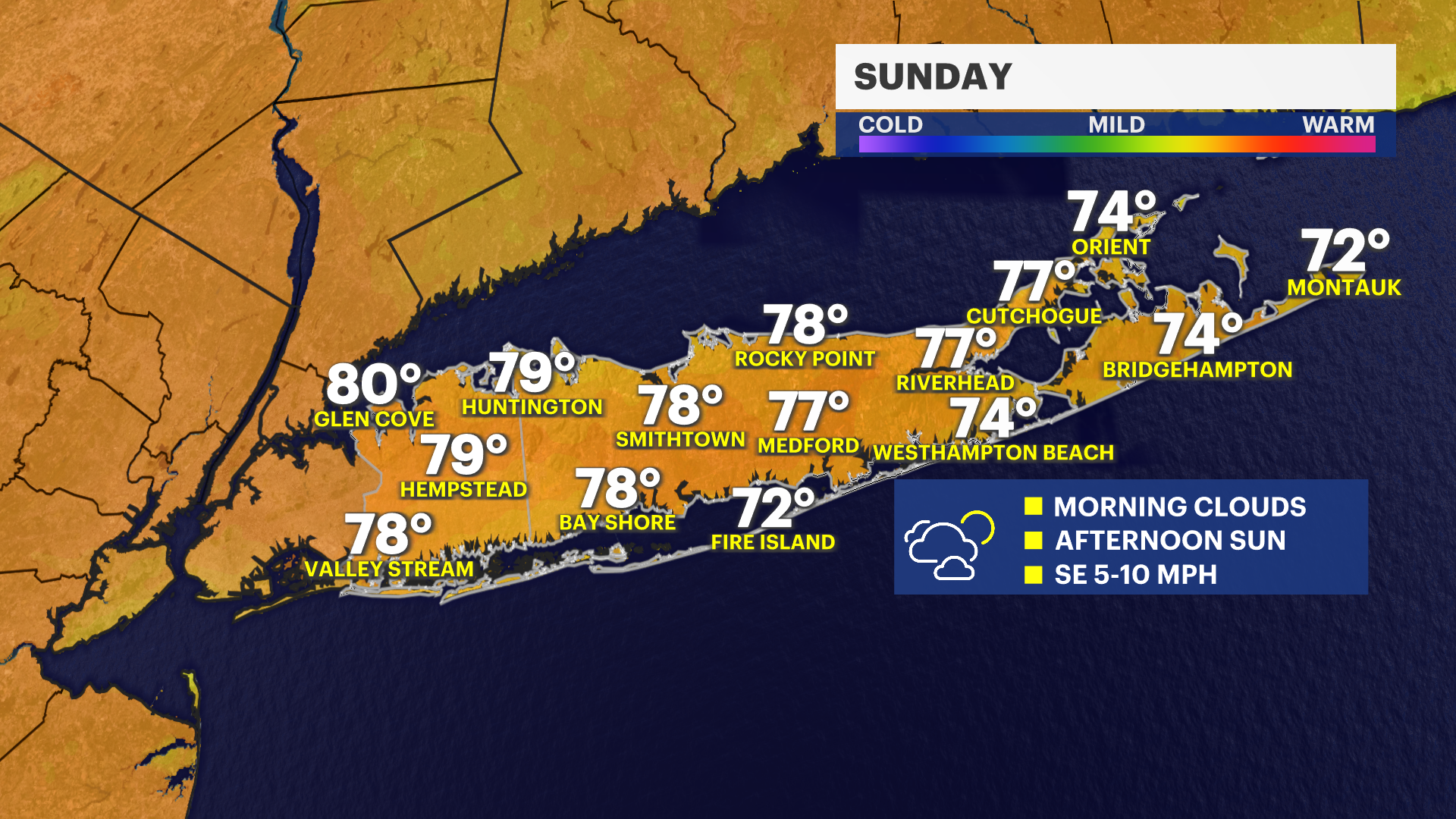
Sunday: Partly sunny and pleasant, with temperatures around 80.
Monday: Mostly sunny, with temperatures in the low 80s.
Tuesday: Mostly sunny and warmer, with temperatures in the mid-80s.
Wednesday: Mostly sunny, hotter and more humid, with temperatures in the upper 80s.
Thursday: Sunny and very hot, with afternoon temperatures in the low to mid-90s.
Friday: Mostly sunny, hot and humid, with a slight chance of a late-day shower. temperatures in the low 90s, with cooler temperatures right along the immediate south shore.