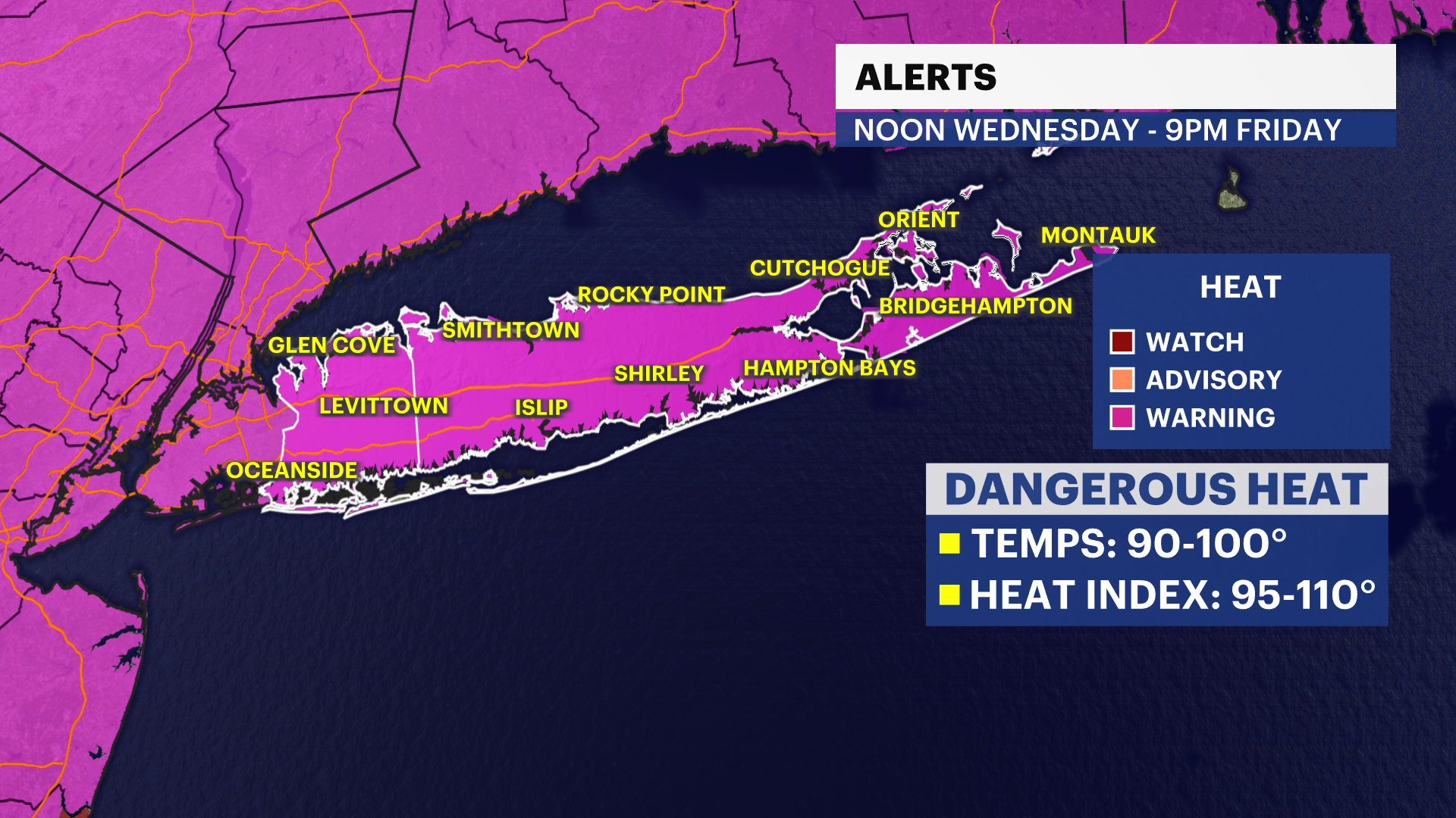
EXTREME HEAT WARNING: Dangerous heat through weekend with pop up thunderstorms for Long Island
Hot and Humid as dangerous heat builds over the area throught the weekend.
More Stories


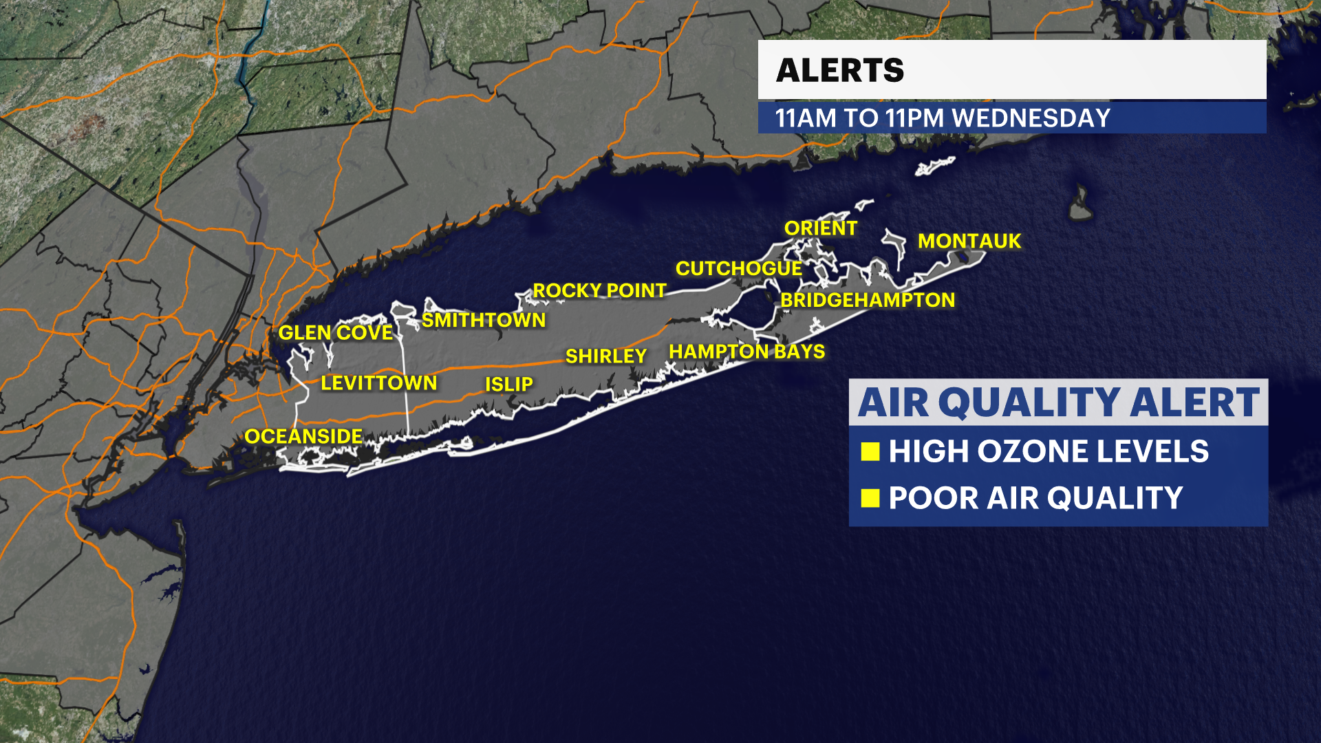
ALERTS:
EXTREME HEAT WARNING is in effect from Now through Friday at 9 p.m.
EXTREME HEAT WATCH remains in effect for Saturday.
AIR QUALITY ALERT is in effect from Now to 11 p.m. tonight and will be extended beyond that.
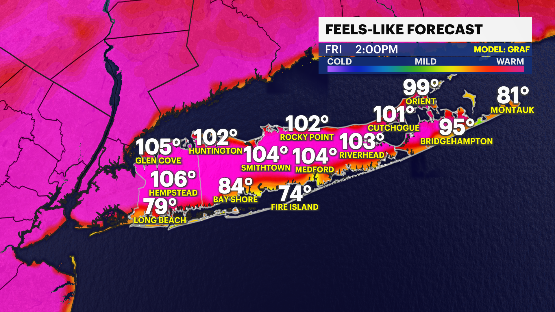
EXTREME HEAT ARRIVES TODAY
8 Times 100 or greater. Forecast high on Friday is 100. This is not typical summer heat. This is dangerous.
104°F – July 3, 1966 (Islip's all-time record high)
102°F – July 5, 1999
101°F – July 6, 2010
101°F – July 21, 1991
101°F – June 24, 2025 (Hottest June day on record)
100°F – July 22, 2011
100°F – August 2, 1975
100°F – August 9, 2001
Today through at least the Fourth of July on Saturday will be a stretch of dangerous heat and humidity on Long Island. Believe it or not, heat is the number one weather-related killer. So, enjoy the outdoors smartly during this stretch. It can feel like anywhere from 95 to 110. You can find some relief at the South Shore and East End beaches, but you still will need to drink plenty of extra water, take frequent breaks in an air-conditioned environment and limit strenuous outdoor activities - do whatever you can to keep your body cool.
Air quality will also be poor throughout the rest of the week. Those with pre-existing respiratory or heart-related illnesses will be most affected, but this is the type of heat and humidity that will affect anyone if you are not going. Please also check on your pets and remember to check cars for anyone or any pets before walking away.
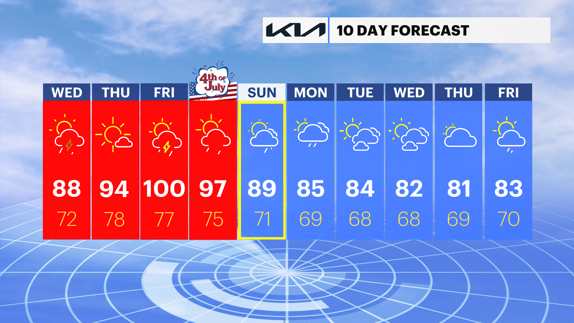
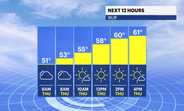
EXTENDED FORECAST
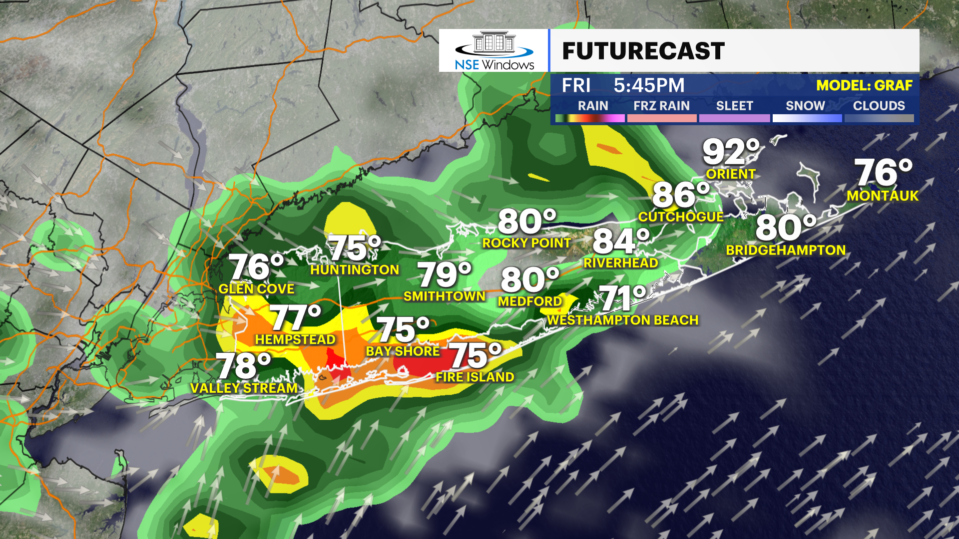
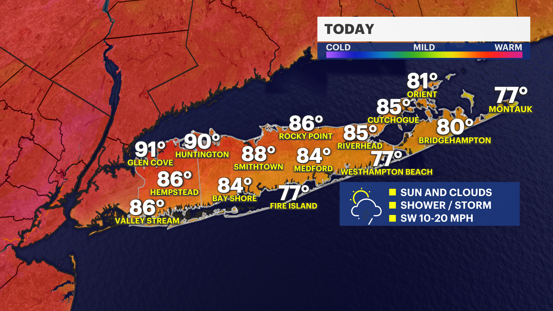
TODAY: HEAT ALERT - Sun and clouds. Hot and humid. Temperatures around 88. It will feel like around 95 to 100. Use caution and take breaks from the heat. A few widely scattered showers and thunderstorms are possible after 3pm.
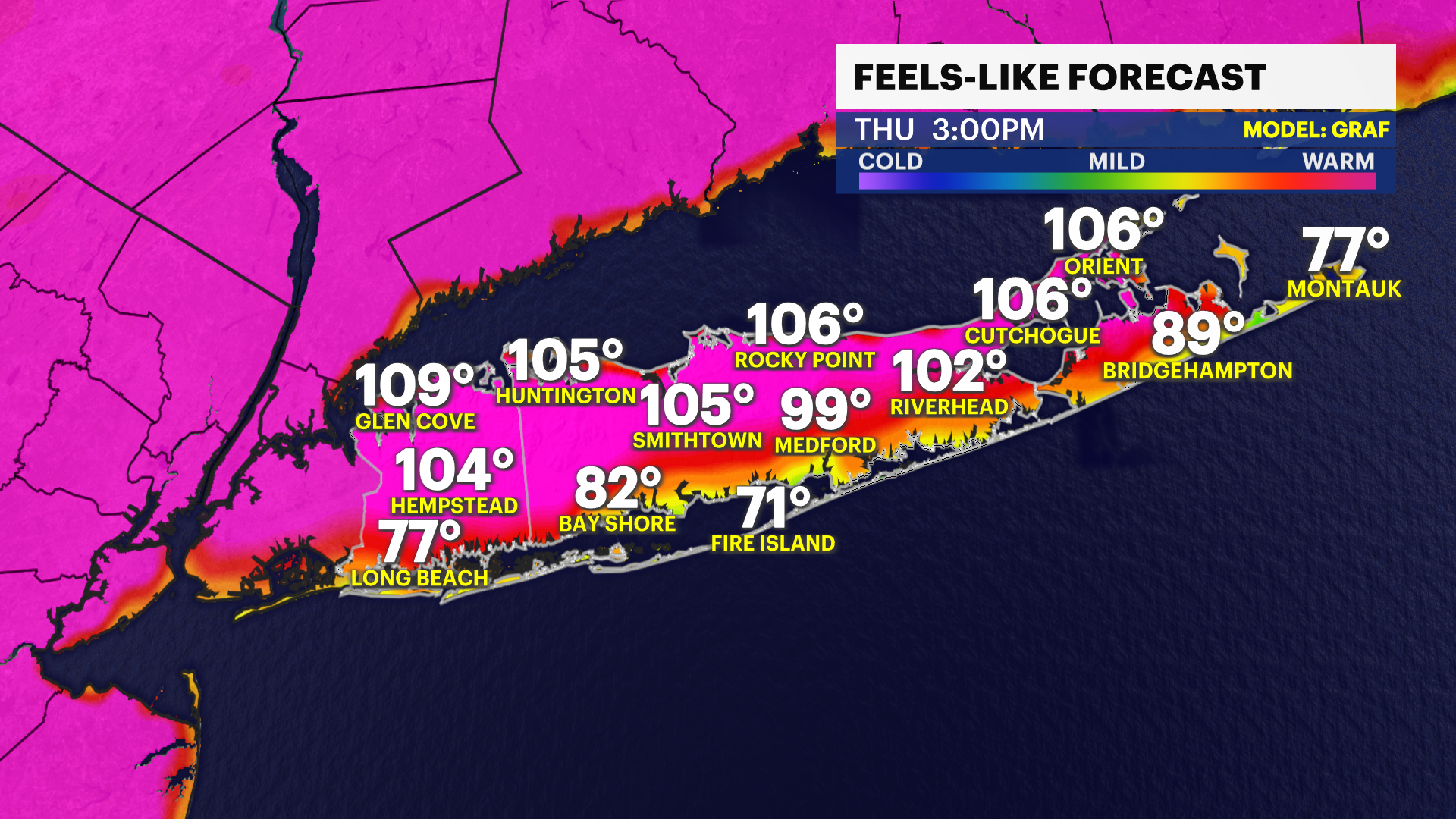
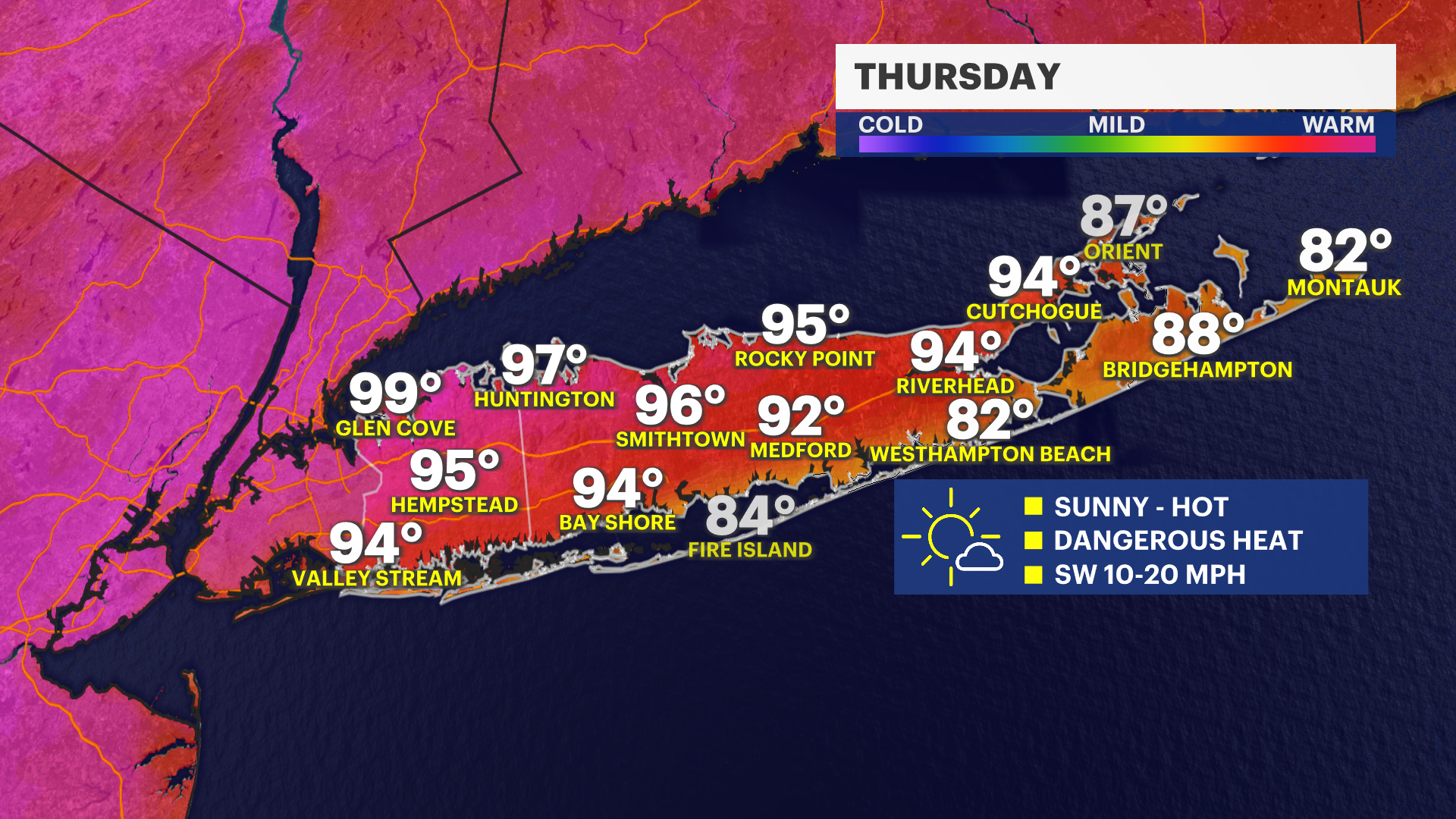
THURSDAY: HEAT ALERT - Hazy, hot and humid. This is the start of the peak of this week's extreme heat. Temperatures around 95. It will feel like 95 to 110. Use caution and take breaks from the heat and stay hydrated. Lows near 77 and humid.
FRIDAY: HEAT ALERT - STORM CHANCE - Hazy, hot and humid. Highs around 100. It will feel like 95 to 110. Use extreme caution and take breaks from the heat and stay hydrated. Slight chance for a shower or thunderstorm, but mostly dry. Lows near 77 and humid. Record High is 104 set in 1966.
SATURDAY: HEAT ALERT - FOURTH OF JULY - EVENING STORM CHANCE - Sun and clouds, with a few spotty showers and thunderstorms possible, mostly in the evening. Hot and humid. Highs around 93 can feel like 95 to 105. Use extreme caution and take breaks from the heat and stay hydrated. Lows near 74.
SUNDAY: STILL HOT - A FEW SHOWERS - Sun and clouds, with a shower chance. High temperatures around 90. Lows near 72.
MONDAY: HIGH HEAT BREAKS -- Partly sunny, with temperatures around 86. A few showers possible. Lows near 68.
TUESDAY: Sun and clouds. Temperatures around 82. Lows near 68.