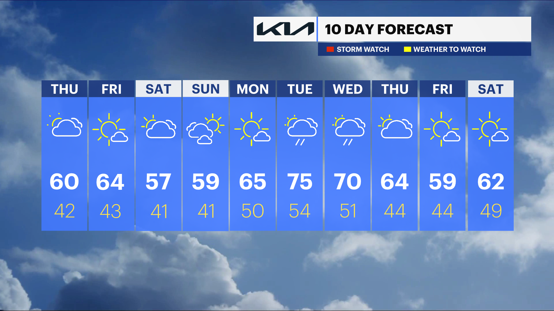
Cloudy with sprinkles today, then some sunshine this weekend in the Hudson Valley
Grab the jacket this morning, it's a damp and dreary start, but Friday looks great.
More Stories


It's a cloudy start to the day today with on and off sprinkles. The rest of the week will be dry, but a few showers are possible for the end of the weekend.
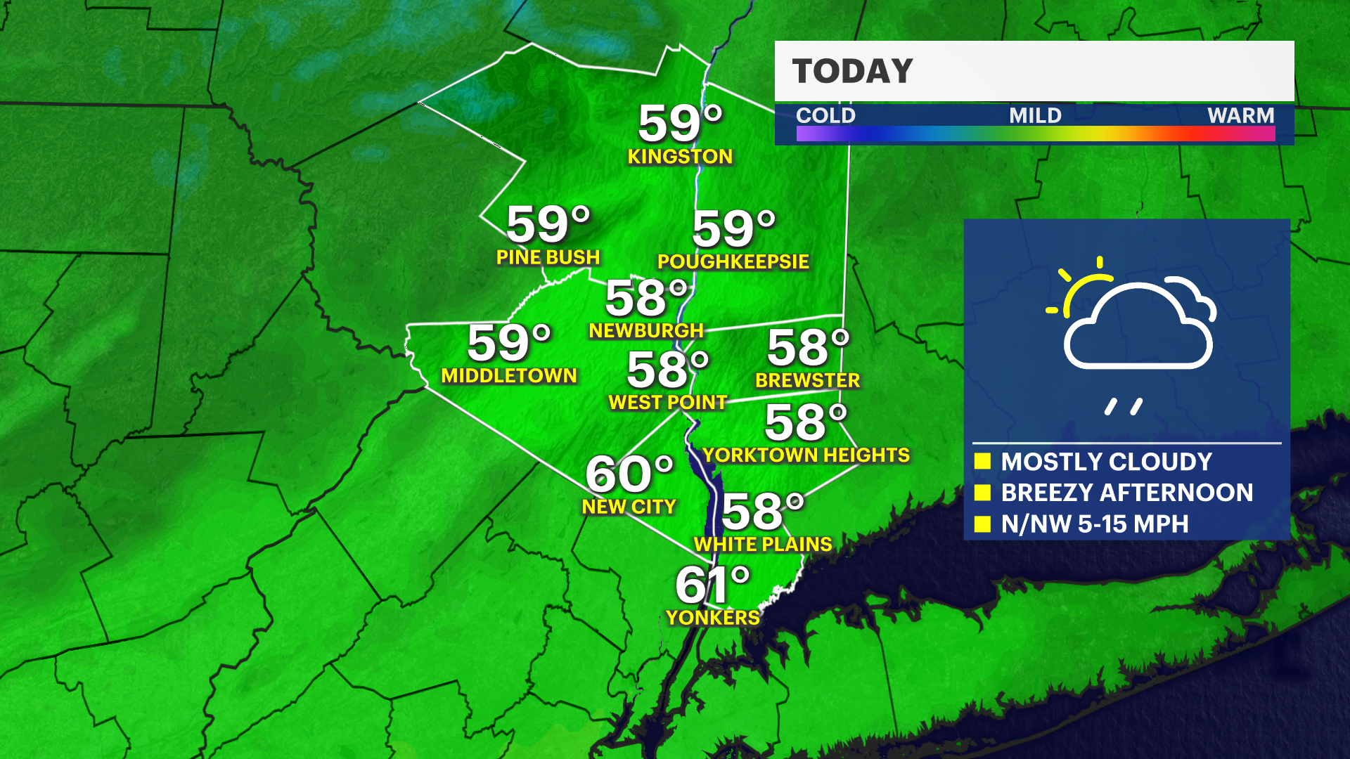
Today: Cloudy with sprinkles
Mainly cloudy skies are expected this morning with a few light showers. A stray shower will return this afternoon with peeks of sunshine. High temperatures will remain in the mid to upper 50s. Breezy overnight with 10-20 mph winds.
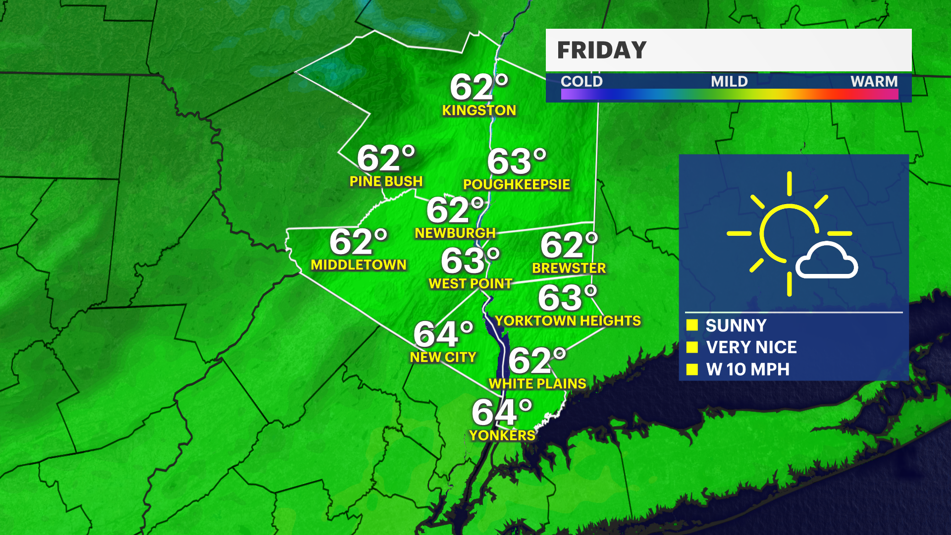
Friday: Ample Sunshine
It's a beautiful star to May with plenty of sun and highs in the low 60s.
The Weekend: A Passing Shower
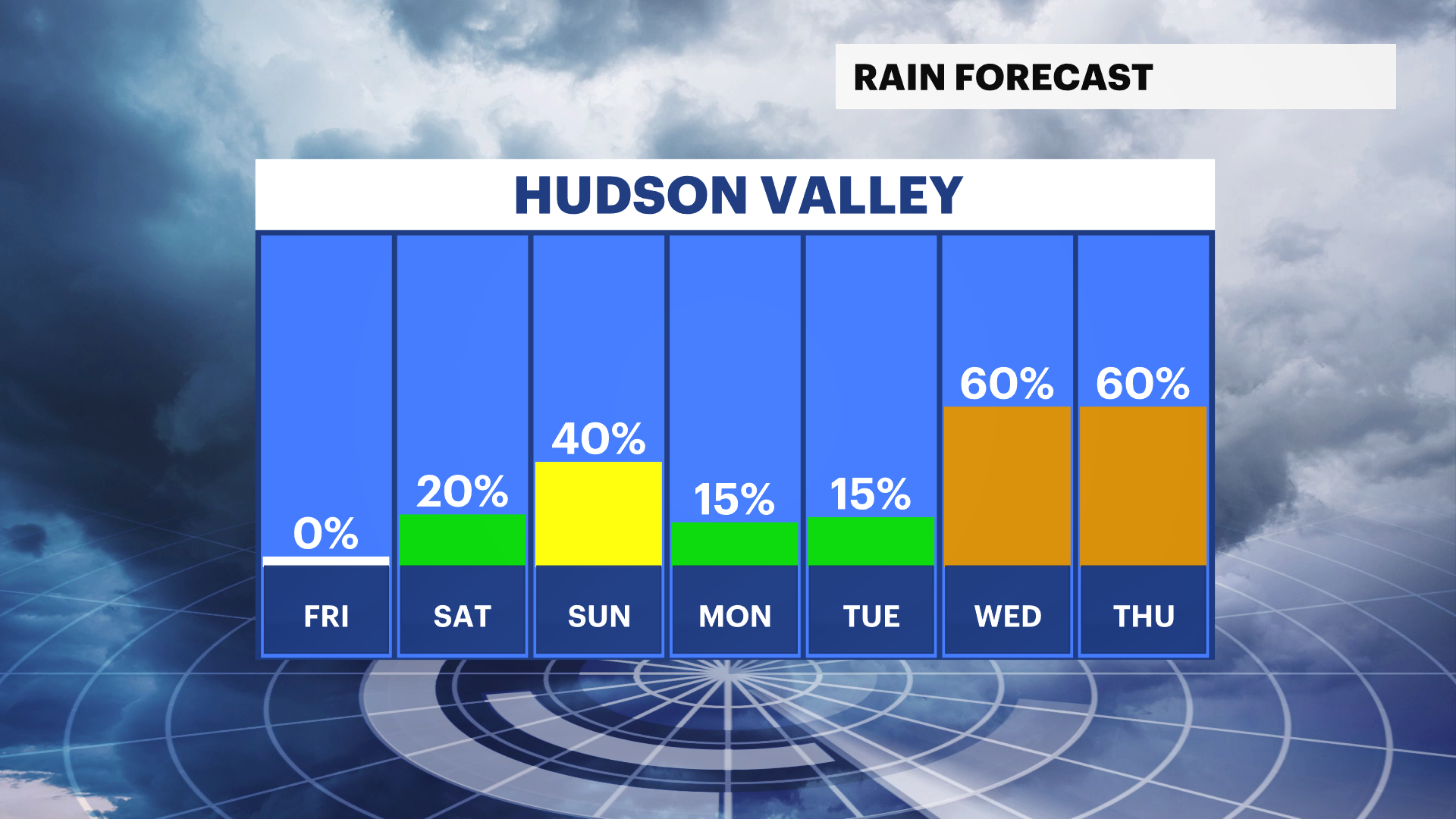
Saturday is mostly cloudy and cooler with highs in the 50s. A stray shower is expected in the evening and overnight.
Sunday is cloudy to start with a passing shower possible, but the risk for rain will decrease and so will the cloud cover in the afternoon. It remains cooler than average with highs near 60.
Next week is milder
Highs will be in the 60s and 70s to start next week with a low chance for rain Tuesday.