Storms end tonight ahead of cooler temperatures and rain showers Thursday
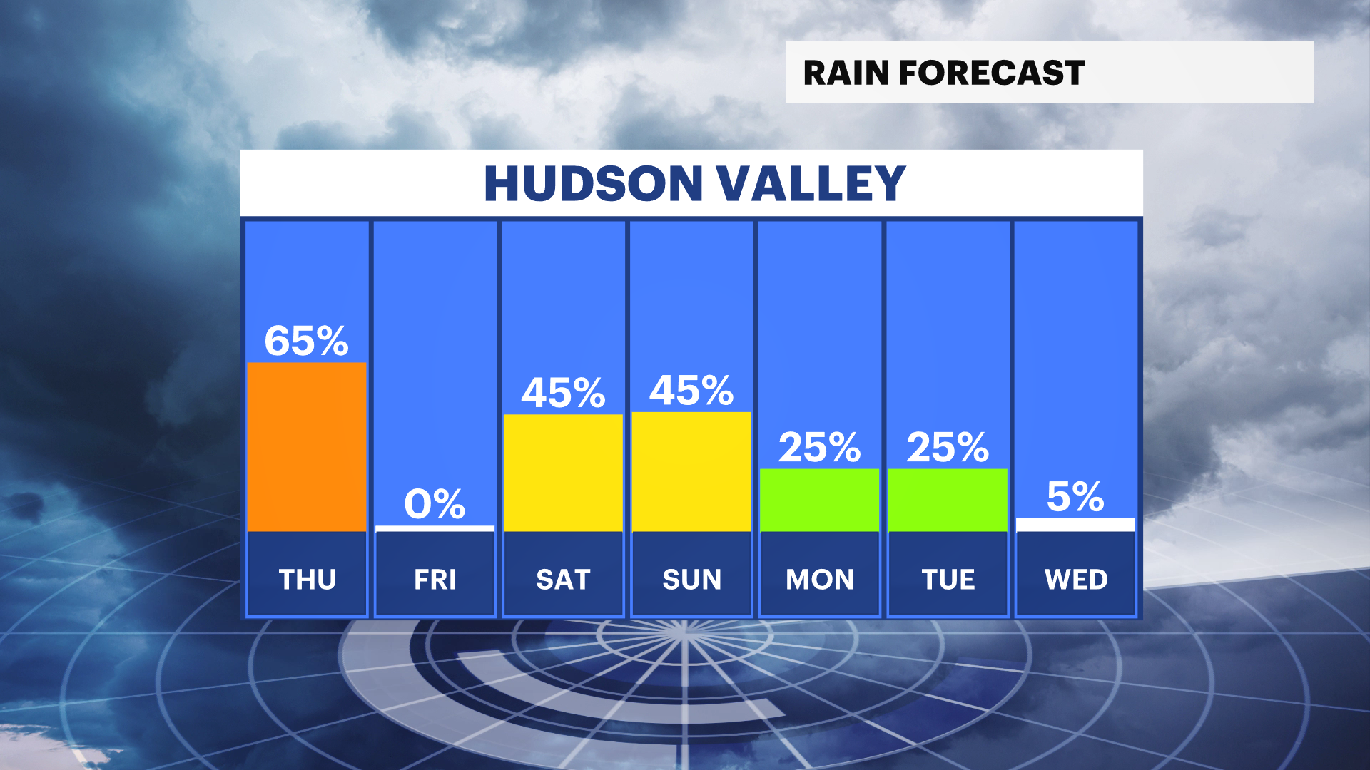
Grab the rain gear for Thursday! Another round of light rain showers will develop overnight impacting the morning commute
Share:
More Stories
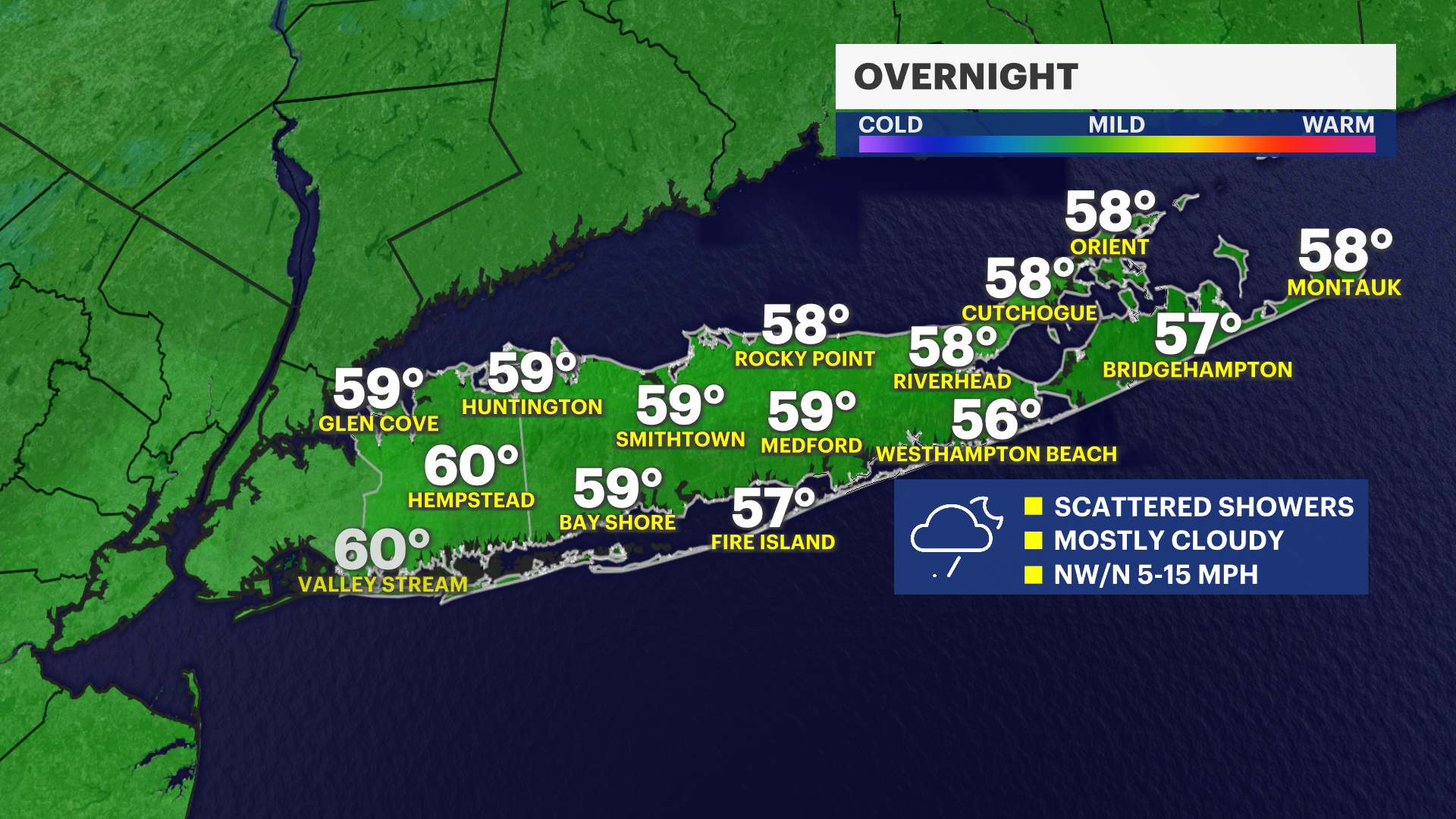


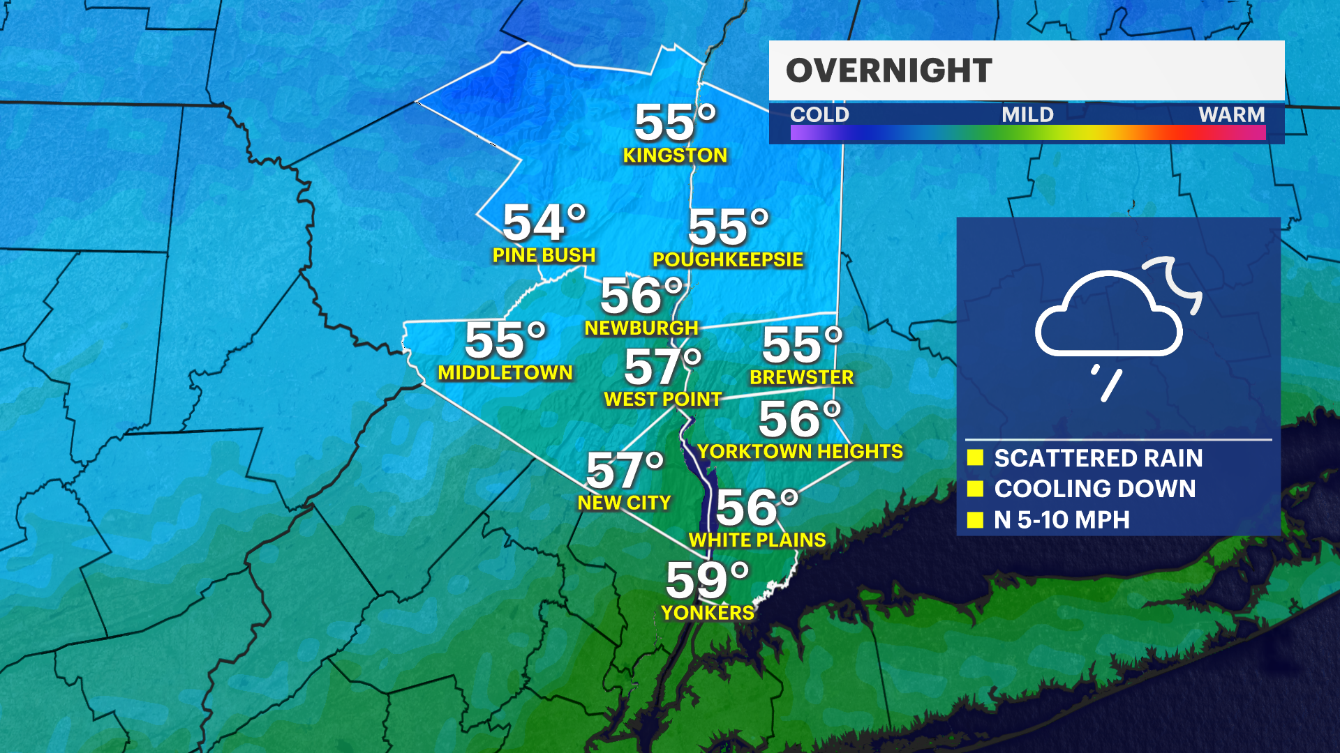
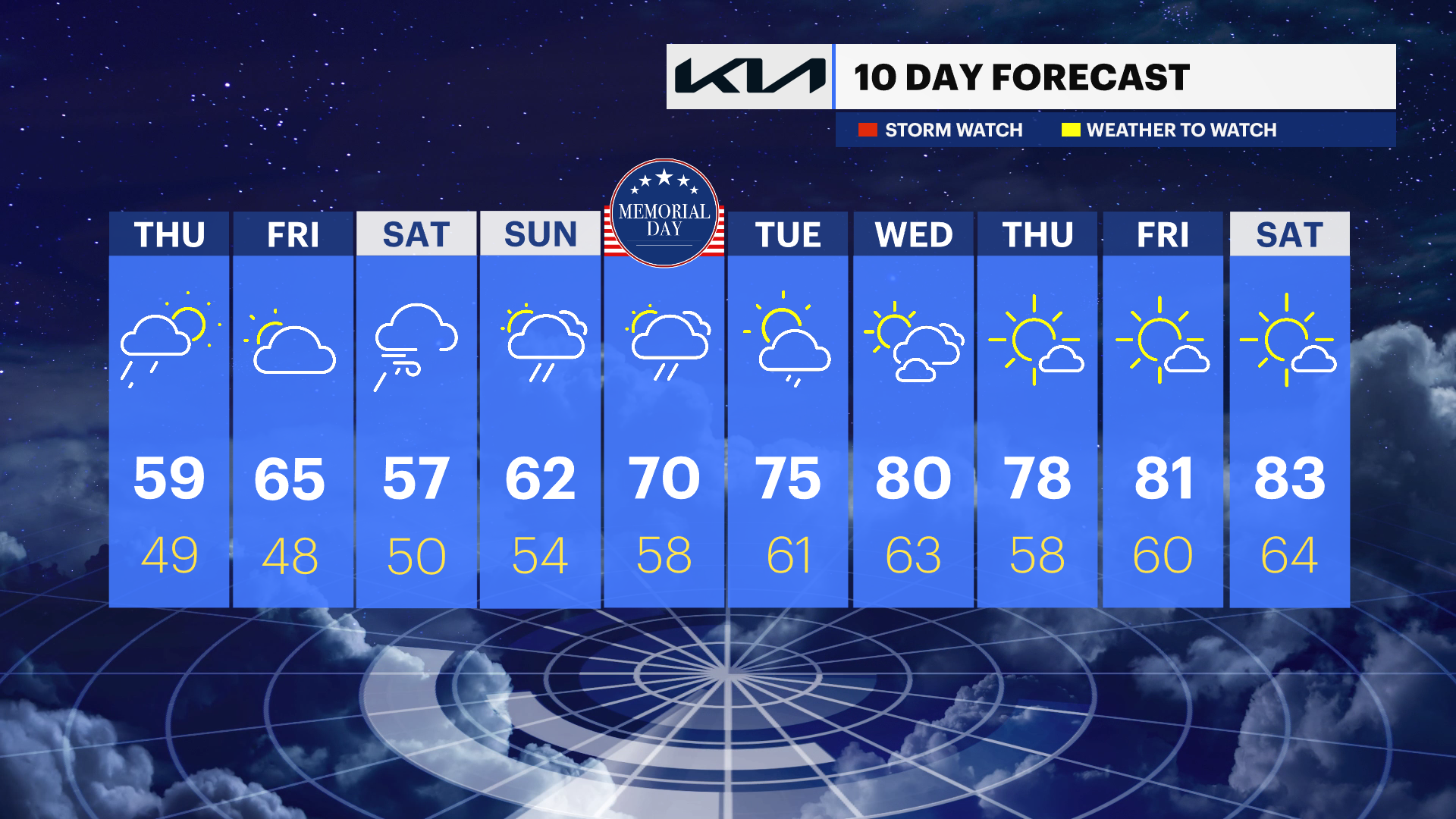
The storm threat ended earlier tonight as cooler temperatures begin to sweep the region. Another round of light rain showers is expected overnight into early Thursday morning. We are not expecting heavy downpours or thunderstorms, but you may want to grab the raingear for tomorrow as rain will likely follow into midday Thursday.
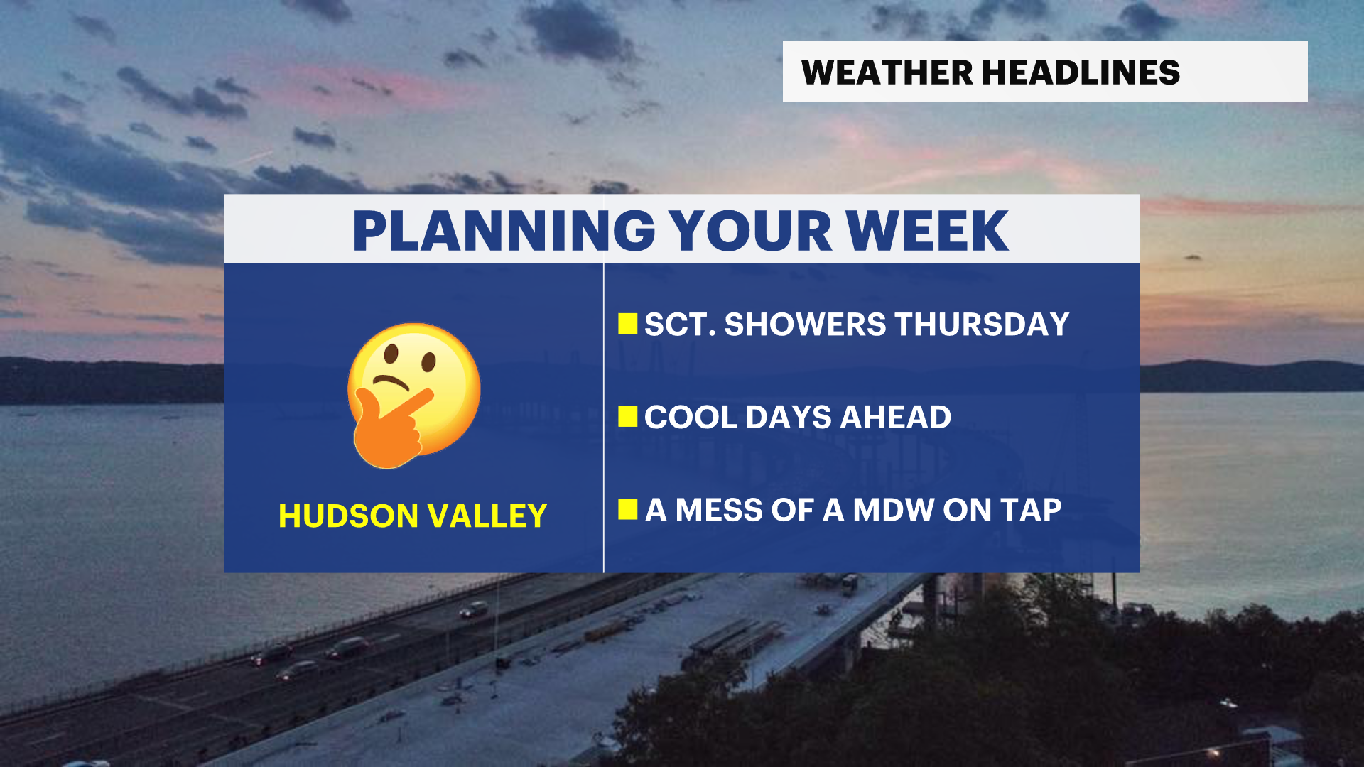
A drier yet cool trend will wrap up the work week with temperatures a few degrees below normal for this time of year by Friday.
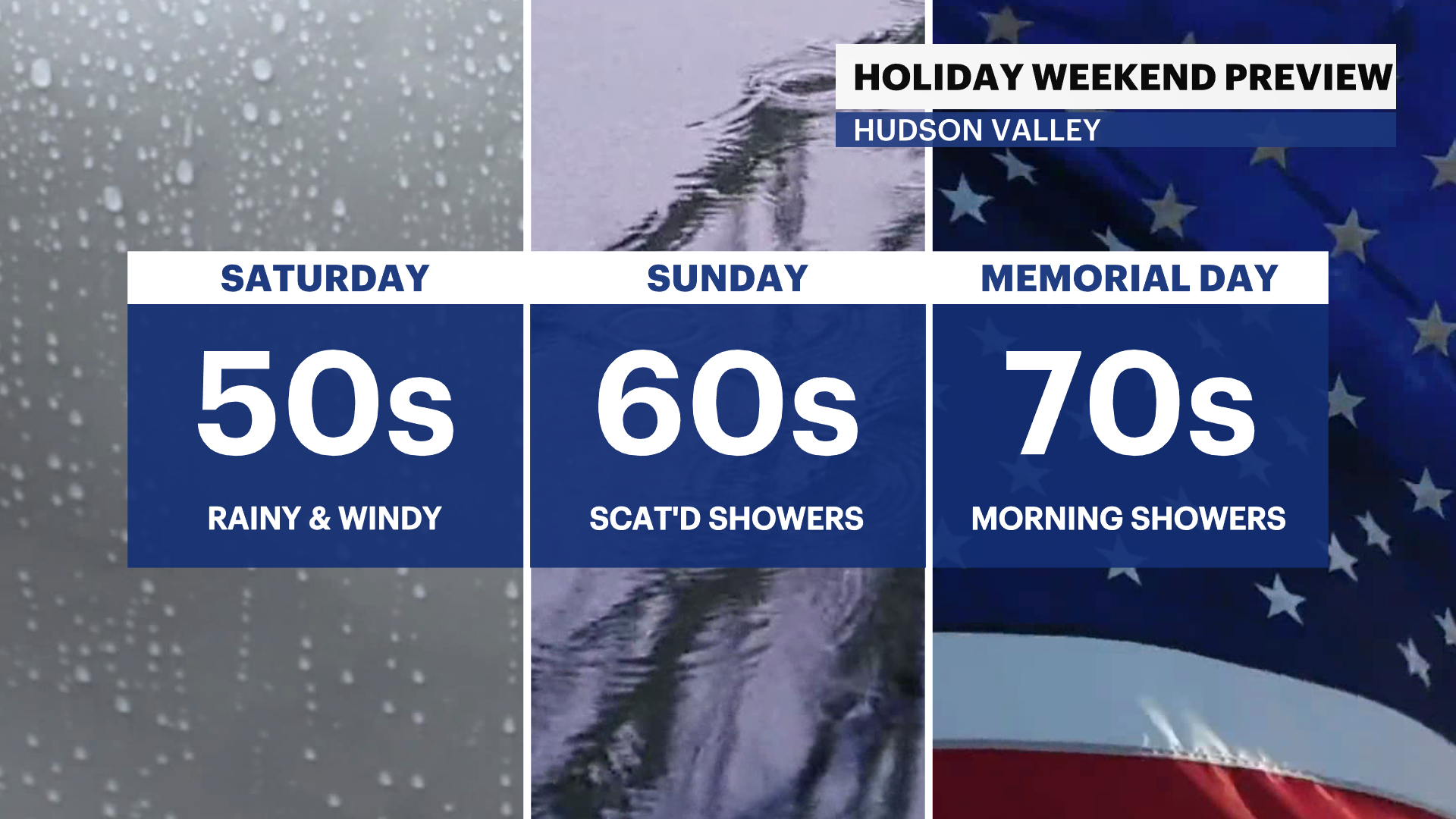
Memorial Day weekend does not look to be the greatest for the "unofficial start of summer." Temperatures will be cool with scattered shower chances. Saturday could be the worst day of this upcoming holiday stretch.