Debby’s aftermath on Long Island
Debby's storm didn’t hit us directly, but it contributed to flooding and wind damage across Long Island and our cloudiest stretch of weather so far this summer.
More Stories


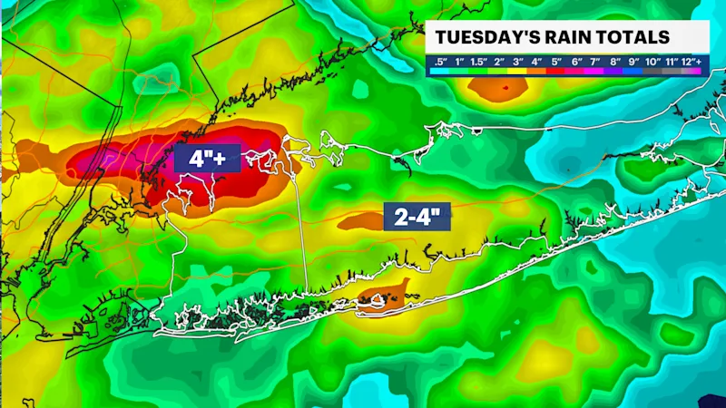
Tuesday’s flooding
A slow-moving frontal system brought drenching, slow moving thunderstorms. Islip reported it’s wettest day so far this year with 2.80” of rain, and just to the west, Dix Hills reported over 4” on Tuesday afternoon. Later that evening, another slow-moving storm set up over the north shore of Nassau county. Here rain totals reached more than 4”.
Stretch of Cold
Although Debby was still in the southeast on Tuesday, tropical moisture from the storm enhanced the storms Tuesday and set the stage for a string of cloudy days. Wednesday’s cloud cover was so thick, temperatures struggled to get to 70F in Islip, which was the coldest August day in 4 years.

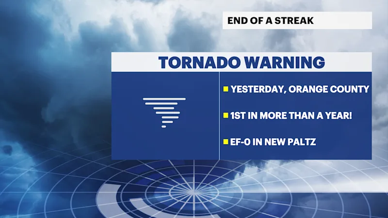
Friday’s wind
Tropical Storm Debby transitioned into a post-tropical cyclone early Friday morning, but the remnants merged with a cold front and brought flooding and tornadoes to our west. The EF-0 tornado in Orange County last night was the first tornado warning issued by Upton since the Long Island Tornado outbreak in November 2022.
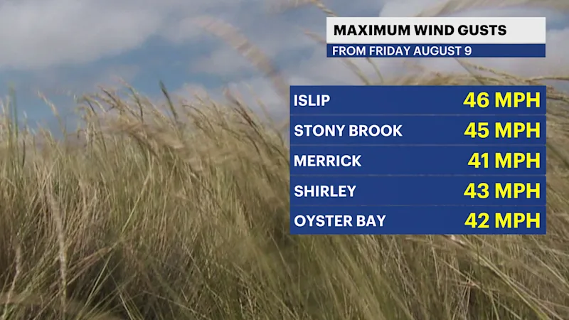
On the island, the storms produced minor impacts, but the wind was strong leading up to the cold front passage. Winds peaked at 46 mph in Islip and wet branches and soil knocked trees down on parts of the island.
What's next?
This weekend surf remains rough, although improves early next week. Our 5th storm of the season could develop in the Central Atlantic or northern Caribbean early next week.


