Dry, breezy weather continues with elevated risk of brushfires Tuesday
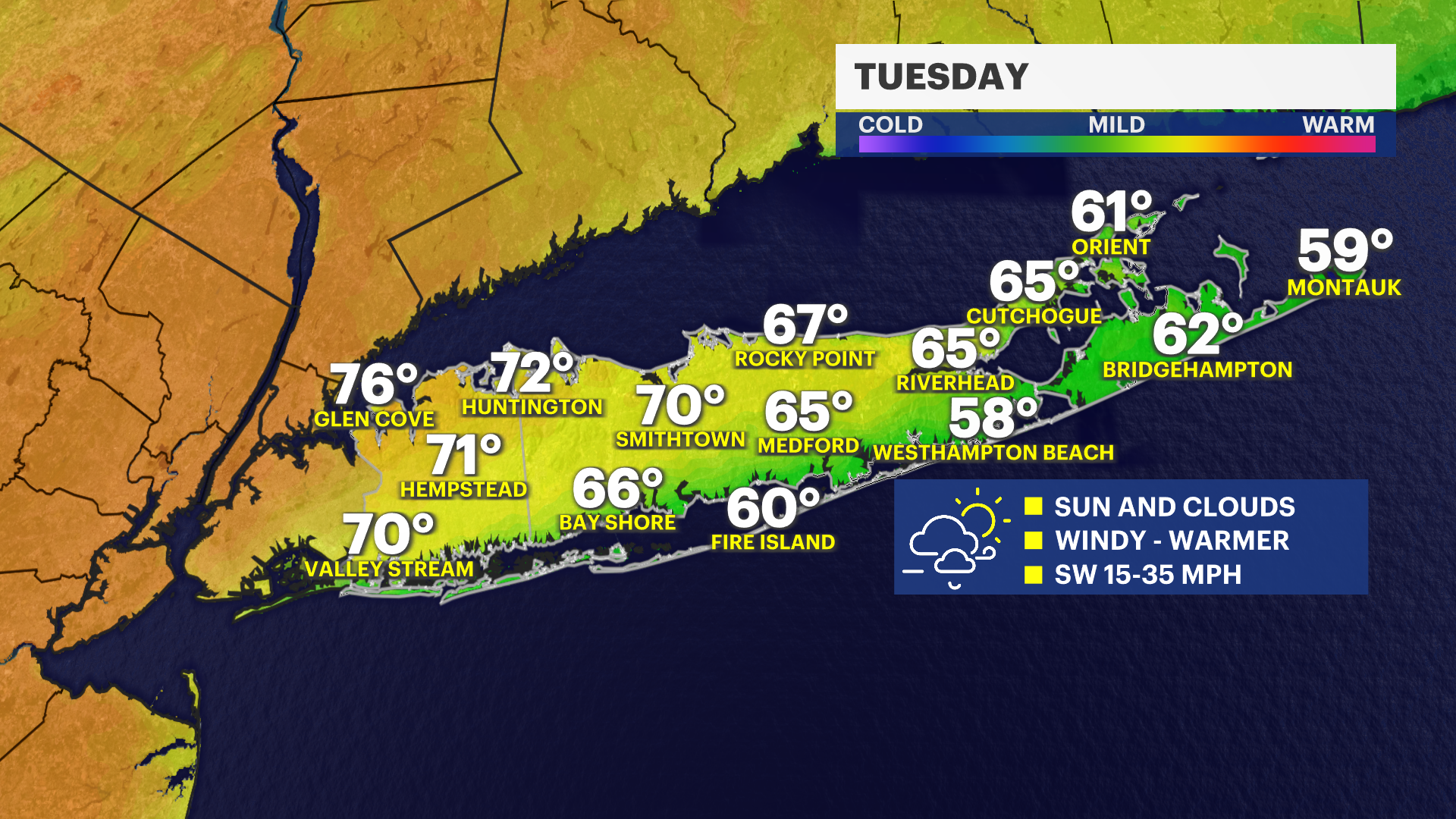
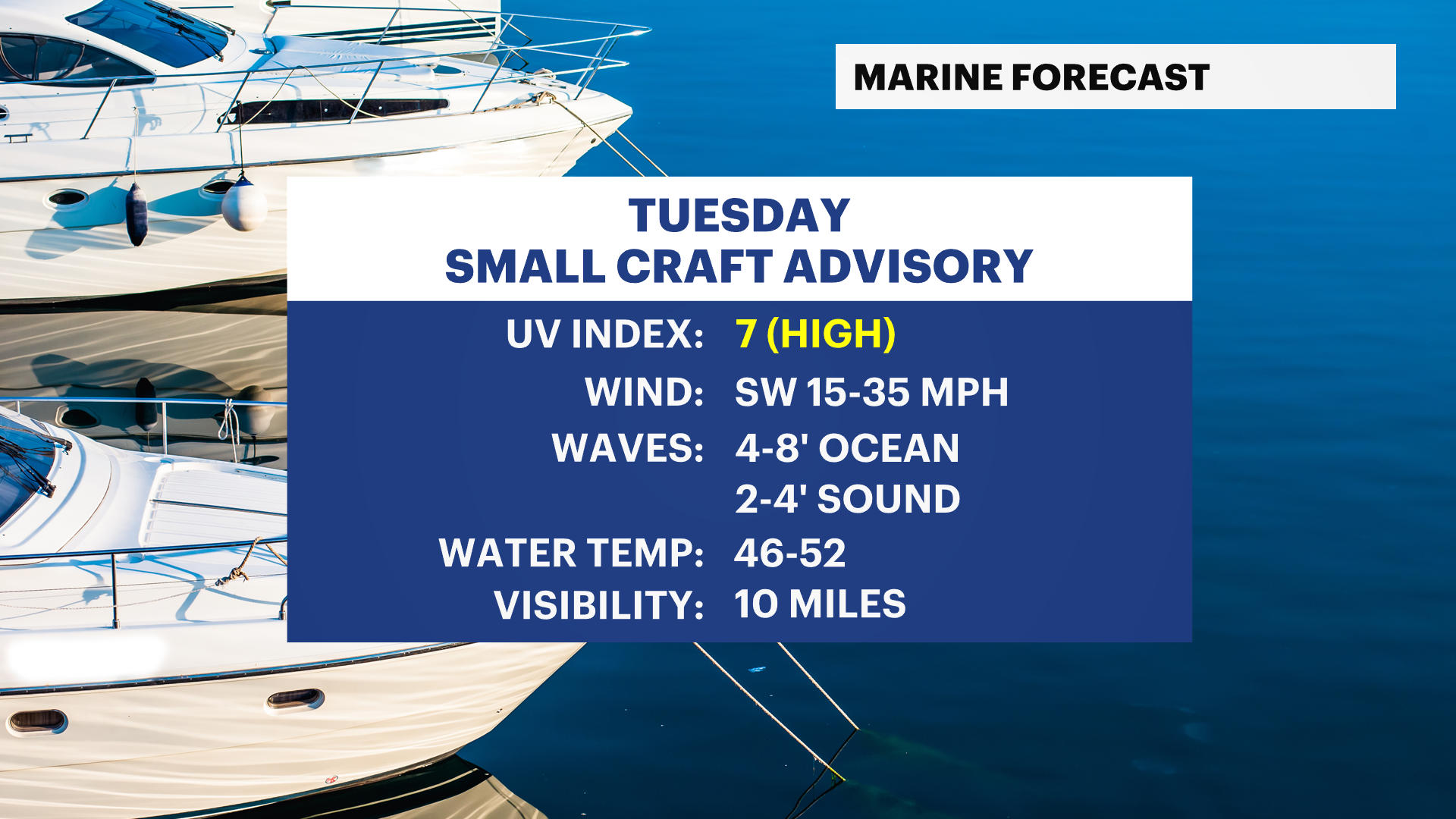
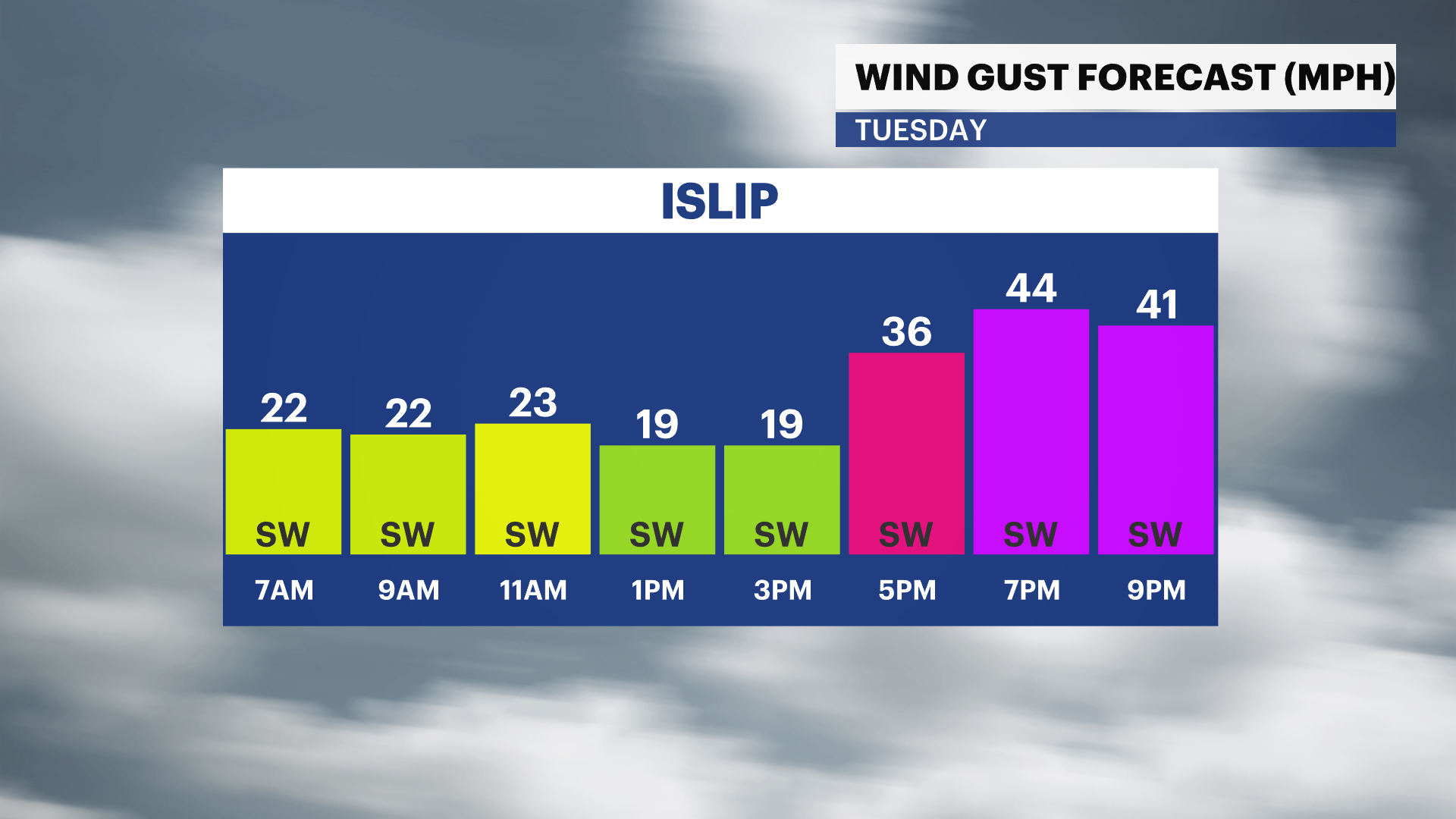
It will be partly cloudy and breezy overnight. Tuesday will get windier in the evening with some gusts potentially over 40 mph.
More Stories


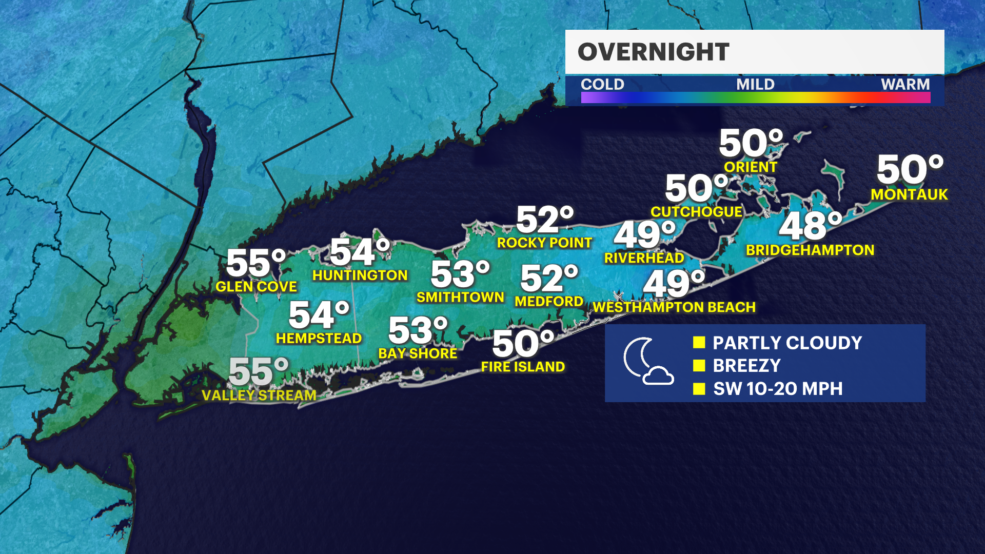
OVERNIGHT
It will continue to feel fairly comfortable and it will stay breezy and dry through overnight. Early morning temperatures Tuesday will be in the upper 40s to low 50s under a partly cloudy sky.
ELEVATED RISK OF BRUSHFIRES
An elevated risk of brushfires starting and spreading quickly will continue through Tuesday given the drought conditions that western Nassau County and eastern Suffolk County are dealing with, paired with very low levels of humidity and a gusty wind. Please continue avoiding the use of open outdoor flames and be extremely cautious with the safe disposal of things like matches and cigarettes. A burn ban continues on Long Island until at least May 14.
NEXT RAIN CHANCE
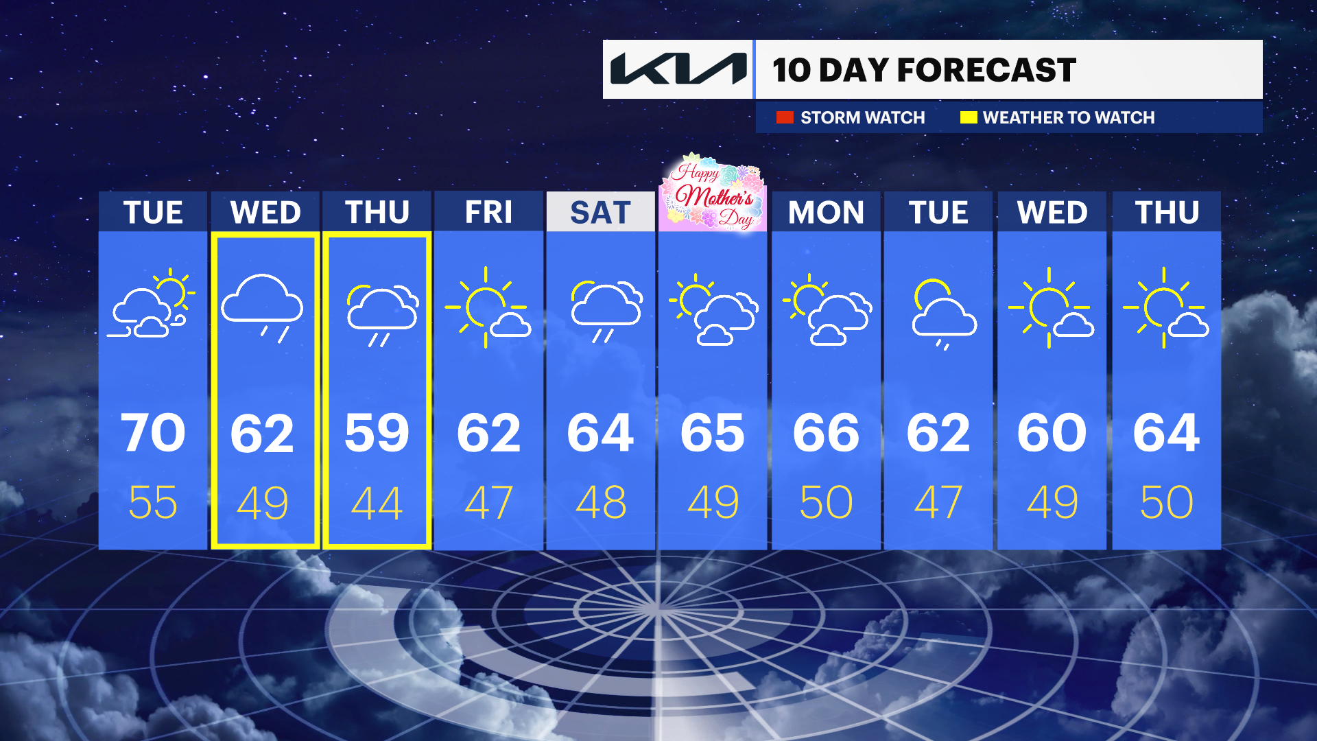
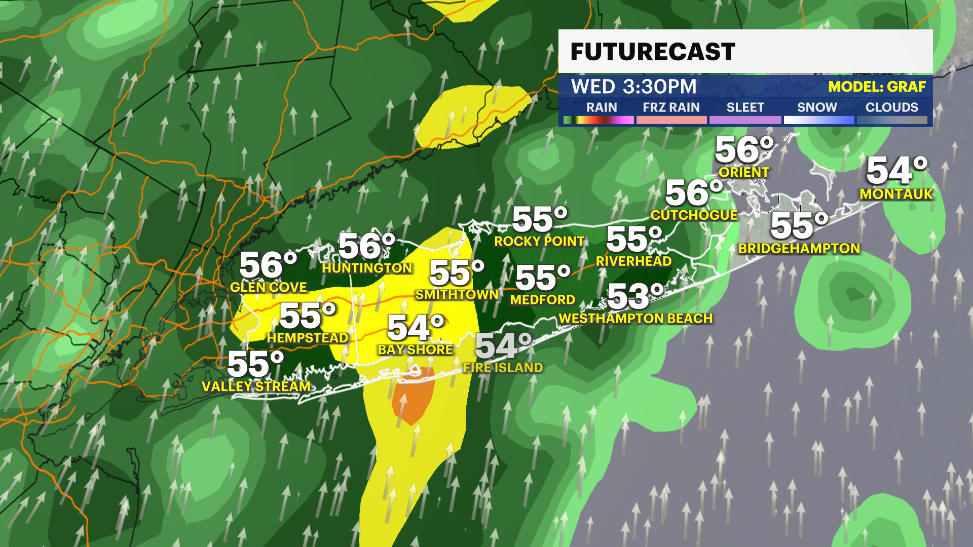
Wednesday will bring a beneficial rain chance to Long Island in the afternoon and evening. You will need the rain gear during this time and travel can be slowed due to scattered periods of moderate rain. This will not fix the current drought levels, but any steady rain can at least help to temporarily limit the elevated brushfire risk. Up to around 1" of rain is possible at this time with a few additional scattered showers, but less steady rain on Thursday.
MOTHER'S DAY WEEKEND
This upcoming weekend is looking like a 50-50 split of rainy versus nice weather as of Monday evening. Saturday and not Sunday is the wet day with periods of rain showers, a gloomy look and high temperatures in the low to mid-60s. Mother's Day Sunday should feature a mix of sun and clouds, with high temperatures still in the 60s although it can be breezy. The News 12 Storm Watch Team will continue to keep an eye on this forecast for you all week.
EXTENDED FORECAST
OVERNIGHT: Partly cloudy, breezy and comfortable. Overnight temperatures will be in the upper 40s to low 50s. Wind: Southwest 10 to 20 mph.
TUESDAY: ELEVATED FIRE SPREAD RISK -- A stray morning rain shower is possible. Otherwise, a mix of sun and clouds. Windy and warmer for most of Long Island. Temperatures in Nassau County will be in the upper 60s to mid-70s. Temperatures in Suffolk County will be in the upper 50s to near 70, coolest along the South Shore and East End. The combination of strong wind and very dry conditions will continue to lead to a brushfire risk along with a fast risk of how quickly fires can spread when they develop. Wind gusts Tuesday evening can be between 30 to 40 mph. Lows around 55 degrees.
WEDNESDAY: RAIN RETURNS -- Mostly cloudy in the morning, with periods of moderate rain in the afternoon and evening. A few downpours are possible with up to around 1" of rain expected as of Monday evening. Staying breezy. Temperatures will be around 62. Lows expected to be near 49.
THURSDAY: Mostly cloudy, with a few scattered rain showers likely. It is looking a bit drier Thursday overall though. Temperatures will be around 59. Lows near 44.
FRIDAY: Mostly sunny to partly cloudy, with high temperatures around 62. Lows near 47.
SATURDAY: Mostly cloudy, with scattered rain showers. Temperatures will be around 64. Lows near 48.
SUNDAY: MOTHER'S DAY -- Sun and clouds. Temperatures will be around 65 degrees. Lows near 49.
MONDAY: Sun and clouds. Temperatures will be around 66. Lows near 50.