Summer feel continues before changes arrive this weekend
Highs remain 10 to 20 degrees above average through Friday. Cooler weather and showers over the weekend.
More Stories


SUMMER FEEL CONTINUES WITH BIG CHANGES BY WEEKEND
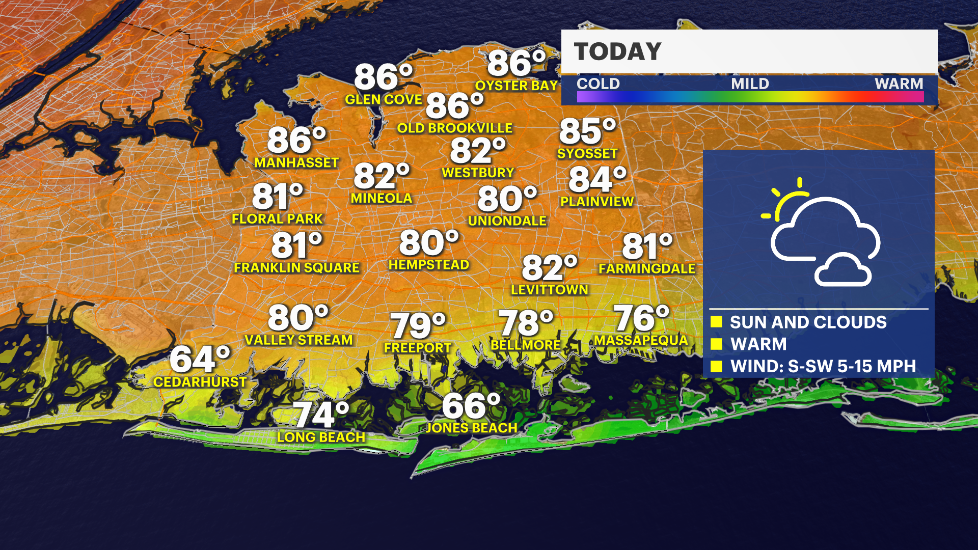
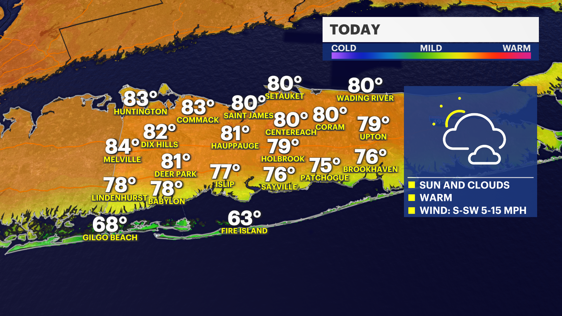
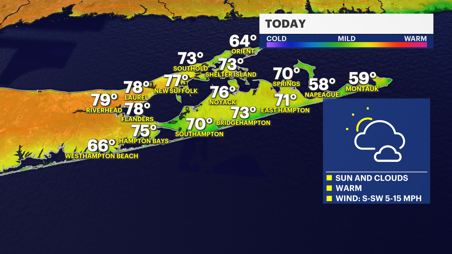
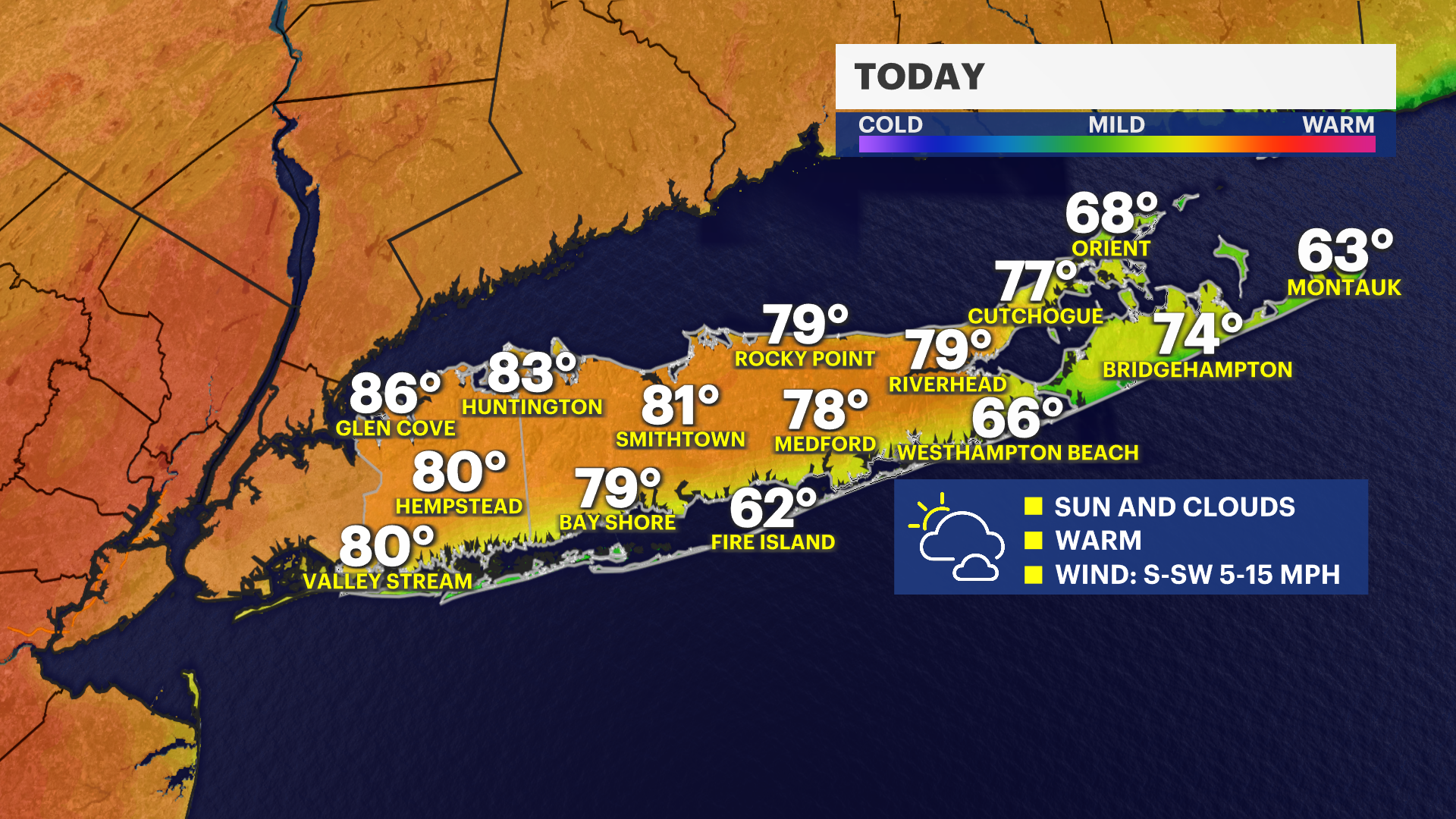
We’re off to a warm start today with a nice mix of sun and clouds across the area. Temperatures will climb into the 70s and 80s, while the immediate shoreline and beaches stay cooler, mainly in the 60s thanks to that ocean influence. It’s a comfortable spring feel overall, just with a bit of that coastal contrast.
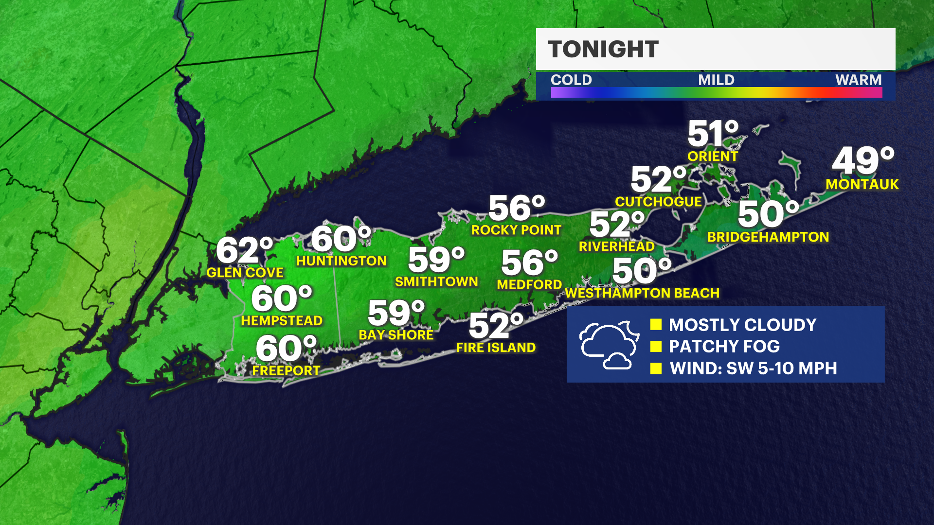
Tonight, clouds take over with mostly cloudy skies settling in, with a chance for a passing shower, and we’ll likely see some areas of fog developing, especially late. It stays mild with overnight lows in the 50s and 60s, so no chill in the air.
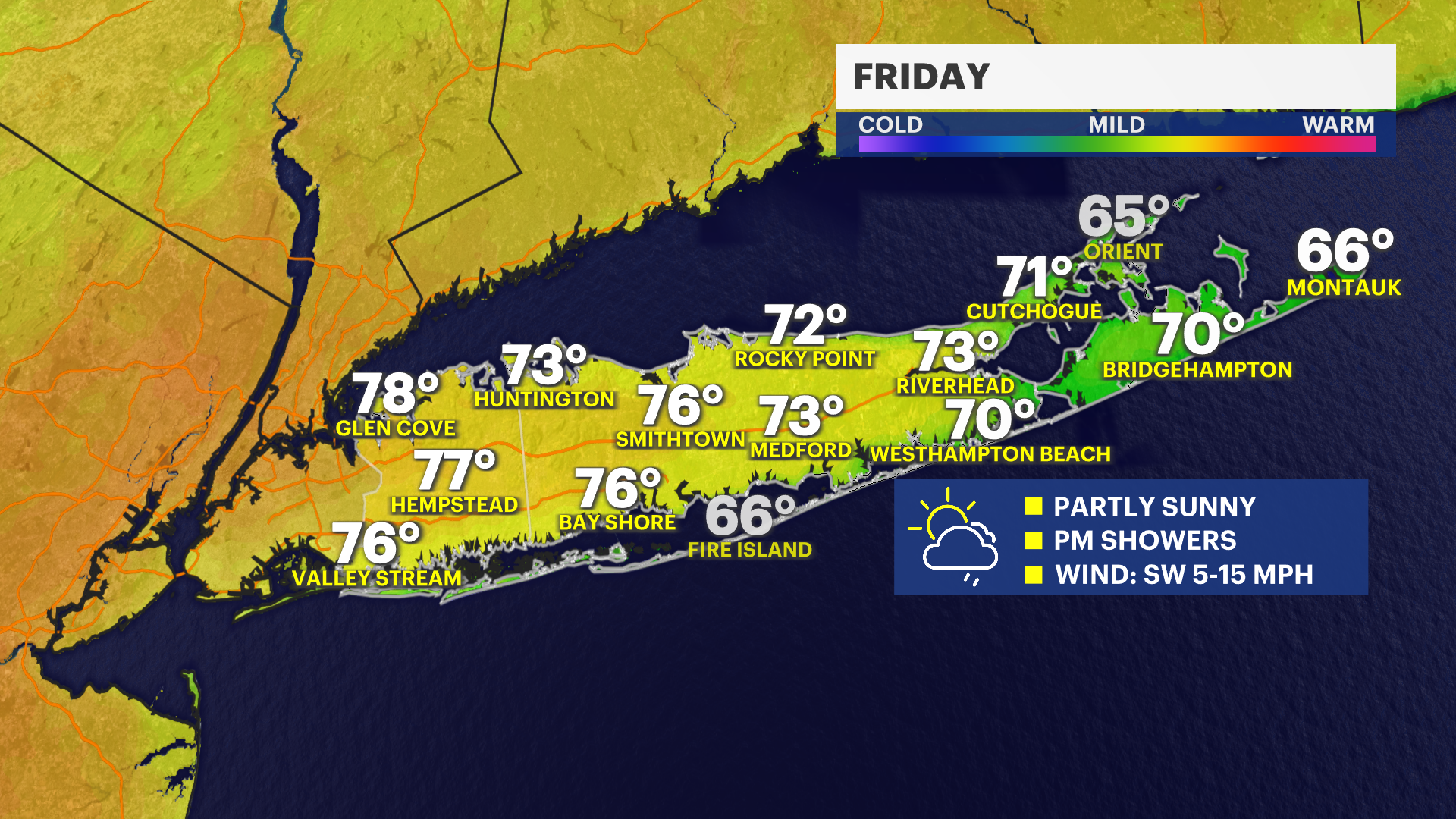
Heading into Friday, we’ll see partly sunny skies, but keep an eye on the afternoon. There’s a chance for a few passing showers developing later in the day. Temperatures will be a touch cooler compared to today, generally in the 60s to and 70s.
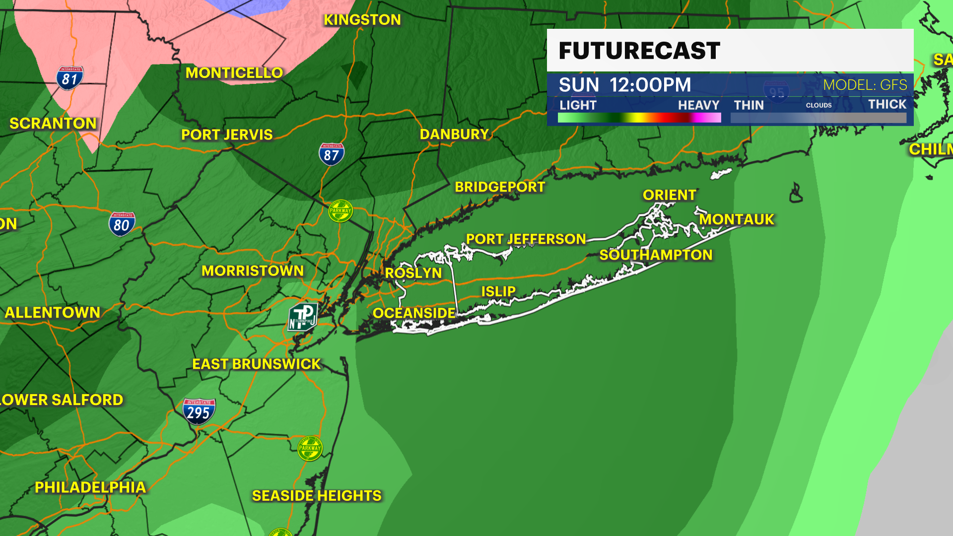
Looking ahead to the weekend, Saturday brings partly sunny skies with a cooler feel—highs in the upper 50s to low 60s. By Sunday, we’re tracking a more unsettled pattern. Expect cloudy skies with showers, especially during the afternoon. High temperatures will be on the cooler side, hovering between 55 and 60 degrees. Cold front Sunday night ends the wet weather, but brings in a chill. Lows Monday morning will be in the 30s and Highs Monday will be 47 to 52 degrees.
Today: Sun and Clouds, with a high near 84. Southwest wind 5 to 15 mph.
Tonight: Mostly cloudy, areas of fog. Chance of a passing shower. Lows near 55. Southwest wind 5 to 15 mph.
Friday: Partly sunny, a few late day showers. High near 75. West wind 5 to 16 mph.
Friday Night: A chance of showers before 10pm. Mostly cloudy, with a low around 52. Northeast wind 5 to 10 mph.
Saturday: Partly sunny, cooler with a high near 62. East wind 5 to 10 mph.
Saturday Night: Mostly cloudy, chance of showers towards morning. Low around 48.
Sunday: Cloudy, with showers. High near 56.
Sunday Night: Mostly cloudy, with a low around 37.
Monday: Mostly sunny, with a high near 49.
Monday Night: Mostly clear, with a low around 34.
Tuesday: Sunny, with a high near 52.