More Stories
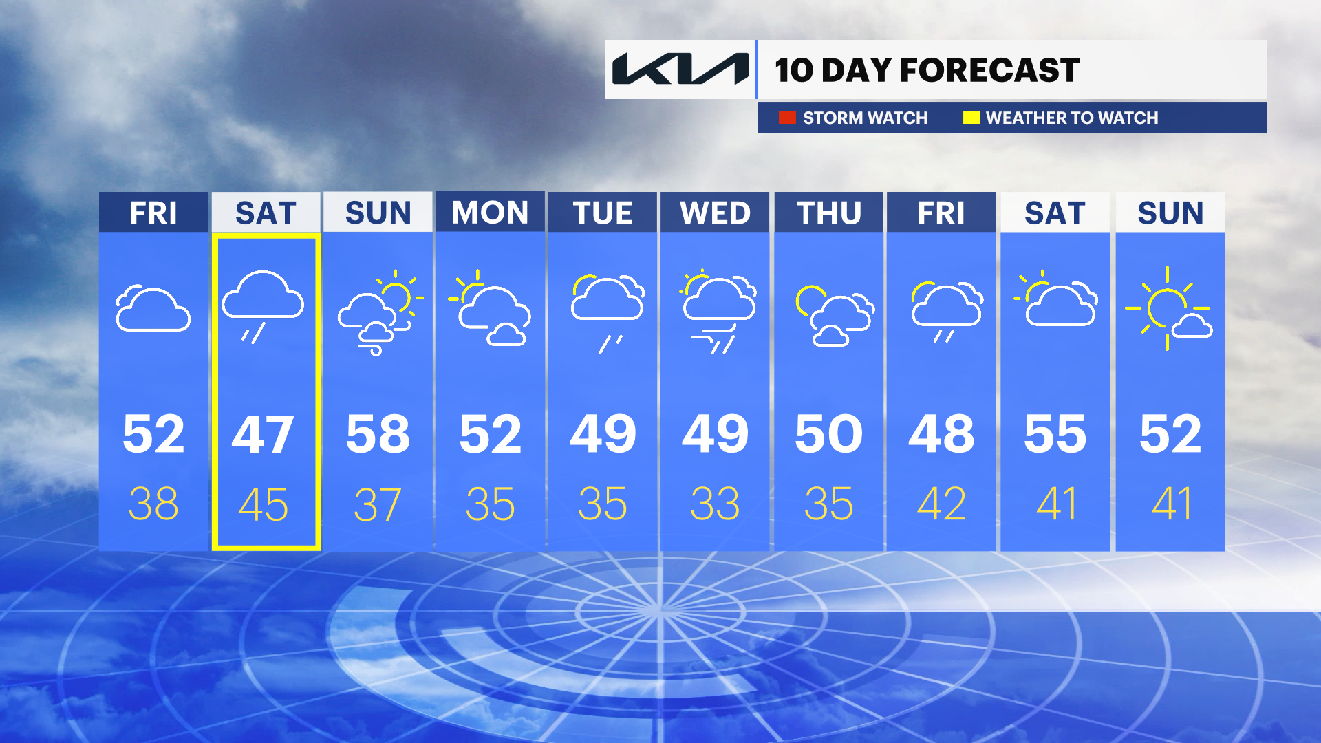
WHAT'S NEW: Rain totals are trending a little lower for Saturday which means any rain we get will be lighter and maybe more scattered in nature. Light showers or drizzle will start after sunrise and continue through much of the day. There may be a few heavy showers rolling through midday. No major impacts here, just a wet, breezy, and chilly day. There is a COASTAL FLOOD ADVISORY for the South Shore of Nassau County Saturday night. There could be some minor flooding in typical low lying areas at high tide.
WHAT'S NEXT: Sunday looks much better and warmer! Highs near 60 with sunshine and a breeze. A few nuisance showers will be around next week but much of the week appears quiet for now and slightly cooler.
News 12 Storm Watch Team Meteorologist Jake Dolinger says to expect a wet, windy start to the weekend with a warm, dry finish.
OVERNIGHT: Cloudy with the chance of a passing shower by morning. Lows near 38. West to east winds 5 to 15 mph. Sunrise: 6:47
SATURDAY: Cloudy and breezy with periods of rain. Feeling chilly with highs near 48. East wind 15 to 30 mph. Sunset: 7:10. Showers continue at night, ending by Sunday morning. Lows near 43.
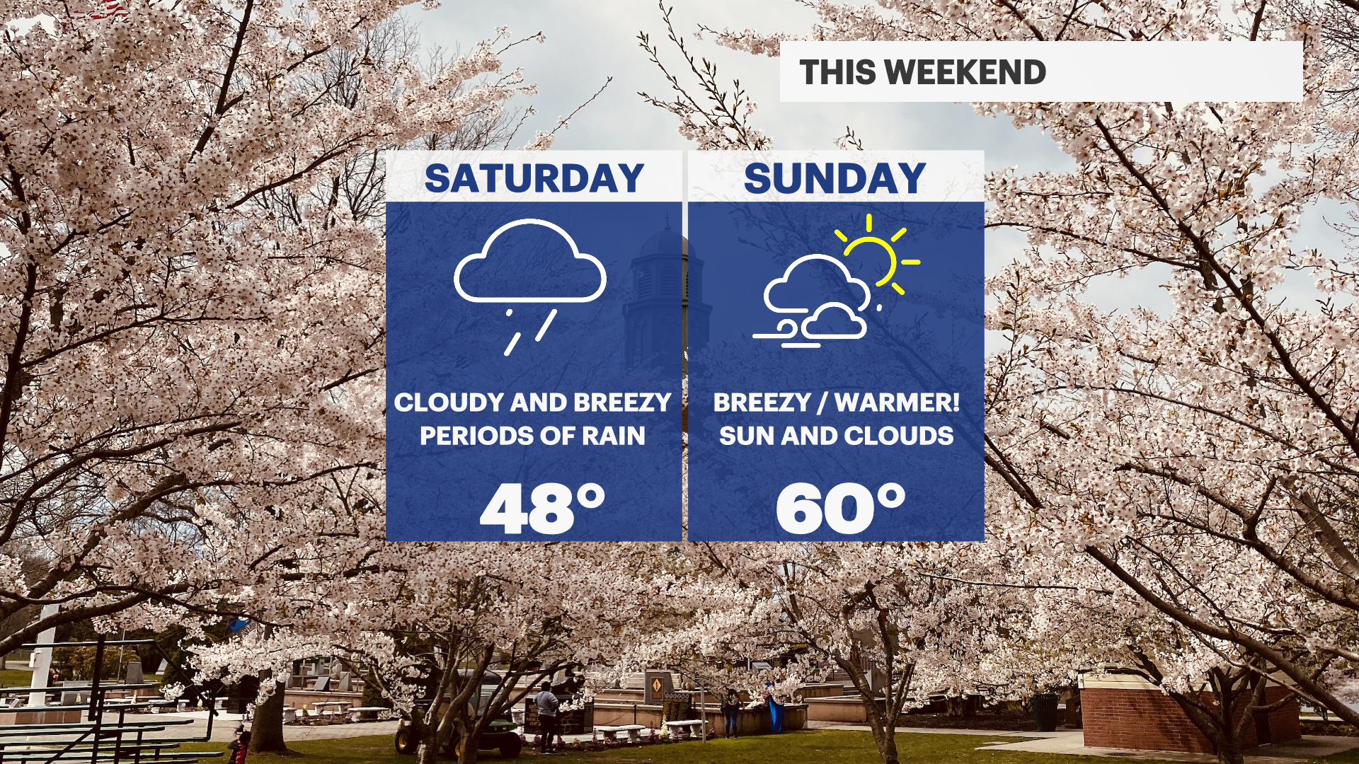

SUNDAY: Breezy and warm with sun and clouds. Highs near 60. Lows near 37.
MONDAY: Partly sunny. Highs near 52. Chance of showers at night with lows near 35.
TUESDAY: Mostly cloudy with the chance of rain showers. Highs near 49. Low near 35.
WEDNESDAY: Mostly cloudy. Highs near 49. Lows near 33.
MONDAY: Partly sunny. Highs near 52. Chance of showers at night with lows near 35.
TUESDAY: Mostly cloudy with the chance of rain showers. Highs near 49. Low near 35.
WEDNESDAY: Mostly cloudy. Highs near 49. Lows near 33.
More from News 12

LIVE RADAR: Tornado Watch in effect for NJ
1:35

Welcome back, spring! Everything you need to know about the upcoming vernal equinox
1:22

Venus and Saturn cozy up in the night sky Sunday - a planetary conjunction
0:39

Blood shortage in wake of February blizzard sparks urgent call for donors
1:19

Clouds may obscure March 3 ‘Blood Moon’ eclipse on East Coast
1:35
