Blizzard of 2026 is now a 'bomb cyclone'
The powerful nor'easter produced blizzard conditions and thundersnow overnight in the tri-state. Worst of the storm continues through the mid-morning hours.
More Stories


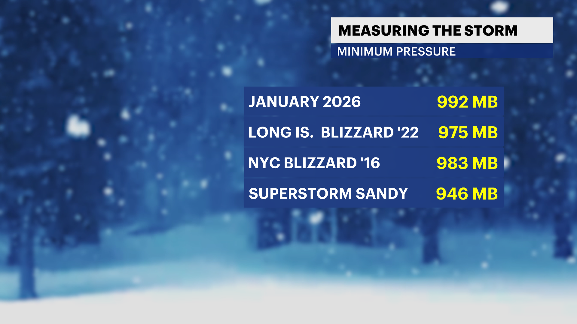
The Blizzard of 2026 is now officially a "bomb cyclone," a designation given to rapidly intensifying nor'easters. All of our worst blizzards have undergone the process of bombogenesis, where the central pressure drops by at least 24 mb in 24 hours.
How strong is the blizzard of 2026
As of the mid morning analysis from the Weather Prediction Center, the blizzard has a central minimal pressure of 968 mb, a drop of about 40 mb. This incredibly fast intensification was aided by the Gulf Stream, a warm ocean current off the coast of Cape Hatteras, and a dip in the jet stream that opened the storm up for rapid vertical motion.
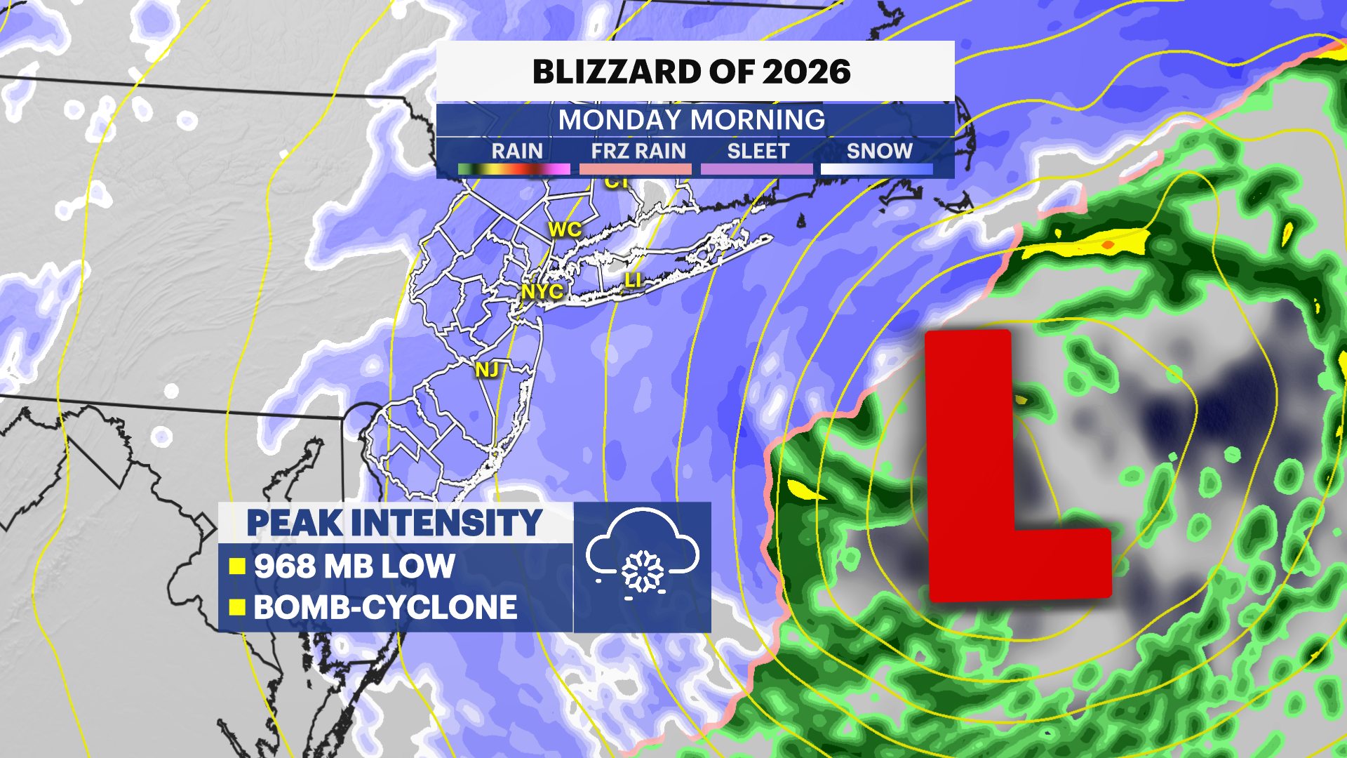
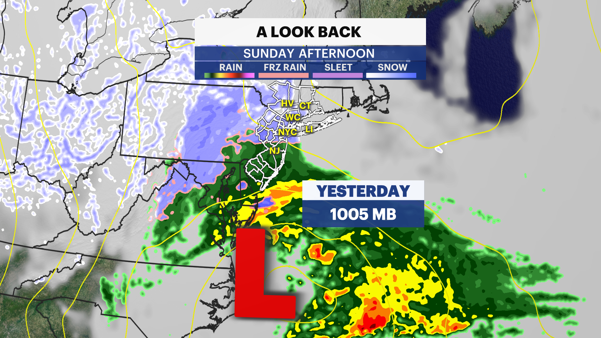
It is now stronger (in terms of pressure) than the blizzard of 2022 that hit Long Island and the January 2016 blizzard, which was the last official blizzard in New York City.
Thundersnow in Manhattan
The storm's updrafts are so intense that it has even produced thundersnow. Thundersnow is exactly like a typical thunderstorm but is much more rare because it contains snow. Thunderstorms typically require warm and moist air, but under special circumstances like a bomb cyclone, the updraft is intense enough to create lightning despite the absence of warm air.
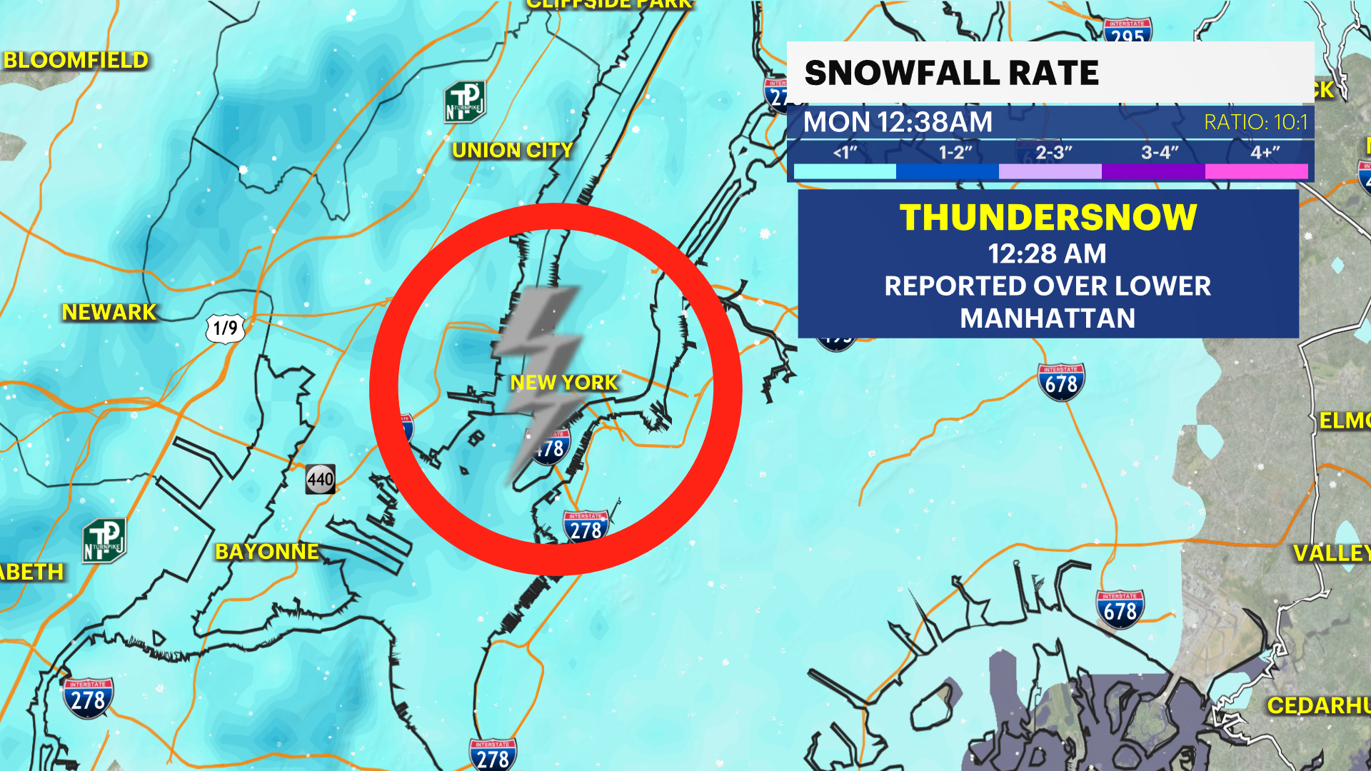
Lightning struck in Lower Manhattan at 12:29 a.m. Monday that resulted in a loud bang that coincided with heavy snowfall. Several more strikes were found in snow bands off the coast of Montauk Point.
Intense wind gusts ongoing
The storm has produced gusts stronger than 90 mph off in the open Atlantic, according to estimates from a product called the "Real Time Mesoanalysis"
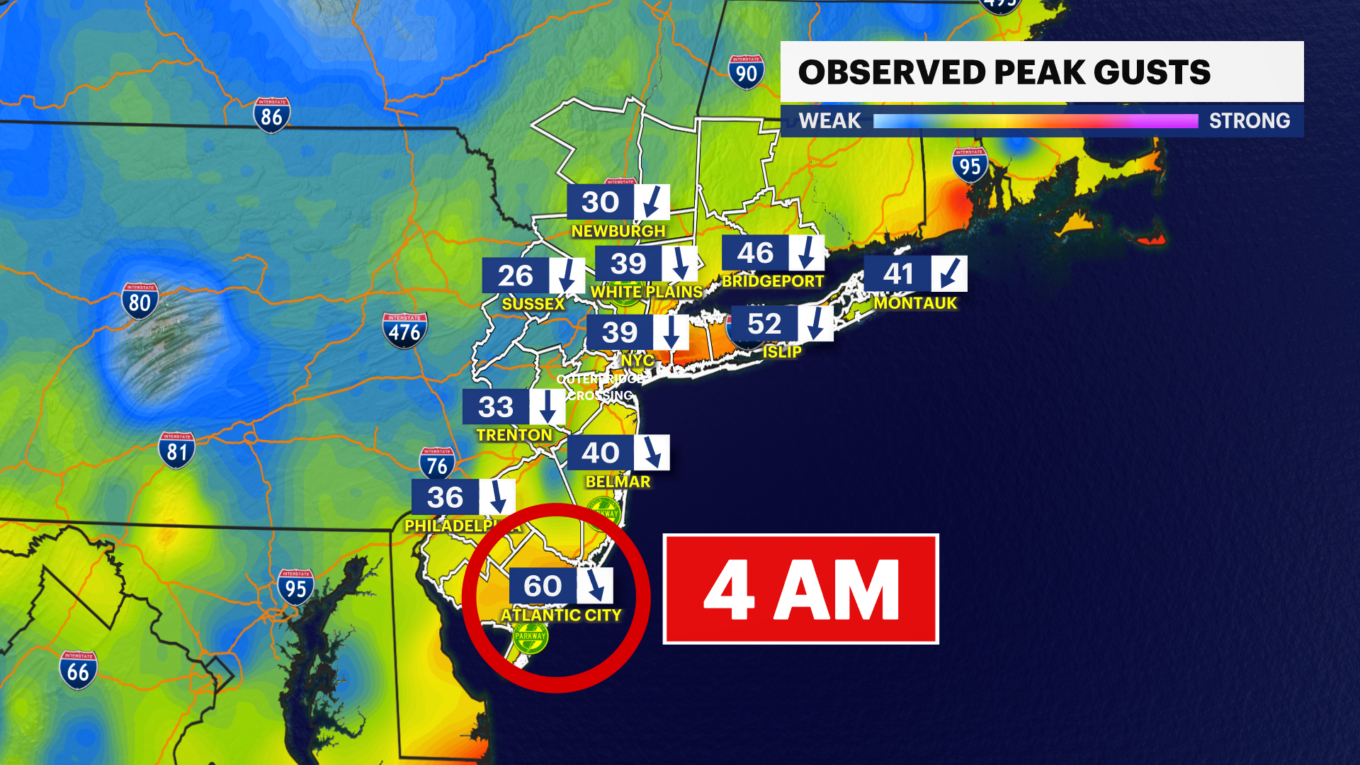
Official wind gusts in our area have reached 50 to 60 mph as of Monday morning along the coast and 40 mph in most other areas. The highest official gust came in from Atlantic City at 2:30 a.m. at 60 mph. Wind gusts will increase on Long Island through sunrise.