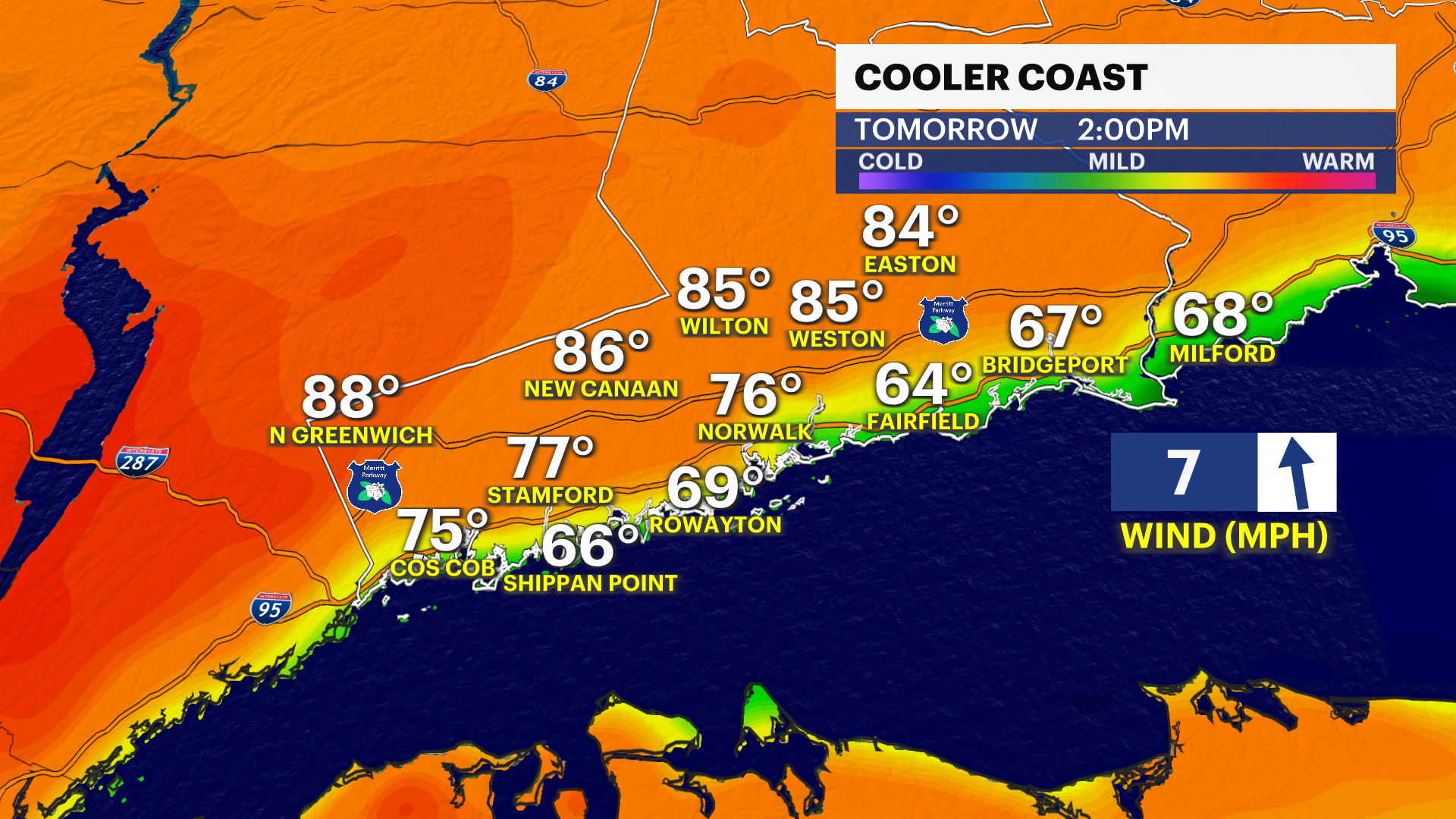
One more day of summer-like heat before Connecticut sees cooler temperatures
Thunderstorms give way to come lingering clouds for the early morning
More Stories


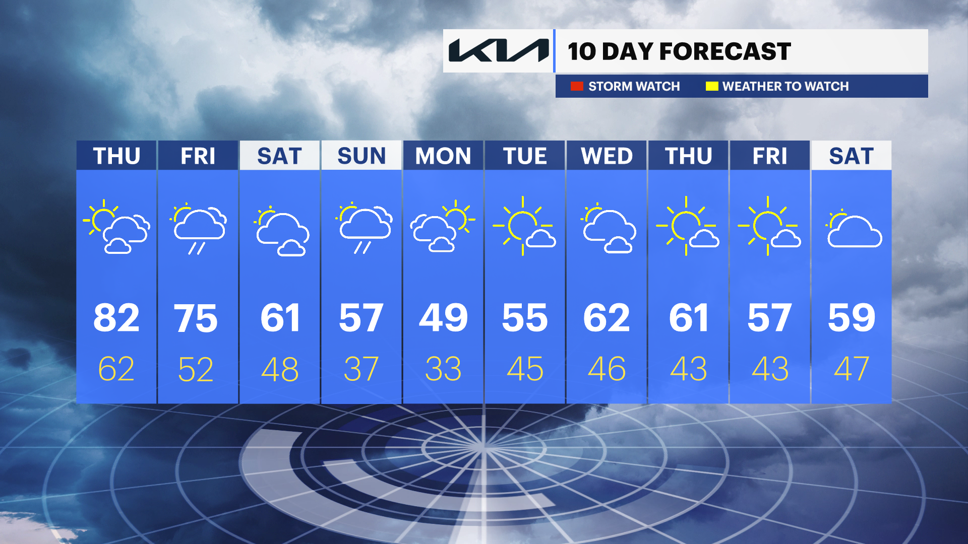
Thunderstorms will give way to some clouds overnight. Temperatures will stay mild and only cool into the upper 70s and lower 60s. The sky will gradually clear heading into the morning.
Bridgeport officially broke a temperature record on Wednesday afternoon, with a high temperature of 82 degrees. Areas farther inland saw highs climb into the middle and upper 80s. Thursday will be a similar day, but the record temperature is a little out of reach.
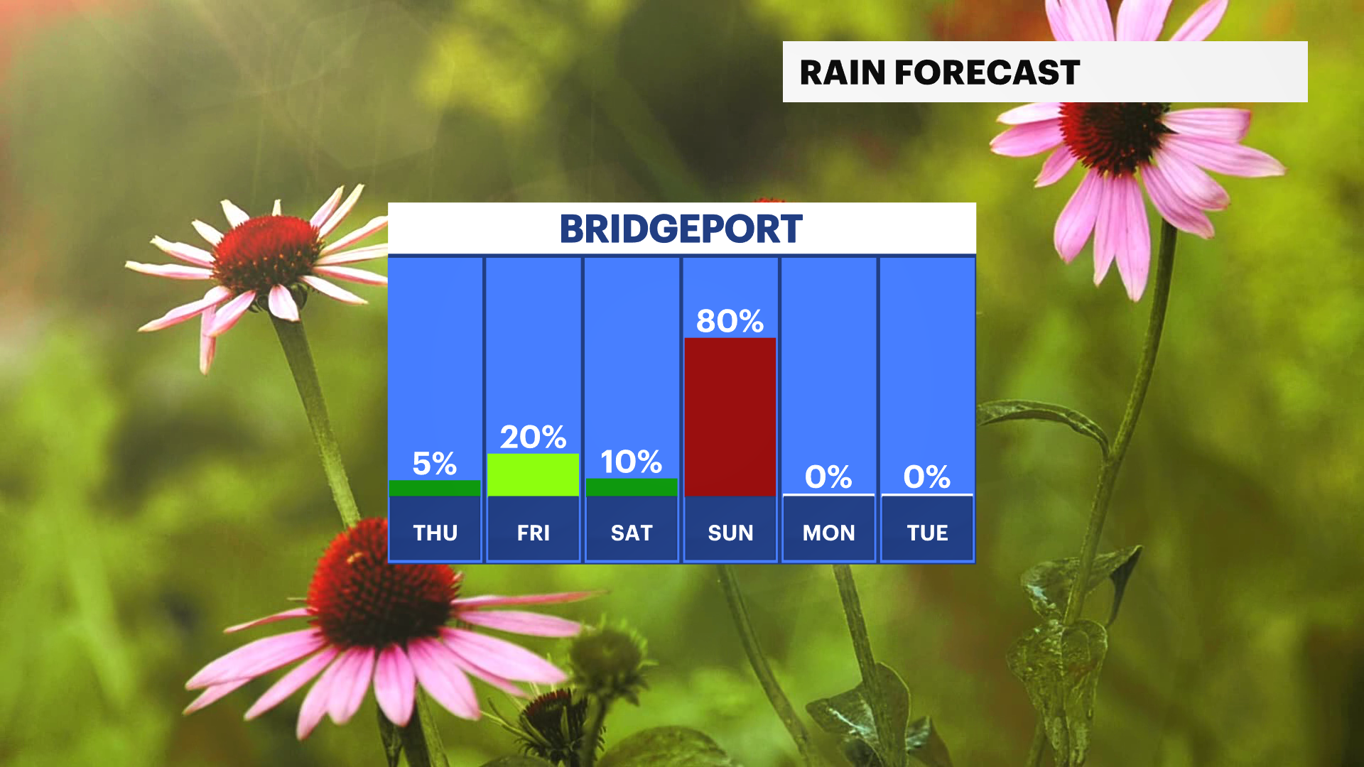
There is a chance of more showers later Thursday and into early Friday. Temperatures will start to cool at that time, but they will drop more over the weekend.
A sharp cold front will bring more widespread showers on Sunday and temperatures will fall back to seasonable levels with highs in the upper 50s.
A heads up for Monday - temperatures may not rise above 50 degrees during the day and frost or a hard freeze is possible Monday night into Tuesday morning.