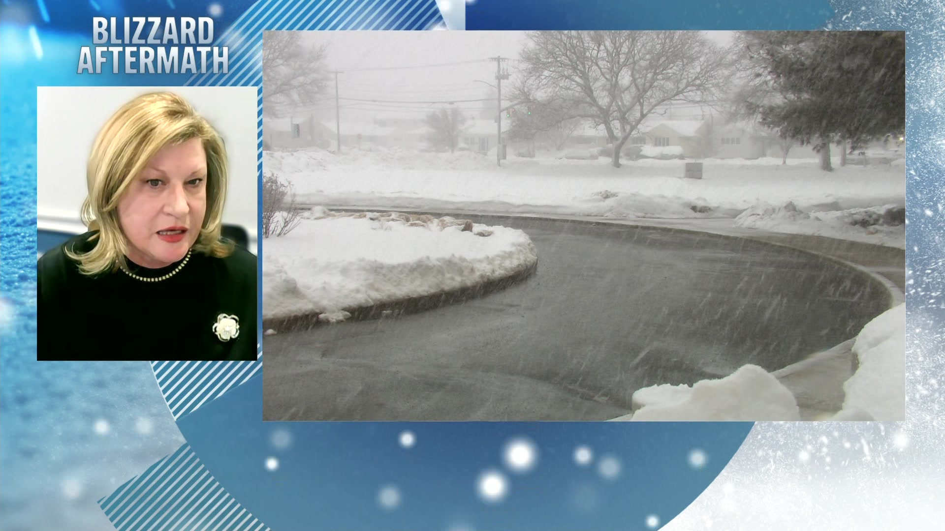
Storm Watch: Severe thunderstorms continue into tonight
A heat advisory is in effect as temps in the 90s may feel about 100 degrees
More Stories


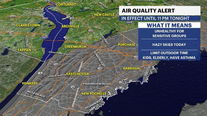
Air Quality Alert: In place until 11 p.m. tonight for southern Westchester County.
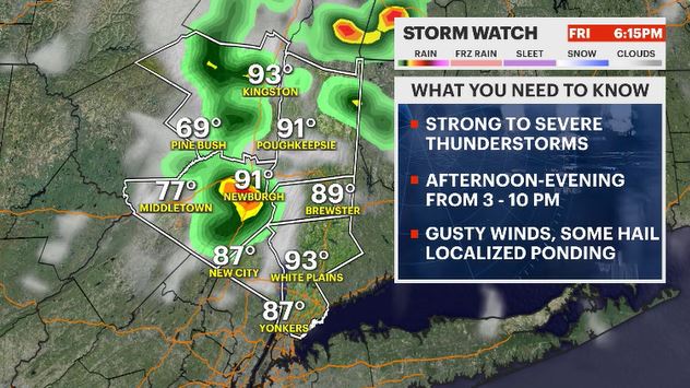
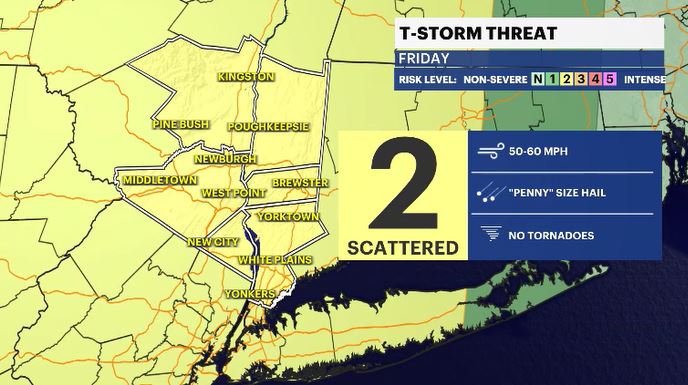
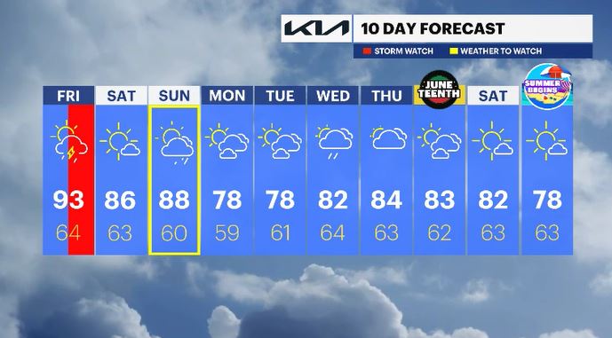
Today was our hottest day of the year, with highs in the 90s, feeling closer to 100. That extreme heat and humidity are fueling another widespread severe storm threat across the Hudson Valley to close out our Friday. The main hazards are damaging wind gusts and heavy downpours that could briefly reduce visibility, with an isolated chance for small hail.
The weekend brings a mixed bag. Saturday is shaping up beautifully - warm, sunny and much more comfortable. However, another system moves in late Sunday, bringing our next round of rain between 5 and 10 p.m.
ALMANAC:
Average High: 77 | Average Low: 58
Record High: 92 (2017) | Record Low: 41 (1980)
Sunrise: 5:22 a.m. | Sunset: 8:27 p.m.
THE FORECAST:
TONIGHT: Mostly cloudy, stuffy, with scattered showers early on in the night. Lows: Upper 60s to low 70s.
SATURDAY: Mostly sunny, less humid but still warm. Highs: Mid-80s. Lows: Low 60s.
SUNDAY: WEATHER TO WATCH - Partly to mostly cloudy with rain moving in later in the day. Humid will be returning as well. Highs: Upper 80s. Lows: Upper 50s to low 60s.
MONDAY: Mix of sun and clouds. Highs: Upper 70s. Lows: Upper 50s to low 60s.
TUESDAY: Mix of sun and clouds. Highs: Upper 70s. Lows: Upper 50s to low 60s. Lows: Upper 50s to low 60s.