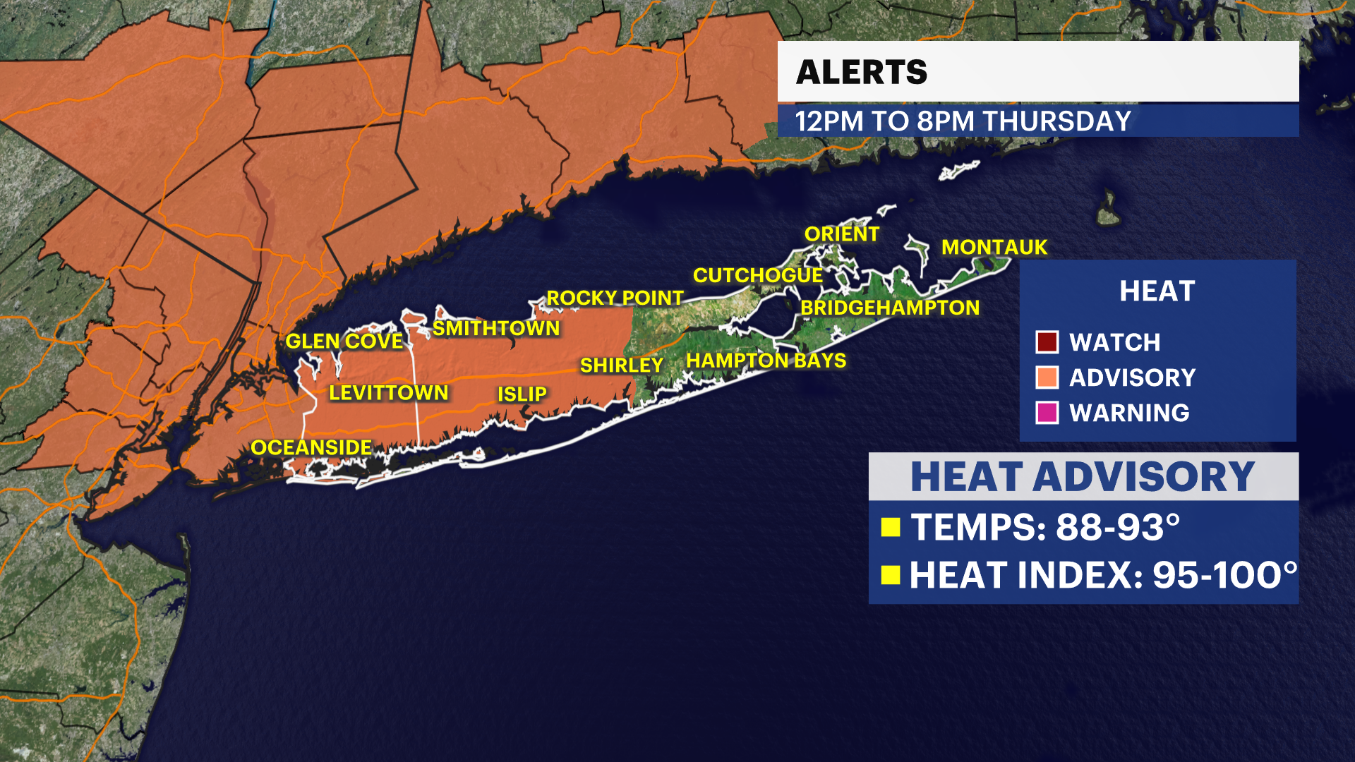
Heat Alert: Heat advisory issued as severe storm threat and dangerous heat build across Hudson Valley
Heat indices near 105 degrees possible through the end of the week while multiple rounds of storms bring damaging wind and heavy rain threats.
More Stories


The Hudson Valley is entering an active weather pattern featuring both dangerous heat and the potential for strong to severe thunderstorms through the end of the week.
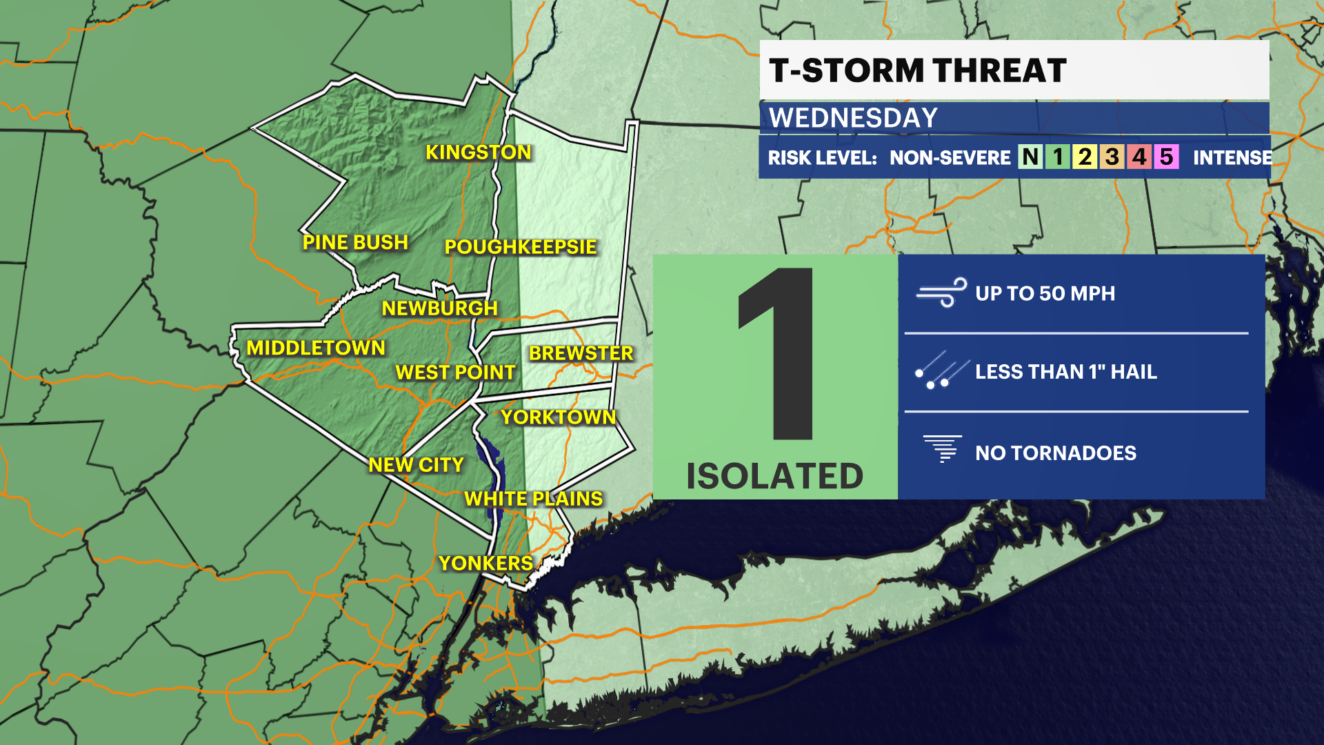
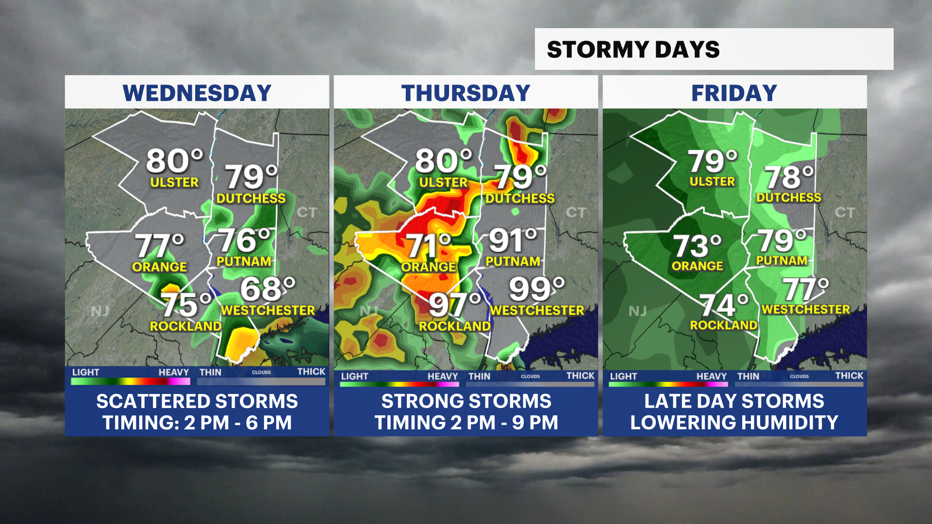
Wednesday will be mostly cloudy with temperatures in the upper 70s to low 80s. A few thunderstorms may develop between 2 p.m. and 6 p.m., with damaging wind gusts, small hail and torrential rain as the primary threats.
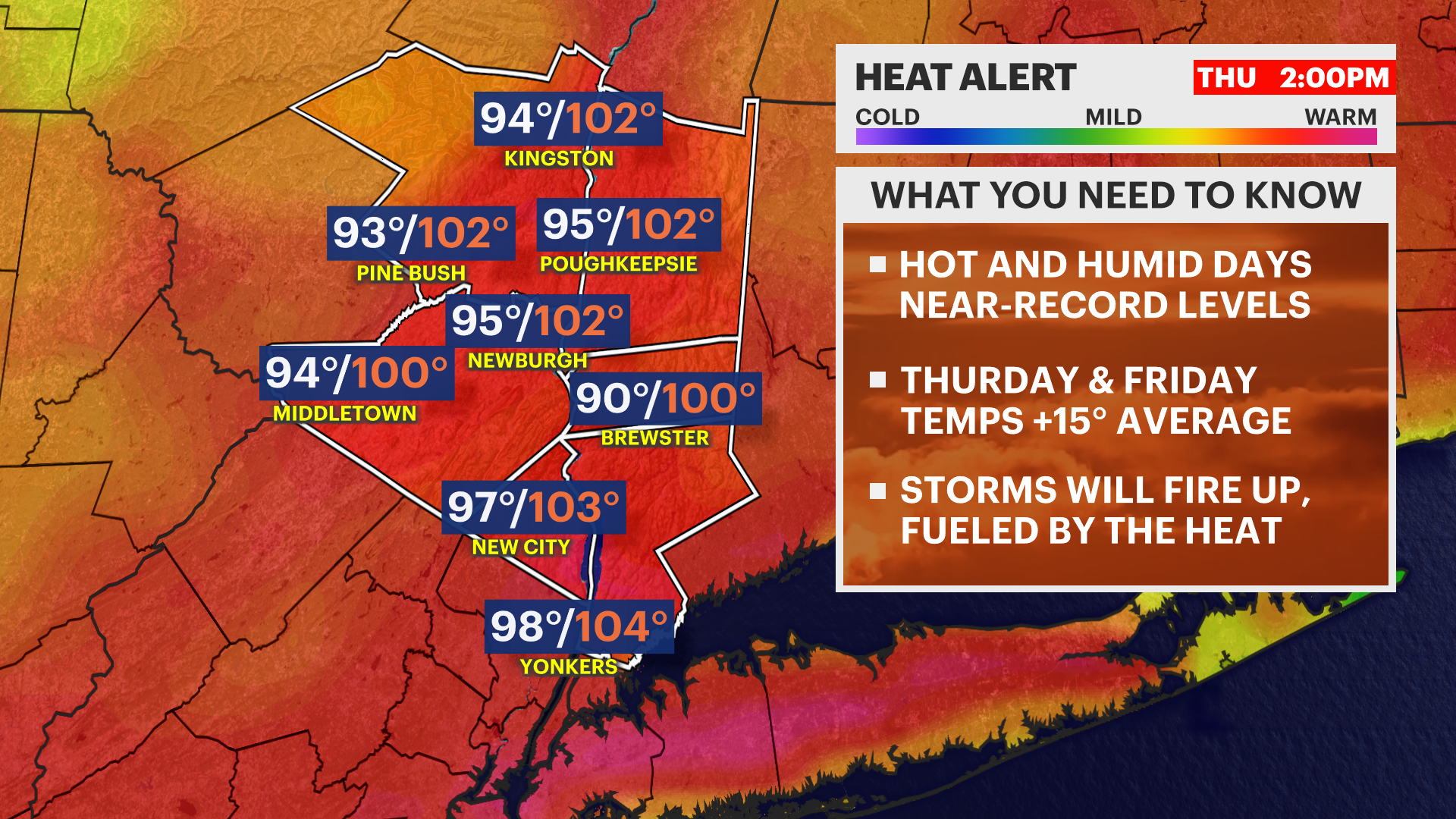
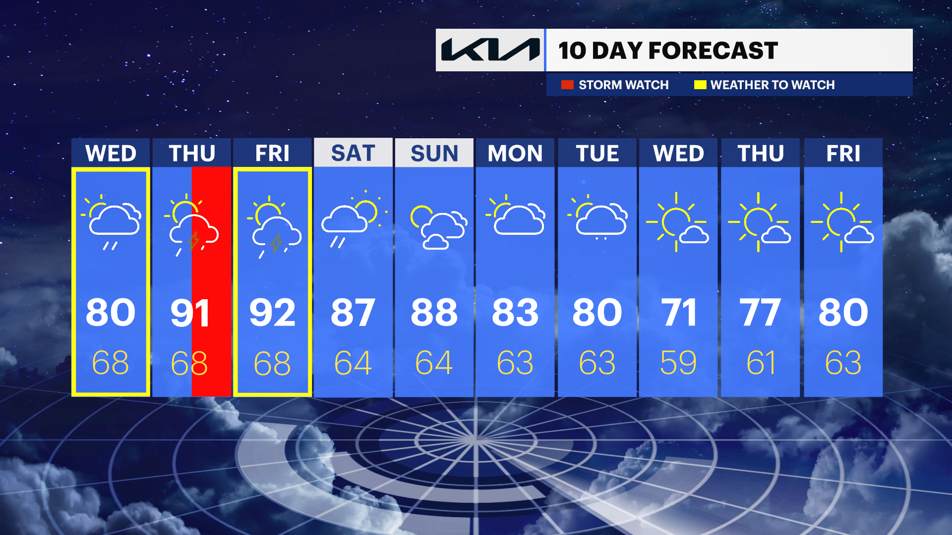
The weather becomes more impactful on Thursday as intense heat and humidity build into the region. Temperatures will run 15 degrees or more above average, with heat index values ranging from 100 to 105 degrees.
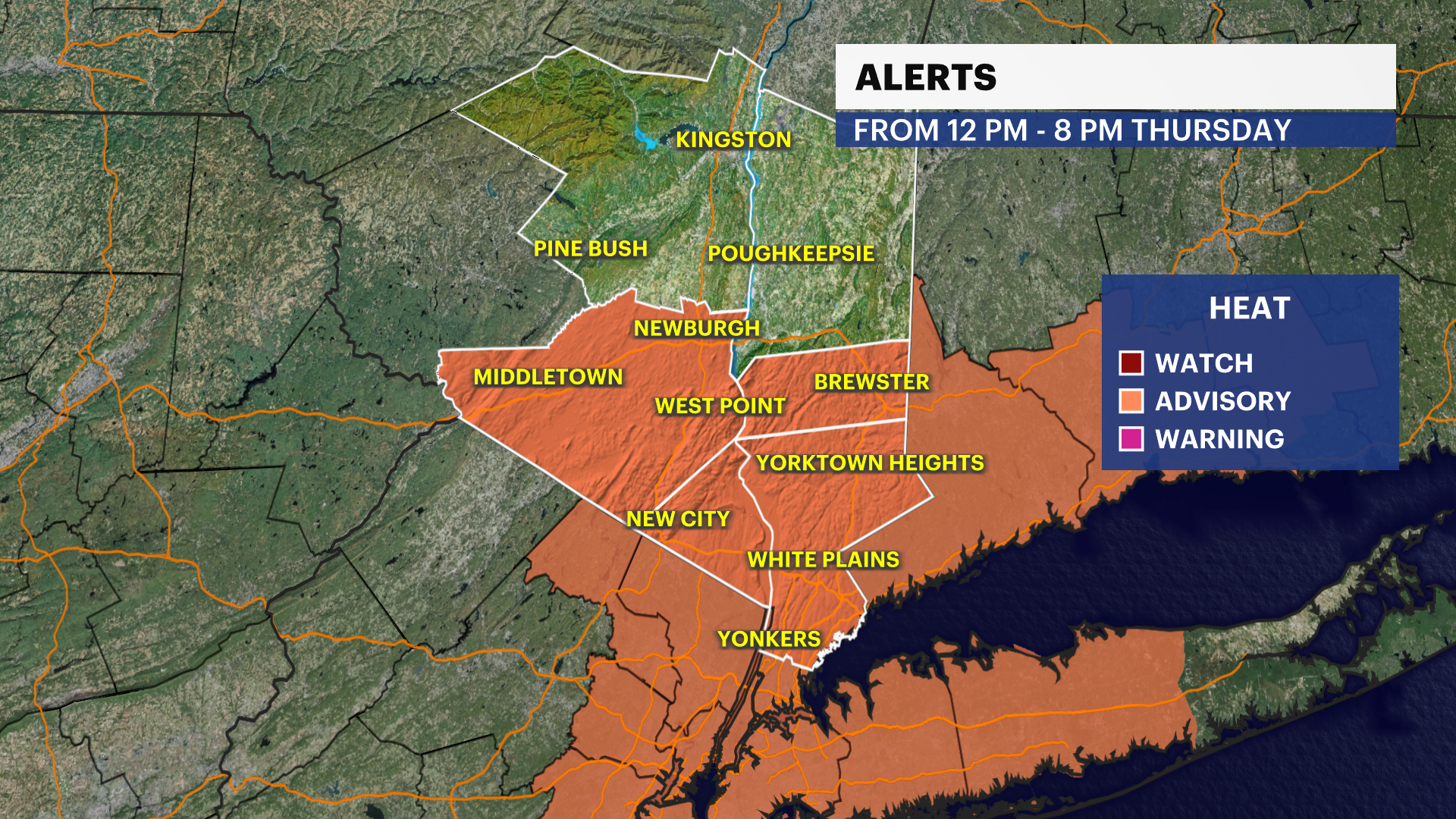
A heat advisory has been issued from noon to 8 p.m. Thursday for Orange, Putnam, Rockland and Westchester counties.
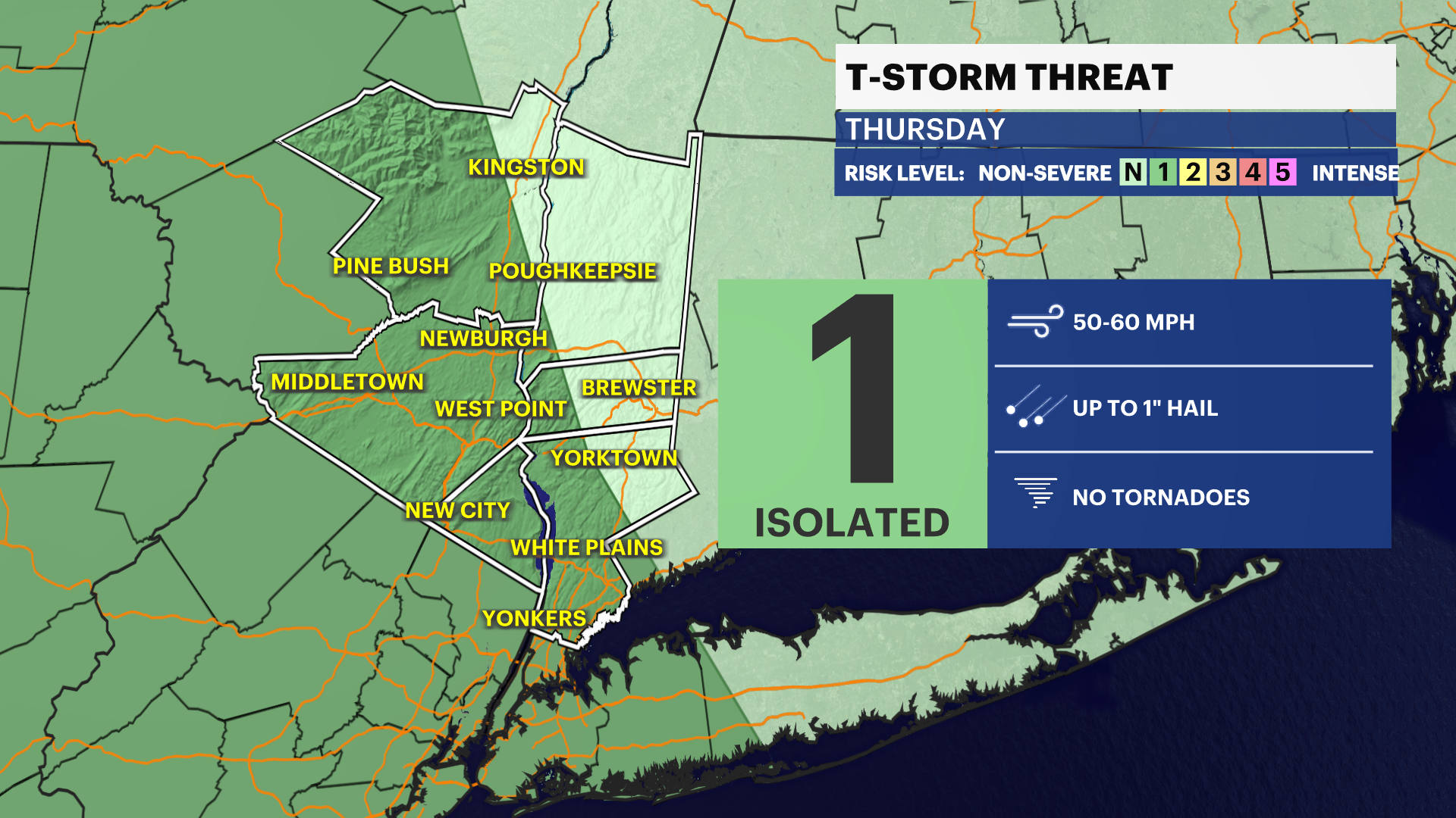
In addition to the heat, strong to severe thunderstorms are possible Thursday afternoon and evening, especially between 2 p.m. and 9 p.m. Damaging wind gusts up to 60 mph, heavy rainfall and small hail will be the main concerns.
Another round of showers and thunderstorms is possible late Friday as hot and humid conditions continue. While temperatures will ease slightly over the weekend, highs will still reach the mid- to upper 80s with gradually lower humidity levels.
Storm timing currently appears to be:
• Wednesday: 2 p.m. to 6 p.m.
• Thursday: 2 p.m. to 9 p.m.
• Friday: Late afternoon and evening
Residents should prepare for both the heat and the possibility of severe weather and continue checking for forecast updates as timing and impacts become more refined.
THE FORECAST:
OVERNIGHT: Mostly cloudy and it may feel a little stuffy with barely a breeze moving the air around. Lows: Low to mid-60s.
WEDNESDAY: Partly cloudy with scattered batches of rain and storms moving in for the afternoon hours. Highs: Low 80s. Lows: Mid- to upper 60s.
THURSDAY: HEAT ALERT - Partly cloudy with an afternoon storm threat. Highs: Upper 80s to low 90s. Lows: Upper 60s.
FRIDAY: HEAT ALERT - Mostly sunny to mostly cloudy with an afternoon storm threat. Highs: Upper 80s to low 90s. Lows: Upper 60s.
SATURDAY: Morning showers fade with partly cloudy skies to follow. Highs: mid-80s. Lows: Mid-60s.