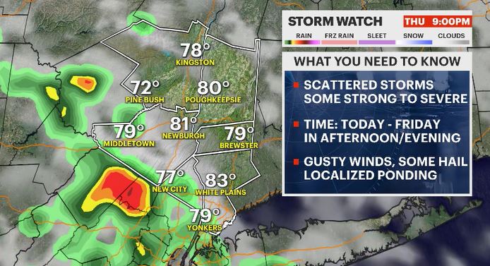
Storm Watch: A threat of late day storms arises as humidity levels shoot up
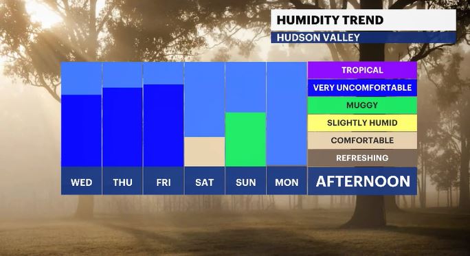
Prepare yourself for several days in a row of heat, humidity and stormy activity
More Stories
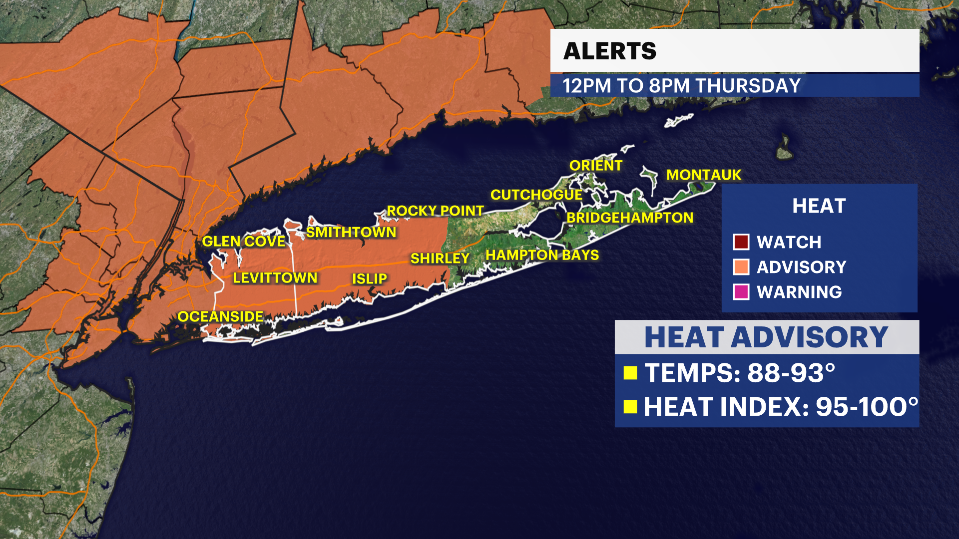


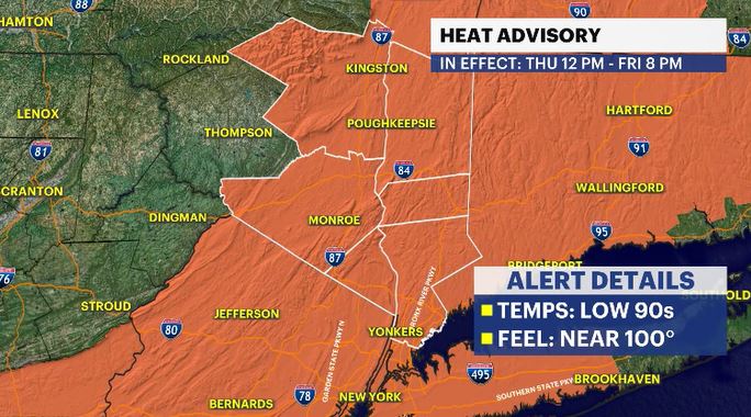
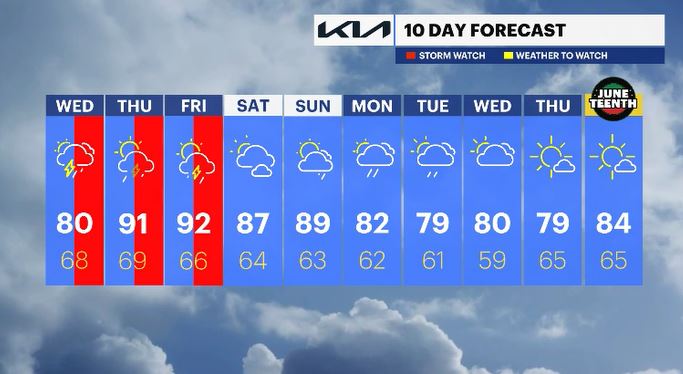
I hope you enjoyed the past two days of nice weather in the Hudson Valley, for some undesirable changes are on the way. That trend starts today with humidity rising to uncomfortable levels and then the heat builds tomorrow. The combination of the two will make it feel near 100 degrees and so a heat advisory is in effect for the entire Hudson Valley for both Thursday and Friday. Temperatures will feel at their worst in the afternoon hours.
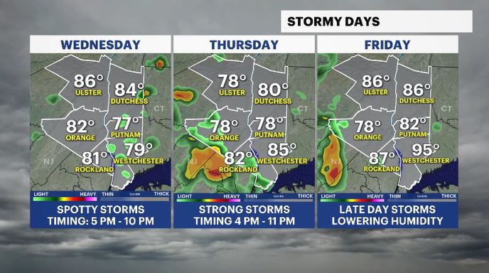
The storm potential will this afternoon with a threat of seeing spotty storms. The threat for severe weather is low but still possible across the area. The main threat will be damaging wind gusts.
Tomorrow will see that threat increase with hail, damaging winds and even a tornado potential. Friday has the threat lowered a little bit we could see any strong to severe storms produce gusty downpours and cause road ponding.
The weekend will have lowered humidity but still warm temperatures. At least we'll be dry with a late day shower chance Sunday.
ALMANAC:
Average High: 76 | Average Low: 57
Record High: 95 (2008) | Record Low: 44 (1980)
Sunrise: 5:22 a.m. | Sunset: 8:26 p.m.
THE FORECAST:
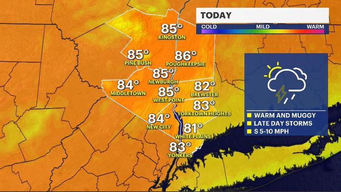
TODAY: STORM WATCH (PM) - Partly to mostly cloudy with scattered batches of rain and spotty storms moving in for the afternoon hours. Highs: upper 70s to low 80s.
TONIGHT: Mostly cloudy, stuffy, with spotty showers. Lows: upper 60s to low 70s.
THURSDAY: STORM WATCH (PM) - HEAT ALERT - Partly cloudy with an afternoon to evening storm threat. Highs: upper 80s to low 90s. Lows: upper 60s.
FRIDAY: STORM WATCH (PM) - HEAT ALERT - Mostly sunny to mostly cloudy with an afternoon to evening storm threat. Highs: upper 80s to low 90s. Lows: mid-60s.
SATURDAY: Partly cloudy, less humid but still warm. Highs: mid-80s. Lows: mid-60s.
SUNDAY: Mix of sun and clouds with a late day shower chance. Highs: upper 80s. Lows: low 60s.