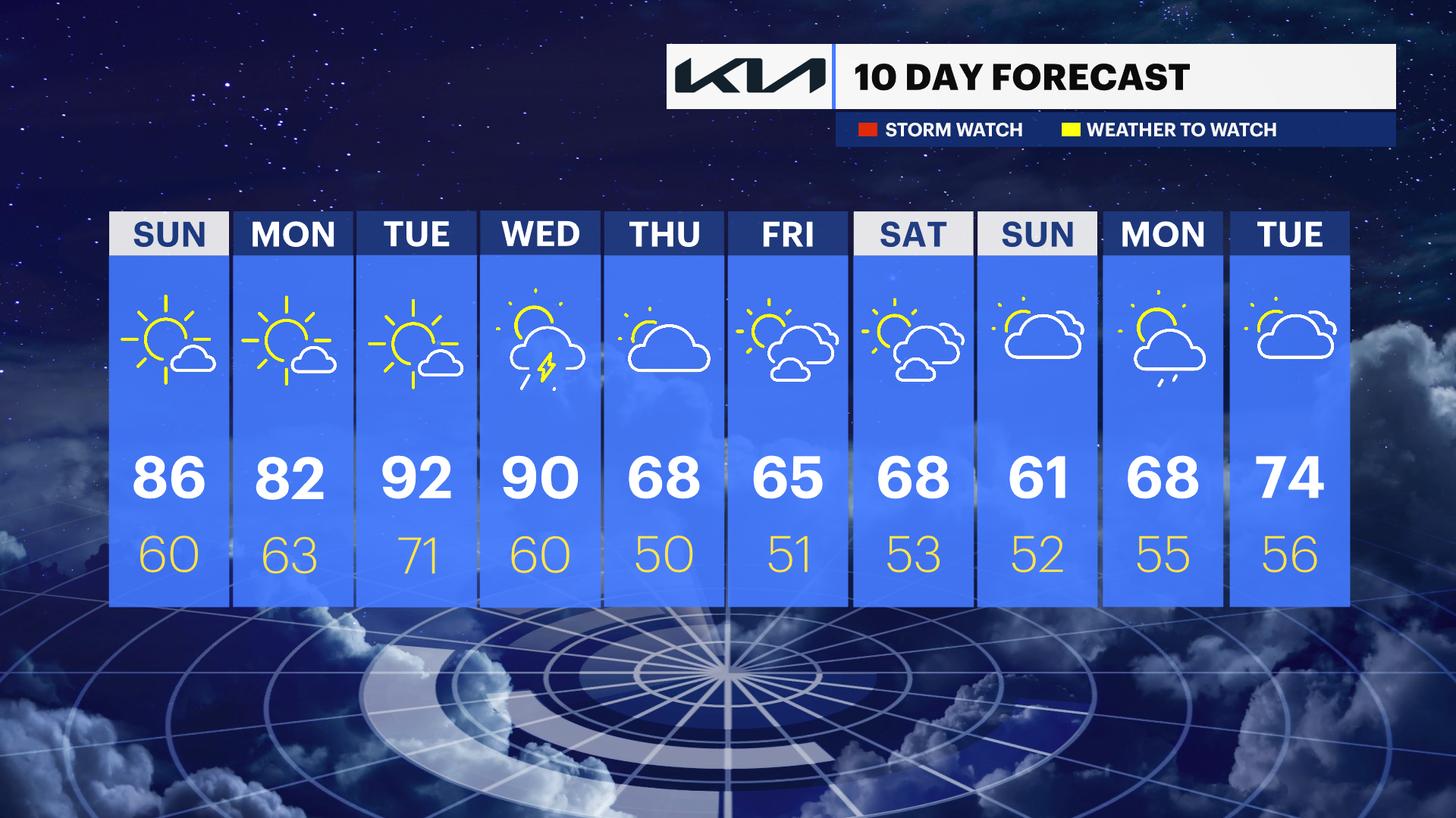
Sunny and warm Sunday before summer-like heat builds across the Hudson Valley through mid-week
Temperatures soar into the upper 80s and 90s through midweek before thunderstorms and a cooldown arrive late Wednesday into Thursday.
More Stories


Overnight
It will be a partly cloudy and mild overnight across the Hudson Valley ,with comfortable late-spring conditions. There is a chance of a passing shower but that would most likely occur during the pre-dawn hours. Temperatures will stay unusually warm for this time of year with just a light breeze through the night.
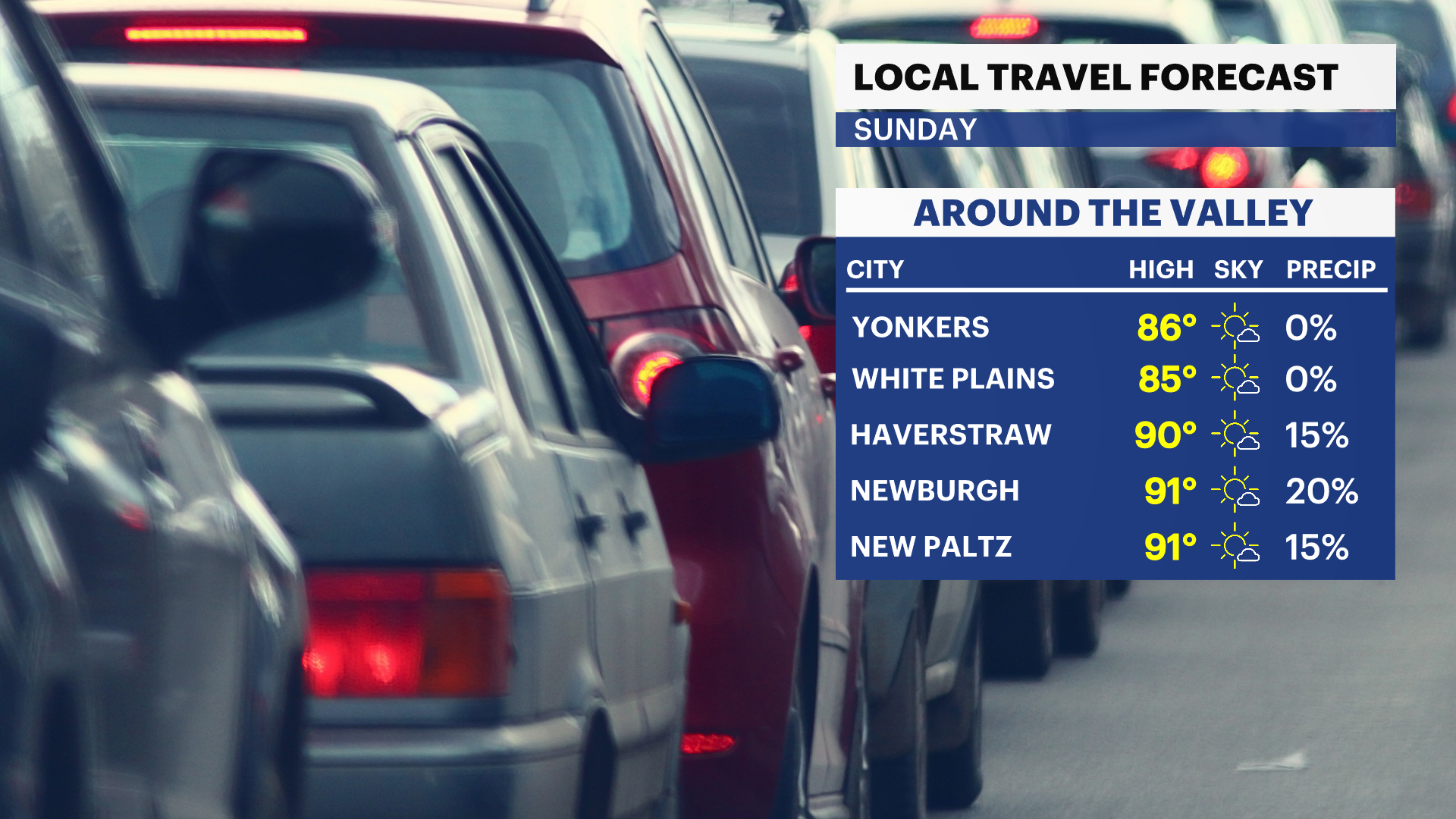
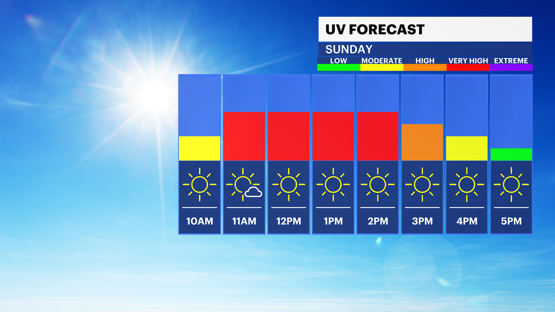
Sunday
A very warm day is expected, with plenty of sunshine and temperatures climbing well into the 80s for many communities. Humidity levels stay fairly low, so despite the warmth, the air should still feel comfortable for most outdoor activities.
Sunday Night
Partly cloudy and mild overnight, with temperatures remaining much warmer than normal for mid-May. Quiet weather continues with no major concerns.
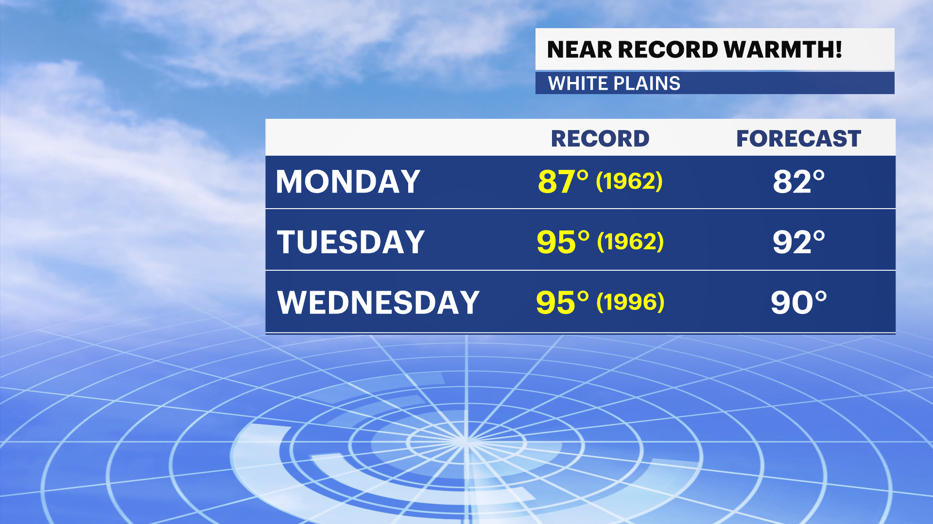
Monday
A weak backdoor cold front may bring slightly cooler air into parts of the region, but the Hudson Valley should still stay quite warm overall. Expect a mix of sun and clouds with afternoon temperatures remaining above normal. A brief isolated shower cannot be ruled out late in the day.
Monday Night
Partly cloudy and mild, with a continued warm breeze overnight. Humidity levels may begin to slowly increase ahead of the hotter weather building for Tuesday.
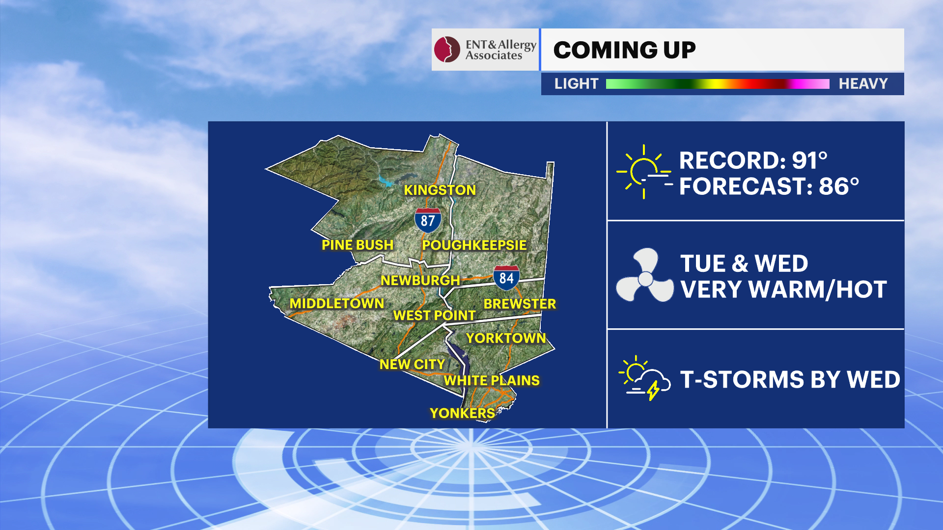
Tuesday
The hottest weather of the stretch arrives, with strong sunshine helping temperatures surge into the upper 80s and low 90s in many locations. It will feel much more like midsummer than late spring, especially during the afternoon. Humidity will also begin creeping upward, though conditions may still stay somewhat manageable.
Tuesday Night
Warm and increasingly muggy overnight, with partly cloudy skies and a gusty southwest breeze at times. A stray late-day or evening thunderstorm cannot be completely ruled out.
Wednesday
Another hot and somewhat humid day is expected ahead of an approaching cold front. Temperatures once again climb well into the upper 80s and low 90s for many areas. Increasing clouds later in the day will give way to scattered showers and thunderstorms Wednesday night, some of which could produce heavy downpours and gusty winds.
Late Week
The cold front moves through Thursday, bringing temperatures back closer to seasonal levels heading into the end of the week. A few lingering showers may still be possible Thursday before cooler and drier air gradually settles in.
Outdoor Reminder
With several unusually warm days expected, anyone spending extended time outside should stay hydrated and take breaks from the heat, especially during the hottest part of the afternoon Tuesday and Wednesday.